Latest earthquakes near Afghanistan today
Complete overview of the latest earthquakes near the country Afghanistan, updated every minute. Did you feel an earthquake today in Afghanistan? If an earthquake is happening right now near Afghanistan (also known as افغانستان), it will show up within minutes.
Recent Afghanistan Earthquake News
These are the latest articles published related to earthquakes occurring near Afghanistan. Check our Earthquake News section for a complete overview of articles written on earthquakes near Afghanistan and elsewhere.
 Apr 3, 2026 08:42PM
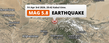
Significant M5.8 Earthquake struck on Friday Evening near Fayzabad in Afghanistan.
Apr 3, 2026 08:42PM
Significant M5.8 Earthquake struck on Friday Evening near Fayzabad in Afghanistan.
 Apr 3, 2026 02:56PM
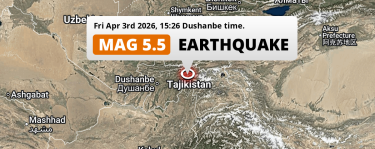
Shallow M5.5 Earthquake struck on Friday Afternoon 190km from Dushanbe in Tajikistan.
Apr 3, 2026 02:56PM
Shallow M5.5 Earthquake struck on Friday Afternoon 190km from Dushanbe in Tajikistan.
 Mar 27, 2026 01:32AM
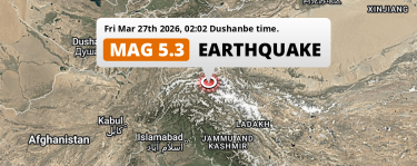
On Friday Night a Shallow M5.3 Earthquake struck 34mi from China.
Mar 27, 2026 01:32AM
On Friday Night a Shallow M5.3 Earthquake struck 34mi from China.
 Feb 20, 2026 05:39PM
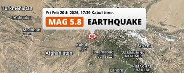
Significant M5.8 Earthquake hit near Bāzārak in Afghanistan on Friday Afternoon.
Feb 20, 2026 05:39PM
Significant M5.8 Earthquake hit near Bāzārak in Afghanistan on Friday Afternoon.
 Nov 3, 2025 12:59AM
DAMAGING M6.2 Earthquake hit near Mazār-e Sharīf in Afghanistan on Monday Night.
Nov 3, 2025 12:59AM
DAMAGING M6.2 Earthquake hit near Mazār-e Sharīf in Afghanistan on Monday Night.
 Sep 4, 2025 09:26PM
DESTRUCTIVE M5.6 Earthquake struck on Thursday Evening near Jalālābād in Afghanistan.
Sep 4, 2025 09:26PM
DESTRUCTIVE M5.6 Earthquake struck on Thursday Evening near Jalālābād in Afghanistan.
Afghanistan Earthquake Statistics
Average
A total of 3035 earthquakes with a magnitude of four or above have struck within 300 km (186 mi) of Afghanistan in the past 10 years. This comes down to a yearly average of 303 earthquakes per year, or 25 per month. On average an earthquake will hit near Afghanistan roughly every 1 days.
A relatively large number of earthquakes occurred near Afghanistan in 2023. A total of 414 earthquakes (mag 4+) were detected within 300 km of Afghanistan that year. The strongest had a 6.9 magnitude.

Magnitude Distribution
The table below visualizes the distribution of all earthquakes that occurred within 300km of Afghanistan in the past 10 years. No earthquakes with a magnitude of 7 or above have occurred near Afghanistan during this time. Usually, higher magnitudes are less common than lower magnitudes. Small earthquakes with a magnitude below 4 on the Richter scale have been omitted from this overview.
| Magnitude | Earthquakes | Percentage |
|---|---|---|
| Mag. 4 | 2878 | 94.83% |
| Mag. 5 | 141 | 4.65% |
| Mag. 6 | 16 | 0.53% |
| Mag. 7 | 0 | 0.0% |
| Mag. 8 | 0 | 0.0% |
| Mag. 9 | 0 | 0.0% |
| Mag. 10 | 0 | 0.0% |
Strongest earthquakes near Afghanistan
The strongest recent earthquake of the past 10 years near Afghanistan occurred on Feb 23, 2023 05:07 local time (Asia/Kabul timezone). It had a magnitude of 6.9 and struck 256 kilometers (159 mi) east-northeast of Fayzabad, at a depth of 9 km. Discover more strong earthquakes near Afghanistan in the list below.
A longer time ago, a MAG-7.8 earthquake struck on Nov 16, 1921 00:36, 98 kilometers (61 mi) east-northeast of Fayzabad. It is the strongest earthquake near Afghanistan in the past 126 years (Our data goes back to January 1st, 1900).
In the table below you will find the strongest earthquakes that occurred near Afghanistan in the past 10 years. You can use the tabs to find the heaviest historic earthquakes since the year 1900 or within a specific year or distance from Afghanistan.
Earthquakes by region of Afghanistan
Click the links below for earthquake reports for regions in Afghanistan.
- Badakhshan (Badakhshān)
- Badghis (ولایت بادغیس)
- Baghlan (Wilāyat-e Baghlān)
- Balkh (Вилояти Балх)
- Bamyan (Bāmīān)
- Farah (Farāh)
- Faryab (Fāryāb)
- Ghazni (Ghaznī)
- Ghowr (Wilāyat-e Ghōr)
- Helmand (ولایت هلمند)
- Herat (Herāt)
- Jowzjan (Jowzjān)
- Kabul (ولایت کابل)
- Kandahar (Kandahār)
- Khowst
- Kunar (Konar)
- Kunduz (Вилояти Кундуз)
- Laghman (Laghmān)
- Logar (Lowgar)
- Nangarhar (Nangarhār)
- Nimroz (Nīmrūz)
- Paktia (ولایت پکتیا)
- Panjshir (ولایت پنجشیر)
- Parwan (Parvān)
- Samangan (Samangān)
- Sar-e Pol
- Takhar (Takhār)
Frequently Asked Questions
These questions are commonly asked in relation to earthquakes occurring near Afghanistan.
When was the last earthquake in Afghanistan?
A 4.3 magnitude earthquake hit near Afghanistan on the morning of April 15, 2026 at 08:30 local time (Asia/Kabul). The center of this earthquake was located 90km south-east of Fayzabad at a depth of 128km under land. Check the list on our website for any earthquakes occurring near Afghanistan in the past hours.
What was the strongest earthquake near Afghanistan?
A 7.8 magnitude earthquake hit near Afghanistan on the night of November 16, 1921 at 00:36 local time (Asia/Kabul). The center of this earthquake was located 98km south of Fayzabad at a depth of 240km under land. This is the strongest earthquake that occurred near Afghanistan since the year 1900.
How often do earthquakes occur near Afghanistan?
In the past 10 years, 3035 earthquakes with a magnitude of four or higher occurred within a 300 kilometer range from Afghanistan. This averages to 304 earthquakes yearly, or one earthquake every 1 days.
