
Latest earthquakes near Japan today
Complete overview of the latest earthquakes near the country Japan, updated every minute. Did you feel an earthquake today in Japan? If an earthquake is happening right now near Japan (also known as 日本), it will show up within minutes.
Recent Japan Earthquake News
These are the latest articles published related to earthquakes occurring near Japan. Check our Earthquake News section for a complete overview of articles written on earthquakes near Japan and elsewhere.
 Sep 20, 2026 04:28PM
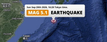
On Sunday Afternoon a Significant M5.1 Earthquake struck in the East China Sea near Naze (Japan).
Sep 20, 2026 04:28PM
On Sunday Afternoon a Significant M5.1 Earthquake struck in the East China Sea near Naze (Japan).
 Sep 17, 2026 12:07AM
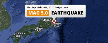
Significant M5.0 Earthquake hit near Mitsukaidō in Japan on Thursday Night.
Sep 17, 2026 12:07AM
Significant M5.0 Earthquake hit near Mitsukaidō in Japan on Thursday Night.
 Sep 13, 2026 05:32AM
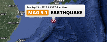
Significant M5.1 Earthquake hit in the East China Sea 250km from Kagoshima (Japan) on Sunday Night.
Sep 13, 2026 05:32AM
Significant M5.1 Earthquake hit in the East China Sea 250km from Kagoshima (Japan) on Sunday Night.
 Aug 27, 2026 04:21AM
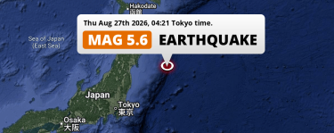
On Thursday Night a Shallow M5.6 Earthquake struck in the North Pacific Ocean 256km from Sendai (Japan).
Aug 27, 2026 04:21AM
On Thursday Night a Shallow M5.6 Earthquake struck in the North Pacific Ocean 256km from Sendai (Japan).
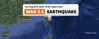 Aug 25, 2026 04:00PM
Shallow M5.5 Earthquake struck on Tuesday Afternoon in the Philippine Sea 136km from Kaohsiung (Taiwan).
Aug 25, 2026 04:00PM
Shallow M5.5 Earthquake struck on Tuesday Afternoon in the Philippine Sea 136km from Kaohsiung (Taiwan).
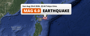 Aug 23, 2026 10:44PM
Strong M6.0 Earthquake struck on Sunday Evening in the North Pacific Ocean 180km from Sapporo (Japan).
Aug 23, 2026 10:44PM
Strong M6.0 Earthquake struck on Sunday Evening in the North Pacific Ocean 180km from Sapporo (Japan).
Japan Earthquake Statistics
Average
A total of 10596 earthquakes with a magnitude of four or above have struck within 300 km (186 mi) of Japan in the past 10 years. This comes down to a yearly average of 1059 earthquakes per year, or 88 per month. On average an earthquake will hit near Japan roughly every 8 hours.
A relatively large number of earthquakes occurred near Japan in 2024. A total of 1563 earthquakes (mag 4+) were detected within 300 km of Japan that year. The strongest had a 7.5 magnitude.

Magnitude Distribution
The table below visualizes the distribution of all earthquakes that occurred within 300km of Japan in the past 10 years. No earthquakes with a magnitude of 8 or above have occurred near Japan during this time. Usually, higher magnitudes are less common than lower magnitudes. Small earthquakes with a magnitude below 4 on the Richter scale have been omitted from this overview.
| Magnitude | Earthquakes | Percentage |
|---|---|---|
| Mag. 4 | 9598 | 90.58% |
| Mag. 5 | 920 | 8.68% |
| Mag. 6 | 70 | 0.66% |
| Mag. 7 | 8 | 0.08% |
| Mag. 8 | 0 | 0.0% |
| Mag. 9 | 0 | 0.0% |
| Mag. 10 | 0 | 0.0% |
Strongest earthquakes near Japan
The strongest recent earthquake of the past 10 years near Japan occurred on Dec 8, 2025 23:15 local time (Asia/Tokyo timezone). It had a magnitude of 7.6 and struck 80 kilometers (50 mi) north-east of Hachinohe, at a depth of 41 km. Discover more strong earthquakes near Japan in the list below.
A longer time ago, a MAG-9.1 earthquake struck on Mar 11, 2011 14:46, 132 kilometers (82 mi) north-east of Sendai. It is the strongest earthquake near Japan in the past 126 years (Our data goes back to January 1st, 1900).
In the table below you will find the strongest earthquakes that occurred near Japan in the past 10 years. You can use the tabs to find the heaviest historic earthquakes since the year 1900 or within a specific year or distance from Japan.
Earthquakes by region of Japan
Click the links below for earthquake reports for regions in Japan.
- Aichi (愛知県)
- Akita (秋田県)
- Aomori (青森県)
- Chiba (千葉県)
- Ehime (愛媛県)
- Fukui (福井県)
- Fukuoka (福岡県)
- Fukushima (福島県)
- Gifu (岐阜県)
- Gunma (群馬県)
- Hirochima (広島県)
- Hokkaido (北海道)
- Hyōgo (兵庫県)
- Ibaraki (茨城県)
- Ishikawa (石川県)
- Iwate (岩手県)
- Kagawa (香川県)
- Kagoshima (鹿児島県)
- Kanagawa (神奈川県)
- Kumamoto (熊本県)
- Kyoto (京都府)
- Kōchi (高知県)
- Mie (三重県)
- Miyagi (宮城県)
- Miyazaki (宮崎県)
- Nagano (長野県)
- Nagasaki (長崎県)
- Nara (奈良県)
- Niigata (新潟県)
- Okayama (岡山県)
- Okinawa (沖繩縣)
- Saga (佐賀県)
- Saitama (埼玉県)
- Shiga (滋賀県)
- Shimane (島根県)
- Shizuoka (静岡県)
- Tochigi (栃木県)
- Tokushima (徳島県)
- Tokyo (東京都)
- Tottori (鳥取県)
- Toyama (富山県)
- Wakayama (和歌山県)
- Yamagata (山形県)
- Yamaguchi (山口県)
- Yamanashi (山梨県)
- Ōita (大分県)
- Ōsaka (大阪府)
Frequently Asked Questions
These questions are commonly asked in relation to earthquakes occurring near Japan.
When was the last earthquake in Japan?
A 5 magnitude earthquake hit near Japan on the evening of September 21, 2026 at 22:38 local time (Asia/Tokyo). The center of this earthquake was located 39km east of Nobeoka at a depth of 43km under water in the Philippine Sea. Check the list on our website for any earthquakes occurring near Japan in the past hours.
What was the strongest earthquake near Japan?
A 9.1 magnitude earthquake hit near Japan on the afternoon of March 11, 2011 at 14:46 local time (Asia/Tokyo). The center of this earthquake was located 132km east of Sendai at a depth of 29km under water in the North Pacific Ocean. This is the strongest earthquake that occurred near Japan since the year 1900.
How often do earthquakes occur near Japan?
In the past 10 years, 10596 earthquakes with a magnitude of four or higher occurred within a 300 kilometer range from Japan. This averages to 1060 earthquakes yearly, or one earthquake every 8 hours.
