
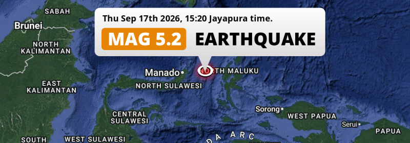
In the Maluku Sea 164 kilometer from Manado, Indonesia, a shallow and significant M5.2 earthquake occurred in the afternoon of Thursday September 17th, 2026.
Felt the earthquake? Share this article: 


Earthquake Summary
This earthquake hit under water in the Maluku Sea, 121 kilometers (75 mi) off the coast of Indonesia, 164 kilometer east of Manado in North Sulawesi. The center of this earthquake had a very shallow depth of 10 km. Shallow earthquakes usually have a larger impact than earthquakes deep in the earth.
| Date and Time: | Sep 17, 2026 15:20 (Jayapura Time) - Sep 17, 2026 06:20 Universal Time. |
|---|---|
| Location: | 164 km east of Manado, North Sulawesi, Indonesia. Coordinates 1°16'46"N 126°18'47"E. |
| Map: | 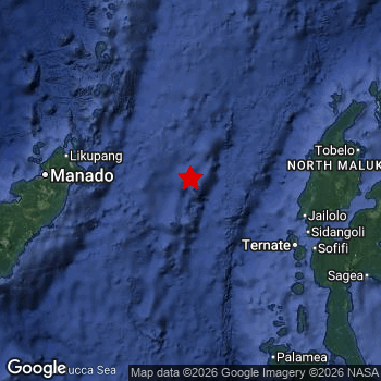 Map of area around epicenter. Click to open in Google Maps. |
| Magnitude: | MAG 5.2 Detected by 148 stations. Maximum Error Range ±0.047 . |
| Depth: | 10 km (6 mi) A very shallow depth. |
| Tsunami Risk: | Low tsunami risk Earthquakes under MAG-6.5 do not usually cause tsunami's. Always stay cautious - More info here. |
Nearby towns and cities
This earthquake may have been felt in Indonesia . The closest significant population center near the earthquake is Ternate in North Maluku, Indonesia. Ternate is located 131 kilometer (81 mi) northwest of the epicenter.
A complete list of nearby places is included below.
Overview of nearby places
| Distance | Place |
|---|---|
| 131 km (81 mi) SE from epicenter |
Ternate North Maluku, Indonesia. |
| 151 km (94 mi) SE from epicenter |
Sofifi North Maluku, Indonesia. |
| 156 km (97 mi) W from epicenter |
Tondano North Sulawesi, Indonesia. |
| 164 km (102 mi) W from epicenter |
Manado North Sulawesi, Indonesia. |
| 168 km (104 mi) W from epicenter |
Tomohon North Sulawesi, Indonesia. |
2 Aftershocks detected
This main shock was followed by 2 smaller aftershocks. Just 6 hrs after this main shock, an earthquake measuring MAG-3.8 was detected 22 km (13 mi) north of this earthquake.
Overview of foreshocks and aftershocks
| Classification | Magnitude | When | Where |
|---|---|---|---|
| Main Shock This Earthquake |
M 5.2 |
Sep 17, 2026 15:20 (Jayapura Time) | - |
| Aftershock | M 3.8 |
6 hrs later Sep 17, 2026 21:12 (Jayapura Time) | 22 km (13 mi) N from Main Shock. |
| Aftershock | M 3.0 |
1 day later Sep 19, 2026 03:20 (Jayapura Time) | 39 km (24 mi) NE from Main Shock. |
More earthquakes coming?
Earthquakes can create aftershocks. These are generally at least 1 magnitude lower than any main shock, and as time passes the chance and strength of aftershocks decreases.
In only six percent of cases, significant earthquakes are followed by a larger main shock, making the current earthquake a foreshock. While the chance of this happening is not so large, it is adviced to maintain cautiousness in the hours and days following a major earthquake.
Read: How to Stay Safe during an Earthquake (cdc.gov).Earthquakes like this happen often in the region
Earthquakes of this strength are very common in the region. This is the strongest earthquake to hit since September 14th, 2026, when a 5.6 magnitude earthquake hit 244 km (152 mi) further north-east. An even stronger magnitude 7.4 earthquake struck on April 1st, 2026.
In total, 157 earthquakes with a magnitude of 5.2 or higher have been registered within 300km (186 mi) of this epicenter in the past 10 years. This comes down to an average of once every 23 days.
Low tsunami risk
Based on early data it appears this earthquake was not strong enough (lower than MAG-6.5) to be likely to cause destructive tsunami's. However this earthquake appeared to have hit at a shallow depth under sea, so stay cautious and monitor advice from local authorities.
Tsunami Risk Factors
| Factor | Under Sea? | MAG-6.5 or stronger? | Shallow depth? |
|---|---|---|---|
| Explanation | Almost all tsunami's are caused by earthquakes with their epicenter under sea or very near the sea. However stay cautious in coastal areas as earthquakes on land may cause landslides into sea, potentially still causing a local tsunami. | Under MAG 6.5: Very unlikely to cause a tsunami. MAG 6.5 to 7.5: Destructive tsunami's do occur, but are uncommon. Likely to observe small sea level changes. MAG 7.6+: Earthquakes with these magnitudes might produce destructive tsunami's. |
Most destructive tsunami's are caused by shallow earthquakes with a depth between 0 and 100km under the surface of the earth. Deeper tsunami's are unlikely to displace to ocean floor. |
| This Earthquake | This earthquake appears to have struck under the sea. | Not this earthquake. This earthquake had a magnitude of 5.2. Earthquakes of this strength are unlikely to trigger a tsunami. |
This earthquake occurred at a depth of of 10 km (6 mi). Earthquakes this shallow could trigger a tsunami. |
Sources
Last updated 10/10/26 09:18 (). As more information on this earthquake becomes available this article will be updated. This article is automatically composed based on data originating from multiple sources.
- US Geographic Society (USGS): Earthquake us7000thzp
- European-Mediterranean Seismological Centre (EMSC): Earthquake 20260917_0000064
- Geonames.org: World Cities Database
- Google Maps: Static API
- Earthquakelist.org: Historic Earthquakes Database
Share this article:
