Latest earthquakes near North Sulawesi, Indonesia today
Complete overview of the latest earthquakes near North Sulawesi, Indonesia, updated every minute. Did you feel an earthquake today in North Sulawesi? If an earthquake is happening right now near North Sulawesi (also known as Sulawesi Utara), it will show up within minutes.
Recent North Sulawesi Earthquake News
These are the latest articles published related to earthquakes occurring near North Sulawesi. Check our Earthquake News section for a complete overview of articles written on earthquakes near North Sulawesi and elsewhere.
 Jul 20, 2026 05:40PM
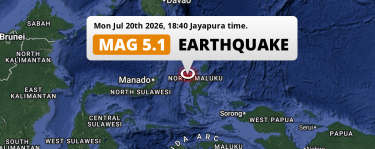
On Monday Evening a Significant M5.1 Earthquake struck in the Maluku Sea near Ternate (Indonesia).
Jul 20, 2026 05:40PM
On Monday Evening a Significant M5.1 Earthquake struck in the Maluku Sea near Ternate (Indonesia).
 Jul 18, 2026 10:23AM
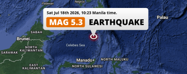
Shallow M5.3 Earthquake hit in the Sulawesi Sea 182km from General Santos (The Philippines) on Saturday Morning.
Jul 18, 2026 10:23AM
Shallow M5.3 Earthquake hit in the Sulawesi Sea 182km from General Santos (The Philippines) on Saturday Morning.
 Jul 12, 2026 09:46PM
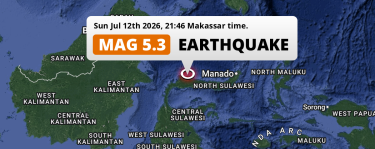
Significant M5.4 Earthquake hit 194km from Gorontalo in Indonesia on Sunday Evening.
Jul 12, 2026 09:46PM
Significant M5.4 Earthquake hit 194km from Gorontalo in Indonesia on Sunday Evening.
 Jul 12, 2026 01:49AM
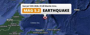
Significant M5.2 FORESHOCK struck on Sunday Night in the Sulawesi Sea 131km from General Santos (The Philippines).
Jul 12, 2026 01:49AM
Significant M5.2 FORESHOCK struck on Sunday Night in the Sulawesi Sea 131km from General Santos (The Philippines).
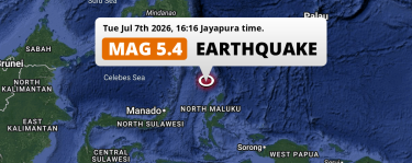 Jul 7, 2026 03:16PM
Significant M5.4 Earthquake hit in the Maluku Sea 260km from Ternate (Indonesia) on Tuesday Afternoon.
Jul 7, 2026 03:16PM
Significant M5.4 Earthquake hit in the Maluku Sea 260km from Ternate (Indonesia) on Tuesday Afternoon.
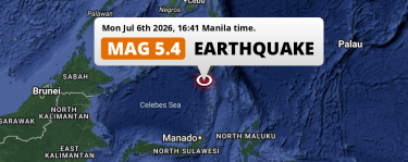 Jul 6, 2026 04:41PM
Significant M5.4 AFTERSHOCK struck on Monday Afternoon in the Sulawesi Sea 134km from General Santos (The Philippines).
Jul 6, 2026 04:41PM
Significant M5.4 AFTERSHOCK struck on Monday Afternoon in the Sulawesi Sea 134km from General Santos (The Philippines).
North Sulawesi Earthquake Statistics
Average
A total of 4478 earthquakes with a magnitude of four or above have struck within 300 km (186 mi) of North Sulawesi, Indonesia in the past 10 years. This comes down to a yearly average of 447 earthquakes per year, or 37 per month. On average an earthquake will hit near North Sulawesi roughly every 0 days.
A relatively large number of earthquakes occurred near North Sulawesi in 2019. A total of 738 earthquakes (mag 4+) were detected within 300 km of North Sulawesi that year. The strongest had a 7.1 magnitude.

Magnitude Distribution
The table below visualizes the distribution of all earthquakes that occurred within 300km of North Sulawesi in the past 10 years. No earthquakes with a magnitude of 8 or above have occurred near North Sulawesi during this time. Usually, higher magnitudes are less common than lower magnitudes. Small earthquakes with a magnitude below 4 on the Richter scale have been omitted from this overview.
| Magnitude | Earthquakes | Percentage |
|---|---|---|
| Mag. 4 | 4118 | 91.96% |
| Mag. 5 | 336 | 7.5% |
| Mag. 6 | 21 | 0.47% |
| Mag. 7 | 3 | 0.07% |
| Mag. 8 | 0 | 0.0% |
| Mag. 9 | 0 | 0.0% |
| Mag. 10 | 0 | 0.0% |
Strongest earthquakes near North Sulawesi
The strongest recent earthquake of the past 10 years near North Sulawesi occurred on Apr 2, 2026 06:48 local time (Asia/Makassar timezone). It had a magnitude of 7.4 and struck 160 kilometers (99 mi) east of Manado, at a depth of 35 km. Discover more strong earthquakes near North Sulawesi in the list below.
A longer time ago, a MAG-8.1 earthquake struck on Dec 22, 1939 05:00, 283 kilometers (176 mi) east of Manado. It is the strongest earthquake near North Sulawesi in the past 126 years (Our data goes back to January 1st, 1900).
In the table below you will find the strongest earthquakes that occurred near North Sulawesi, Indonesia in the past 10 years. You can use the tabs to find the heaviest historic earthquakes since the year 1900 or within a specific year or distance from North Sulawesi.
Earthquakes by city in North Sulawesi
Click the links below for earthquake reports for major places in North Sulawesi, Indonesia.
Use this regional North Sulawesi earthquake report for earthquakes that were felt in smaller towns and cities in the region, including Tondano and Tomohon.
Frequently Asked Questions
These questions are commonly asked in relation to earthquakes occurring near North Sulawesi.
When was the last earthquake in North Sulawesi, Indonesia?
A 3.1 magnitude earthquake hit near North Sulawesi on the evening of July 21, 2026 at 23:36 local time (Asia/Makassar). The center of this earthquake was located 193km south of Manado at a depth of 18km under water in the Maluku Sea. Check the list on our website for any earthquakes occurring near North Sulawesi, Indonesia in the past hours.
What was the strongest earthquake near North Sulawesi, Indonesia?
A 8.1 magnitude earthquake hit near North Sulawesi on the night of December 22, 1939 at 05:00 local time (Asia/Makassar). The center of this earthquake was located 283km southwest of Manado at a depth of 150km under water in the Gulf Of Tomini. This is the strongest earthquake that occurred near North Sulawesi since the year 1900.
How often do earthquakes occur near North Sulawesi, Indonesia?
In the past 10 years, 4478 earthquakes with a magnitude of four or higher occurred within a 300 kilometer range from North Sulawesi. This averages to 448 earthquakes yearly, or one earthquake every 1 days.
