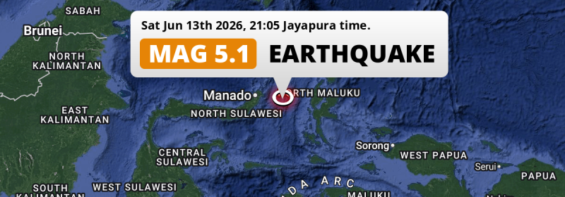
In the Maluku Sea 151 kilometer from Manado, Indonesia, a significant Magnitude 5.1 earthquake occurred in the evening of Saturday June 13th, 2026.
Felt the earthquake? Share this article: 


Earthquake Summary
This earthquake hit under water in the Maluku Sea, 110 kilometers (68 mi) off the coast of Indonesia, 151 kilometer east of Manado in North Sulawesi. The center of this earthquake had a quite shallow depth of 35 km. Shallow earthquakes usually have a larger impact than earthquakes deep in the earth.
| Date and Time: | Jun 13, 2026 20:05 (Makassar Time) - Jun 13, 2026 12:05 Universal Time. |
|---|---|
| Location: | 151 km east of Manado, North Sulawesi, Indonesia. Coordinates 1°5'14"N 126°9'3"E. |
| Map: | 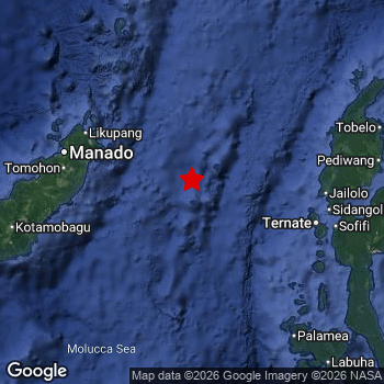 Map of area around epicenter. Click to open in Google Maps. |
| Magnitude: | MAG 5.1 Detected by 154 stations. Maximum Error Range ±0.046 . |
| Depth: | 35 km (22 mi) A quite shallow depth. |
| Tsunami Risk: | Low tsunami risk Earthquakes under MAG-6.5 do not usually cause tsunami's. Always stay cautious - More info here. |
Nearby towns and cities
This earthquake may have been felt in Indonesia . The closest significant population center near the earthquake is Tondano in North Sulawesi, Indonesia. Tondano is located 140 kilometer (87 mi) east of the epicenter.
The table below provides an overview of all places in proximity of today's earthquake.
Overview of nearby places
| Distance | Place |
|---|---|
| 140 km (87 mi) W from epicenter |
Tondano North Sulawesi, Indonesia. |
| 141 km (88 mi) E from epicenter |
Ternate North Maluku, Indonesia. |
| 151 km (94 mi) W from epicenter |
Manado North Sulawesi, Indonesia. |
| 152 km (94 mi) W from epicenter |
Tomohon North Sulawesi, Indonesia. |
| 161 km (100 mi) E from epicenter |
Sofifi North Maluku, Indonesia. |
Shaking reported by 1 person
People that feel an earthquake may report their experience to the US Geographic Survey. Currently, 1 person has reported shaking in one place in Indonesia.We keep updating this article as more ground reports become available. You may report that you felt this earthquake here.
Places with most reports:
- Manado, Sulawesi Utara, Indonesia: 1 person.
20 Aftershocks detected
After this earthquake struck, 20 smaller aftershocks occurred. Just 3 days after this main shock, an earthquake measuring MAG-4.9 was detected 78 km (48 mi) south-east of this earthquake.
Before this earthquake struck, 9 smaller foreshocks occurred. Nearby this earthquake a foreshock struck 23 hrs earlier. It measured a magnitude of 3.2
Overview of foreshocks and aftershocks
| Classification | Magnitude | When | Where |
|---|---|---|---|
| Foreshock | M 2.7 |
3 days earlier Jun 10, 2026 20:36 (Makassar Time) | 29 km (18 mi) E from Main Shock. |
| Foreshock | M 3.2 |
3 days earlier Jun 11, 2026 06:02 (Makassar Time) | 79 km (49 mi) NW from Main Shock. |
| Foreshock | M 2.8 |
3 days earlier Jun 11, 2026 06:35 (Makassar Time) | 44 km (27 mi) NE from Main Shock. |
| Foreshock | M 2.7 |
2 days earlier Jun 11, 2026 13:01 (Makassar Time) | 85 km (53 mi) E from Main Shock. |
| Foreshock | M 3.0 |
2 days earlier Jun 11, 2026 17:14 (Makassar Time) | 28 km (17 mi) NE from Main Shock. |
| Foreshock | M 3.2 |
2 days earlier Jun 11, 2026 19:31 (Makassar Time) | 31 km (19 mi) NE from Main Shock. |
| Foreshock | M 3.2 |
2 days earlier Jun 12, 2026 01:16 (Makassar Time) | 34 km (21 mi) S from Main Shock. |
| Foreshock | M 2.7 |
1 day earlier Jun 12, 2026 17:48 (Makassar Time) | 28 km (17 mi) NE from Main Shock. |
| Foreshock | M 3.2 |
23 hrs earlier Jun 12, 2026 20:38 (Makassar Time) | 51 km (31 mi) NW from Main Shock. |
| Main Shock This Earthquake |
M 5.1 |
Jun 13, 2026 20:05 (Makassar Time) | - |
| Aftershock | M 2.6 |
13 hrs later Jun 14, 2026 08:45 (Makassar Time) | 44 km (27 mi) NE from Main Shock. |
| Aftershock | M 2.6 |
13 hrs later Jun 14, 2026 09:18 (Makassar Time) | 34 km (21 mi) NE from Main Shock. |
| Aftershock | M 3.1 |
14 hrs later Jun 14, 2026 10:01 (Makassar Time) | 35 km (22 mi) NE from Main Shock. |
| Aftershock | M 2.6 |
15 hrs later Jun 14, 2026 11:24 (Makassar Time) | 39 km (24 mi) NE from Main Shock. |
| Aftershock | M 4.1 |
20 hrs later Jun 14, 2026 15:35 (Makassar Time) | 27 km (17 mi) W from Main Shock. |
| Aftershock | M 3.3 |
20 hrs later Jun 14, 2026 15:35 (Makassar Time) | 13 km (8 mi) NE from Main Shock. |
| Aftershock | M 3.9 |
1 day later Jun 15, 2026 03:16 (Makassar Time) | 28 km (17 mi) SW from Main Shock. |
| Aftershock | M 3.5 |
2 days later Jun 15, 2026 09:35 (Makassar Time) | 67 km (42 mi) E from Main Shock. |
| Aftershock | M 3.0 |
2 days later Jun 15, 2026 11:02 (Makassar Time) | 43 km (26 mi) NE from Main Shock. |
| Aftershock | M 3.0 |
2 days later Jun 15, 2026 11:44 (Makassar Time) | 60 km (38 mi) N from Main Shock. |
| Aftershock | M 2.9 |
2 days later Jun 15, 2026 18:46 (Makassar Time) | 96 km (60 mi) SE from Main Shock. |
| Aftershock | M 2.8 |
2 days later Jun 15, 2026 20:51 (Makassar Time) | 24 km (15 mi) NE from Main Shock. |
| Aftershock | M 2.8 |
2 days later Jun 16, 2026 02:21 (Makassar Time) | 32 km (20 mi) S from Main Shock. |
| Aftershock | M 3.0 |
2 days later Jun 16, 2026 03:37 (Makassar Time) | 42 km (26 mi) NE from Main Shock. |
| Aftershock | M 3.2 |
2 days later Jun 16, 2026 04:46 (Makassar Time) | 17 km (11 mi) E from Main Shock. |
| Aftershock | M 2.7 |
3 days later Jun 16, 2026 08:38 (Makassar Time) | 16 km (10 mi) NE from Main Shock. |
| Aftershock | M 3.9 |
3 days later Jun 16, 2026 13:14 (Makassar Time) | 28 km (18 mi) NE from Main Shock. |
| Aftershock | M 4.4 |
3 days later Jun 16, 2026 13:14 (Makassar Time) | 85 km (53 mi) SW from Main Shock. |
| Aftershock | M 4.9 |
3 days later Jun 16, 2026 18:23 (Makassar Time) | 78 km (48 mi) SE from Main Shock. |
| Aftershock | M 4.9 |
3 days later Jun 16, 2026 18:23 (Makassar Time) | 78 km (48 mi) SE from Main Shock. |
More earthquakes coming?
Earthquakes can create aftershocks. These are generally at least 1 magnitude lower than any main shock, and as time passes the chance and strength of aftershocks decreases.
In only six percent of cases, significant earthquakes are followed by a larger main shock, making the current earthquake a foreshock. While the chance of this happening is not so large, it is adviced to maintain cautiousness in the hours and days following a major earthquake.
Read: How to Stay Safe during an Earthquake (cdc.gov).Earthquakes like this happen often in the region
Earthquakes of this strength are very common in the region. This is the strongest earthquake to hit since June 6th, 2026, when a 5.2 magnitude earthquake hit 175 km (108 mi) further southwest. An even stronger magnitude 7.4 earthquake struck on April 1st, 2026.
In total, 205 earthquakes with a magnitude of 5.1 or higher have been registered within 300km (186 mi) of this epicenter in the past 10 years. This comes down to an average of once every 18 days.
Low tsunami risk
Based on early data it appears this earthquake was not strong enough (lower than MAG-6.5) to be likely to cause destructive tsunami's. However this earthquake appeared to have hit at a shallow depth under sea, so stay cautious and monitor advice from local authorities.
Tsunami Risk Factors
| Factor | Under Sea? | MAG-6.5 or stronger? | Shallow depth? |
|---|---|---|---|
| Explanation | Almost all tsunami's are caused by earthquakes with their epicenter under sea or very near the sea. However stay cautious in coastal areas as earthquakes on land may cause landslides into sea, potentially still causing a local tsunami. | Under MAG 6.5: Very unlikely to cause a tsunami. MAG 6.5 to 7.5: Destructive tsunami's do occur, but are uncommon. Likely to observe small sea level changes. MAG 7.6+: Earthquakes with these magnitudes might produce destructive tsunami's. |
Most destructive tsunami's are caused by shallow earthquakes with a depth between 0 and 100km under the surface of the earth. Deeper tsunami's are unlikely to displace to ocean floor. |
| This Earthquake | This earthquake appears to have struck under the sea. | Not this earthquake. This earthquake had a magnitude of 5.1. Earthquakes of this strength are unlikely to trigger a tsunami. |
This earthquake occurred at a depth of of 35 km (22 mi). Earthquakes this shallow could trigger a tsunami. |
Sources
Last updated 10/07/26 14:58 (). This article contains currently available information about the earthquake and is automatically composed. We continue to update this article up to a few days after the earthquake occurred.
- US Geographic Society (USGS): Earthquake us7000ssp2
- European-Mediterranean Seismological Centre (EMSC): Earthquake 20260613_0000188
- Geonames.org: World Cities Database
- Google Maps: Static API
- Earthquakelist.org: Historic Earthquakes Database
Share this article:
