 Read this article


Latest earthquakes near Chile today
Complete overview of the latest earthquakes near the country Chile, updated every minute. Did you feel an earthquake today in Chile? If an earthquake is happening right now near Chile, it will show up within minutes.
Recent Chile Earthquake News
These are the latest articles published related to earthquakes occurring near Chile. Check our Earthquake News section for a complete overview of articles written on earthquakes near Chile and elsewhere.
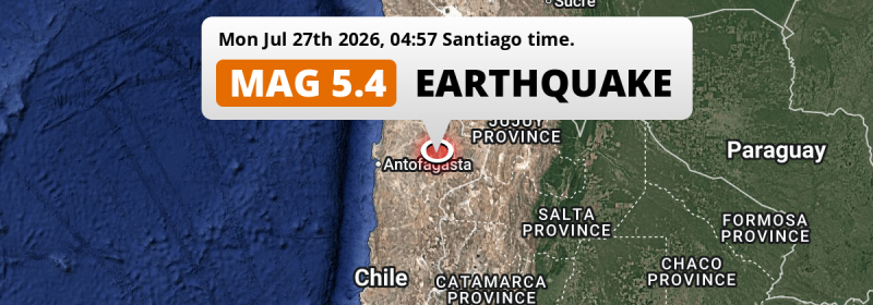
 Jul 27, 2026 04:57AM
On Monday Night a Significant M5.4 Earthquake struck 180km from Antofagasta in Chile.
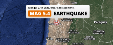
Jul 27, 2026 04:57AM
On Monday Night a Significant M5.4 Earthquake struck 180km from Antofagasta in Chile.
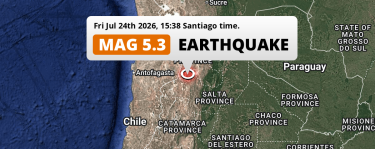 Jul 24, 2026 03:38PM
Significant M5.3 Earthquake struck on Friday Afternoon 151km from Salta in Argentina.
Jul 24, 2026 03:38PM
Significant M5.3 Earthquake struck on Friday Afternoon 151km from Salta in Argentina.
 Jul 22, 2026 01:34PM
M4.8 Earthquake struck on Wednesday Afternoon 105km from Calama in Chile.
Jul 22, 2026 01:34PM
M4.8 Earthquake struck on Wednesday Afternoon 105km from Calama in Chile.
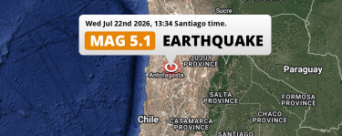
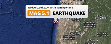 Jul 22, 2026 05:34AM
Shallow M5.1 Earthquake struck on Wednesday Night in the South Pacific Ocean 146km from Copiapó (Chile).
Jul 22, 2026 05:34AM
Shallow M5.1 Earthquake struck on Wednesday Night in the South Pacific Ocean 146km from Copiapó (Chile).
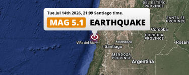 Jul 14, 2026 09:09PM
On Tuesday Evening a Shallow M5.1 Earthquake struck in the South Pacific Ocean near Valparaíso (Chile).
Jul 14, 2026 09:09PM
On Tuesday Evening a Shallow M5.1 Earthquake struck in the South Pacific Ocean near Valparaíso (Chile).
 Jul 6, 2026 12:15PM
On Monday Afternoon a Shallow M5.1 Earthquake struck in the South Pacific Ocean near Valparaíso (Chile).
Jul 6, 2026 12:15PM
On Monday Afternoon a Shallow M5.1 Earthquake struck in the South Pacific Ocean near Valparaíso (Chile).
Chile Earthquake Statistics
Average
A total of 9286 earthquakes with a magnitude of four or above have struck within 300 km (186 mi) of Chile in the past 10 years. This comes down to a yearly average of 928 earthquakes per year, or 77 per month. On average an earthquake will hit near Chile roughly every 9 hours.
A relatively large number of earthquakes occurred near Chile in 2016. A total of 1031 earthquakes (mag 4+) were detected within 300 km of Chile that year. The strongest had a 7.6 magnitude.

Magnitude Distribution
The table below visualizes the distribution of all earthquakes that occurred within 300km of Chile in the past 10 years. No earthquakes with a magnitude of 8 or above have occurred near Chile during this time. Usually, higher magnitudes are less common than lower magnitudes. Small earthquakes with a magnitude below 4 on the Richter scale have been omitted from this overview.
| Magnitude | Earthquakes | Percentage |
|---|---|---|
| Mag. 4 | 8748 | 94.21% |
| Mag. 5 | 478 | 5.15% |
| Mag. 6 | 58 | 0.62% |
| Mag. 7 | 2 | 0.02% |
| Mag. 8 | 0 | 0.0% |
| Mag. 9 | 0 | 0.0% |
| Mag. 10 | 0 | 0.0% |
Strongest earthquakes near Chile
The strongest recent earthquake of the past 10 years near Chile occurred on Dec 25, 2016 11:22 local time (America/Santiago timezone). It had a magnitude of 7.6 and struck 41 kilometers (25 mi) south-west of Quellón, at a depth of 38 km. Discover more strong earthquakes near Chile in the list below.
A longer time ago, a MAG-9.5 earthquake struck on May 22, 1960 15:11, 97 kilometers (60 mi) south-west of Temuco. It is the strongest earthquake near Chile in the past 126 years (Our data goes back to January 1st, 1900).
In the table below you will find the strongest earthquakes that occurred near Chile in the past 10 years. You can use the tabs to find the heaviest historic earthquakes since the year 1900 or within a specific year or distance from Chile.
Earthquakes by region of Chile
Click the links below for earthquake reports for regions in Chile.
- Antofagasta
- Araucanía
- Arica y Parinacota
- Atacama
- Aysén
- Biobío
- Coquimbo Region (Coquimbo)
- Los Lagos Region (Los Lagos)
- Los Ríos Region (Los Ríos)
- Magallanes
- Maule Region (Maule)
- O'Higgins Region (O'Higgins)
- Santiago Metropolitan (Metropolitana)
- Tarapacá
- Valparaíso
- Ñuble
Frequently Asked Questions
These questions are commonly asked in relation to earthquakes occurring near Chile.
When was the last earthquake in Chile?
A 2.7 magnitude earthquake hit near Chile on the night of July 28, 2026 at 04:16 local time (America/Santiago). The center of this earthquake was located 167km south-east of Iquique at a depth of 126km under land. Check the list on our website for any earthquakes occurring near Chile in the past hours.
What was the strongest earthquake near Chile?
A 9.5 magnitude earthquake hit near Chile on the afternoon of May 22, 1960 at 15:11 local time (America/Santiago). The center of this earthquake was located 97km northwest of Temuco at a depth of 25km under land. This is the strongest earthquake that occurred near Chile since the year 1900.
How often do earthquakes occur near Chile?
In the past 10 years, 9286 earthquakes with a magnitude of four or higher occurred within a 300 kilometer range from Chile. This averages to 929 earthquakes yearly, or one earthquake every 9 hours.
