 Read this article


Latest earthquakes near Taiwan today
Complete overview of the latest earthquakes near the country Taiwan, updated every minute. Did you feel an earthquake today in Taiwan? If an earthquake is happening right now near Taiwan, it will show up within minutes.
Recent Taiwan Earthquake News
These are the latest articles published related to earthquakes occurring near Taiwan. Check our Earthquake News section for a complete overview of articles written on earthquakes near Taiwan and elsewhere.
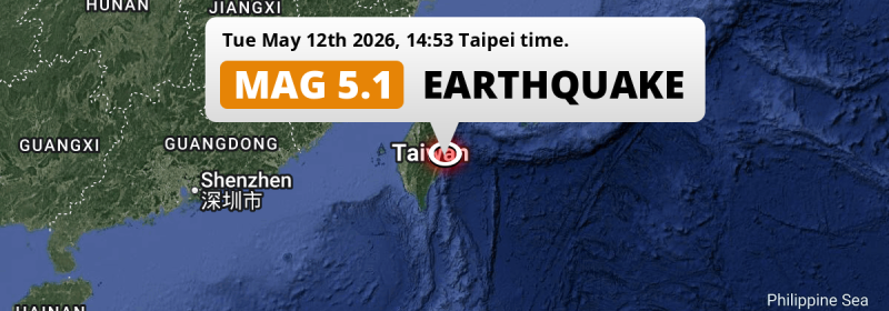
 May 12, 2026 02:53PM
On Tuesday Afternoon a Shallow M5.1 Earthquake struck in the Philippine Sea near Hualien City (Taiwan).
May 12, 2026 02:53PM
On Tuesday Afternoon a Shallow M5.1 Earthquake struck in the Philippine Sea near Hualien City (Taiwan).
 May 1, 2026 08:39PM
On Friday Evening a Significant M5.8 Earthquake struck in the Philippine Sea near Taipei (Taiwan).
May 1, 2026 08:39PM
On Friday Evening a Significant M5.8 Earthquake struck in the Philippine Sea near Taipei (Taiwan).
Taiwan Earthquake Statistics
Average
A total of 2646 earthquakes with a magnitude of four or above have struck within 300 km (186 mi) of Taiwan in the past 10 years. This comes down to a yearly average of 264 earthquakes per year, or 22 per month. On average an earthquake will hit near Taiwan roughly every 1 days.
A relatively large number of earthquakes occurred near Taiwan in 2024. A total of 655 earthquakes (mag 4+) were detected within 300 km of Taiwan that year. The strongest had a 7.4 magnitude.

Magnitude Distribution
The table below visualizes the distribution of all earthquakes that occurred within 300km of Taiwan in the past 10 years. No earthquakes with a magnitude of 8 or above have occurred near Taiwan during this time. Usually, higher magnitudes are less common than lower magnitudes. Small earthquakes with a magnitude below 4 on the Richter scale have been omitted from this overview.
| Magnitude | Earthquakes | Percentage |
|---|---|---|
| Mag. 4 | 2385 | 90.14% |
| Mag. 5 | 241 | 9.11% |
| Mag. 6 | 19 | 0.72% |
| Mag. 7 | 1 | 0.04% |
| Mag. 8 | 0 | 0.0% |
| Mag. 9 | 0 | 0.0% |
| Mag. 10 | 0 | 0.0% |
Strongest earthquakes near Taiwan
The strongest recent earthquake of the past 10 years near Taiwan occurred on Apr 3, 2024 07:58 local time (Asia/Taipei timezone). It had a magnitude of 7.4 and struck 16 kilometers (10 mi) south of Hualien City, at a depth of 40 km. Discover more strong earthquakes near Taiwan in the list below.
A longer time ago, a MAG-8.2 earthquake struck on Jun 5, 1920 12:21, 48 kilometers (30 mi) south of Hualien City. It is the strongest earthquake near Taiwan in the past 126 years (Our data goes back to January 1st, 1900).
In the table below you will find the strongest earthquakes that occurred near Taiwan in the past 10 years. You can use the tabs to find the heaviest historic earthquakes since the year 1900 or within a specific year or distance from Taiwan.
Earthquakes by region of Taiwan
Click the links below for earthquake reports for regions in Taiwan.
- Changhua County (Changhua)
- Fukien (金門縣)
- Hsinchu County (新竹市)
- Hualien County (花蓮縣)
- Kaohsiung (高雄市)
- Keelung (基隆市)
- Nantou County (南投縣)
- New Taipei City (新北市)
- Penghu County (P’eng-hu)
- Pingtung County (屏東縣)
- Taichung City
- Tainan City (臺南市)
- Taipei City (臺北市)
- Taoyuan City (桃園縣)
- Yilan County (宜蘭縣)
- Yunlin County (雲林縣)
Frequently Asked Questions
These questions are commonly asked in relation to earthquakes occurring near Taiwan.
When was the last earthquake in Taiwan?
A 5.1 magnitude earthquake hit near Taiwan on the afternoon of May 12, 2026 at 14:53 local time (Asia/Taipei). The center of this earthquake was located 80km south of Hualien City at a depth of 26km under water in the Philippine Sea. Check the list on our website for any earthquakes occurring near Taiwan in the past hours.
What was the strongest earthquake near Taiwan?
A 8.2 magnitude earthquake hit near Taiwan on the afternoon of June 5, 1920 at 12:21 local time (Asia/Taipei). The center of this earthquake was located 48km south-east of Hualien City at a depth of 20km under water in the Philippine Sea. This is the strongest earthquake that occurred near Taiwan since the year 1900.
How often do earthquakes occur near Taiwan?
In the past 10 years, 2646 earthquakes with a magnitude of four or higher occurred within a 300 kilometer range from Taiwan. This averages to 265 earthquakes yearly, or one earthquake every 1 days.
