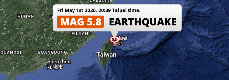
In the evening of Friday May 1st, 2026, a significant MAG-5.8 earthquake hit in the Philippine Sea 55 kilometer from Taipei, Taiwan. The earthquake struck near a very densely populated region. Around 19 million people have been exposed to shaking. Japan and China are also near its epicenter.
Felt the earthquake? Share this article: 


Earthquake Summary
This earthquake hit under water in the Philippine Sea, right off the coast of Taiwan (9 mi offshore), 55 kilometer east of Taipei in Taipei City. The center of this earthquake had an intermediate depth of 103 km.
| Date and Time: | May 1, 2026 20:39 (Taipei Time) - May 1, 2026 12:39 Universal Time. |
|---|---|
| Location: | 55 km east of Taipei, Taipei City, Taiwan. Coordinates 24°52'27"N 122°2'40"E. |
| Map: | 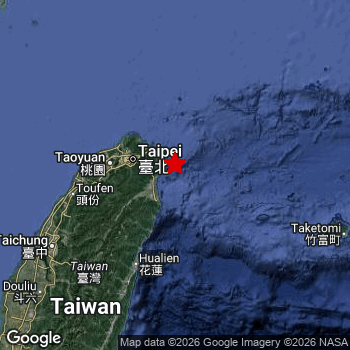 Map of area around epicenter. Click to open in Google Maps. |
| Magnitude: | MAG 5.8 Detected by 34 stations. Maximum Error Range ±0.053 . |
| Depth: | 103 km (64 mi) An intermediate depth. |
| Max. Intensity: | IV
Light On the Modified Mercalli Scale. |
| Tsunami Risk: | Tsunami very unlikely Earthquakes under MAG-6.5 at depths deeper than 100km are very unlikely to cause tsunami's. Always stay cautious - More info here. |
Minimal impact predicted
Based on scientific estimates by the US Geographic Survey (USGS), the risk of high fatalities for this earthquake is classified at level GREEN (low). They expect an 90% likelyhood of between 0 and 1 fatalities.
The USGS classifies the economic impact of this earthquake at level GREEN (low). They expect an 90% likelyhood of between 0 and 1 million US Dollars in economic damage and impact.
Roughly 19 million people exposed to shaking
The USGS has published a report estimating the number of people exposed to this earthquake. Acoording to their analysis, roughly 19 million have been exposed to shaking at an MMI level of II or higher.
The highest earthquake impact level for this earthquake is IV, which corresponds with light shaking and likely no damage. Roughly 702,900 people are expected to be exposed to this level. Intensity level III was experienced by the majority of people (around 18 million). In their region, weak shaking and probably no damage can be expected.
People in 3 countries have been exposed to shaking. In Taiwan , around 19 million people, with impact levels up to IV (light shaking, likely no damage). A smaller number of people were exposed in the following countries: China and Japan.
| People | MMI Level | Shaking | Damage |
|---|---|---|---|
| 0 | I |
Not noticable | None |
| 126,700 | II |
Very weak | None |
| 17,770,000 | III |
Weak | Probably none |
| 702,900 | IV |
Light | Likely none |
| 0 | V |
Moderate | Very light |
| 0 | VI |
Strong | Light |
| 0 | VII |
Very Strong | Moderate |
| 0 | VIII |
Severe | Moderate to heavy |
| 0 | IX |
Violent | Heavy |
| 0 | X |
Extreme | Very heavy |
Nearby towns and cities
This earthquake struck within proximity of multiple countries. Taiwan , Japan and China are all within 300km distance of its epicenter.
Yilan in Yilan County, Taiwan is the nearest significant place from the epicenter. The earthquake occurred 32 kilometer (20 mi) north-east of Yilan. The intensity of shaking and damage in Yilan is estimated to be around level IV on the Modified Mercalli Intensity scale (light shaking, likely no damage).
Multiple large cities are in proximity of today's earthquake. Taipei is located 55 km to the west and experienced an intensity of IV (light shaking, likely no damage). Fuzhou is located 305 km to the northwest (intensity unknown, possibly low). Keelung is located 42 km to the northwest and experienced an intensity of III (weak shaking, probably no damage).
The table below provides an overview of all places in proximity of today's earthquake. Where available, the estimated intensity on the Modified Mercalli Intensity Scale in each place is included. Places where this information is omitted likely experienced little impact.
Overview of nearby places
| Distance | Place | Intensity (MMI) |
|---|---|---|
| 32 km (20 mi) SW from epicenter |
Yilan Yilan County, Taiwan. |
IV
Light |
| 42 km (26 mi) NW from epicenter |
Keelung Keelung, Taiwan. |
III
Weak |
| 55 km (34 mi) W from epicenter |
Taipei Taipei City, Taiwan. |
IV
Light |
| 60 km (37 mi) W from epicenter |
Banqiao New Taipei City, Taiwan. |
III
Weak |
| 76 km (47 mi) W from epicenter |
Daxi Taoyuan City , Taiwan. |
III
Weak |
| 77 km (48 mi) W from epicenter |
Taoyuan City Taoyuan City , Taiwan. |
III
Weak |
| 109 km (68 mi) W from epicenter |
Hsinchu Hsinchu County, Taiwan. |
III
Weak |
| 109 km (68 mi) SW from epicenter |
Hualien City Hualien County, Taiwan. |
IV
Light |
| 148 km (92 mi) SW from epicenter |
Puli Nantou County, Taiwan. |
III
Weak |
| 160 km (99 mi) SW from epicenter |
Taichung Taichung City, Taiwan. |
III
Weak |
| 171 km (106 mi) SW from epicenter |
Zhongxing New Village Nantou County, Taiwan. |
III
Weak |
| 176 km (109 mi) SW from epicenter |
Nantou Nantou County, Taiwan. |
III
Weak |
| 180 km (112 mi) SW from epicenter |
Yuanlin Changhua County, Taiwan. |
III
Weak |
| 181 km (112 mi) SW from epicenter |
Lugu Nantou County, Taiwan. |
III
Weak |
| 200 km (124 mi) SW from epicenter |
Douliu Yunlin County, Taiwan. |
III
Weak |
| 222 km (138 mi) E from epicenter |
Ishigaki Okinawa, Japan. |
|
| 252 km (157 mi) SW from epicenter |
Yujing Tainan City, Taiwan. |
II
Weak |
| 277 km (172 mi) NW from epicenter |
Tantou Fujian, China. |
|
| 280 km (174 mi) SW from epicenter |
Tainan Tainan City, Taiwan. |
|
| 285 km (177 mi) W from epicenter |
Fuqing Fujian, China. |
|
| 289 km (180 mi) SW from epicenter |
Magong Penghu County , Taiwan. |
|
| 294 km (183 mi) W from epicenter |
Jiangkou Fujian, China. |
|
| 303 km (188 mi) NW from epicenter |
Songcheng Fujian, China. |
|
| 305 km (190 mi) NW from epicenter |
Fuzhou Fujian, China. |
|
| 307 km (191 mi) SW from epicenter |
Kaohsiung Kaohsiung, Taiwan. |
|
| 312 km (194 mi) W from epicenter |
Putian Fujian, China. |
|
| 313 km (194 mi) SW from epicenter |
Donggang Pingtung County, Taiwan. |
|
| 319 km (198 mi) NW from epicenter |
Jinxiang Zhejiang, China. |
|
| 321 km (199 mi) NW from epicenter |
Ningde Fujian, China. |
|
| 328 km (204 mi) NW from epicenter |
Fuding Fujian, China. |
|
| 329 km (204 mi) E from epicenter |
Hirara Okinawa, Japan. |
|
| 339 km (211 mi) W from epicenter |
Luoyang Fujian, China. |
|
| 344 km (214 mi) NW from epicenter |
Fu’an Fujian, China. |
|
| 344 km (214 mi) NW from epicenter |
Kunyang Zhejiang, China. |
|
| 346 km (215 mi) S from epicenter |
Hengchun Pingtung County, Taiwan. |
|
| 349 km (217 mi) W from epicenter |
Quanzhou Fujian, China. |
|
| 350 km (217 mi) W from epicenter |
Jinjiang Fujian, China. |
|
| 351 km (218 mi) NW from epicenter |
Rui’an Zhejiang, China. |
|
| 369 km (229 mi) W from epicenter |
Ximeicun Fujian, China. |
|
| 374 km (232 mi) N from epicenter |
Wenzhou Zhejiang, China. |
|
| 380 km (236 mi) W from epicenter |
Jincheng Fukien, Taiwan. |
|
| 395 km (245 mi) N from epicenter |
Wenling Zhejiang, China. |
Earthquake Intensity Map
The maximum intensity (MMI Scale) caused by this earthquake is IV. The map below shows in which areas this earthquake was the most and least impactful. It is based on data from the US Geographic Survey.

Shaking reported by 45 people
People that feel an earthquake may report their experience to the US Geographic Survey. Currently, 45 people have reported shaking in 19 places, all within Taiwan.We keep updating this article as more ground reports become available. You may report that you felt this earthquake here.
Places with most reports:
- Yungho, Taipei Hsien, Taiwan: 15 people.
- Taichung, Taichung Shih, Taiwan: 4 people.
- Sanchung, Taipei Hsien, Taiwan: 4 people.
- Luchou, Taipei Hsien, Taiwan: 3 people.
- Taoyuan, Taoyuan, Taiwan: 3 people.
- Chiayi, Chiayi Shih, Taiwan: 2 people.
- Lotung, Ilan, Taiwan: 2 people.
- Tanshui, Taipei Hsien, Taiwan: 1 person.
- Hsintien, Taipei Hsien, Taiwan: 1 person.
- Puli, Nantou, Taiwan: 1 person.
2 Aftershocks detected
This main shock was followed by 2 smaller aftershocks. Just 3 days after this main shock, an earthquake measuring MAG-4.4 was detected 27 km (17 mi) southwest of this earthquake.
Overview of foreshocks and aftershocks
| Classification | Magnitude | When | Where |
|---|---|---|---|
| Main Shock This Earthquake |
M 5.8 |
May 1, 2026 20:39 (Taipei Time) | - |
| Aftershock | M 4.3 |
3 days later May 4, 2026 09:05 (Taipei Time) | 36 km (22 mi) SW from Main Shock. |
| Aftershock | M 4.4 |
3 days later May 4, 2026 14:59 (Taipei Time) | 27 km (17 mi) SW from Main Shock. |
More earthquakes coming?
The risk of aftershocks decreases rapidly over time. Usually, aftershocks are at least one order of magnitude lower than a main shock.
It's always adviced to be cautious of the risk of a larger shock following any significant earthquake, however this risk is fairly small. There is a roughly 94 percent change that no larger main shock will follow in the days following this earthquake.
Read: How to Stay Safe during an Earthquake (cdc.gov).Earthquakes like this happen often in the region
Earthquakes of this strength are very common in the region. This is the strongest earthquake to hit since December 27th, 2025, when a 6.6 magnitude earthquake hit 21 km (13 mi) further south. An even stronger magnitude 7.4 earthquake struck on April 2nd, 2024.
In total, 38 earthquakes with a magnitude of 5.8 or higher have been registered within 300km (186 mi) of this epicenter in the past 10 years. This comes down to an average of once every 3 months.
Tsunami very unlikely
For a serious tsunami to occur, earthquakes usually need to have a magnitude of at least 6.5 and occur at a shallow depth of maximum 100km. Neither are the case with this earthquake. However always stay cautious and monitor advice from local authorities.
Tsunami Risk Factors
| Factor | Under Sea? | MAG-6.5 or stronger? | Shallow depth? |
|---|---|---|---|
| Explanation | Almost all tsunami's are caused by earthquakes with their epicenter under sea or very near the sea. However stay cautious in coastal areas as earthquakes on land may cause landslides into sea, potentially still causing a local tsunami. | Under MAG 6.5: Very unlikely to cause a tsunami. MAG 6.5 to 7.5: Destructive tsunami's do occur, but are uncommon. Likely to observe small sea level changes. MAG 7.6+: Earthquakes with these magnitudes might produce destructive tsunami's. |
Most destructive tsunami's are caused by shallow earthquakes with a depth between 0 and 100km under the surface of the earth. Deeper tsunami's are unlikely to displace to ocean floor. |
| This Earthquake | This earthquake appears to have struck under the sea. | Not this earthquake. This earthquake had a magnitude of 5.8. Earthquakes of this strength are unlikely to trigger a tsunami. |
Not this earthquake. This earthquake occurred at a depth of 103 km (64 mi). Earthquakes this deep in the earth are unlikely to trigger a tsunami. |
Sources
Last updated 29/06/26 20:38 (). As more information on this earthquake becomes available this article will be updated. This article is automatically composed based on data originating from multiple sources.
- US Geographic Society (USGS): Earthquake us7000shjp
- European-Mediterranean Seismological Centre (EMSC): Earthquake 20260501_0000195
- Geonames.org: World Cities Database
- Google Maps: Static API
- Earthquakelist.org: Historic Earthquakes Database
Share this article:
