 Read this article


Latest earthquakes near Mexico today
Complete overview of the latest earthquakes near the country Mexico, updated every minute. Did you feel an earthquake today in Mexico? If an earthquake is happening right now near Mexico, it will show up within minutes.
Recent Mexico Earthquake News
These are the latest articles published related to earthquakes occurring near Mexico. Check our Earthquake News section for a complete overview of articles written on earthquakes near Mexico and elsewhere.
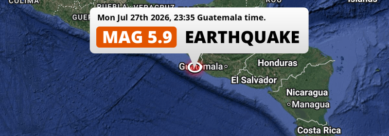
 Jul 27, 2026 11:35PM
Significant M5.9 Earthquake hit in the North Pacific Ocean near Tapachula (Mexico) on Monday Evening.
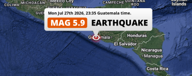
Jul 27, 2026 11:35PM
Significant M5.9 Earthquake hit in the North Pacific Ocean near Tapachula (Mexico) on Monday Evening.
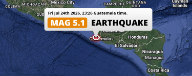 Jul 24, 2026 11:26PM
Significant M5.1 Earthquake hit in the North Pacific Ocean near Tapachula (Mexico) on Friday Evening.
Jul 24, 2026 11:26PM
Significant M5.1 Earthquake hit in the North Pacific Ocean near Tapachula (Mexico) on Friday Evening.
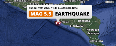 Jul 19, 2026 11:45AM
On Sunday Morning a Significant M5.5 AFTERSHOCK struck in the North Pacific Ocean 108km from Tapachula (Mexico).
Jul 19, 2026 11:45AM
On Sunday Morning a Significant M5.5 AFTERSHOCK struck in the North Pacific Ocean 108km from Tapachula (Mexico).
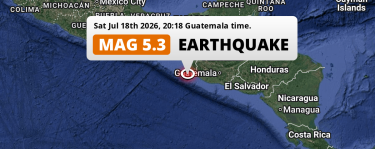 Jul 18, 2026 08:18PM
Shallow M5.3 AFTERSHOCK struck on Saturday Evening in the North Pacific Ocean near Tapachula (Mexico).
Jul 18, 2026 08:18PM
Shallow M5.3 AFTERSHOCK struck on Saturday Evening in the North Pacific Ocean near Tapachula (Mexico).
 Jul 18, 2026 07:47PM
Shallow M5.3 AFTERSHOCK struck on Saturday Evening in the North Pacific Ocean 113km from Tapachula (Mexico).
Jul 18, 2026 07:47PM
Shallow M5.3 AFTERSHOCK struck on Saturday Evening in the North Pacific Ocean 113km from Tapachula (Mexico).
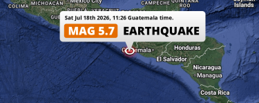 Jul 18, 2026 11:26AM
Shallow M5.7 AFTERSHOCK struck on Saturday Morning in the North Pacific Ocean 100km from Tapachula (Mexico).
Jul 18, 2026 11:26AM
Shallow M5.7 AFTERSHOCK struck on Saturday Morning in the North Pacific Ocean 100km from Tapachula (Mexico).
Mexico Earthquake Statistics
Average
A total of 19241 earthquakes with a magnitude of four or above have struck within 300 km (186 mi) of Mexico in the past 10 years. This comes down to a yearly average of 1924 earthquakes per year, or 160 per month. On average an earthquake will hit near Mexico roughly every 4 hours.
A relatively large number of earthquakes occurred near Mexico in 2017. A total of 2226 earthquakes (mag 4+) were detected within 300 km of Mexico that year. The strongest had a 8.2 magnitude.

Magnitude Distribution
The table below visualizes the distribution of all earthquakes that occurred within 300km of Mexico in the past 10 years. No earthquakes with a magnitude of 9 or above have occurred near Mexico during this time. Usually, higher magnitudes are less common than lower magnitudes. Small earthquakes with a magnitude below 4 on the Richter scale have been omitted from this overview.
| Magnitude | Earthquakes | Percentage |
|---|---|---|
| Mag. 4 | 18828 | 97.85% |
| Mag. 5 | 378 | 1.96% |
| Mag. 6 | 28 | 0.15% |
| Mag. 7 | 6 | 0.03% |
| Mag. 8 | 1 | 0.01% |
| Mag. 9 | 0 | 0.0% |
| Mag. 10 | 0 | 0.0% |
Strongest earthquakes near Mexico
The strongest recent earthquake of the past 10 years near Mexico occurred on Sep 7, 2017 23:49 local time (America/Mexico_City timezone). It had a magnitude of 8.2 and struck 177 kilometers (110 mi) west of Tapachula, at a depth of 47 km. Discover more strong earthquakes near Mexico in the list below.
In the table below you will find the strongest earthquakes that occurred near Mexico in the past 10 years. You can use the tabs to find the heaviest historic earthquakes since the year 1900 or within a specific year or distance from Mexico.
Earthquakes by region of Mexico
Click the links below for earthquake reports for regions in Mexico.
- Aguascalientes
- Baja California
- Baja California Sur
- Campeche
- Chiapas
- Chihuahua
- Coahuila (Coahuila de Zaragoza)
- Colima
- Durango
- Guanajuato
- Guerrero
- Hidalgo
- Jalisco
- Mexico City (Ciudad de México)
- Michoacán (Michoacán de Ocampo)
- Morelos
- México
- Nayarit
- Nuevo León
- Oaxaca
- Puebla
- Querétaro (Querétaro de Arteaga)
- Quintana Roo
- San Luis Potosí
- Sinaloa
- Sonora
- Tabasco
- Tamaulipas
- Tlaxcala
- Veracruz (Veracruz-Llave)
- Yucatán
- Zacatecas
Frequently Asked Questions
These questions are commonly asked in relation to earthquakes occurring near Mexico.
When was the last earthquake in Mexico?
A 2.1 magnitude earthquake hit near Mexico on the morning of July 28, 2026 at 09:33 local time (America/Tijuana). The center of this earthquake was located 61km northwest of Tijuana at a depth of 12km under water in the North Pacific Ocean. Check the list on our website for any earthquakes occurring near Mexico in the past hours.
What was the strongest earthquake near Mexico?
A 8.2 magnitude earthquake hit near Mexico on the evening of September 7, 2017 at 23:49 local time (America/Mexico_City). The center of this earthquake was located 177km west of Tapachula at a depth of 47km under water in the North Pacific Ocean. This is the strongest earthquake that occurred near Mexico since the year 1900.
How often do earthquakes occur near Mexico?
In the past 10 years, 19241 earthquakes with a magnitude of four or higher occurred within a 300 kilometer range from Mexico. This averages to 1924 earthquakes yearly, or one earthquake every 5 hours.
