Just after midnight of Sunday May 10th, 2026, a shallow M4.7 earthquake hit under land 2 miles from Brawley in The United States. Shaking may have been felt by a total of 9 million people. Another nearby country is Mexico.
Felt the earthquake? Share this article: 


Earthquake Summary
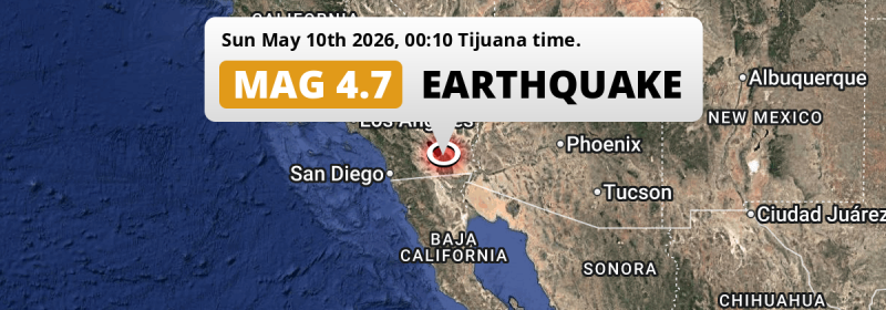
The earthquake struck on land in The United States, 2 miles (3 km) west of Brawley in California. The center of this earthquake had a very shallow depth of 9 km. Shallow earthquakes usually have a larger impact than earthquakes deep in the earth.
| Date and Time: | May 10, 2026 12:10AM (Los Angeles Time) - May 10, 2026 07:10 Universal Time. |
|---|---|
| Location: | 2 mi west of Brawley, California, The United States. Coordinates 32°58'17"N 115°33'44"W. |
| Map: | 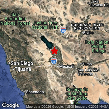 Map of area around epicenter. Click to open in Google Maps. |
| Magnitude: | MAG 4.7 Detected by 23 stations. Maximum Error Range ±0.2 . |
| Depth: | 9 mi (15 km) A very shallow depth. |
| Max. Intensity: | VI
Strong On the Modified Mercalli Scale. |
| Tsunami Risk: | Tsunami very unlikely While this was a shallow earthquake, it appears to have occurred under land with a magnitude not strong enough to cause tsunami's. Always stay cautious - More info here. |
Minimal impact predicted
Based on scientific estimates by the US Geographic Survey (USGS), the risk of high fatalities for this earthquake is classified at level GREEN (low). They expect an 90% likelyhood of between 0 and 1 fatalities.
The USGS classifies the economic impact of this earthquake at level GREEN (low). They expect an 90% likelyhood of between 0 and 1 million US Dollars in economic damage and impact.
Roughly 9 million people exposed to shaking
An estimated 9 million have been exposed to shaking (An MMI or Modified Mercalli Intensity level II or higher) as a result of this earthquake according scientific estimates published by the USGS.
An estimated 22,820 people were exposed to level VI. At this level, strong shaking and probably light damage can be expected. The majority of people (roughly 7.1 million) live in an area exposed to level II, where very weak shaking and no damage is expected. All exposure to shaking was within the borders of Mexico .
| People | MMI Level | Shaking | Damage |
|---|---|---|---|
| 3,894,000 | I |
Not noticable | None |
| 7,134,000 | II |
Very weak | None |
| 1,466,000 | III |
Weak | Probably none |
| 169,900 | IV |
Light | Likely none |
| 9,600 | V |
Moderate | Very light |
| 22,820 | VI |
Strong | Light |
| 0 | VII |
Very Strong | Moderate |
| 0 | VIII |
Severe | Moderate to heavy |
| 0 | IX |
Violent | Heavy |
| 0 | X |
Extreme | Very heavy |
Nearby towns and cities
2 countries can be found within 300km of the epicenter of this earthquake: The United States and Mexico .
Located 2 miles (3 km) west of the epicenter of this earthquake, Brawley (California, The United States) is the nearest significant population center. The intensity of shaking and damage in Brawley is estimated to be around level VI on the Modified Mercalli Intensity scale (strong shaking, probably light damage).
Multiple major population centers exist within 300km of the earthquake that struck today. Mexicali is located 40 km to the south and experienced an intensity of III (weak shaking, probably no damage). Los Angeles is located 171 mi to the northwest (intensity unknown, possibly low). San Diego is located 94 mi to the west and experienced an intensity of II (very weak shaking, no damage).
A complete list of nearby places is included below. Estimated intensity data (MMI) sourced from a shake-map published by the US Geographic Survey is shown where available (cities without data probably experienced little impact).
Overview of nearby places
| Distance | Place | Intensity (MMI) |
|---|---|---|
| 2 mi (3 km) E from epicenter |
Brawley California, The United States. |
VI
Strong |
| 9 mi (14 km) S from epicenter |
Imperial California, The United States. |
IV
Light |
| 12 mi (20 km) S from epicenter |
El Centro California, The United States. |
IV
Light |
| 21 mi (33 km) S from epicenter |
Calexico California, The United States. |
III
Weak |
| 38 km (24 mi) S from epicenter |
Santa Isabel Baja California, Mexico. |
III
Weak |
| 40 km (25 mi) S from epicenter |
Mexicali Baja California, Mexico. |
III
Weak |
| 49 km (30 mi) SE from epicenter |
Puebla Baja California, Mexico. |
III
Weak |
| 87 km (54 mi) SE from epicenter |
Guadalupe Victoria Baja California, Mexico. |
III
Weak |
| 56 mi (90 km) SE from epicenter |
Somerton Arizona, The United States. |
III
Weak |
| 57 mi (91 km) SE from epicenter |
San Luis Arizona, The United States. |
III
Weak |
| 57 mi (92 km) E from epicenter |
Yuma Arizona, The United States. |
III
Weak |
| 94 km (58 mi) SE from epicenter |
San Luis Río Colorado Sonora, Mexico. |
III
Weak |
| 60 mi (97 km) NW from epicenter |
Coachella California, The United States. |
II
Weak |
| 64 mi (103 km) NW from epicenter |
Indio California, The United States. |
II
Weak |
| 65 mi (104 km) NW from epicenter |
La Quinta California, The United States. |
II
Weak |
| 109 km (68 mi) SW from epicenter |
Tecate Baja California, Mexico. |
II
Weak |
| 70 mi (113 km) NW from epicenter |
Palm Desert California, The United States. |
II
Weak |
| 70 mi (113 km) E from epicenter |
Fortuna Foothills Arizona, The United States. |
II
Weak |
| 76 mi (123 km) NW from epicenter |
Cathedral City California, The United States. |
II
Weak |
| 82 mi (132 km) W from epicenter |
El Cajon California, The United States. |
II
Weak |
| 82 mi (132 km) NW from epicenter |
Palm Springs California, The United States. |
II
Weak |
| 83 mi (133 km) W from epicenter |
Santee California, The United States. |
II
Weak |
| 85 mi (137 km) W from epicenter |
Poway California, The United States. |
II
Weak |
| 86 mi (138 km) W from epicenter |
La Mesa California, The United States. |
II
Weak |
| 89 mi (143 km) W from epicenter |
Escondido California, The United States. |
II
Weak |
| 145 km (90 mi) W from epicenter |
Tijuana Baja California, Mexico. |
II
Weak |
| 90 mi (145 km) W from epicenter |
Rancho Penasquitos California, The United States. |
II
Weak |
| 91 mi (147 km) W from epicenter |
Chula Vista California, The United States. |
II
Weak |
| 91 mi (147 km) W from epicenter |
National City California, The United States. |
II
Weak |
| 92 mi (148 km) W from epicenter |
Mira Mesa California, The United States. |
III
Weak |
| 94 mi (151 km) W from epicenter |
San Marcos California, The United States. |
II
Weak |
| 94 mi (152 km) W from epicenter |
San Diego California, The United States. |
II
Weak |
| 155 km (96 mi) SW from epicenter |
Rosarito Baja California, Mexico. |
II
Weak |
| 156 km (97 mi) SW from epicenter |
Ensenada Baja California, Mexico. |
II
Weak |
| 98 mi (157 km) NW from epicenter |
Hemet California, The United States. |
II
Weak |
| 99 mi (159 km) W from epicenter |
Temecula California, The United States. |
I
Not felt |
| 99 mi (159 km) W from epicenter |
Vista California, The United States. |
II
Weak |
| 100 mi (161 km) W from epicenter |
Encinitas California, The United States. |
II
Weak |
| 104 mi (167 km) W from epicenter |
Murrieta California, The United States. |
II
Weak |
| 104 mi (168 km) W from epicenter |
Carlsbad California, The United States. |
II
Weak |
| 106 mi (170 km) NW from epicenter |
Menifee California, The United States. |
II
Weak |
| 106 mi (171 km) W from epicenter |
Oceanside California, The United States. |
II
Weak |
| 111 mi (179 km) NW from epicenter |
Perris California, The United States. |
II
Weak |
| 117 mi (188 km) NW from epicenter |
Moreno Valley California, The United States. |
I
Not felt |
| 126 mi (202 km) NW from epicenter |
Riverside California, The United States. |
II
Weak |
| 127 mi (204 km) NW from epicenter |
San Bernardino California, The United States. |
II
Weak |
| 139 mi (224 km) W from epicenter |
Irvine California, The United States. |
|
| 144 mi (231 km) W from epicenter |
Santa Ana California, The United States. |
|
| 149 mi (239 km) NW from epicenter |
Anaheim California, The United States. |
|
| 161 mi (259 km) W from epicenter |
Long Beach California, The United States. |
|
| 171 mi (276 km) NW from epicenter |
Los Angeles California, The United States. |
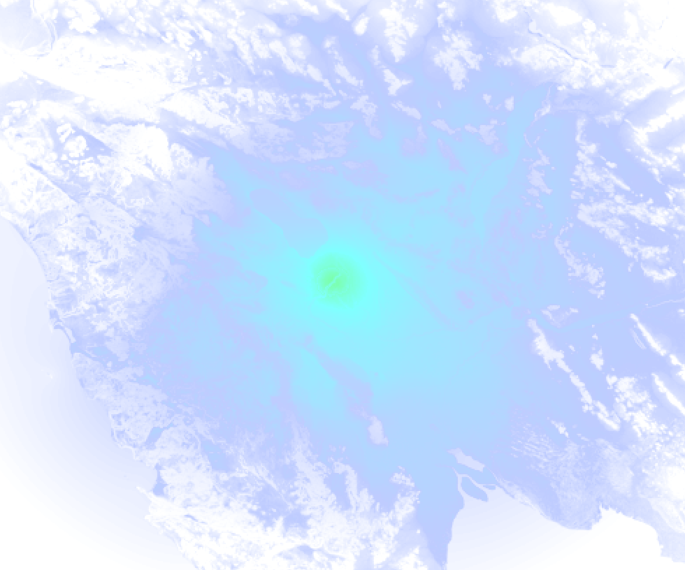
Earthquake Intensity Map
The maximum intensity (MMI Scale) caused by this earthquake is VI. The map below shows in which areas this earthquake was the most and least impactful. It is based on data from the US Geographic Survey.
Shaking reported by 19 people
People that feel an earthquake may report their experience to the US Geographic Survey. Currently, 19 people have reported shaking in 3 places, all within Mexico.We keep updating this article as more ground reports become available. You may report that you felt this earthquake here.
Places with most reports:
- Mexicali, Baja California, Mexico: 14 people.
- Tijuana, Baja California, Mexico: 3 people.
- Puebla, Baja California, Mexico: 2 people.
15 Aftershocks detected
This main shock was followed by 15 smaller aftershocks. Just 31 mins after this main shock, an earthquake measuring MAG-3.2 was detected 0.2 mi (0.4 km) south of this earthquake.
Before this earthquake struck, 31 smaller foreshocks occurred. A 4.5 magnitude earthquake hit 4 hrs earlier nearby.
Overview of foreshocks and aftershocks
| Classification | Magnitude | When | Where |
|---|---|---|---|
| Foreshock | M 3.4 |
8 hrs earlier May 9, 2026 04:14PM (Los Angeles Time) | 0.4 mi (0.7 km) E from Main Shock. |
| Foreshock | M 2.6 |
8 hrs earlier May 9, 2026 04:18PM (Los Angeles Time) | 0.4 mi (0.7 km) SE from Main Shock. |
| Foreshock | M 2.8 |
8 hrs earlier May 9, 2026 04:22PM (Los Angeles Time) | 0.1 mi (0.1 km) S from Main Shock. |
| Foreshock | M 3.5 |
7 hrs earlier May 9, 2026 04:49PM (Los Angeles Time) | 0.4 mi (0.6 km) SE from Main Shock. |
| Foreshock | M 3.5 |
7 hrs earlier May 9, 2026 04:49PM (Los Angeles Time) | 1.6 mi (2.6 km) NW from Main Shock. |
| Foreshock | M 2.5 |
7 hrs earlier May 9, 2026 05:32PM (Los Angeles Time) | 0.9 mi (1.4 km) S from Main Shock. |
| Foreshock | M 3.4 |
7 hrs earlier May 9, 2026 05:34PM (Los Angeles Time) | 0.2 mi (0.4 km) S from Main Shock. |
| Foreshock | M 3.0 |
7 hrs earlier May 9, 2026 05:36PM (Los Angeles Time) | 0.6 mi (0.9 km) S from Main Shock. |
| Foreshock | M 2.6 |
6 hrs earlier May 9, 2026 05:58PM (Los Angeles Time) | 0.7 mi (1.1 km) SE from Main Shock. |
| Foreshock | M 4.4 |
5 hrs earlier May 9, 2026 07:22PM (Los Angeles Time) | 0.2 mi (0.4 km) SE from Main Shock. |
| Foreshock | M 2.5 |
5 hrs earlier May 9, 2026 07:26PM (Los Angeles Time) | 0.6 mi (0.9 km) SW from Main Shock. |
| Foreshock | M 2.5 |
5 hrs earlier May 9, 2026 07:32PM (Los Angeles Time) | 1.1 mi (1.7 km) SE from Main Shock. |
| Foreshock | M 2.9 |
5 hrs earlier May 9, 2026 07:33PM (Los Angeles Time) | 0.7 mi (1.2 km) E from Main Shock. |
| Foreshock | M 2.7 |
4 hrs earlier May 9, 2026 08:05PM (Los Angeles Time) | 0.6 mi (1 km) S from Main Shock. |
| Foreshock | M 2.6 |
4 hrs earlier May 9, 2026 08:10PM (Los Angeles Time) | 1.1 mi (1.8 km) SE from Main Shock. |
| Foreshock | M 3.1 |
4 hrs earlier May 9, 2026 08:13PM (Los Angeles Time) | 0.4 mi (0.7 km) E from Main Shock. |
| Foreshock | M 4.5 |
4 hrs earlier May 9, 2026 08:39PM (Los Angeles Time) | 0.9 mi (1.4 km) NE from Main Shock. |
| Foreshock | M 2.6 |
3 hrs earlier May 9, 2026 08:41PM (Los Angeles Time) | 1.5 mi (2.4 km) E from Main Shock. |
| Foreshock | M 3.5 |
3 hrs earlier May 9, 2026 08:44PM (Los Angeles Time) | 0.9 mi (1.4 km) E from Main Shock. |
| Foreshock | M 2.7 |
3 hrs earlier May 9, 2026 08:46PM (Los Angeles Time) | 0.9 mi (1.4 km) SE from Main Shock. |
| Foreshock | M 2.9 |
3 hrs earlier May 9, 2026 09:18PM (Los Angeles Time) | 0.7 mi (1.1 km) SE from Main Shock. |
| Foreshock | M 2.5 |
2 hrs earlier May 9, 2026 09:43PM (Los Angeles Time) | 0.9 mi (1.5 km) S from Main Shock. |
| Foreshock | M 2.8 |
2 hrs earlier May 9, 2026 10:05PM (Los Angeles Time) | 0.8 mi (1.3 km) E from Main Shock. |
| Foreshock | M 3.0 |
2 hrs earlier May 9, 2026 10:11PM (Los Angeles Time) | 0.4 mi (0.6 km) S from Main Shock. |
| Foreshock | M 3.1 |
2 hrs earlier May 9, 2026 10:11PM (Los Angeles Time) | 0.9 mi (1.4 km) SW from Main Shock. |
| Foreshock | M 2.5 |
2 hrs earlier May 9, 2026 10:12PM (Los Angeles Time) | 1.2 mi (2 km) SW from Main Shock. |
| Foreshock | M 3.3 |
1 hr earlier May 9, 2026 10:51PM (Los Angeles Time) | 2.1 mi (3 km) NE from Main Shock. |
| Foreshock | M 3.4 |
1 hr earlier May 9, 2026 11:02PM (Los Angeles Time) | 0.8 mi (1.3 km) S from Main Shock. |
| Foreshock | M 3.0 |
34 mins earlier May 9, 2026 11:36PM (Los Angeles Time) | 0.4 mi (0.7 km) SE from Main Shock. |
| Foreshock | M 2.6 |
27 mins earlier May 9, 2026 11:42PM (Los Angeles Time) | 0.5 mi (0.8 km) S from Main Shock. |
| Foreshock | M 3.2 |
27 mins earlier May 9, 2026 11:43PM (Los Angeles Time) | 2.1 mi (3 km) E from Main Shock. |
| Main Shock This Earthquake |
M 4.7 |
May 10, 2026 12:10AM (Los Angeles Time) | - |
| Aftershock | M 2.9 |
3 mins later May 10, 2026 12:13AM (Los Angeles Time) | 0.6 mi (0.9 km) SE from Main Shock. |
| Aftershock | M 2.6 |
4 mins later May 10, 2026 12:14AM (Los Angeles Time) | 1.6 mi (2.5 km) SE from Main Shock. |
| Aftershock | M 2.6 |
4 mins later May 10, 2026 12:14AM (Los Angeles Time) | 1.4 mi (2.3 km) E from Main Shock. |
| Aftershock | M 2.6 |
4 mins later May 10, 2026 12:14AM (Los Angeles Time) | 0.7 mi (1.1 km) S from Main Shock. |
| Aftershock | M 2.5 |
5 mins later May 10, 2026 12:15AM (Los Angeles Time) | 0.3 mi (0.5 km) SE from Main Shock. |
| Aftershock | M 2.7 |
6 mins later May 10, 2026 12:16AM (Los Angeles Time) | 1.2 mi (2 km) S from Main Shock. |
| Aftershock | M 2.6 |
8 mins later May 10, 2026 12:18AM (Los Angeles Time) | 1.4 mi (2.3 km) E from Main Shock. |
| Aftershock | M 3.2 |
18 mins later May 10, 2026 12:27AM (Los Angeles Time) | 1.4 mi (2.3 km) E from Main Shock. |
| Aftershock | M 3.2 |
31 mins later May 10, 2026 12:41AM (Los Angeles Time) | 0.2 mi (0.4 km) S from Main Shock. |
| Aftershock | M 2.6 |
38 mins later May 10, 2026 12:48AM (Los Angeles Time) | 0.8 mi (1.3 km) SW from Main Shock. |
| Aftershock | M 2.9 |
43 mins later May 10, 2026 12:53AM (Los Angeles Time) | 0.4 mi (0.7 km) S from Main Shock. |
| Aftershock | M 2.9 |
4 hrs later May 10, 2026 03:47AM (Los Angeles Time) | 1.2 mi (2 km) NE from Main Shock. |
| Aftershock | M 2.8 |
4 hrs later May 10, 2026 04:03AM (Los Angeles Time) | 1.2 mi (2 km) NE from Main Shock. |
| Aftershock | M 2.7 |
7 hrs later May 10, 2026 07:16AM (Los Angeles Time) | 1 mi (1.6 km) NE from Main Shock. |
| Aftershock | M 2.5 |
1 day later May 11, 2026 02:13AM (Los Angeles Time) | 2.4 mi (4 km) SE from Main Shock. |
More earthquakes coming?
The risk of aftershocks decreases rapidly over time. Usually, aftershocks are at least one order of magnitude lower than a main shock.
The chance that a significant earthquake like this one is followed by an even larger earthquake is not so large. On average, scientists estimate a 94% chance that a major earthquake will not be followed by an even larger one. It is still adviced to be aware of this risk
Read: How to Stay Safe during an Earthquake (cdc.gov).Earthquakes like this happen often in the region
Earthquakes of this strength are very common in the region. This is the strongest earthquake to hit since January 20th, 2026, when a 4.9 magnitude earthquake hit 73 mi (117 km) further northwest. An even stronger magnitude 6.2 earthquake struck on November 22nd, 2022.
In total, 19 earthquakes with a magnitude of 4.7 or higher have been registered within 300km (186 mi) of this epicenter in the past 10 years. This comes down to an average of once every 6 months.
Tsunami very unlikely
While MAG-6.5+ earthquakes may cause tsunami's, it appears that the epicenter of this earthquake hit under land. In addition, the reported depth is deeper than 100km, making the risk of a tsunami even less likely. However always stay cautious and monitor advice from local authorities.
Tsunami Risk Factors
| Factor | Under Sea? | MAG-6.5 or stronger? | Shallow depth? |
|---|---|---|---|
| Explanation | Almost all tsunami's are caused by earthquakes with their epicenter under sea or very near the sea. However stay cautious in coastal areas as earthquakes on land may cause landslides into sea, potentially still causing a local tsunami. | Under MAG 6.5: Very unlikely to cause a tsunami. MAG 6.5 to 7.5: Destructive tsunami's do occur, but are uncommon. Likely to observe small sea level changes. MAG 7.6+: Earthquakes with these magnitudes might produce destructive tsunami's. |
Most destructive tsunami's are caused by shallow earthquakes with a depth between 0 and 100km under the surface of the earth. Deeper tsunami's are unlikely to displace to ocean floor. |
| This Earthquake | Not this earthquake. This earthquake appears to have struck on land far from any coast. |
Not this earthquake. This earthquake had a magnitude of 4.7. Earthquakes of this strength are unlikely to trigger a tsunami. |
This earthquake occurred at a depth of of 9 mi (15 km). Earthquakes this shallow could trigger a tsunami. |
Sources
Last updated 09/07/26 05:58 (). This article is automatically generated based on available data. We keep checking multiple sources for additional information. This article gets updated as new details on this earthquake become available.
- US Geographic Society (USGS): Earthquake ci41461608
- European-Mediterranean Seismological Centre (EMSC): Earthquake 20260510_0000145
- Geonames.org: World Cities Database
- Google Maps: Static API
- Earthquakelist.org: Historic Earthquakes Database
Share this article:
