Around noon of Saturday January 31st, 2026, a shallow and significant MAG-5.3 earthquake hit under land 110 kilometer from Akureyri in Iceland.
Felt the earthquake? Share this article: 


Earthquake Summary
The earthquake struck on land in Iceland, 110 kilometer (68 mi) south of Akureyri in Northeast. The center of this earthquake had a very shallow depth of 10 km. Shallow earthquakes usually have a larger impact than earthquakes deep in the earth.
| Date and Time: | Jan 31, 2026 11:54 (Reykjavik Time) - Jan 31, 2026 11:54 Universal Time. |
|---|---|
| Location: | 110 km south of Akureyri, Northeast, Iceland. Coordinates 64°41'54"N 17°49'34"W. |
| Map: | 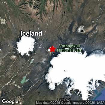 Map of area around epicenter. Click to open in Google Maps. |
| Magnitude: | MAG 5.3 Detected by 23 stations. Maximum Error Range ±0.065 . |
| Depth: | 10 km (6 mi) A very shallow depth. |
| Tsunami Risk: | Tsunami very unlikely While this was a shallow earthquake, it appears to have occurred under land with a magnitude not strong enough to cause tsunami's. Always stay cautious - More info here. |
Nearby towns and cities
This earthquake may have been felt in Iceland . Located 110 kilometer (68 mi) south of the epicenter of this earthquake, Akureyri (Northeast, Iceland) is the nearest significant population center.
An overview of nearby towns and cities is available in the overview below.
Overview of nearby places
| Distance | Place |
|---|---|
| 110 km (68 mi) N from epicenter |
Akureyri Northeast, Iceland. |
| 205 km (127 mi) WSW from epicenter |
Reykjavík Capital Region, Iceland. |
| 207 km (129 mi) WSW from epicenter |
Kópavogur Capital Region, Iceland. |
| 210 km (130 mi) WSW from epicenter |
Hafnarfjörður Capital Region, Iceland. |
Aftershocks detected
This main shock was followed by 1 smaller aftershock. A 3 magnitude earthquake hit 8 hrs later 23 km (14 mi) south-southeast of this earthquake.
Overview of foreshocks and aftershocks
| Classification | Magnitude | When | Where |
|---|---|---|---|
| Main Shock This Earthquake |
M 5.3 |
Jan 31, 2026 11:54 (Reykjavik Time) | - |
| Aftershock | M 3.0 |
8 hrs later Jan 31, 2026 19:54 (Reykjavik Time) | 23 km (14 mi) SSE from Main Shock. |
More earthquakes coming?
Aftershocks are usually at least 1 order of magnitude less strong than main shocks. The more time passes, the smaller the chance and likely strength of any potential aftershocks.
In only six percent of cases, significant earthquakes are followed by a larger main shock, making the current earthquake a foreshock. While the chance of this happening is not so large, it is adviced to maintain cautiousness in the hours and days following a major earthquake.
Read: How to Stay Safe during an Earthquake (cdc.gov).Earthquakes like this happen often in the region
Earthquakes of this strength are very common in the region. This is the strongest earthquake to hit since October 29th, 2025, when a 5.4 magnitude earthquake hit 27 km (17 mi) further east-southeast. An even stronger magnitude 6 earthquake struck on June 21st, 2020.
In total, 14 earthquakes with a magnitude of 5.3 or higher have been registered within 300km (186 mi) of this epicenter in the past 10 years. This comes down to an average of once every 9 months.
Tsunami very unlikely
While MAG-6.5+ earthquakes may cause tsunami's, it appears that the epicenter of this earthquake hit under land. In addition, the reported depth is deeper than 100km, making the risk of a tsunami even less likely. However always stay cautious and monitor advice from local authorities.
Tsunami Risk Factors
| Factor | Under Sea? | MAG-6.5 or stronger? | Shallow depth? |
|---|---|---|---|
| Explanation | Almost all tsunami's are caused by earthquakes with their epicenter under sea or very near the sea. However stay cautious in coastal areas as earthquakes on land may cause landslides into sea, potentially still causing a local tsunami. | Under MAG 6.5: Very unlikely to cause a tsunami. MAG 6.5 to 7.5: Destructive tsunami's do occur, but are uncommon. Likely to observe small sea level changes. MAG 7.6+: Earthquakes with these magnitudes might produce destructive tsunami's. |
Most destructive tsunami's are caused by shallow earthquakes with a depth between 0 and 100km under the surface of the earth. Deeper tsunami's are unlikely to displace to ocean floor. |
| This Earthquake | Not this earthquake. This earthquake appears to have struck on land far from any coast. |
Not this earthquake. This earthquake had a magnitude of 5.3. Earthquakes of this strength are unlikely to trigger a tsunami. |
This earthquake occurred at a depth of of 10 km (6 mi). Earthquakes this shallow could trigger a tsunami. |
Sources
Last updated 18/02/26 14:08 (). This article is automatically generated based on available data. We keep checking multiple sources for additional information. This article gets updated as new details on this earthquake become available.
- US Geographic Society (USGS): Earthquake us6000s5qs
- European-Mediterranean Seismological Centre (EMSC): Earthquake 20260131_0000174
- Geonames.org: World Cities Database
- Google Maps: Static API
- Earthquakelist.org: Historic Earthquakes Database
Share this article:
