Latest earthquakes near Pakistan today
Complete overview of the latest earthquakes near the country Pakistan, updated every minute. Did you feel an earthquake today in Pakistan? If an earthquake is happening right now near Pakistan (also known as پاکستان), it will show up within minutes.
| Date and Time | Magnitude | Location |
|---|---|---|
| 1 day ago (Jan 19 22:28 Karachi) |
M 4.2 | 279 km N from Mingora |
| 1 day ago (Jan 19 22:28 Karachi) |
M 4.6 | 276 km NNW from Battagram |
| 3 days ago (Jan 18 15:21 Karachi) |
M 3.2 | 192 km E from Sialkot |
| 5 days ago (Jan 15 23:32 Karachi) |
M 4.2 | 291 km N from Peshawar |
| 6 days ago (Jan 15 06:31 Karachi) |
M 4.3 | 269 km NW from Mingora |
| 7 days ago (Jan 14 03:25 Karachi) |
M 4.1 | 284 km N from Mingora |
| 9 days ago (Jan 11 22:28 Karachi) |
M 4.4 | 293 km NNW from Mingora |
| 11 days ago (Jan 9 16:56 Karachi) |
M 3.2 | 293 km W from Turbat |
| 13 days ago (Jan 7 16:44 Karachi) |
M 3.4 | 241 km E from Lahore |
| 16 days ago (Jan 5 13:04 Karachi) |
M 3.5 | 196 km ENE from Gujranwala |
| 16 days ago (Jan 5 11:56 Karachi) |
M 4.2 | 284 km N from Mingora |
| 16 days ago (Jan 5 06:01 Karachi) |
M 4.2 | 230 km NNW from Peshawar |
| 17 days ago (Jan 4 16:07 Karachi) |
M 3.6 | 259 km SE from Hyderabad |
| 21 days ago (Dec 31 02:48 Karachi) |
M 4.0 | 294 km NW from Battagram |
| 22 days ago (Dec 29 22:35 Karachi) |
M 4.2 | 257 km NNW from Peshawar |
| 22 days ago (Dec 29 21:47 Karachi) |
M 4.0 | 283 km N from Peshawar |
| 23 days ago (Dec 29 05:11 Karachi) |
M 4.1 | 274 km NNW from Battagram |
| 23 days ago (Dec 28 19:04 Karachi) |
M 3.4 | 153 km ENE from Kotli |
| 24 days ago (Dec 28 03:39 Karachi) |
M 4.7 | 116 km NNW from Quetta |
| 24 days ago (Dec 27 20:37 Karachi) |
M 4.3 | 66 km ENE from Muzaffarābād |
| 24 days ago (Dec 27 20:36 Karachi) |
M 4.0 | 90 km E from Muzaffarābād |
| 24 days ago (Dec 27 18:44 Karachi) |
M 4.3 | 266 km NNW from Peshawar |
| 25 days ago (Dec 27 06:11 Karachi) |
M 4.1 | 295 km NNW from Peshawar |
| 25 days ago (Dec 27 06:11 Karachi) |
M 4.4 | 262 km N from Peshawar |
| 26 days ago (Dec 25 17:37 Karachi) |
M 3.1 | 199 km E from Sialkot |
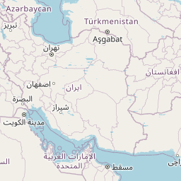
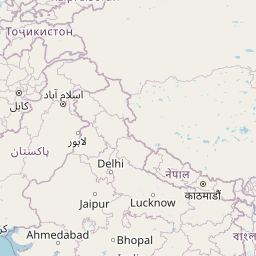
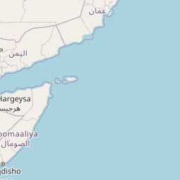
Map of Latest Earthquakes near Pakistan
Pakistan Earthquake Statistics
Average
A total of 2433 earthquakes with a magnitude of four or above have struck within 300 km (186 mi) of Pakistan in the past 10 years. This comes down to a yearly average of 243 earthquakes per year, or 20 per month. On average an earthquake will hit near Pakistan roughly every 1 days.
A relatively large number of earthquakes occurred near Pakistan in 2015. A total of 301 earthquakes (mag 4+) were detected within 300 km of Pakistan that year. The strongest had a 6.3 magnitude.

Magnitude Distribution
The table below visualizes the distribution of all earthquakes that occurred within 300km of Pakistan in the past 10 years. No earthquakes with a magnitude of 7 or above have occurred near Pakistan during this time. Usually, higher magnitudes are less common than lower magnitudes. Small earthquakes with a magnitude below 4 on the Richter scale have been omitted from this overview.
| Magnitude | Earthquakes | Percentage |
|---|---|---|
| Mag. 4 | 2309 | 94.9% |
| Mag. 5 | 114 | 4.69% |
| Mag. 6 | 10 | 0.41% |
| Mag. 7 | 0 | 0.0% |
| Mag. 8 | 0 | 0.0% |
| Mag. 9 | 0 | 0.0% |
| Mag. 10 | 0 | 0.0% |
Strongest earthquakes near Pakistan
The strongest recent earthquake of the past 10 years near Pakistan occurred on Apr 10, 2016 15:28 local time (Asia/Karachi timezone). It had a magnitude of 6.6 and struck 277 kilometers (172 mi) north of Peshawar, at a depth of 212 km. Discover more strong earthquakes near Pakistan in the list below.
A longer time ago, a MAG-8.1 earthquake struck on Nov 28, 1945 03:26, 130 kilometers (81 mi) north of Turbat. It is the strongest earthquake near Pakistan in the past 125 years (Our data goes back to January 1st, 1900).
In the table below you will find the strongest earthquakes that occurred near Pakistan in the past 10 years. You can use the tabs to find the heaviest historic earthquakes since the year 1900 or within a specific year or distance from Pakistan.
| Date and Time | Magnitude | Location |
|---|---|---|
| Apr 10, 2016 15:28 (Karachi) |
M 6.6 | 277 km N from Peshawar |
| Mar 21, 2023 21:47 (Karachi) |
M 6.5 | 285 km NNW from Peshawar |
| Jan 11, 2024 14:20 (Karachi) |
M 6.4 | 291 km NNW from Peshawar |
| Dec 26, 2015 00:14 (Karachi) |
M 6.3 | 279 km N from Peshawar |
| Feb 8, 2017 03:03 (Karachi) |
M 6.3 | 93 km SSE from Turbat |
| May 9, 2018 15:41 (Karachi) |
M 6.2 | 297 km NNW from Battagram |
| Jan 31, 2018 12:07 (Karachi) |
M 6.2 | 288 km NNW from Peshawar |
| Dec 20, 2019 16:39 (Karachi) |
M 6.1 | 299 km NNW from Peshawar |
| Jun 22, 2022 01:54 (Karachi) |
M 6.0 | 225 km WSW from Peshawar |
| Jan 5, 2023 19:25 (Karachi) |
M 6.0 | 284 km NNW from Peshawar |
Map of Strongest Earthquakes near Pakistan
Earthquakes by region of Pakistan
Click the links below for earthquake reports for regions in Pakistan.
- Azad Kashmir
- Balochistan
- Islamabad (اسلام آباد)
- Khyber Pakhtunkhwa (Khyber Pakhtunkhwa Province)
- Punjab
- Sindh (سندھ)
Frequently Asked Questions
These questions are commonly asked in relation to earthquakes occurring near Pakistan.
When was the last earthquake in Pakistan?
A 4.2 magnitude earthquake hit near Pakistan on the evening of January 19, 2025 at 22:28 local time (Asia/Karachi). The center of this earthquake was located 279km north of Mingora at a depth of 153km under land. Check the list on our website for any earthquakes occurring near Pakistan in the past hours.
What was the strongest earthquake near Pakistan?
A 8.1 magnitude earthquake hit near Pakistan on the night of November 28, 1945 at 03:26 local time (Asia/Karachi). The center of this earthquake was located 130km south-southeast of Turbat at a depth of 15km under water in the Arabian Sea. This is the strongest earthquake that occurred near Pakistan since the year 1900.
How often do earthquakes occur near Pakistan?
In the past 10 years, 2433 earthquakes with a magnitude of four or higher occurred within a 300 kilometer range from Pakistan. This averages to 243 earthquakes yearly, or one earthquake every 2 days.
