
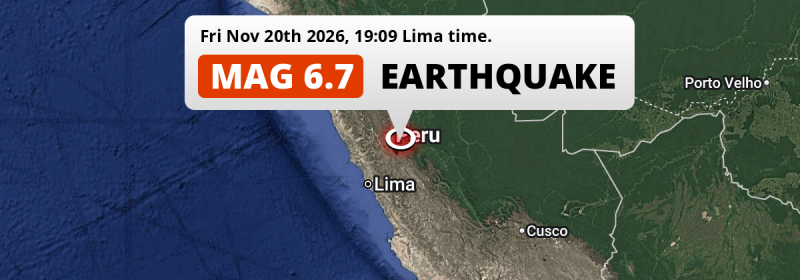
Under land 37 kilometer from Cerro de Pasco in Peru, an unusually powerful M6.7 earthquake occurred in the evening of Friday November 20th, 2026. The USGS has indicated there is a potential risk at tsunami's following this earthquake.
Felt the earthquake? Share this article: 


Earthquake Summary
The earthquake struck on land in Peru, 37 kilometer (23 mi) south-east of Cerro de Pasco in Pasco. The center of this earthquake had an intermediate depth of 108 km.
| Date and Time: | Nov 20, 2026 19:09 (Lima Time) - Nov 21, 2026 00:09 Universal Time. |
|---|---|
| Location: | 37 km SE of Cerro de Pasco, Pasco, Peru. Coordinates 10°51'17"S 75°58'40"W. |
| Map: | 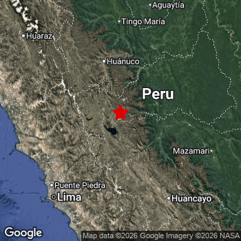 Map of area around epicenter. Click to open in Google Maps. |
| Magnitude: | MAG 6.7 Detected by 80 stations. Maximum Error Range ±0.042 . |
| Depth: | 108 km (67 mi) An intermediate depth. |
| Max. Intensity: | VI
Strong On the Modified Mercalli Scale. |
| Tsunami Risk: | Potential tsunami risk The USGS has indicated there is a potential risk at tsunami's following this earthquake. Always stay cautious - More info here. |
Potential tsunami risk
There is a potential tsunami risk in the aftermath of this earthquake, immediately evacuate to higher grounds away from coastal areas and monitor advice from local authorities. The US Geographic Survey organization has indicated a potential risk for tsunami's following this earthquake.
Tsunami Risk Factors
| Factor | Under Sea? | MAG-6.5 or stronger? | Shallow depth? |
|---|---|---|---|
| Explanation | Almost all tsunami's are caused by earthquakes with their epicenter under sea or very near the sea. However stay cautious in coastal areas as earthquakes on land may cause landslides into sea, potentially still causing a local tsunami. | Under MAG 6.5: Very unlikely to cause a tsunami. MAG 6.5 to 7.5: Destructive tsunami's do occur, but are uncommon. Likely to observe small sea level changes. MAG 7.6+: Earthquakes with these magnitudes might produce destructive tsunami's. |
Most destructive tsunami's are caused by shallow earthquakes with a depth between 0 and 100km under the surface of the earth. Deeper tsunami's are unlikely to displace to ocean floor. |
| This Earthquake | Not this earthquake. This earthquake appears to have struck on land far from any coast. |
This earthquake had a magnitude of 6.7. Earthquakes of this strength could trigger a tsunami. | Not this earthquake. This earthquake occurred at a depth of 108 km (67 mi). Earthquakes this deep in the earth are unlikely to trigger a tsunami. |
Minimal impact predicted
Based on scientific estimates by the US Geographic Survey (USGS), the risk of high fatalities for this earthquake is classified at level GREEN (low). They expect an 90% likelyhood of between 0 and 1 fatalities.
The USGS classifies the economic impact of this earthquake at level GREEN (low). They expect an 90% likelyhood of between 0 and 1 million US Dollars in economic damage and impact.
Roughly 0.8 million people exposed to shaking
An estimated 0.8 million have been exposed to shaking (An MMI or Modified Mercalli Intensity level II or higher) as a result of this earthquake according scientific estimates published by the USGS.
Strong shaking and probably light damage may have been experienced by an estimated 5,400 people. At VI, it is the highest MMI level this earthquake has caused. The majority of people (roughly 410 thousand) live in an area exposed to level IV, where light shaking and likely no damage is expected. All exposure to shaking was within the borders of Peru .
| People | MMI Level | Shaking | Damage |
|---|---|---|---|
| 0 | I |
Not noticable | None |
| 0 | II |
Very weak | None |
| 0 | III |
Weak | Probably none |
| 406,200 | IV |
Light | Likely none |
| 366,100 | V |
Moderate | Very light |
| 5,400 | VI |
Strong | Light |
| 0 | VII |
Very Strong | Moderate |
| 0 | VIII |
Severe | Moderate to heavy |
| 0 | IX |
Violent | Heavy |
| 0 | X |
Extreme | Very heavy |
Nearby towns and cities
This earthquake may have been felt in Peru . Located 34 kilometer (21 mi) north of the epicenter of this earthquake, Junín (Junin, Peru) is the nearest significant population center. The intensity of shaking and damage in Junín is estimated to be around level V on the Modified Mercalli Intensity scale (moderate shaking, very light damage).
Multiple major population centers exist within 300km of the earthquake that struck today. Lima is located 175 km to the southwest (intensity unknown, possibly low). Callao is located 182 km to the southwest (intensity unknown, possibly low). Huancayo is located 159 km to the south-east (intensity unknown, possibly low).
A complete list of nearby places is included below. Estimated intensity data (MMI) sourced from a shake-map published by the US Geographic Survey is shown where available (cities without data probably experienced little impact).
Overview of nearby places
| Distance | Place | Intensity (MMI) |
|---|---|---|
| 34 km (21 mi) S from epicenter |
Junín Junin, Peru. |
V
Moderate |
| 37 km (23 mi) NW from epicenter |
Cerro de Pasco Pasco, Peru. |
V
Moderate |
| 37 km (23 mi) NW from epicenter |
Yanacancha Pasco, Peru. |
V
Moderate |
| 70 km (43 mi) SE from epicenter |
Tarma Junin, Peru. |
V
Moderate |
| 73 km (45 mi) NW from epicenter |
Chaupimarca Pasco, Peru. |
IV
Light |
| 74 km (46 mi) S from epicenter |
La Oroya Junin, Peru. |
IV
Light |
| 100 km (62 mi) NW from epicenter |
Yanacancha Huanuco, Peru. |
IV
Light |
| 107 km (66 mi) N from epicenter |
Huánuco Huanuco, Peru. |
|
| 115 km (71 mi) SE from epicenter |
Jauja Junin, Peru. |
|
| 120 km (75 mi) E from epicenter |
Santa Rosa Junin, Peru. |
|
| 145 km (90 mi) SW from epicenter |
Chosica Lima Region, Peru. |
|
| 152 km (94 mi) SW from epicenter |
Huaral Lima Region, Peru. |
|
| 153 km (95 mi) E from epicenter |
Satipo Junin, Peru. |
|
| 159 km (99 mi) SE from epicenter |
Huancayo Junin, Peru. |
|
| 161 km (100 mi) SE from epicenter |
Chilca Junin, Peru. |
|
| 162 km (101 mi) SW from epicenter |
Chancay Lima Region, Peru. |
|
| 172 km (107 mi) SW from epicenter |
Santa Anita - Los Ficus Lima Region, Peru. |
|
| 173 km (107 mi) N from epicenter |
Tingo María Huanuco, Peru. |
|
| 175 km (109 mi) SW from epicenter |
Lima Lima Region, Peru. |
|
| 177 km (110 mi) SW from epicenter |
San Francisco De Borja Lima Region, Peru. |
|
| 178 km (111 mi) SW from epicenter |
Jesus Maria Lima Region, Peru. |
|
| 178 km (111 mi) SW from epicenter |
Breña Lima Region, Peru. |
|
| 179 km (111 mi) W from epicenter |
Huaura Lima Region, Peru. |
|
| 180 km (112 mi) SW from epicenter |
San Isidro Lima Region, Peru. |
|
| 180 km (112 mi) W from epicenter |
Huacho Lima Region, Peru. |
|
| 181 km (112 mi) W from epicenter |
Hualmay Lima Region, Peru. |
|
| 181 km (112 mi) SW from epicenter |
Carmen De La Legua Reynoso Callao, Peru. |
|
| 181 km (112 mi) SW from epicenter |
Santiago de Surco Lima Region, Peru. |
|
| 182 km (113 mi) SW from epicenter |
Callao Callao, Peru. |
|
| 196 km (122 mi) W from epicenter |
Barranca Lima Region, Peru. |
|
| 204 km (127 mi) W from epicenter |
Paramonga Lima Region, Peru. |
|
| 213 km (132 mi) S from epicenter |
Mala Lima Region, Peru. |
|
| 225 km (140 mi) NW from epicenter |
Huaraz Ancash, Peru. |
|
| 226 km (140 mi) NW from epicenter |
Centenario Ancash, Peru. |
|
| 241 km (150 mi) SE from epicenter |
Huancavelica Huancavelica, Peru. |
|
| 248 km (154 mi) S from epicenter |
Imperial Lima Region, Peru. |
|
| 250 km (155 mi) S from epicenter |
Nuevo Imperial Lima Region, Peru. |
|
| 251 km (156 mi) S from epicenter |
San Vicente de Cañete Lima Region, Peru. |
|
| 253 km (157 mi) W from epicenter |
Huarmey Ancash, Peru. |
|
| 272 km (169 mi) N from epicenter |
Uchiza San Martín, Peru. |
|
| 285 km (177 mi) S from epicenter |
Chincha Alta Ica, Peru. |
|
| 298 km (185 mi) SE from epicenter |
Huanta Ayacucho, Peru. |
|
| 302 km (188 mi) N from epicenter |
Tocache San Martín, Peru. |
|
| 316 km (196 mi) NE from epicenter |
San Fernando Ucayali, Peru. |
|
| 316 km (196 mi) NE from epicenter |
Pucallpa Ucayali, Peru. |
|
| 318 km (198 mi) S from epicenter |
Pisco Ica, Peru. |
|
| 319 km (198 mi) SE from epicenter |
Ayacucho Ayacucho, Peru. |
|
| 346 km (215 mi) NW from epicenter |
Chimbote Ancash, Peru. |
|
| 358 km (222 mi) S from epicenter |
Ica Ica, Peru. |
|
| 419 km (260 mi) SE from epicenter |
Santa Ana Cusco, Peru. |
|
| 453 km (281 mi) NW from epicenter |
Trujillo La Libertad, Peru. |
|
| 457 km (284 mi) SE from epicenter |
Abancay Apurímac, Peru. |
|
| 495 km (308 mi) NW from epicenter |
Cajamarca Cajamarca, Peru. |
Earthquake Intensity Map
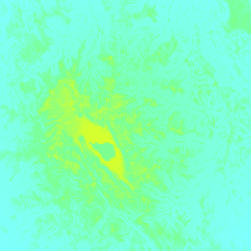
The intensity in shaking and damage by this earthquake is illustrated through the map below. The highest intensity measured for this earthquake is VI.
Shaking reported by 104 people in 2 countries
People that feel an earthquake may report their experience to the US Geographic Survey. Currently, 104 people have reported shaking in 11 places in 2 countries (Peru, Brazil).We keep updating this article as more ground reports become available. You may report that you felt this earthquake here.
Places with most reports:
- San Luis, Lima Provincias, Peru: 44 people.
- Lima, Lima Provincias, Peru: 42 people.
- Santa María, Lima Provincias, Peru: 7 people.
- Pucallpa, Ucayali, Peru: 3 people.
- Oxapampa, Pasco, Peru: 2 people.
- Tarma, Junín, Peru: 1 person.
- San Ramón, Junín, Peru: 1 person.
- Cruzeiro do Sul, Acre, Brazil: 1 person.
- Ayna, Ayacucho, Peru: 1 person.
- Chachapoyas, Amazonas, Peru: 1 person.
Aftershocks detected
Since this main shock, 1 smaller aftershock was detected. Just 5 hrs after this main shock, an earthquake measuring MAG-5 was detected 9 km (5 mi) southwest of this earthquake.
Overview of foreshocks and aftershocks
| Classification | Magnitude | When | Where |
|---|---|---|---|
| Main Shock This Earthquake |
M 6.7 |
Nov 20, 2026 19:09 (Lima Time) | - |
| Aftershock | M 5.0 |
5 hrs later Nov 21, 2026 00:12 (Lima Time) | 9 km (5 mi) SW from Main Shock. |
More earthquakes coming?
Earthquakes can create aftershocks. These are generally at least 1 magnitude lower than any main shock, and as time passes the chance and strength of aftershocks decreases.
The chance that a significant earthquake like this one is followed by an even larger earthquake is not so large. On average, scientists estimate a 94% chance that a major earthquake will not be followed by an even larger one. It is still adviced to be aware of this risk
Read: How to Stay Safe during an Earthquake (cdc.gov).This is an unusually powerful earthquake
No earthquake of this strength has struck this region for a long time. Our data goes back 10 years, and no earthquakes measuring a magnitude of 6.7 or higher have been detected within 300 km (186 mi) of this epicenter.
Sources
Last updated 21/11/26 20:08 (). This article contains currently available information about the earthquake and is automatically composed. We continue to update this article up to a few days after the earthquake occurred.
- US Geographic Society (USGS): Earthquake us6000ucfm
- European-Mediterranean Seismological Centre (EMSC): Earthquake 20261121_0000007
- Geonames.org: World Cities Database
- Google Maps: Static API
- Earthquakelist.org: Historic Earthquakes Database
Share this article:
