
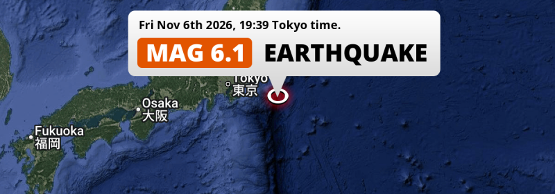
An unusually powerful MAG-6.1 earthquake struck in the North Pacific Ocean 195 kilometer from Chiba, Japan in the evening of Friday November 6th, 2026. Such earthquakes in regions like this usually have a minimal impact on people and the economy.
Felt the earthquake? Share this article: 


Earthquake Summary
This earthquake hit under water in the North Pacific Ocean, 165 kilometers (103 mi) off the coast of Japan, 195 kilometer east of Chiba. The center of this earthquake had a quite shallow depth of 29 km. Shallow earthquakes usually have a larger impact than earthquakes deep in the earth.
| Date and Time: | Nov 6, 2026 19:39 (Tokyo Time) - Nov 6, 2026 10:39 Universal Time. |
|---|---|
| Location: | 195 km east of Chiba, Japan. Coordinates 34°58'4"N 142°7'3"E. |
| Map: | 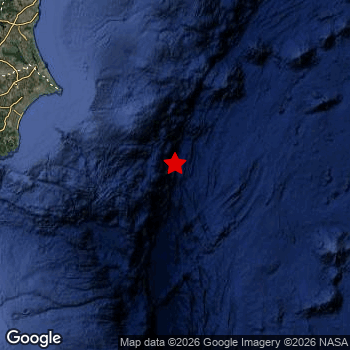 Map of area around epicenter. Click to open in Google Maps. |
| Magnitude: | MAG 6.1 Detected by 54 stations. Maximum Error Range ±0.042 . |
| Depth: | 29 km (18 mi) A quite shallow depth. |
| Tsunami Risk: | Low tsunami risk Earthquakes under MAG-6.5 do not usually cause tsunami's. Always stay cautious - More info here. |
Minimal impact predicted
Based on scientific estimates by the US Geographic Survey (USGS), the risk of high fatalities for this earthquake is classified at level GREEN (low). They expect an 90% likelyhood of between 0 and 1 fatalities.
The USGS classifies the economic impact of this earthquake at level GREEN (low). They expect an 90% likelyhood of between 0 and 1 million US Dollars in economic damage and impact.
Not many people felt this earthquake
All exposure to shaking was within the borders of Japan .
| People | MMI Level | Shaking | Damage |
|---|---|---|---|
| 0 | I |
Not noticable | None |
| 0 | II |
Very weak | None |
| 0 | III |
Weak | Probably none |
| 0 | IV |
Light | Likely none |
| 0 | V |
Moderate | Very light |
| 0 | VI |
Strong | Light |
| 0 | VII |
Very Strong | Moderate |
| 0 | VIII |
Severe | Moderate to heavy |
| 0 | IX |
Violent | Heavy |
| 0 | X |
Extreme | Very heavy |
Nearby towns and cities
This earthquake may have been felt in Japan . Located 144 kilometer (89 mi) south-east of the epicenter of this earthquake, Hasaki (Chiba, Japan) is the nearest significant population center.
Multiple large cities are in proximity of today's earthquake. Tokyo is located 234 km to the west. Yokohama is located 230 km to the west. Kawasaki is located 226 km to the west.
A complete list of nearby places is included below.
Overview of nearby places
| Distance | Place |
|---|---|
| 144 km (89 mi) NW from epicenter |
Hasaki Chiba, Japan. |
| 157 km (98 mi) NW from epicenter |
Asahi Chiba, Japan. |
| 172 km (107 mi) W from epicenter |
Tōgane Chiba, Japan. |
| 173 km (107 mi) W from epicenter |
Mobara Chiba, Japan. |
| 173 km (107 mi) NW from epicenter |
Kashima-shi Ibaraki, Japan. |
| 175 km (109 mi) W from epicenter |
Ōami Chiba, Japan. |
| 178 km (111 mi) NW from epicenter |
Sawara Chiba, Japan. |
| 179 km (111 mi) NW from epicenter |
Katori-shi Chiba, Japan. |
| 180 km (112 mi) NW from epicenter |
Yachimata Chiba, Japan. |
| 187 km (116 mi) NW from epicenter |
Narita Chiba, Japan. |
| 190 km (118 mi) NW from epicenter |
Sakura Chiba, Japan. |
| 193 km (120 mi) NW from epicenter |
Yotsukaidō Chiba, Japan. |
| 195 km (121 mi) W from epicenter |
Chiba Chiba, Japan. |
| 195 km (121 mi) W from epicenter |
Ichihara Chiba, Japan. |
| 210 km (130 mi) W from epicenter |
Honchō Chiba, Japan. |
| 213 km (132 mi) NW from epicenter |
Katsuta Ibaraki, Japan. |
| 214 km (133 mi) NW from epicenter |
Hitachi-Naka Ibaraki, Japan. |
| 215 km (134 mi) NW from epicenter |
Mito Ibaraki, Japan. |
| 217 km (135 mi) W from epicenter |
Urayasu Tokyo, Japan. |
| 218 km (135 mi) NW from epicenter |
Kashiwa Chiba, Japan. |
| 220 km (137 mi) NW from epicenter |
Matsudo Chiba, Japan. |
| 224 km (139 mi) NW from epicenter |
Nagareyama Chiba, Japan. |
| 225 km (140 mi) NW from epicenter |
Hitachi Ibaraki, Japan. |
| 226 km (140 mi) W from epicenter |
Yokosuka Kanagawa, Japan. |
| 226 km (140 mi) W from epicenter |
Kawasaki Kanagawa, Japan. |
| 228 km (142 mi) NW from epicenter |
Tsukuba Ibaraki, Japan. |
| 230 km (143 mi) W from epicenter |
Yokohama Kanagawa, Japan. |
| 231 km (144 mi) NW from epicenter |
Sōka Saitama, Japan. |
| 234 km (145 mi) W from epicenter |
Tokyo Tokyo, Japan. |
| 235 km (146 mi) NW from epicenter |
Koshigaya Saitama, Japan. |
| 236 km (147 mi) W from epicenter |
Kamakura Kanagawa, Japan. |
| 237 km (147 mi) NW from epicenter |
Kawaguchi Saitama, Japan. |
| 242 km (150 mi) NW from epicenter |
Kasukabe Saitama, Japan. |
| 244 km (152 mi) W from epicenter |
Fujisawa Kanagawa, Japan. |
| 245 km (152 mi) W from epicenter |
Chōfu Tokyo, Japan. |
| 246 km (153 mi) W from epicenter |
Kamirenjaku Tokyo, Japan. |
| 246 km (153 mi) NW from epicenter |
Saitama Saitama, Japan. |
| 249 km (155 mi) W from epicenter |
Nishi-Tokyo-shi Tokyo, Japan. |
| 250 km (155 mi) W from epicenter |
Minamirinkan Kanagawa, Japan. |
| 250 km (155 mi) W from epicenter |
Machida Tokyo, Japan. |
| 250 km (155 mi) W from epicenter |
Chigasaki Kanagawa, Japan. |
| 253 km (157 mi) NW from epicenter |
Ageoshimo Saitama, Japan. |
| 255 km (158 mi) W from epicenter |
Atsugi Kanagawa, Japan. |
| 256 km (159 mi) W from epicenter |
Hiratsuka Kanagawa, Japan. |
| 257 km (160 mi) W from epicenter |
Tokorozawa Saitama, Japan. |
| 257 km (160 mi) NW from epicenter |
Iwaki Fukushima, Japan. |
| 260 km (162 mi) NW from epicenter |
Kawagoe Saitama, Japan. |
| 265 km (165 mi) W from epicenter |
Hachiōji Tokyo, Japan. |
| 269 km (167 mi) NW from epicenter |
Utsunomiya Tochigi, Japan. |
| 289 km (180 mi) NW from epicenter |
Ōta Gunma, Japan. |
| 331 km (206 mi) W from epicenter |
Kōfu Yamanashi, Japan. |
| 340 km (211 mi) W from epicenter |
Shizuoka Shizuoka, Japan. |
| 381 km (237 mi) NW from epicenter |
Ueda Nagano, Japan. |
| 383 km (238 mi) N from epicenter |
Sendai Miyagi, Japan. |
| 386 km (240 mi) NW from epicenter |
Tōkamachi Niigata, Japan. |
| 395 km (245 mi) NW from epicenter |
Yamagata Yamagata, Japan. |
Earthquake Intensity Map
The graph below overlays a map of the region around the epicenter with earthquake intensity data provided by the US Geographic Survey. The highest intensity level detected for this earthquake is 0.

Risk of aftershocks?
We monitor for foreshocks or aftershocks that have a magnitude of 2.5+ and occur within 100km (62 mi) of the epicenter of this earthquake. So far no such earthquakes have been detected.
The risk of aftershocks decreases rapidly over time. Usually, aftershocks are at least one order of magnitude lower than a main shock.
In only six percent of cases, significant earthquakes are followed by a larger main shock, making the current earthquake a foreshock. While the chance of this happening is not so large, it is adviced to maintain cautiousness in the hours and days following a major earthquake.
Read: How to Stay Safe during an Earthquake (cdc.gov).This is the strongest earthquake in 10 years
Earthquakes of this strength are not so common in the region, but it's not the first time. This is the strongest earthquake to hit since November 21st, 2016, when a 6.9 magnitude earthquake hit 278 km (172 mi) further north. That was also the heaviest earthquake to hit the region in the past 10 years.
In total, 1 earthquake with a magnitude of 6.1 or higher have been registered within 300km (186 mi) of this epicenter in the past 10 years. This comes down to an average of once every 10 years.
Low tsunami risk
Based on early data it appears this earthquake was not strong enough (lower than MAG-6.5) to be likely to cause destructive tsunami's. However this earthquake appeared to have hit at a shallow depth under sea, so stay cautious and monitor advice from local authorities.
Tsunami Risk Factors
| Factor | Under Sea? | MAG-6.5 or stronger? | Shallow depth? |
|---|---|---|---|
| Explanation | Almost all tsunami's are caused by earthquakes with their epicenter under sea or very near the sea. However stay cautious in coastal areas as earthquakes on land may cause landslides into sea, potentially still causing a local tsunami. | Under MAG 6.5: Very unlikely to cause a tsunami. MAG 6.5 to 7.5: Destructive tsunami's do occur, but are uncommon. Likely to observe small sea level changes. MAG 7.6+: Earthquakes with these magnitudes might produce destructive tsunami's. |
Most destructive tsunami's are caused by shallow earthquakes with a depth between 0 and 100km under the surface of the earth. Deeper tsunami's are unlikely to displace to ocean floor. |
| This Earthquake | This earthquake appears to have struck under the sea. | Not this earthquake. This earthquake had a magnitude of 6.1. Earthquakes of this strength are unlikely to trigger a tsunami. |
This earthquake occurred at a depth of of 29 km (18 mi). Earthquakes this shallow could trigger a tsunami. |
Sources
Last updated 06/11/26 15:18 (). This article contains currently available information about the earthquake and is automatically composed. We continue to update this article up to a few days after the earthquake occurred.
- US Geographic Society (USGS): Earthquake us7000twg9
- European-Mediterranean Seismological Centre (EMSC): Earthquake 20261106_0000133
- Geonames.org: World Cities Database
- Google Maps: Static API
- Earthquakelist.org: Historic Earthquakes Database
Share this article:
