
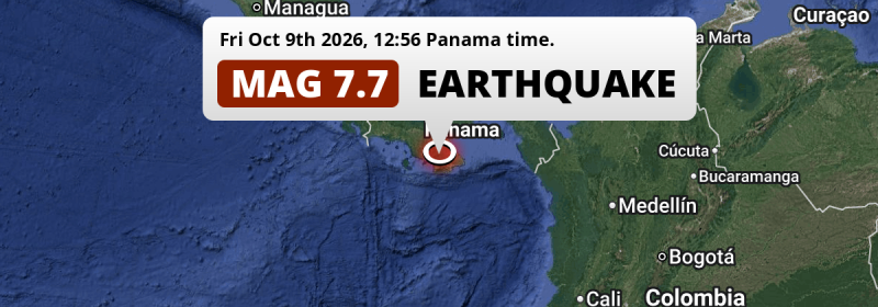
In the early afternoon of Friday October 9th, 2026, a DESTRUCTIVE and very strong Magnitude 7.7 earthquake hit under land 62 kilometer from Santiago de Veraguas in Panama. Mag 6.5+ earthquakes at such shallow depth can cause tsunami's, but this earthquake hit under land. As it's epicenter is close to a coastal area, we still advice cautiousness. Costa Rica is also near its epicenter.
Felt the earthquake? Share this article: 


Earthquake Summary
The earthquake struck on land in Panama, 62 kilometer (39 mi) south-east of Santiago de Veraguas in Veraguas. The center of this earthquake had a very shallow depth of 13 km. Shallow earthquakes usually have a larger impact than earthquakes deep in the earth.
| Date and Time: | Oct 9, 2026 12:56PM (Panama Time) - Oct 9, 2026 17:56 Universal Time. |
|---|---|
| Location: | 62 km SE of Santiago de Veraguas, Veraguas, Panama. Coordinates 7°35'12"N 80°46'8"W. |
| Map: | 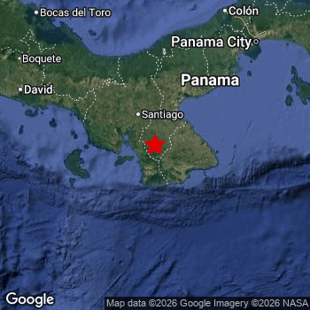 Map of area around epicenter. Click to open in Google Maps. |
| Magnitude: | MAG 7.7 Detected by 13 stations. Maximum Error Range ±0.025 . |
| Depth: | 13 km (8 mi) A very shallow depth. |
| Max. Intensity: | X
Extreme On the Modified Mercalli Scale. |
| Tsunami Risk: | Small Tsunami Risk Mag 6.5+ earthquakes at such shallow depth can cause tsunami's, but this earthquake hit under land. As it's epicenter is close to a coastal area, we still advice cautiousness. Always stay cautious - More info here. |
Small Tsunami Risk
There is a small tsunami risk following this earthquake, as it appears the epicenter was under land, 21 km from the coast. However this was a very strong earthquake at a shallow depth that would have a very high risk at causing tsunami's if it would have occurred under sea. Stay cautious and monitor advice from local authorities.
Tsunami Risk Factors
| Factor | Under Sea? | MAG-6.5 or stronger? | Shallow depth? |
|---|---|---|---|
| Explanation | Almost all tsunami's are caused by earthquakes with their epicenter under sea or very near the sea. However stay cautious in coastal areas as earthquakes on land may cause landslides into sea, potentially still causing a local tsunami. | Under MAG 6.5: Very unlikely to cause a tsunami. MAG 6.5 to 7.5: Destructive tsunami's do occur, but are uncommon. Likely to observe small sea level changes. MAG 7.6+: Earthquakes with these magnitudes might produce destructive tsunami's. |
Most destructive tsunami's are caused by shallow earthquakes with a depth between 0 and 100km under the surface of the earth. Deeper tsunami's are unlikely to displace to ocean floor. |
| This Earthquake | This earthquake appears to have struck on land near a coastal area (21 km from the sea). | This earthquake had a magnitude of 7.7. Earthquakes of this strength could trigger a tsunami. | This earthquake occurred at a depth of of 13 km (8 mi). Earthquakes this shallow could trigger a tsunami. |
Significant impact predicted
Based on scientific estimates by the US Geographic Survey (USGS), the risk of high fatalities for this earthquake is classified at level ORANGE (orange). They expect an 36% likelyhood of between 100 and 1,000 fatalities, and a 97% chance that the number of fatalities falls between 1 and 10,000.
The USGS classifies the economic impact of this earthquake at level RED (high). They expect an 35% likelyhood of between 1,000 and 10,000 million US Dollars in economic damage and impact, and a 95% chance that the economic impact of this earthquake falls between 100 and 10,000,000 million USD.
Roughly 9 million people exposed to shaking
An estimated 9 million have been exposed to shaking (An MMI or Modified Mercalli Intensity level II or higher) as a result of this earthquake according scientific estimates published by the USGS.
Violent shaking and likely heavy damage may have been experienced by an estimated 14,160 people. At IX, it is the highest MMI level this earthquake has caused. The majority of people (roughly 3.7 million) live in an area exposed to level IV, where light shaking and likely no damage is expected.
People in 4 countries have been exposed to shaking. In Panama , around 4.7 million people, with impact levels up to IX (violent shaking, likely heavy damage). In Costa Rica , around 4.5 million people. A smaller number of people were exposed in the following countries: Colombia and Nicaragua.
| People | MMI Level | Shaking | Damage |
|---|---|---|---|
| 0 | I |
Not noticable | None |
| 0 | II |
Very weak | None |
| 794,700 | III |
Weak | Probably none |
| 3,748,000 | IV |
Light | Likely none |
| 3,032,000 | V |
Moderate | Very light |
| 1,159,000 | VI |
Strong | Light |
| 453,500 | VII |
Very Strong | Moderate |
| 179,700 | VIII |
Severe | Moderate to heavy |
| 14,160 | IX |
Violent | Heavy |
| 0 | X |
Extreme | Very heavy |
Nearby towns and cities
5 countries can be found within 300km of the epicenter of this earthquake: Panama and Costa Rica . Futher away, this earthquake may also have been felt in Colombia, Nicaragua and Ecuador.
The closest significant population center near the earthquake is Santiago de Veraguas in Veraguas, Panama. Santiago de Veraguas is located 62 kilometer (39 mi) south-east of the epicenter. The intensity of shaking and damage in Santiago de Veraguas is estimated to be around level VIII on the Modified Mercalli Intensity scale (severe shaking, likely moderate to heavy damage).
Multiple large cities are in proximity of today's earthquake. Cali is located 659 km to the south-east (intensity unknown, possibly low). Medellín is located 593 km to the east (intensity unknown, possibly low). Panamá is located 208 km to the north-east and experienced an intensity of V (moderate shaking, very light damage).
A complete list of nearby places is included below. Estimated intensity data (MMI) sourced from a shake-map published by the US Geographic Survey is shown where available (cities without data probably experienced little impact).
Overview of nearby places
| Distance | Place | Intensity (MMI) |
|---|---|---|
| 62 km (39 mi) NW from epicenter |
Santiago de Veraguas Veraguas, Panama. |
VIII
Severe |
| 113 km (70 mi) NE from epicenter |
Penonomé Coclé, Panama. |
VII
Very Strong |
| 180 km (112 mi) NE from epicenter |
La Chorrera Panamá Oeste, Panama. |
VI
Strong |
| 192 km (119 mi) NE from epicenter |
Veracruz Panamá Oeste, Panama. |
V
Moderate |
| 195 km (121 mi) NE from epicenter |
Arraiján Panamá Oeste, Panama. |
VI
Strong |
| 203 km (126 mi) NW from epicenter |
Pedregal Chiriquí, Panama. |
VI
Strong |
| 203 km (126 mi) NE from epicenter |
El Chorrillo Panamá, Panama. |
V
Moderate |
| 203 km (126 mi) NE from epicenter |
Ancón Panamá, Panama. |
V
Moderate |
| 204 km (127 mi) NE from epicenter |
Curundú Panamá, Panama. |
V
Moderate |
| 205 km (127 mi) NW from epicenter |
David Chiriquí, Panama. |
VI
Strong |
| 208 km (129 mi) NE from epicenter |
Panamá Panamá, Panama. |
V
Moderate |
| 213 km (132 mi) NE from epicenter |
Río Abajo Panamá, Panama. |
V
Moderate |
| 214 km (133 mi) NE from epicenter |
Parque Lefevre Panamá, Panama. |
V
Moderate |
| 215 km (134 mi) NE from epicenter |
Chilibre Panamá, Panama. |
V
Moderate |
| 215 km (134 mi) NE from epicenter |
Las Cumbres Panamá, Panama. |
V
Moderate |
| 217 km (135 mi) NE from epicenter |
San Miguelito Panamá, Panama. |
V
Moderate |
| 217 km (135 mi) NE from epicenter |
Alcalde Díaz Panamá, Panama. |
V
Moderate |
| 218 km (135 mi) NE from epicenter |
Juan Díaz Panamá, Panama. |
VI
Strong |
| 218 km (135 mi) NE from epicenter |
La Cabima Panamá, Panama. |
V
Moderate |
| 219 km (136 mi) NE from epicenter |
Colón Colón, Panama. |
V
Moderate |
| 221 km (137 mi) NE from epicenter |
Pedregal Panamá, Panama. |
V
Moderate |
| 222 km (138 mi) NE from epicenter |
Sabanitas Colón, Panama. |
V
Moderate |
| 223 km (139 mi) NE from epicenter |
Cativá Colón, Panama. |
V
Moderate |
| 226 km (140 mi) NE from epicenter |
Nuevo Belén Panamá, Panama. |
V
Moderate |
| 226 km (140 mi) NE from epicenter |
Tocumen Panamá, Panama. |
V
Moderate |
| 229 km (142 mi) NW from epicenter |
La Concepción Chiriquí, Panama. |
V
Moderate |
| 281 km (175 mi) NW from epicenter |
Changuinola Bocas del Toro, Panama. |
VI
Strong |
| 365 km (227 mi) NW from epicenter |
Limón Limón, Costa Rica. |
|
| 378 km (235 mi) NW from epicenter |
San Isidro San José, Costa Rica. |
|
| 423 km (263 mi) NW from epicenter |
Paraíso Cartago, Costa Rica. |
|
| 448 km (278 mi) NW from epicenter |
San José San José, Costa Rica. |
|
| 449 km (279 mi) E from epicenter |
Turbo Antioquia, Colombia. |
|
| 451 km (280 mi) E from epicenter |
Chigorodó Antioquia, Colombia. |
|
| 456 km (283 mi) NW from epicenter |
San Francisco Heredia, Costa Rica. |
|
| 458 km (285 mi) E from epicenter |
Apartadó Antioquia, Colombia. |
|
| 465 km (289 mi) NW from epicenter |
Alajuela Alajuela, Costa Rica. |
|
| 501 km (311 mi) SE from epicenter |
Quibdó Chocó, Colombia. |
|
| 520 km (323 mi) NW from epicenter |
Puntarenas Puntarenas, Costa Rica. |
|
| 553 km (344 mi) E from epicenter |
Montería Córdoba, Colombia. |
|
| 565 km (351 mi) N from epicenter |
San Andrés San Andres y Providencia, Colombia. |
|
| 584 km (363 mi) SE from epicenter |
Buenaventura Valle del Cauca, Colombia. |
|
| 592 km (368 mi) NW from epicenter |
Bluefields South Caribbean Coast, Nicaragua. |
|
| 592 km (368 mi) E from epicenter |
Itagüí Antioquia, Colombia. |
|
| 592 km (368 mi) E from epicenter |
Bello Antioquia, Colombia. |
|
| 593 km (368 mi) E from epicenter |
Envigado Antioquia, Colombia. |
|
| 593 km (368 mi) E from epicenter |
Medellín Antioquia, Colombia. |
|
| 614 km (382 mi) NW from epicenter |
Liberia Guanacaste, Costa Rica. |
|
| 621 km (386 mi) E from epicenter |
Sincelejo Sucre, Colombia. |
|
| 640 km (398 mi) SE from epicenter |
Pereira Risaralda, Colombia. |
|
| 641 km (398 mi) SE from epicenter |
Dosquebradas Risaralda, Colombia. |
|
| 644 km (400 mi) SE from epicenter |
Manizales Caldas, Colombia. |
|
| 656 km (408 mi) NE from epicenter |
Cartagena Bolívar, Colombia. |
|
| 657 km (408 mi) SE from epicenter |
Armenia Quindío, Colombia. |
|
| 659 km (409 mi) SE from epicenter |
Cali Valle del Cauca, Colombia. |
|
| 668 km (415 mi) SE from epicenter |
Palmira Valle del Cauca, Colombia. |
|
| 681 km (423 mi) S from epicenter |
Tumaco Nariño, Colombia. |
|
| 701 km (436 mi) NW from epicenter |
Rivas Rivas, Nicaragua. |
|
| 702 km (436 mi) E from epicenter |
Plato Magdalena, Colombia. |
|
| 705 km (438 mi) SE from epicenter |
Ibagué Tolima, Colombia. |
|
| 706 km (439 mi) E from epicenter |
Puerto Boyacá Boyacá, Colombia. |
|
| 711 km (442 mi) NW from epicenter |
Juigalpa Chontales, Nicaragua. |
|
| 726 km (451 mi) NE from epicenter |
Sabanalarga Atlántico, Colombia. |
|
| 735 km (457 mi) SE from epicenter |
Popayán Cauca, Colombia. |
|
| 744 km (462 mi) NW from epicenter |
Camoapa Boaco, Nicaragua. |
|
| 746 km (464 mi) NW from epicenter |
Granada Granada, Nicaragua. |
|
| 747 km (464 mi) S from epicenter |
Esmeraldas Esmeraldas, Ecuador. |
Earthquake Intensity Map
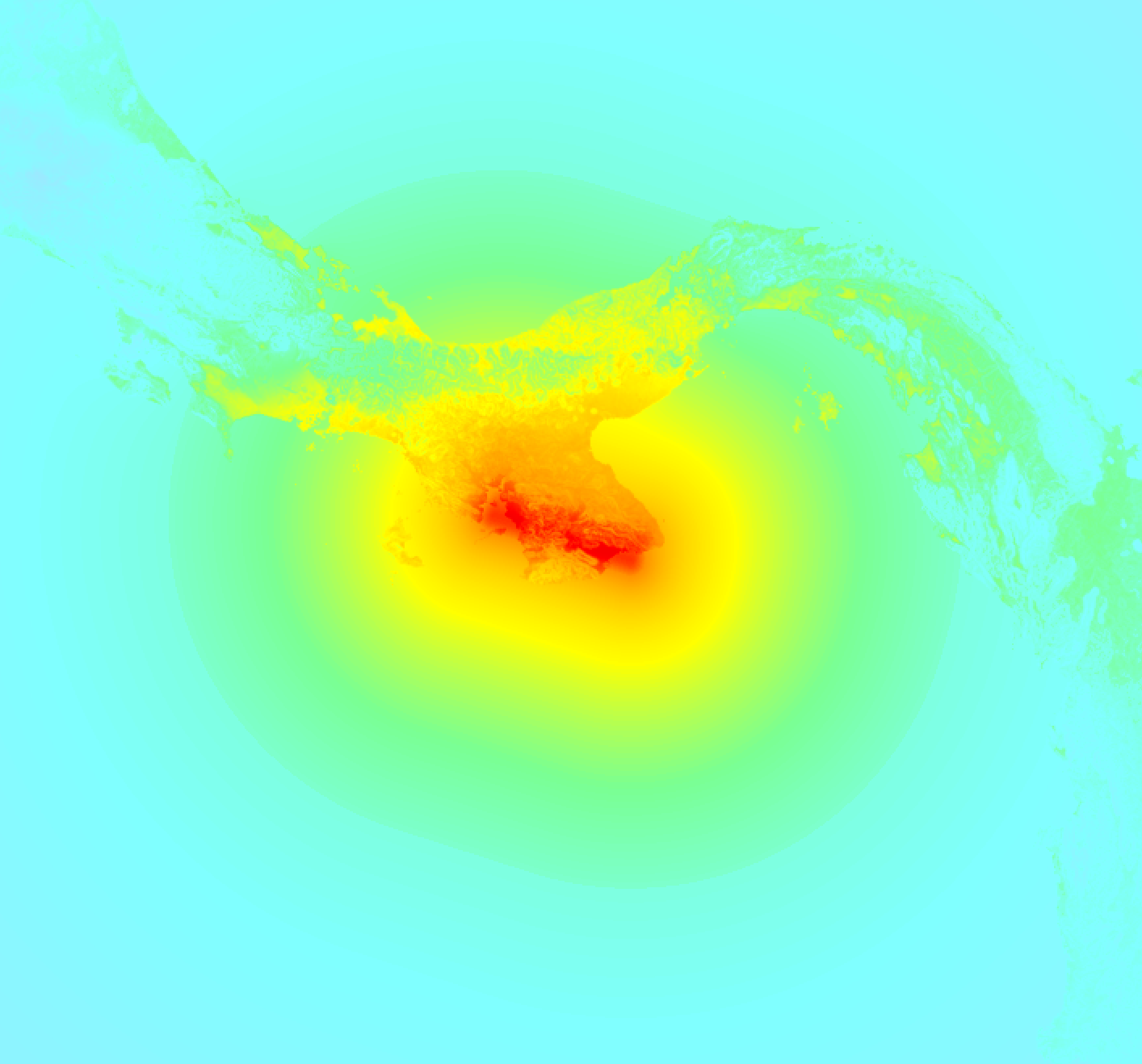
The intensity in shaking and damage by this earthquake is illustrated through the map below. The highest intensity measured for this earthquake is IX.
Shaking reported by 420 people in 8 countries
People that feel an earthquake may report their experience to the US Geographic Survey. Currently, 420 people have reported shaking in 153 places in 8 countries (Panama, Costa Rica, Peru, Nicaragua, Brazil, Colombia, Venezuela, Honduras).We keep updating this article as more ground reports become available. You may report that you felt this earthquake here.
Places with most reports:
- Panamá, Panamá, Panama: 59 people.
- San Miguelito, Panamá, Panama: 35 people.
- Ancón, Panamá, Panama: 29 people.
- Almirante, Bocas del Toro, Panama: 11 people.
- Balboa, Panamá, Panama: 11 people.
- San José, San José, Costa Rica: 10 people.
- Tocumen, Panamá, Panama: 9 people.
- Cahuita, Limón, Costa Rica: 8 people.
- Boquete, Chiriquí, Panama: 8 people.
- David, Chiriquí, Panama: 7 people.
50 Aftershocks detected
Since this main shock, 50 smaller aftershocks were detected. Just 2 hrs after this main shock, an earthquake measuring MAG-6.6 was detected 79 km (49 mi) west of this earthquake.
In the days before this main shock, 1 smaller foreshock was detected. Roughly 12 hrs before this earthquake, a foreshock measuring MAG-2.6 was detected nearby this earthquake.
Overview of foreshocks and aftershocks
| Classification | Magnitude | When | Where |
|---|---|---|---|
| Foreshock | M 2.6 |
12 hrs earlier Oct 9, 2026 12:53AM (Panama Time) | 5 km (2.9 mi) SE from Main Shock. |
| Main Shock This Earthquake |
M 7.7 |
Oct 9, 2026 12:56PM (Panama Time) | - |
| Aftershock | M 3.4 |
19 mins later Oct 9, 2026 01:15PM (Panama Time) | 7 km (4 mi) W from Main Shock. |
| Aftershock | M 5.5 |
26 mins later Oct 9, 2026 01:22PM (Panama Time) | 53 km (33 mi) E from Main Shock. |
| Aftershock | M 3.9 |
35 mins later Oct 9, 2026 01:30PM (Panama Time) | 66 km (41 mi) W from Main Shock. |
| Aftershock | M 5.8 |
42 mins later Oct 9, 2026 01:37PM (Panama Time) | 44 km (27 mi) E from Main Shock. |
| Aftershock | M 5.0 |
51 mins later Oct 9, 2026 01:47PM (Panama Time) | 36 km (22 mi) W from Main Shock. |
| Aftershock | M 5.0 |
54 mins later Oct 9, 2026 01:50PM (Panama Time) | 77 km (48 mi) E from Main Shock. |
| Aftershock | M 5.0 |
1 hr later Oct 9, 2026 02:04PM (Panama Time) | 53 km (33 mi) W from Main Shock. |
| Aftershock | M 4.8 |
1 hr later Oct 9, 2026 02:17PM (Panama Time) | 30 km (19 mi) W from Main Shock. |
| Aftershock | M 4.6 |
1 hr later Oct 9, 2026 02:25PM (Panama Time) | 61 km (38 mi) NW from Main Shock. |
| Aftershock | M 3.8 |
2 hrs later Oct 9, 2026 02:27PM (Panama Time) | 33 km (21 mi) W from Main Shock. |
| Aftershock | M 4.7 |
2 hrs later Oct 9, 2026 02:32PM (Panama Time) | 21 km (13 mi) E from Main Shock. |
| Aftershock | M 4.4 |
2 hrs later Oct 9, 2026 02:41PM (Panama Time) | 36 km (22 mi) SW from Main Shock. |
| Aftershock | M 4.5 |
2 hrs later Oct 9, 2026 02:42PM (Panama Time) | 61 km (38 mi) E from Main Shock. |
| Aftershock | M 4.8 |
2 hrs later Oct 9, 2026 02:45PM (Panama Time) | 70 km (44 mi) E from Main Shock. |
| Aftershock | M 5.2 |
2 hrs later Oct 9, 2026 02:48PM (Panama Time) | 55 km (34 mi) W from Main Shock. |
| Aftershock | M 4.9 |
2 hrs later Oct 9, 2026 03:20PM (Panama Time) | 29 km (18 mi) W from Main Shock. |
| Aftershock | M 5.0 |
2 hrs later Oct 9, 2026 03:21PM (Panama Time) | 27 km (17 mi) SE from Main Shock. |
| Aftershock | M 6.6 |
2 hrs later Oct 9, 2026 03:25PM (Panama Time) | 79 km (49 mi) W from Main Shock. |
| Aftershock | M 4.9 |
3 hrs later Oct 9, 2026 03:41PM (Panama Time) | 37 km (23 mi) W from Main Shock. |
| Aftershock | M 5.0 |
3 hrs later Oct 9, 2026 03:42PM (Panama Time) | 78 km (48 mi) W from Main Shock. |
| Aftershock | M 4.9 |
3 hrs later Oct 9, 2026 03:54PM (Panama Time) | 82 km (51 mi) W from Main Shock. |
| Aftershock | M 4.9 |
3 hrs later Oct 9, 2026 04:05PM (Panama Time) | 77 km (48 mi) W from Main Shock. |
| Aftershock | M 4.2 |
4 hrs later Oct 9, 2026 04:30PM (Panama Time) | 91 km (57 mi) W from Main Shock. |
| Aftershock | M 4.6 |
4 hrs later Oct 9, 2026 04:47PM (Panama Time) | 63 km (39 mi) W from Main Shock. |
| Aftershock | M 4.3 |
4 hrs later Oct 9, 2026 05:13PM (Panama Time) | 74 km (46 mi) W from Main Shock. |
| Aftershock | M 4.4 |
5 hrs later Oct 9, 2026 05:41PM (Panama Time) | 79 km (49 mi) E from Main Shock. |
| Aftershock | M 4.3 |
5 hrs later Oct 9, 2026 05:45PM (Panama Time) | 10 km (6 mi) N from Main Shock. |
| Aftershock | M 4.1 |
5 hrs later Oct 9, 2026 05:54PM (Panama Time) | 13 km (8 mi) E from Main Shock. |
| Aftershock | M 4.3 |
5 hrs later Oct 9, 2026 06:06PM (Panama Time) | 72 km (44 mi) W from Main Shock. |
| Aftershock | M 5.0 |
5 hrs later Oct 9, 2026 06:10PM (Panama Time) | 34 km (21 mi) SE from Main Shock. |
| Aftershock | M 5.0 |
5 hrs later Oct 9, 2026 06:10PM (Panama Time) | 34 km (21 mi) SE from Main Shock. |
| Aftershock | M 5.4 |
5 hrs later Oct 9, 2026 06:12PM (Panama Time) | 76 km (47 mi) E from Main Shock. |
| Aftershock | M 5.4 |
5 hrs later Oct 9, 2026 06:12PM (Panama Time) | 76 km (47 mi) E from Main Shock. |
| Aftershock | M 4.9 |
5 hrs later Oct 9, 2026 06:23PM (Panama Time) | 70 km (44 mi) W from Main Shock. |
| Aftershock | M 3.9 |
6 hrs later Oct 9, 2026 06:35PM (Panama Time) | 85 km (53 mi) W from Main Shock. |
| Aftershock | M 4.7 |
6 hrs later Oct 9, 2026 06:57PM (Panama Time) | 78 km (48 mi) W from Main Shock. |
| Aftershock | M 4.6 |
6 hrs later Oct 9, 2026 07:00PM (Panama Time) | 7 km (5 mi) NE from Main Shock. |
| Aftershock | M 4.8 |
6 hrs later Oct 9, 2026 07:03PM (Panama Time) | 56 km (35 mi) E from Main Shock. |
| Aftershock | M 4.8 |
6 hrs later Oct 9, 2026 07:03PM (Panama Time) | 56 km (35 mi) E from Main Shock. |
| Aftershock | M 4.5 |
6 hrs later Oct 9, 2026 07:10PM (Panama Time) | 28 km (17 mi) S from Main Shock. |
| Aftershock | M 4.3 |
6 hrs later Oct 9, 2026 07:13PM (Panama Time) | 75 km (47 mi) W from Main Shock. |
| Aftershock | M 4.1 |
6 hrs later Oct 9, 2026 07:22PM (Panama Time) | 86 km (53 mi) W from Main Shock. |
| Aftershock | M 4.7 |
7 hrs later Oct 9, 2026 08:11PM (Panama Time) | 21 km (13 mi) E from Main Shock. |
| Aftershock | M 4.2 |
7 hrs later Oct 9, 2026 08:23PM (Panama Time) | 51 km (32 mi) E from Main Shock. |
| Aftershock | M 4.6 |
8 hrs later Oct 9, 2026 08:35PM (Panama Time) | 61 km (38 mi) W from Main Shock. |
| Aftershock | M 4.3 |
8 hrs later Oct 9, 2026 08:47PM (Panama Time) | 86 km (54 mi) W from Main Shock. |
| Aftershock | M 4.3 |
8 hrs later Oct 9, 2026 09:07PM (Panama Time) | 80 km (50 mi) W from Main Shock. |
| Aftershock | M 4.3 |
8 hrs later Oct 9, 2026 09:13PM (Panama Time) | 93 km (58 mi) W from Main Shock. |
| Aftershock | M 4.4 |
8 hrs later Oct 9, 2026 09:20PM (Panama Time) | 71 km (44 mi) W from Main Shock. |
| Aftershock | M 5.1 |
9 hrs later Oct 9, 2026 09:26PM (Panama Time) | 37 km (23 mi) E from Main Shock. |
More earthquakes coming?
Aftershocks are usually at least 1 order of magnitude less strong than main shocks. The more time passes, the smaller the chance and likely strength of any potential aftershocks.
The chance that a significant earthquake like this one is followed by an even larger earthquake is not so large. On average, scientists estimate a 94% chance that a major earthquake will not be followed by an even larger one. It is still adviced to be aware of this risk
Read: How to Stay Safe during an Earthquake (cdc.gov).This is an unusually powerful earthquake
No earthquake of this strength has struck this region for a long time. Our data goes back 10 years, and no earthquakes measuring a magnitude of 7.7 or higher have been detected within 300 km (186 mi) of this epicenter.
Sources
Last updated 10/10/26 02:38 (). This article is automatically generated based on available data. We keep checking multiple sources for additional information. This article gets updated as new details on this earthquake become available.
- US Geographic Society (USGS): Earthquake us6000u18k
- European-Mediterranean Seismological Centre (EMSC): Earthquake 20261009_0000264
- Geonames.org: World Cities Database
- Google Maps: Static API
- Earthquakelist.org: Historic Earthquakes Database
Share this article:
