
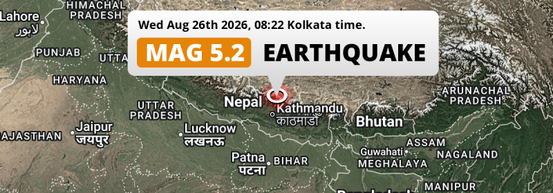
Under land 66 kilometer from Kathmandu in Nepal, a shallow and significant MAG-5.2 earthquake occurred in the morning of Wednesday August 26th, 2026. Another country near the epicenter is India.
Felt the earthquake? Share this article: 


Earthquake Summary
The earthquake struck on land in Nepal, 66 kilometer (41 mi) north of Kathmandu in Bagmati Province. The center of this earthquake had a very shallow depth of 0 km. Shallow earthquakes usually have a larger impact than earthquakes deep in the earth.
| Date and Time: | Aug 26, 2026 08:37AM (Kathmandu Time) - Aug 26, 2026 02:52 Universal Time. |
|---|---|
| Location: | 66 km north of Kathmandu, Bagmati Province, Nepal. Coordinates 28°16'16"N 85°30'54"E. |
| Map: | 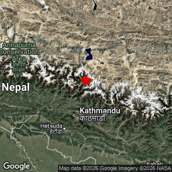 Map of area around epicenter. Click to open in Google Maps. |
| Magnitude: | MAG 5.2 Detected by 29 stations. Maximum Error Range ±0.085 . |
| Depth: | 0 km (0 mi) A very shallow depth. |
| Tsunami Risk: | Tsunami very unlikely While this was a shallow earthquake, it appears to have occurred under land with a magnitude not strong enough to cause tsunami's. Always stay cautious - More info here. |
Nearby towns and cities
2 countries can be found within 300km of the epicenter of this earthquake: Nepal and India .
Kathmandu in Bagmati Province, Nepal is the nearest significant place from the epicenter. The earthquake occurred 66 kilometer (41 mi) north of Kathmandu.
Major cities near this earthquake: Kathmandu is located 66 km to the south. Pātan is located 69 km to the south. Gorakhpur is located 270 km to the southwest.
The table below provides an overview of all places in proximity of today's earthquake.
Overview of nearby places
| Distance | Place |
|---|---|
| 66 km (41 mi) S from epicenter |
Kathmandu Bagmati Province, Nepal. |
| 67 km (42 mi) S from epicenter |
Madhyapur Thimi Bagmati Province, Nepal. |
| 69 km (43 mi) S from epicenter |
Pātan Bagmati Province, Nepal. |
| 70 km (43 mi) S from epicenter |
Kirtipur Bagmati Province, Nepal. |
| 71 km (44 mi) S from epicenter |
Banepā Bagmati Province, Nepal. |
| 72 km (45 mi) S from epicenter |
Dhulikhel Bagmati Province, Nepal. |
| 76 km (47 mi) S from epicenter |
Panauti Bagmati Province, Nepal. |
| 76 km (47 mi) S from epicenter |
Panauti̇̄ Bagmati Province, Nepal. |
| 105 km (65 mi) SW from epicenter |
Hetauda Bagmati Province, Nepal. |
| 125 km (78 mi) SW from epicenter |
Bharatpur Bagmati Province, Nepal. |
| 151 km (94 mi) W from epicenter |
Pokhara Gandaki Pradesh, Nepal. |
| 153 km (95 mi) SW from epicenter |
Birgañj Province 2, Nepal. |
| 157 km (98 mi) S from epicenter |
Malaṅgawā Province 2, Nepal. |
| 158 km (98 mi) SW from epicenter |
Raxaul Bihar, India. |
| 169 km (105 mi) S from epicenter |
Gaur Province 2, Nepal. |
| 170 km (106 mi) SW from epicenter |
Rāmnagar Bihar, India. |
| 172 km (107 mi) S from epicenter |
Bairāgnia Bihar, India. |
| 175 km (109 mi) W from epicenter |
Wāliṅ Gandaki Pradesh, Nepal. |
| 176 km (109 mi) S from epicenter |
Janakpur Province 2, Nepal. |
| 181 km (112 mi) S from epicenter |
Dhāka Bihar, India. |
| 183 km (114 mi) S from epicenter |
Jaleshwar Province 2, Nepal. |
| 184 km (114 mi) SW from epicenter |
Sagauli Bihar, India. |
| 187 km (116 mi) S from epicenter |
Sītāmarhi Bihar, India. |
| 189 km (117 mi) W from epicenter |
Bāglung Gandaki Pradesh, Nepal. |
| 190 km (118 mi) S from epicenter |
Mothīhāri Bihar, India. |
| 191 km (119 mi) SW from epicenter |
Bagaha Bihar, India. |
| 191 km (119 mi) SW from epicenter |
Bettiah Bihar, India. |
| 192 km (119 mi) S from epicenter |
Siraha Province 2, Nepal. |
| 194 km (121 mi) SE from epicenter |
Khā̃dbāri̇̄ Province 1, Nepal. |
| 197 km (122 mi) S from epicenter |
Jainagar Bihar, India. |
| 197 km (122 mi) S from epicenter |
Sheohar Bihar, India. |
| 197 km (122 mi) SE from epicenter |
Lahān Province 2, Nepal. |
| 198 km (123 mi) W from epicenter |
Tānsen Lumbini Province, Nepal. |
| 202 km (126 mi) SE from epicenter |
Triyuga Province 1, Nepal. |
| 213 km (132 mi) W from epicenter |
Butwāl Lumbini Province, Nepal. |
| 214 km (133 mi) SW from epicenter |
Padrauna Uttar Pradesh, India. |
| 220 km (137 mi) SW from epicenter |
Siddharthanagar Lumbini Province, Nepal. |
| 220 km (137 mi) S from epicenter |
Madhubani Bihar, India. |
| 227 km (141 mi) SW from epicenter |
Gopālganj Bihar, India. |
| 238 km (148 mi) SE from epicenter |
Dharān Province 1, Nepal. |
| 239 km (149 mi) S from epicenter |
Darbhanga Bihar, India. |
| 239 km (149 mi) S from epicenter |
Muzaffarpur Bihar, India. |
| 245 km (152 mi) SE from epicenter |
Inaruwa Province 1, Nepal. |
| 255 km (158 mi) SW from epicenter |
Siwān Bihar, India. |
| 261 km (162 mi) SW from epicenter |
Deoria Uttar Pradesh, India. |
| 266 km (165 mi) SE from epicenter |
Biratnagar Province 1, Nepal. |
| 270 km (168 mi) SW from epicenter |
Gorakhpur Uttar Pradesh, India. |
| 287 km (178 mi) S from epicenter |
Saharsa Bihar, India. |
| 287 km (178 mi) S from epicenter |
Chāpra Bihar, India. |
| 289 km (180 mi) S from epicenter |
Hājīpur Bihar, India. |
| 297 km (185 mi) S from epicenter |
Dinapore Bihar, India. |
Shaking reported by 1 person
People that feel an earthquake may report their experience to the US Geographic Survey. Currently, 1 person has reported shaking in one place in Nepal.We keep updating this article as more ground reports become available. You may report that you felt this earthquake here.
Places with most reports:
- Kathmandu, Kathmandu, Nepal: 1 person.
Aftershocks detected
After this earthquake struck, 1 smaller aftershock occurred. Just 3 hrs after this main shock, an earthquake measuring MAG-4.2 was detected 7 km (4 mi) northwest of this earthquake.
Overview of foreshocks and aftershocks
| Classification | Magnitude | When | Where |
|---|---|---|---|
| Main Shock This Earthquake |
M 5.2 |
Aug 26, 2026 08:37AM (Kathmandu Time) | - |
| Aftershock | M 4.2 |
3 hrs later Aug 26, 2026 11:45AM (Kathmandu Time) | 7 km (4 mi) NW from Main Shock. |
More earthquakes coming?
Aftershocks are usually at least 1 order of magnitude less strong than main shocks. The more time passes, the smaller the chance and likely strength of any potential aftershocks.
The chance that a significant earthquake like this one is followed by an even larger earthquake is not so large. On average, scientists estimate a 94% chance that a major earthquake will not be followed by an even larger one. It is still adviced to be aware of this risk
Read: How to Stay Safe during an Earthquake (cdc.gov).Earthquakes like this are common in the region
Earthquakes of this strength occur quite regularly in the region. This is the strongest earthquake to hit since May 11th, 2025, when a 5.5 magnitude earthquake hit 222 km (138 mi) further north-east. An even stronger magnitude 7.1 earthquake struck on January 7th, 2025.
In total, 7 earthquakes with a magnitude of 5.2 or higher have been registered within 300km (186 mi) of this epicenter in the past 10 years. This comes down to an average of once every year.
Tsunami very unlikely
While MAG-6.5+ earthquakes may cause tsunami's, it appears that the epicenter of this earthquake hit under land. In addition, the reported depth is deeper than 100km, making the risk of a tsunami even less likely. However always stay cautious and monitor advice from local authorities.
Tsunami Risk Factors
| Factor | Under Sea? | MAG-6.5 or stronger? | Shallow depth? |
|---|---|---|---|
| Explanation | Almost all tsunami's are caused by earthquakes with their epicenter under sea or very near the sea. However stay cautious in coastal areas as earthquakes on land may cause landslides into sea, potentially still causing a local tsunami. | Under MAG 6.5: Very unlikely to cause a tsunami. MAG 6.5 to 7.5: Destructive tsunami's do occur, but are uncommon. Likely to observe small sea level changes. MAG 7.6+: Earthquakes with these magnitudes might produce destructive tsunami's. |
Most destructive tsunami's are caused by shallow earthquakes with a depth between 0 and 100km under the surface of the earth. Deeper tsunami's are unlikely to displace to ocean floor. |
| This Earthquake | Not this earthquake. This earthquake appears to have struck on land far from any coast. |
Not this earthquake. This earthquake had a magnitude of 5.2. Earthquakes of this strength are unlikely to trigger a tsunami. |
This earthquake occurred at a depth of of 0 km (0 mi). Earthquakes this shallow could trigger a tsunami. |
Sources
Last updated 13/10/26 04:48 (). This article contains currently available information about the earthquake and is automatically composed. We continue to update this article up to a few days after the earthquake occurred.
- US Geographic Society (USGS): Earthquake us7000tbwb
- European-Mediterranean Seismological Centre (EMSC): Earthquake 20260826_0000052
- Geonames.org: World Cities Database
- Google Maps: Static API
- Earthquakelist.org: Historic Earthquakes Database
Share this article:
