
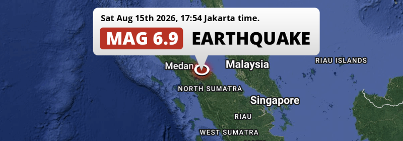
An unusually powerful M6.9 earthquake struck under land 10 kilometer from Pematangsiantar in Indonesia in the late afternoon of Saturday August 15th, 2026. The earthquake struck near a very densely populated region. Shaking may have been felt by a total of 16 million people. Malaysia is also near its epicenter.
Felt the earthquake? Share this article: 


Earthquake Summary
The earthquake struck on land in Indonesia, 10 kilometer (6 mi) west of Pematangsiantar in North Sumatra. The center of this earthquake had an intermediate depth of 175 km.
| Date and Time: | Aug 15, 2026 17:54 (Jakarta Time) - Aug 15, 2026 10:54 Universal Time. |
|---|---|
| Location: | 10 km west of Pematangsiantar, North Sumatra, Indonesia. Coordinates 2°59'11"N 98°59'7"E. |
| Map: | 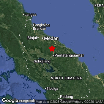 Map of area around epicenter. Click to open in Google Maps. |
| Magnitude: | MAG 6.9 Detected by 59 stations. Maximum Error Range ±0.04 . |
| Depth: | 175 km (109 mi) An intermediate depth. |
| Max. Intensity: | VI
Strong On the Modified Mercalli Scale. |
| Tsunami Risk: | Tsunami very unlikely While a very strong earthquake, it appears to have occurred under land. Always stay cautious - More info here. |
Minimal impact predicted
Based on scientific estimates by the US Geographic Survey (USGS), the risk of high fatalities for this earthquake is classified at level GREEN (low). They expect an 90% likelyhood of between 0 and 1 fatalities.
The USGS classifies the economic impact of this earthquake at level GREEN (low). They expect an 90% likelyhood of between 0 and 1 million US Dollars in economic damage and impact.
Roughly 16 million people exposed to shaking
This earthquake may have been felt by around 16 million people. That is the expected population size of the area exposed to a level of shaking of II or higher on the Modified Mercalli scale according to the USGS.
The highest earthquake impact level for this earthquake is V, which corresponds with moderate shaking and very light damage. Roughly 11,550,000 people are expected to be exposed to this level.
People in 2 countries have been exposed to shaking. Roughly 16 million people were exposed to shaking in Indonesia , with level V (moderate shaking, very light damage) as the highest recorded. People were exposed to shaking in Malaysia as well.
| People | MMI Level | Shaking | Damage |
|---|---|---|---|
| 0 | I |
Not noticable | None |
| 0 | II |
Very weak | None |
| 14,220 | III |
Weak | Probably none |
| 4,896,000 | IV |
Light | Likely none |
| 11,550,000 | V |
Moderate | Very light |
| 0 | VI |
Strong | Light |
| 0 | VII |
Very Strong | Moderate |
| 0 | VIII |
Severe | Moderate to heavy |
| 0 | IX |
Violent | Heavy |
| 0 | X |
Extreme | Very heavy |
Nearby towns and cities
Indonesia and Malaysia are both located within 300km distance of the epicenter of the earthquake. Futher away, this earthquake may also have been felt in Thailand.
Located 10 kilometer (6 mi) west of the epicenter of this earthquake, Pematangsiantar (North Sumatra, Indonesia) is the nearest significant population center. The intensity of shaking and damage in Pematangsiantar is estimated to be around level V on the Modified Mercalli Intensity scale (moderate shaking, very light damage).
Multiple major population centers exist within 300km of the earthquake that struck today. Medan is located 75 km to the northwest and experienced an intensity of V (moderate shaking, very light damage). Pematangsiantar is located 10 km to the east and experienced an intensity of V (moderate shaking, very light damage). Kuala Lumpur is located 300 km to the east (intensity unknown, possibly low).
A complete list of nearby places is included below. Estimated intensity data (MMI) sourced from a shake-map published by the US Geographic Survey is shown where available (cities without data probably experienced little impact).
Overview of nearby places
| Distance | Place | Intensity (MMI) |
|---|---|---|
| 10 km (6 mi) E from epicenter |
Pematangsiantar North Sumatra, Indonesia. |
V
Moderate |
| 25 km (16 mi) NE from epicenter |
Pekan Bahapal North Sumatra, Indonesia. |
V
Moderate |
| 43 km (27 mi) NE from epicenter |
Tebingtinggi North Sumatra, Indonesia. |
V
Moderate |
| 52 km (32 mi) W from epicenter |
Tongging North Sumatra, Indonesia. |
IV
Light |
| 56 km (35 mi) W from epicenter |
Kabanjahe North Sumatra, Indonesia. |
V
Moderate |
| 58 km (36 mi) NW from epicenter |
Berastagi North Sumatra, Indonesia. |
V
Moderate |
| 65 km (40 mi) N from epicenter |
Perbaungan North Sumatra, Indonesia. |
V
Moderate |
| 67 km (42 mi) NW from epicenter |
Deli Tua North Sumatra, Indonesia. |
V
Moderate |
| 70 km (43 mi) E from epicenter |
Kisaran North Sumatra, Indonesia. |
V
Moderate |
| 72 km (45 mi) N from epicenter |
Percut North Sumatra, Indonesia. |
V
Moderate |
| 75 km (47 mi) NW from epicenter |
Medan North Sumatra, Indonesia. |
V
Moderate |
| 77 km (48 mi) NW from epicenter |
Sunggal North Sumatra, Indonesia. |
V
Moderate |
| 88 km (55 mi) NW from epicenter |
Binjai North Sumatra, Indonesia. |
V
Moderate |
| 89 km (55 mi) NW from epicenter |
Labuhan Deli North Sumatra, Indonesia. |
V
Moderate |
| 90 km (56 mi) E from epicenter |
Tanjungbalai North Sumatra, Indonesia. |
V
Moderate |
| 92 km (57 mi) E from epicenter |
Teluk Nibung North Sumatra, Indonesia. |
V
Moderate |
| 94 km (58 mi) N from epicenter |
Belawan North Sumatra, Indonesia. |
V
Moderate |
| 102 km (63 mi) NW from epicenter |
Stabat North Sumatra, Indonesia. |
V
Moderate |
| 134 km (83 mi) SE from epicenter |
Bandar North Sumatra, Indonesia. |
IV
Light |
| 136 km (85 mi) SE from epicenter |
Rantauprapat North Sumatra, Indonesia. |
V
Moderate |
| 138 km (86 mi) NW from epicenter |
Tanjungtiram North Sumatra, Indonesia. |
V
Moderate |
| 140 km (87 mi) S from epicenter |
Sibolga North Sumatra, Indonesia. |
IV
Light |
| 140 km (87 mi) NW from epicenter |
Pangkalan Brandan North Sumatra, Indonesia. |
V
Moderate |
| 154 km (96 mi) SW from epicenter |
Singkil Aceh, Indonesia. |
V
Moderate |
| 181 km (112 mi) S from epicenter |
Padangsidempuan North Sumatra, Indonesia. |
IV
Light |
| 200 km (124 mi) NW from epicenter |
Langsa Aceh, Indonesia. |
IV
Light |
| 229 km (142 mi) NE from epicenter |
Lumut Perak, Malaysia. |
IV
Light |
| 254 km (158 mi) NE from epicenter |
Teluk Intan Perak, Malaysia. |
|
| 255 km (158 mi) E from epicenter |
Kuala Selangor Selangor, Malaysia. |
|
| 260 km (162 mi) E from epicenter |
Kampong Dungun Perak, Malaysia. |
|
| 273 km (170 mi) E from epicenter |
Klang Selangor, Malaysia. |
|
| 283 km (176 mi) E from epicenter |
Shah Alam Selangor, Malaysia. |
|
| 284 km (176 mi) E from epicenter |
Kampung Baru Subang Selangor, Malaysia. |
|
| 284 km (176 mi) NE from epicenter |
Taiping Perak, Malaysia. |
|
| 288 km (179 mi) E from epicenter |
Subang Jaya Selangor, Malaysia. |
|
| 290 km (180 mi) E from epicenter |
Rawang Selangor, Malaysia. |
|
| 291 km (181 mi) E from epicenter |
Petaling Jaya Selangor, Malaysia. |
|
| 293 km (182 mi) NE from epicenter |
Ipoh Perak, Malaysia. |
|
| 297 km (185 mi) NE from epicenter |
Kampung Sungai Ara Penang, Malaysia. |
|
| 300 km (186 mi) E from epicenter |
Kuala Lumpur Kuala Lumpur, Malaysia. |
|
| 301 km (187 mi) E from epicenter |
Putrajaya Putrajaya, Malaysia. |
|
| 308 km (191 mi) NE from epicenter |
George Town Penang, Malaysia. |
|
| 309 km (192 mi) E from epicenter |
Ampang Kuala Lumpur, Malaysia. |
|
| 309 km (192 mi) E from epicenter |
Sepang Selangor, Malaysia. |
|
| 310 km (193 mi) SE from epicenter |
Dumai Riau, Indonesia. |
|
| 311 km (193 mi) NE from epicenter |
Bukit Mertajam Penang, Malaysia. |
|
| 317 km (197 mi) NE from epicenter |
Kulim Kedah, Malaysia. |
|
| 329 km (204 mi) E from epicenter |
Seremban Negeri Sembilan, Malaysia. |
|
| 340 km (211 mi) NE from epicenter |
Sungai Petani Kedah, Malaysia. |
|
| 372 km (231 mi) E from epicenter |
Malacca Melaka, Malaysia. |
|
| 380 km (236 mi) NE from epicenter |
Alor Setar Kedah, Malaysia. |
|
| 387 km (240 mi) SE from epicenter |
Pekanbaru Riau, Indonesia. |
|
| 393 km (244 mi) NE from epicenter |
Gua Musang Kelantan, Malaysia. |
|
| 407 km (253 mi) N from epicenter |
Kangar Perlis, Malaysia. |
|
| 412 km (256 mi) E from epicenter |
Muar Johor, Malaysia. |
|
| 422 km (262 mi) N from epicenter |
Satun Satun, Thailand. |
|
| 463 km (288 mi) S from epicenter |
Padang West Sumatra, Indonesia. |
|
| 470 km (292 mi) NE from epicenter |
Yala Yala, Thailand. |
|
| 477 km (296 mi) N from epicenter |
Hat Yai Songkhla, Thailand. |
|
| 490 km (304 mi) E from epicenter |
Kuantan Pahang, Malaysia. |
|
| 495 km (308 mi) NE from epicenter |
Narathiwat Narathiwat, Thailand. |
|
| 499 km (310 mi) NE from epicenter |
Pattani Pattani, Thailand. |
Earthquake Intensity Map
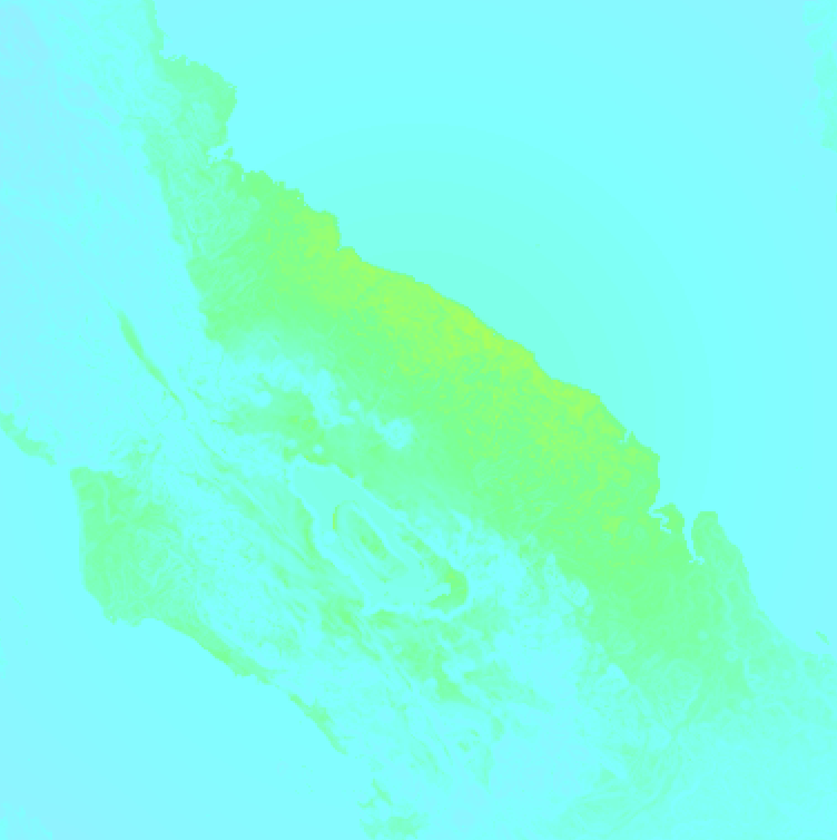
The maximum intensity (MMI Scale) caused by this earthquake is V. The map below shows in which areas this earthquake was the most and least impactful. It is based on data from the US Geographic Survey.
Shaking reported by 43 people in 3 countries
People that feel an earthquake may report their experience to the US Geographic Survey. Currently, 43 people have reported shaking in 23 places in 3 countries (Indonesia, Malaysia, Thailand).We keep updating this article as more ground reports become available. You may report that you felt this earthquake here.
Places with most reports:
- Georgetown, Pulau Pinang, Malaysia: 9 people.
- Tanjong Tokong, Pulau Pinang, Malaysia: 4 people.
- Kuala Lumpur, Kuala Lumpur, Malaysia: 4 people.
- Kuah, Kedah, Malaysia: 3 people.
- Sungai Ara, Pulau Pinang, Malaysia: 3 people.
- Tanjong Bunga, Pulau Pinang, Malaysia: 2 people.
- Padang, Sumatera Barat, Indonesia: 2 people.
- Hat Yai, Songkhla, Thailand: 1 person.
- Butterworth, Pulau Pinang, Malaysia: 1 person.
- Shah Alam, Selangor, Malaysia: 1 person.
Aftershocks detected
After this earthquake struck, 1 smaller aftershock occurred. A 2.7 magnitude earthquake hit 1 day later 36 km (22 mi) northwest of this earthquake.
Before this earthquake struck, 1 smaller foreshock occurred. Roughly 3 days before this earthquake, a foreshock measuring MAG-2.7 was detected nearby this earthquake.
Overview of foreshocks and aftershocks
| Classification | Magnitude | When | Where |
|---|---|---|---|
| Foreshock | M 2.7 |
3 days earlier Aug 12, 2026 19:40 (Jakarta Time) | 67 km (42 mi) S from Main Shock. |
| Main Shock This Earthquake |
M 6.9 |
Aug 15, 2026 17:54 (Jakarta Time) | - |
| Aftershock | M 2.7 |
1 day later Aug 16, 2026 20:20 (Jakarta Time) | 36 km (22 mi) NW from Main Shock. |
More earthquakes coming?
Earthquakes can create aftershocks. These are generally at least 1 magnitude lower than any main shock, and as time passes the chance and strength of aftershocks decreases.
The chance that a significant earthquake like this one is followed by an even larger earthquake is not so large. On average, scientists estimate a 94% chance that a major earthquake will not be followed by an even larger one. It is still adviced to be aware of this risk
Read: How to Stay Safe during an Earthquake (cdc.gov).This is an unusually powerful earthquake
No earthquake of this strength has struck this region for a long time. Our data goes back 10 years, and no earthquakes measuring a magnitude of 6.9 or higher have been detected within 300 km (186 mi) of this epicenter.
Tsunami very unlikely
While MAG-6.5+ earthquakes may cause tsunami's, it appears that the epicenter of this earthquake hit inland, 61 km away from coastal areas. In addition, the reported depth is deeper than 100km, making the risk at a tsunami even less likely. However always stay cautious and monitor advice from local authorities.
Tsunami Risk Factors
| Factor | Under Sea? | MAG-6.5 or stronger? | Shallow depth? |
|---|---|---|---|
| Explanation | Almost all tsunami's are caused by earthquakes with their epicenter under sea or very near the sea. However stay cautious in coastal areas as earthquakes on land may cause landslides into sea, potentially still causing a local tsunami. | Under MAG 6.5: Very unlikely to cause a tsunami. MAG 6.5 to 7.5: Destructive tsunami's do occur, but are uncommon. Likely to observe small sea level changes. MAG 7.6+: Earthquakes with these magnitudes might produce destructive tsunami's. |
Most destructive tsunami's are caused by shallow earthquakes with a depth between 0 and 100km under the surface of the earth. Deeper tsunami's are unlikely to displace to ocean floor. |
| This Earthquake | Not this earthquake. This earthquake appears to have struck on land far from any coast. |
This earthquake had a magnitude of 6.9. Earthquakes of this strength could trigger a tsunami. | Not this earthquake. This earthquake occurred at a depth of 175 km (109 mi). Earthquakes this deep in the earth are unlikely to trigger a tsunami. |
Sources
Last updated 14/10/26 08:48 (). As more information on this earthquake becomes available this article will be updated. This article is automatically composed based on data originating from multiple sources.
- US Geographic Society (USGS): Earthquake us6000tkyk
- European-Mediterranean Seismological Centre (EMSC): Earthquake 20260815_0000371
- Geonames.org: World Cities Database
- Google Maps: Static API
- Earthquakelist.org: Historic Earthquakes Database
Share this article:
