
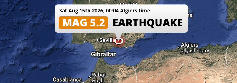
In the night of Saturday August 15th, 2026, a shallow and significant MAG-5.2 earthquake hit under land 10 kilometer from Granada in Spain. Earthquakes like this can cause significant economic damage but are usually unlikely to result on large numbers of fatalities. Other nearby countries are Gibraltar, Morocco and Algeria.
Felt the earthquake? Share this article: 


Earthquake Summary
The earthquake struck on land in Spain, 10 kilometer (6 mi) southwest of Granada in Andalusia. The center of this earthquake had a very shallow depth of 10 km. Shallow earthquakes usually have a larger impact than earthquakes deep in the earth.
| Date and Time: | Aug 15, 2026 01:04 (Madrid Time) - Aug 14, 2026 23:04 Universal Time. |
|---|---|
| Location: | 10 km SW of Granada, Andalusia, Spain. Coordinates 37°6'31"N 3°39'51"W. |
| Map: | 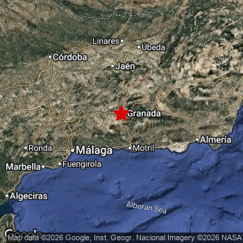 Map of area around epicenter. Click to open in Google Maps. |
| Magnitude: | MAG 5.2 Detected by 108 stations. Maximum Error Range ±0.055 . |
| Depth: | 10 km (6 mi) A very shallow depth. |
| Max. Intensity: | VII
Very Strong On the Modified Mercalli Scale. |
| Tsunami Risk: | Tsunami very unlikely While this was a shallow earthquake, it appears to have occurred under land with a magnitude not strong enough to cause tsunami's. Always stay cautious - More info here. |
Significant economic impact
The US Geographic Survey (USGS) describes the impact of this earthquake as follows:
Some homes and buildings damaged and power outages occurred in the Granada area.
Based on scientific estimates by the USGS, the risk of high fatalities for this earthquake is classified at level GREEN (low). They expect an 90% likelyhood of between 0 and 1 fatalities.
The USGS classifies the economic impact of this earthquake at level YELLOW (significant). They expect an 35% likelyhood of between 10 and 100 million US Dollars in economic damage and impact, and a 96% chance that the economic impact of this earthquake falls no higher than 1,000 million USD.
Roughly 9 million people exposed to shaking
This earthquake may have been felt by around 9 million people. That is the expected population size of the area exposed to a level of shaking of II or higher on the Modified Mercalli scale according to the USGS.
An estimated 26,830 people were exposed to level VII. At this level, very strong shaking and likely moderate damage can be expected. Intensity level II was experienced by a large group of people (around 4.2 million). In their region, very weak shaking and no damage can be expected.
People in 4 countries have been exposed to shaking. Roughly 6.6 million people were exposed to shaking in Spain , with level VII (very strong shaking, likely moderate damage) as the highest recorded. In Morocco , around 2 million people. A smaller number of people were exposed in the following countries: Algeria and Gibraltar.
| People | MMI Level | Shaking | Damage |
|---|---|---|---|
| 80,600 | I |
Not noticable | None |
| 4,220,000 | II |
Very weak | None |
| 3,556,000 | III |
Weak | Probably none |
| 419,500 | IV |
Light | Likely none |
| 302,800 | V |
Moderate | Very light |
| 131,200 | VI |
Strong | Light |
| 26,830 | VII |
Very Strong | Moderate |
| 0 | VIII |
Severe | Moderate to heavy |
| 0 | IX |
Violent | Heavy |
| 0 | X |
Extreme | Very heavy |
Nearby towns and cities
This earthquake struck within proximity of multiple countries. Spain , Gibraltar , Morocco and Algeria are all within 300km distance of its epicenter.
Located 3 kilometer (2 mi) south of the epicenter of this earthquake, Las Gabias (Andalusia, Spain) is the nearest significant population center. The intensity of shaking and damage in Las Gabias is estimated to be around level VI on the Modified Mercalli Intensity scale (strong shaking, probably light damage).
Multiple major population centers exist within 300km of the earthquake that struck today. Granada is located 10 km to the north-east and experienced an intensity of V (moderate shaking, very light damage). Málaga is located 80 km to the southwest and experienced an intensity of III (weak shaking, probably no damage). Sevilla is located 207 km to the west (intensity unknown, possibly low).
The table below provides an overview of all places in proximity of today's earthquake. Where available, the estimated intensity on the Modified Mercalli Intensity Scale in each place is included. Places where this information is omitted likely experienced little impact.
Overview of nearby places
| Distance | Place | Intensity (MMI) |
|---|---|---|
| 3 km (2 mi) N from epicenter |
Las Gabias Andalusia, Spain. |
VI
Strong |
| 5 km (3 mi) NE from epicenter |
Armilla Andalusia, Spain. |
VI
Strong |
| 7 km (4 mi) E from epicenter |
Zubia Andalusia, Spain. |
VI
Strong |
| 10 km (6 mi) NE from epicenter |
Granada Andalusia, Spain. |
V
Moderate |
| 10 km (6 mi) NW from epicenter |
Santafé Andalusia, Spain. |
V
Moderate |
| 11 km (7 mi) N from epicenter |
Maracena Andalusia, Spain. |
V
Moderate |
| 13 km (8 mi) N from epicenter |
Atarfe Andalusia, Spain. |
V
Moderate |
| 14 km (9 mi) N from epicenter |
Albolote Andalusia, Spain. |
V
Moderate |
| 42 km (26 mi) S from epicenter |
Motril Andalusia, Spain. |
IV
Light |
| 42 km (26 mi) S from epicenter |
Almuñécar Andalusia, Spain. |
IV
Light |
| 44 km (27 mi) SW from epicenter |
Nerja Andalusia, Spain. |
IV
Light |
| 44 km (27 mi) W from epicenter |
Loja Andalusia, Spain. |
III
Weak |
| 45 km (28 mi) NW from epicenter |
Alcalá la Real Andalusia, Spain. |
III
Weak |
| 47 km (29 mi) SW from epicenter |
Torrox Andalusia, Spain. |
IV
Light |
| 51 km (32 mi) NE from epicenter |
Guadix Andalusia, Spain. |
IV
Light |
| 53 km (33 mi) SW from epicenter |
Vélez-Málaga Andalusia, Spain. |
IV
Light |
| 56 km (35 mi) SW from epicenter |
Torre del Mar Andalusia, Spain. |
IV
Light |
| 60 km (37 mi) NW from epicenter |
Priego de Córdoba Andalusia, Spain. |
III
Weak |
| 70 km (43 mi) SW from epicenter |
Rincón de la Victoria Andalusia, Spain. |
III
Weak |
| 70 km (43 mi) SE from epicenter |
Adra Andalusia, Spain. |
III
Weak |
| 70 km (43 mi) SE from epicenter |
Berja Andalusia, Spain. |
III
Weak |
| 73 km (45 mi) N from epicenter |
Martos Andalusia, Spain. |
III
Weak |
| 74 km (46 mi) N from epicenter |
Jaén Andalusia, Spain. |
III
Weak |
| 80 km (50 mi) NW from epicenter |
Cabra Andalusia, Spain. |
III
Weak |
| 80 km (50 mi) SW from epicenter |
Málaga Andalusia, Spain. |
III
Weak |
| 80 km (50 mi) W from epicenter |
Antequera Andalusia, Spain. |
III
Weak |
| 80 km (50 mi) NW from epicenter |
Lucena Andalusia, Spain. |
III
Weak |
| 81 km (50 mi) NW from epicenter |
Baena Andalusia, Spain. |
III
Weak |
| 84 km (52 mi) SE from epicenter |
El Ejido Andalusia, Spain. |
III
Weak |
| 90 km (56 mi) NE from epicenter |
Baza Andalusia, Spain. |
III
Weak |
| 92 km (57 mi) SW from epicenter |
Torremolinos Andalusia, Spain. |
III
Weak |
| 94 km (58 mi) SW from epicenter |
Alhaurín de la Torre Andalusia, Spain. |
III
Weak |
| 96 km (60 mi) E from epicenter |
Vícar Andalusia, Spain. |
III
Weak |
| 96 km (60 mi) SW from epicenter |
Arroyo de la Miel Andalusia, Spain. |
III
Weak |
| 97 km (60 mi) SW from epicenter |
Cártama Andalusia, Spain. |
III
Weak |
| 99 km (62 mi) SW from epicenter |
Benalmádena Andalusia, Spain. |
III
Weak |
| 100 km (62 mi) N from epicenter |
Baeza Andalusia, Spain. |
III
Weak |
| 101 km (63 mi) E from epicenter |
Roquetas de Mar Andalusia, Spain. |
III
Weak |
| 104 km (65 mi) N from epicenter |
Úbeda Andalusia, Spain. |
III
Weak |
| 104 km (65 mi) SW from epicenter |
Mijas Andalusia, Spain. |
III
Weak |
| 106 km (66 mi) SW from epicenter |
Fuengirola Andalusia, Spain. |
III
Weak |
| 109 km (68 mi) N from epicenter |
Andújar Andalusia, Spain. |
III
Weak |
| 110 km (68 mi) N from epicenter |
Linares Andalusia, Spain. |
III
Weak |
| 111 km (69 mi) E from epicenter |
Almería Andalusia, Spain. |
III
Weak |
| 127 km (79 mi) SW from epicenter |
Marbella Andalusia, Spain. |
III
Weak |
| 131 km (81 mi) NW from epicenter |
Córdoba Andalusia, Spain. |
III
Weak |
| 137 km (85 mi) NE from epicenter |
Campiña Andalusia, Spain. |
II
Weak |
| 180 km (112 mi) N from epicenter |
Puertollano Castille-La Mancha, Spain. |
II
Weak |
| 185 km (115 mi) SW from epicenter |
Gibraltar All regions, Gibraltar. |
II
Weak |
| 201 km (125 mi) SW from epicenter |
Ceuta Ceuta, Spain. |
II
Weak |
| 207 km (129 mi) W from epicenter |
Sevilla Andalusia, Spain. |
|
| 208 km (129 mi) S from epicenter |
Al Hoceïma Tanger-Tetouan-Al Hoceima, Morocco. |
II
Weak |
| 212 km (132 mi) S from epicenter |
Melilla Melilla, Spain. |
II
Weak |
| 226 km (140 mi) S from epicenter |
Nador Oriental, Morocco. |
|
| 242 km (150 mi) SW from epicenter |
Tangier Tanger-Tetouan-Al Hoceima, Morocco. |
II
Weak |
| 244 km (152 mi) NE from epicenter |
Murcia Murcia, Spain. |
|
| 282 km (175 mi) NW from epicenter |
Don Benito Extremadura, Spain. |
|
| 287 km (178 mi) SE from epicenter |
Beni Saf Aïn Témouchent, Algeria. |
I
Not felt |
| 290 km (180 mi) SE from epicenter |
Nedroma Tlemcen, Algeria. |
|
| 291 km (181 mi) NE from epicenter |
Elche Valencia, Spain. |
|
| 299 km (186 mi) S from epicenter |
Taounate Fès-Meknès, Morocco. |
Earthquake Intensity Map
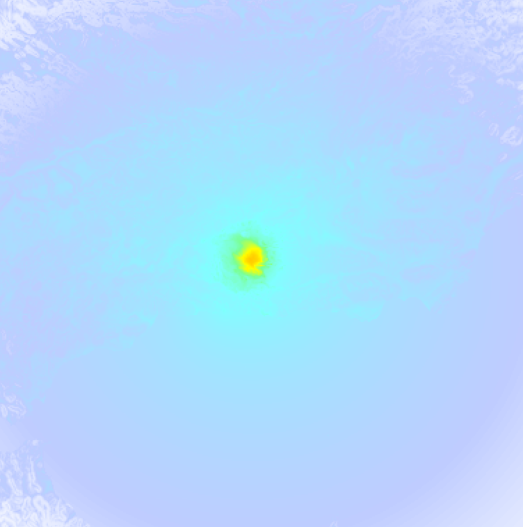
The graph below overlays a map of the region around the epicenter with earthquake intensity data provided by the US Geographic Survey. The highest intensity level detected for this earthquake is VII.
Shaking reported by 125 people in 2 countries
People that feel an earthquake may report their experience to the US Geographic Survey. Currently, 125 people have reported shaking in 48 places in 2 countries (Spain, Morocco).We keep updating this article as more ground reports become available. You may report that you felt this earthquake here.
Places with most reports:
- Granada, Granada, Spain: 30 people.
- Málaga, Málaga, Spain: 16 people.
- Almuñécar, Granada, Spain: 7 people.
- Armilla, Granada, Spain: 5 people.
- Otura, Granada, Spain: 4 people.
- Fuengirola, Málaga, Spain: 4 people.
- Maracena, Granada, Spain: 3 people.
- Nerja, Málaga, Spain: 3 people.
- Torremolinos, Málaga, Spain: 3 people.
- Dúrcal, Granada, Spain: 2 people.
5 Aftershocks detected
Since this main shock, 5 smaller aftershocks were detected. Just 5 hrs after this main shock, an earthquake measuring MAG-3.3 was detected 5 km (3 mi) east of this earthquake.
In the days before this main shock, 1 smaller foreshock was detected. A 3.6 magnitude earthquake hit 6 hrs earlier nearby.
Overview of foreshocks and aftershocks
| Classification | Magnitude | When | Where |
|---|---|---|---|
| Foreshock | M 3.6 |
6 hrs earlier Aug 14, 2026 18:43 (Madrid Time) | 6 km (4 mi) E from Main Shock. |
| Main Shock This Earthquake |
M 5.2 |
Aug 15, 2026 01:04 (Madrid Time) | - |
| Aftershock | M 2.6 |
30 mins later Aug 15, 2026 01:34 (Madrid Time) | 4 km (2.2 mi) E from Main Shock. |
| Aftershock | M 3.3 |
5 hrs later Aug 15, 2026 06:34 (Madrid Time) | 5 km (3 mi) E from Main Shock. |
| Aftershock | M 3.0 |
8 hrs later Aug 15, 2026 08:57 (Madrid Time) | 4 km (2.7 mi) E from Main Shock. |
| Aftershock | M 3.1 |
1 day later Aug 16, 2026 04:40 (Madrid Time) | 5 km (3 mi) NE from Main Shock. |
| Aftershock | M 2.8 |
1 day later Aug 16, 2026 06:27 (Madrid Time) | 5 km (2.9 mi) E from Main Shock. |
More earthquakes coming?
The risk of aftershocks decreases rapidly over time. Usually, aftershocks are at least one order of magnitude lower than a main shock.
The chance that a significant earthquake like this one is followed by an even larger earthquake is not so large. On average, scientists estimate a 94% chance that a major earthquake will not be followed by an even larger one. It is still adviced to be aware of this risk
Read: How to Stay Safe during an Earthquake (cdc.gov).This is the strongest earthquake in 4 years
Earthquakes of this strength are not so common in the region, but it's not the first time. This is the strongest earthquake to hit since May 20th, 2022, when a 5.5 magnitude earthquake hit 178 km (110 mi) further south. That was also the heaviest earthquake to hit the region in the past 10 years.
In total, 2 earthquakes with a magnitude of 5.2 or higher have been registered within 300km (186 mi) of this epicenter in the past 10 years. This comes down to an average of once every 5 years.
Tsunami very unlikely
While MAG-6.5+ earthquakes may cause tsunami's, it appears that the epicenter of this earthquake hit under land. In addition, the reported depth is deeper than 100km, making the risk of a tsunami even less likely. However always stay cautious and monitor advice from local authorities.
Tsunami Risk Factors
| Factor | Under Sea? | MAG-6.5 or stronger? | Shallow depth? |
|---|---|---|---|
| Explanation | Almost all tsunami's are caused by earthquakes with their epicenter under sea or very near the sea. However stay cautious in coastal areas as earthquakes on land may cause landslides into sea, potentially still causing a local tsunami. | Under MAG 6.5: Very unlikely to cause a tsunami. MAG 6.5 to 7.5: Destructive tsunami's do occur, but are uncommon. Likely to observe small sea level changes. MAG 7.6+: Earthquakes with these magnitudes might produce destructive tsunami's. |
Most destructive tsunami's are caused by shallow earthquakes with a depth between 0 and 100km under the surface of the earth. Deeper tsunami's are unlikely to displace to ocean floor. |
| This Earthquake | Not this earthquake. This earthquake appears to have struck on land far from any coast. |
Not this earthquake. This earthquake had a magnitude of 5.2. Earthquakes of this strength are unlikely to trigger a tsunami. |
This earthquake occurred at a depth of of 10 km (6 mi). Earthquakes this shallow could trigger a tsunami. |
Sources
Last updated 13/10/26 06:48 (). As more information on this earthquake becomes available this article will be updated. This article is automatically composed based on data originating from multiple sources.
- US Geographic Society (USGS): Earthquake us6000tkv2
- European-Mediterranean Seismological Centre (EMSC): Earthquake 20260814_0000322
- Geonames.org: World Cities Database
- Google Maps: Static API
- Earthquakelist.org: Historic Earthquakes Database
Share this article:
