
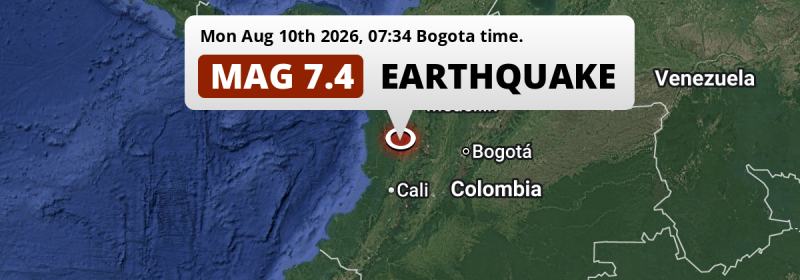
Under land 58 kilometer from Pereira in Colombia, a DESTRUCTIVE and very strong M7.4 earthquake occurred in the morning of Monday August 10th, 2026. Earthquakes this strong in locations like this are likely to cause a high number of fatalities and likely to have a large economic impact.
Felt the earthquake? Share this article: 


Earthquake Summary
The earthquake struck on land in Colombia, 58 kilometer (36 mi) west of Pereira in Risaralda. The center of this earthquake had an intermediate depth of 108 km.
| Date and Time: | Aug 10, 2026 07:34AM (Bogota Time) - Aug 10, 2026 12:34 Universal Time. |
|---|---|
| Location: | 58 km west of Pereira, Risaralda, Colombia. Coordinates 4°53'1"N 76°13'6"W. |
| Map: | 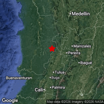 Map of area around epicenter. Click to open in Google Maps. |
| Magnitude: | MAG 7.4 Detected by 325 stations. Maximum Error Range ±0.026 . |
| Depth: | 108 km (67 mi) An intermediate depth. |
| Max. Intensity: | IX
Violent On the Modified Mercalli Scale. |
| Tsunami Risk: | Tsunami very unlikely While a very strong earthquake, it appears to have occurred under land. Always stay cautious - More info here. |
High fatalities and economic impact
The US Geographic Survey (USGS) describes the impact of this earthquake as follows:
At least 331 persons killed in the Caldas-Choco-Risaralda-Valle del Cauca area. At least 4,611 injured and 240 missing; 31,540 homes destroyed and 178,555 damaged, 603 buildings destroyed throughout Colombia. At least 10 airports damaged including the Armenia, Buenaventura, Cartago, Manizales and Quibdo airports. Landslides occurred in Choco and in Valle del Cauca.
Based on scientific estimates by the USGS, the risk of high fatalities for this earthquake is classified at level RED (high). They expect an 33% likelyhood of between 1,000 and 10,000 fatalities, and a 93% chance that the number of fatalities falls between 10 and 100,000.
The USGS classifies the economic impact of this earthquake at level RED (high). They expect an 33% likelyhood of between 1,000 and 10,000 million US Dollars in economic damage and impact, and a 96% chance that the economic impact of this earthquake falls between 100 and 10,000,000 million USD.
Roughly 35 million people exposed to shaking
An estimated 35 million have been exposed to shaking (An MMI or Modified Mercalli Intensity level II or higher) as a result of this earthquake according scientific estimates published by the USGS.
An estimated 1,648,000 people were exposed to level VIII. At this level, severe shaking and likely moderate to heavy damage can be expected. Intensity level V was experienced by a large group of people (around 14 million). In their region, moderate shaking and very light damage can be expected.
People in 3 countries have been exposed to shaking. In Colombia , around 35 million people, with impact levels up to VIII (severe shaking, likely moderate to heavy damage). A smaller number of people were exposed in the following countries: Panama and Ecuador.
| People | MMI Level | Shaking | Damage |
|---|---|---|---|
| 0 | I |
Not noticable | None |
| 0 | II |
Very weak | None |
| 31,330 | III |
Weak | Probably none |
| 10,990,000 | IV |
Light | Likely none |
| 14,190,000 | V |
Moderate | Very light |
| 2,240,000 | VI |
Strong | Light |
| 5,442,000 | VII |
Very Strong | Moderate |
| 1,648,000 | VIII |
Severe | Moderate to heavy |
| 0 | IX |
Violent | Heavy |
| 0 | X |
Extreme | Very heavy |
Nearby towns and cities
This earthquake may have been felt in Colombia . The closest significant population center near the earthquake is Cartago in Valle del Cauca, Colombia. Cartago is located 37 kilometer (23 mi) northwest of the epicenter. The intensity of shaking and damage in Cartago is estimated to be around level VIII on the Modified Mercalli Intensity scale (severe shaking, likely moderate to heavy damage).
Multiple large cities are in proximity of today's earthquake. Bogotá is located 239 km to the east and experienced an intensity of IV (light shaking, likely no damage). Cali is located 164 km to the south and experienced an intensity of VII (very strong shaking, likely moderate damage). Medellín is located 169 km to the north-east and experienced an intensity of V (moderate shaking, very light damage).
An overview of nearby towns and cities is available in the overview below. If places don't have intensity data available, it likely means the experienced impact in those places was fairly small.
Overview of nearby places
| Distance | Place | Intensity (MMI) |
|---|---|---|
| 37 km (23 mi) SE from epicenter |
Cartago Valle del Cauca, Colombia. |
VIII
Severe |
| 37 km (23 mi) E from epicenter |
La Virginia Risaralda, Colombia. |
VIII
Severe |
| 41 km (25 mi) S from epicenter |
La Unión Valle del Cauca, Colombia. |
VIII
Severe |
| 43 km (27 mi) NE from epicenter |
Viterbo Caldas, Colombia. |
VIII
Severe |
| 52 km (32 mi) NE from epicenter |
Belén de Umbría Risaralda, Colombia. |
VI
Strong |
| 53 km (33 mi) S from epicenter |
Roldanillo Valle del Cauca, Colombia. |
VIII
Severe |
| 57 km (35 mi) S from epicenter |
Zarzal Valle del Cauca, Colombia. |
VIII
Severe |
| 58 km (36 mi) SE from epicenter |
Quimbaya Quindío, Colombia. |
VII
Very Strong |
| 58 km (36 mi) E from epicenter |
Pereira Risaralda, Colombia. |
VIII
Severe |
| 61 km (38 mi) E from epicenter |
Dosquebradas Risaralda, Colombia. |
VIII
Severe |
| 63 km (39 mi) SE from epicenter |
Montenegro Quindío, Colombia. |
VIII
Severe |
| 66 km (41 mi) E from epicenter |
Santa Rosa de Cabal Risaralda, Colombia. |
VIII
Severe |
| 68 km (42 mi) SE from epicenter |
La Tebaida Quindío, Colombia. |
VII
Very Strong |
| 69 km (43 mi) NE from epicenter |
Anserma Risaralda, Colombia. |
VI
Strong |
| 69 km (43 mi) E from epicenter |
Chinchiná Caldas, Colombia. |
VII
Very Strong |
| 71 km (44 mi) SE from epicenter |
Armenia Quindío, Colombia. |
VII
Very Strong |
| 71 km (44 mi) SE from epicenter |
Circasia Quindío, Colombia. |
VII
Very Strong |
| 75 km (47 mi) SE from epicenter |
Calarcá Quindío, Colombia. |
VII
Very Strong |
| 75 km (47 mi) SE from epicenter |
Caicedonia Valle del Cauca, Colombia. |
VII
Very Strong |
| 76 km (47 mi) SE from epicenter |
Sevilla Valle del Cauca, Colombia. |
VII
Very Strong |
| 79 km (49 mi) S from epicenter |
Andalucía Valle del Cauca, Colombia. |
VII
Very Strong |
| 80 km (50 mi) E from epicenter |
Manizales Caldas, Colombia. |
VII
Very Strong |
| 80 km (50 mi) E from epicenter |
Villamaría Caldas, Colombia. |
VII
Very Strong |
| 83 km (52 mi) NE from epicenter |
Riosucio Caldas, Colombia. |
VI
Strong |
| 89 km (55 mi) S from epicenter |
Tuluá Valle del Cauca, Colombia. |
VII
Very Strong |
| 94 km (58 mi) NE from epicenter |
Andes Antioquia, Colombia. |
VI
Strong |
| 100 km (62 mi) NE from epicenter |
Salamina Caldas, Colombia. |
VII
Very Strong |
| 101 km (63 mi) SE from epicenter |
Anaime Tolima, Colombia. |
VI
Strong |
| 102 km (63 mi) NW from epicenter |
Quibdó Chocó, Colombia. |
VII
Very Strong |
| 110 km (68 mi) S from epicenter |
Guadalajara de Buga Valle del Cauca, Colombia. |
VI
Strong |
| 120 km (75 mi) SE from epicenter |
Ibagué Tolima, Colombia. |
V
Moderate |
| 128 km (80 mi) E from epicenter |
Líbano Tolima, Colombia. |
V
Moderate |
| 134 km (83 mi) S from epicenter |
El Cerrito Valle del Cauca, Colombia. |
VI
Strong |
| 140 km (87 mi) SE from epicenter |
Payandé Tolima, Colombia. |
V
Moderate |
| 143 km (89 mi) SW from epicenter |
Buenaventura Valle del Cauca, Colombia. |
VIII
Severe |
| 148 km (92 mi) S from epicenter |
Yumbo Valle del Cauca, Colombia. |
VI
Strong |
| 149 km (93 mi) NE from epicenter |
Caldas Antioquia, Colombia. |
V
Moderate |
| 150 km (93 mi) S from epicenter |
Palmira Valle del Cauca, Colombia. |
V
Moderate |
| 155 km (96 mi) NE from epicenter |
La Estrella Antioquia, Colombia. |
V
Moderate |
| 160 km (99 mi) NE from epicenter |
Itagüí Antioquia, Colombia. |
V
Moderate |
| 160 km (99 mi) NE from epicenter |
Envigado Antioquia, Colombia. |
V
Moderate |
| 164 km (102 mi) S from epicenter |
Cali Valle del Cauca, Colombia. |
VII
Very Strong |
| 169 km (105 mi) NE from epicenter |
Rionegro Antioquia, Colombia. |
V
Moderate |
| 169 km (105 mi) NE from epicenter |
Medellín Antioquia, Colombia. |
V
Moderate |
| 169 km (105 mi) SE from epicenter |
Espinal Tolima, Colombia. |
VI
Strong |
| 169 km (105 mi) E from epicenter |
Girardot City Cundinamarca, Colombia. |
V
Moderate |
| 177 km (110 mi) NE from epicenter |
Bello Antioquia, Colombia. |
V
Moderate |
| 183 km (114 mi) E from epicenter |
La Dorada Caldas, Colombia. |
V
Moderate |
| 185 km (115 mi) S from epicenter |
Puerto Tejada Cauca, Colombia. |
VI
Strong |
| 224 km (139 mi) E from epicenter |
Soacha Cundinamarca, Colombia. |
IV
Light |
| 239 km (149 mi) E from epicenter |
Bogotá Bogota D.C., Colombia. |
IV
Light |
| 241 km (150 mi) SE from epicenter |
Neiva Huila, Colombia. |
IV
Light |
| 299 km (186 mi) E from epicenter |
Villavicencio Meta, Colombia. |
IV
Light |
| 324 km (201 mi) E from epicenter |
Tunja Boyacá, Colombia. |
|
| 370 km (230 mi) S from epicenter |
Florencia Caquetá, Colombia. |
|
| 418 km (260 mi) S from epicenter |
Mocoa Putumayo, Colombia. |
|
| 424 km (263 mi) NE from epicenter |
Bucaramanga Santander, Colombia. |
|
| 425 km (264 mi) S from epicenter |
Pasto Nariño, Colombia. |
|
| 426 km (265 mi) E from epicenter |
Yopal Casanare, Colombia. |
|
| 431 km (268 mi) N from epicenter |
Montería Córdoba, Colombia. |
|
| 472 km (293 mi) SE from epicenter |
San José del Guaviare Guaviare, Colombia. |
|
| 477 km (296 mi) NE from epicenter |
Aguachica Cesar, Colombia. |
|
| 482 km (300 mi) S from epicenter |
Tulcán Carchi, Ecuador. |
|
| 500 km (311 mi) N from epicenter |
Sincelejo Sucre, Colombia. |
|
| 529 km (329 mi) NE from epicenter |
Cúcuta Norte de Santander, Colombia. |
|
| 539 km (335 mi) S from epicenter |
Nueva Loja Sucumbios, Ecuador. |
|
| 545 km (339 mi) NE from epicenter |
San Cristóbal Táchira, Venezuela. |
|
| 546 km (339 mi) S from epicenter |
Ibarra Imbabura, Ecuador. |
|
| 580 km (360 mi) SW from epicenter |
Esmeraldas Esmeraldas, Ecuador. |
|
| 584 km (363 mi) NW from epicenter |
Panamá Panamá, Panama. |
|
| 588 km (365 mi) NW from epicenter |
Arraiján Panamá Oeste, Panama. |
|
| 601 km (373 mi) S from epicenter |
Puerto Francisco de Orellana Orellana, Ecuador. |
|
| 610 km (379 mi) NW from epicenter |
Penonomé Coclé, Panama. |
|
| 618 km (384 mi) N from epicenter |
Cartagena Bolívar, Colombia. |
|
| 624 km (388 mi) SW from epicenter |
Quito Pichincha, Ecuador. |
|
| 636 km (395 mi) NW from epicenter |
Santiago de Veraguas Veraguas, Panama. |
|
| 642 km (399 mi) NW from epicenter |
Colón Colón, Panama. |
|
| 651 km (405 mi) NE from epicenter |
Arauca Departamento de Arauca, Colombia. |
|
| 659 km (409 mi) NE from epicenter |
San Carlos del Zulia Zulia, Venezuela. |
|
| 659 km (409 mi) SW from epicenter |
Santo Domingo de los Colorados Santo Domingo de los Tsáchilas, Ecuador. |
|
| 661 km (411 mi) NE from epicenter |
Guasdualito Apure, Venezuela. |
|
| 677 km (421 mi) S from epicenter |
Tena Napo, Ecuador. |
|
| 694 km (431 mi) NE from epicenter |
Mérida Mérida, Venezuela. |
|
| 695 km (432 mi) N from epicenter |
Barranquilla Atlántico, Colombia. |
|
| 700 km (435 mi) S from epicenter |
Latacunga Cotopaxi, Ecuador. |
|
| 703 km (437 mi) NE from epicenter |
Socopó Barinas, Venezuela. |
|
| 713 km (443 mi) E from epicenter |
Cumaribo Vichada, Colombia. |
|
| 732 km (455 mi) S from epicenter |
Ambato Tungurahua, Ecuador. |
|
| 735 km (457 mi) S from epicenter |
Puyo Pastaza, Ecuador. |
|
| 741 km (460 mi) N from epicenter |
Santa Marta Magdalena, Colombia. |
|
| 744 km (462 mi) NE from epicenter |
San Juan del Cesar La Guajira, Colombia. |
|
| 750 km (466 mi) SW from epicenter |
Quevedo Los Ríos, Ecuador. |
Earthquake Intensity Map
The intensity in shaking and damage by this earthquake is illustrated through the map below. The highest intensity measured for this earthquake is VIII.
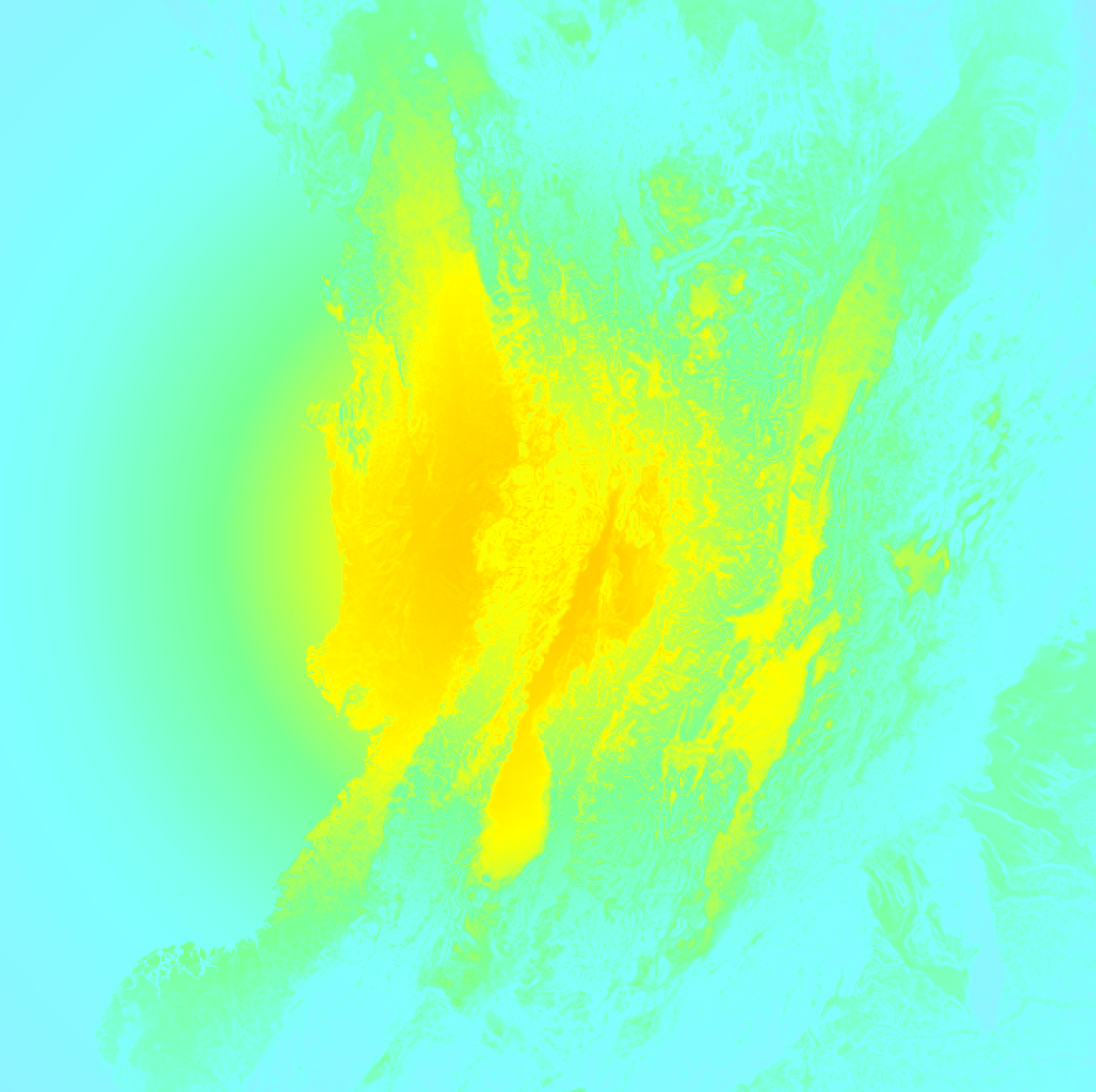
Shaking reported by 1228 people in 9 countries
People that feel an earthquake may report their experience to the US Geographic Survey. Currently, 1228 people have reported shaking in 224 places in 9 countries (Colombia, Mexico, Panama, Peru, Venezuela, Ecuador, Brazil, Jamaica, Dominican Republic).We keep updating this article as more ground reports become available. You may report that you felt this earthquake here.
Places with most reports:
- Bogotá, Bogotá, Colombia: 183 people.
- Medellín, Antioquia, Colombia: 67 people.
- Envigado, Antioquia, Colombia: 61 people.
- La Calera, Cundinamarca, Colombia: 60 people.
- Panamá, Panamá, Panama: 58 people.
- Cali, Valle del Cauca, Colombia: 56 people.
- Quito, Pichincha, Ecuador: 54 people.
- Pereira, Risaralda, Colombia: 44 people.
- San Miguelito, Panamá, Panama: 32 people.
- Itagüí, Antioquia, Colombia: 27 people.
2 Aftershocks detected
After this earthquake struck, 2 smaller aftershocks occurred. At a distance of 14 km (9 mi) north of this earthquake, an aftershock struck 2 hrs later. It measured a magnitude of 4.3
Overview of foreshocks and aftershocks
| Classification | Magnitude | When | Where |
|---|---|---|---|
| Main Shock | M 5.0 |
Aug 10, 2026 08:18AM (Bogota Time) | - |
| Aftershock | M 4.3 |
2 hrs later Aug 10, 2026 10:01AM (Bogota Time) | 14 km (9 mi) N from Main Shock. |
| Aftershock | M 4.1 |
1 day later Aug 11, 2026 10:43AM (Bogota Time) | 4 km (2.4 mi) N from Main Shock. |
More earthquakes coming?
Aftershocks are usually at least 1 order of magnitude less strong than main shocks. The more time passes, the smaller the chance and likely strength of any potential aftershocks.
In only six percent of cases, significant earthquakes are followed by a larger main shock, making the current earthquake a foreshock. While the chance of this happening is not so large, it is adviced to maintain cautiousness in the hours and days following a major earthquake.
Read: How to Stay Safe during an Earthquake (cdc.gov).This is an unusually powerful earthquake
No earthquake of this strength has struck this region for a long time. Our data goes back 10 years, and no earthquakes measuring a magnitude of 7.4 or higher have been detected within 300 km (186 mi) of this epicenter.
Tsunami very unlikely
While MAG-6.5+ earthquakes may cause tsunami's, it appears that the epicenter of this earthquake hit inland, more than 100 km away from coastal areas. In addition, the reported depth is deeper than 100km, making the risk at a tsunami even less likely. However always stay cautious and monitor advice from local authorities.
Tsunami Risk Factors
| Factor | Under Sea? | MAG-6.5 or stronger? | Shallow depth? |
|---|---|---|---|
| Explanation | Almost all tsunami's are caused by earthquakes with their epicenter under sea or very near the sea. However stay cautious in coastal areas as earthquakes on land may cause landslides into sea, potentially still causing a local tsunami. | Under MAG 6.5: Very unlikely to cause a tsunami. MAG 6.5 to 7.5: Destructive tsunami's do occur, but are uncommon. Likely to observe small sea level changes. MAG 7.6+: Earthquakes with these magnitudes might produce destructive tsunami's. |
Most destructive tsunami's are caused by shallow earthquakes with a depth between 0 and 100km under the surface of the earth. Deeper tsunami's are unlikely to displace to ocean floor. |
| This Earthquake | Not this earthquake. This earthquake appears to have struck on land far from any coast. |
This earthquake had a magnitude of 7.4. Earthquakes of this strength could trigger a tsunami. | Not this earthquake. This earthquake occurred at a depth of 108 km (67 mi). Earthquakes this deep in the earth are unlikely to trigger a tsunami. |
Sources
Last updated 09/10/26 05:38 (). This article is automatically generated based on available data. We keep checking multiple sources for additional information. This article gets updated as new details on this earthquake become available.
- US Geographic Society (USGS): Earthquake us6000tjl2
- European-Mediterranean Seismological Centre (EMSC): Earthquake 20260810_0000177
- Geonames.org: World Cities Database
- Google Maps: Static API
- Earthquakelist.org: Historic Earthquakes Database
Share this article:
