
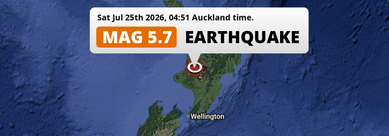
In the night of Saturday July 25th, 2026, a shallow and significant MAG-5.7 earthquake hit under land 79 kilometer from Taupo in New Zealand. Around 1.5 million people have been exposed to shaking.
Felt the earthquake? Share this article: 


Earthquake Summary
The earthquake struck on land in New Zealand, 79 kilometer (49 mi) southwest of Taupo in Waikato. The center of this earthquake had a very shallow depth of 10 km. Shallow earthquakes usually have a larger impact than earthquakes deep in the earth.
| Date and Time: | Jul 25, 2026 04:51 (Auckland Time) - Jul 24, 2026 16:51 Universal Time. |
|---|---|
| Location: | 79 km SW of Taupo, Waikato, New Zealand. Coordinates 38°58'9"S 175°14'56"E. |
| Map: | 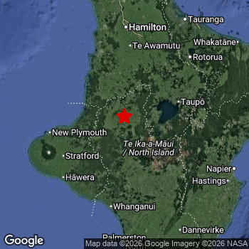 Map of area around epicenter. Click to open in Google Maps. |
| Magnitude: | MAG 5.7 Detected by 67 stations. Maximum Error Range ±0.038 . |
| Depth: | 10 km (6 mi) A very shallow depth. |
| Max. Intensity: | VII
Very Strong On the Modified Mercalli Scale. |
| Tsunami Risk: | Tsunami very unlikely While this was a shallow earthquake, it appears to have occurred under land with a magnitude not strong enough to cause tsunami's. Always stay cautious - More info here. |
Minimal impact predicted
The US Geographic Survey (USGS) describes the impact of this earthquake as follows:
One person injured, items knocked from shelves, windows broken and small landslides occurred in the Taumarunui area.
Based on scientific estimates by the USGS, the risk of high fatalities for this earthquake is classified at level GREEN (low). They expect an 95% likelyhood of between 0 and 1 fatalities.
The USGS classifies the economic impact of this earthquake at level GREEN (low). They expect an 90% likelyhood of between 0 and 1 million US Dollars in economic damage and impact.
Roughly 1.5 million people exposed to shaking
The USGS has published a report estimating the number of people exposed to this earthquake. Acoording to their analysis, roughly 1.5 million have been exposed to shaking at an MMI level of II or higher.
An estimated 10 people were exposed to level VII. At this level, very strong shaking and likely moderate damage can be expected. The majority of people (roughly 1.1 million) live in an area exposed to level III, where weak shaking and probably no damage is expected. All exposure to shaking was within the borders of New Zealand .
| People | MMI Level | Shaking | Damage |
|---|---|---|---|
| 0 | I |
Not noticable | None |
| 8,220 | II |
Very weak | None |
| 1,146,000 | III |
Weak | Probably none |
| 305,700 | IV |
Light | Likely none |
| 1,730 | V |
Moderate | Very light |
| 3,930 | VI |
Strong | Light |
| 10 | VII |
Very Strong | Moderate |
| 0 | VIII |
Severe | Moderate to heavy |
| 0 | IX |
Violent | Heavy |
| 0 | X |
Extreme | Very heavy |
Nearby towns and cities
This earthquake may have been felt in New Zealand . Located 79 kilometer (49 mi) southwest of the epicenter of this earthquake, Taupo (Waikato, New Zealand) is the nearest significant population center. Taupo experienced an earthquake intensity (MMI Scale) of roughly III. That level implies weak shaking and probably no damage.
Multiple large cities are in proximity of today's earthquake. Auckland is located 240 km to the north (intensity unknown, possibly low). Manukau City is located 222 km to the north (intensity unknown, possibly low). Wellington is located 261 km to the south (intensity unknown, possibly low).
An overview of nearby towns and cities is available in the overview below. If places don't have intensity data available, it likely means the experienced impact in those places was fairly small.
Overview of nearby places
| Distance | Place | Intensity (MMI) |
|---|---|---|
| 79 km (49 mi) NE from epicenter |
Taupo Waikato, New Zealand. |
III
Weak |
| 101 km (63 mi) W from epicenter |
New Plymouth Taranaki, New Zealand. |
IV
Light |
| 109 km (68 mi) S from epicenter |
Whanganui Manawatu-Wanganui, New Zealand. |
IV
Light |
| 122 km (76 mi) N from epicenter |
Cambridge Waikato, New Zealand. |
III
Weak |
| 127 km (79 mi) NE from epicenter |
Rotorua Bay of Plenty, New Zealand. |
III
Weak |
| 132 km (82 mi) N from epicenter |
Hamilton Waikato, New Zealand. |
IV
Light |
| 151 km (94 mi) SE from epicenter |
Taradale Hawke's Bay, New Zealand. |
III
Weak |
| 155 km (96 mi) E from epicenter |
Napier Hawke's Bay, New Zealand. |
III
Weak |
| 156 km (97 mi) SE from epicenter |
Hastings Hawke's Bay, New Zealand. |
III
Weak |
| 157 km (98 mi) S from epicenter |
Palmerston North Manawatu-Wanganui, New Zealand. |
III
Weak |
| 162 km (101 mi) S from epicenter |
Linton Military Camp Manawatu-Wanganui, New Zealand. |
III
Weak |
| 164 km (102 mi) NE from epicenter |
Tauranga Bay of Plenty, New Zealand. |
III
Weak |
| 185 km (115 mi) S from epicenter |
Levin Manawatu-Wanganui, New Zealand. |
III
Weak |
| 188 km (117 mi) NE from epicenter |
Whakatane Bay of Plenty, New Zealand. |
III
Weak |
| 198 km (123 mi) N from epicenter |
Pukekohe East Auckland, New Zealand. |
III
Weak |
| 213 km (132 mi) N from epicenter |
Papakura Auckland, New Zealand. |
|
| 217 km (135 mi) S from epicenter |
Paraparaumu Wellington, New Zealand. |
|
| 219 km (136 mi) N from epicenter |
Manurewa Auckland, New Zealand. |
|
| 222 km (138 mi) N from epicenter |
Manukau City Auckland, New Zealand. |
|
| 224 km (139 mi) S from epicenter |
Masterton Wellington, New Zealand. |
|
| 225 km (140 mi) N from epicenter |
Papatoetoe Auckland, New Zealand. |
|
| 226 km (140 mi) N from epicenter |
Mangere Auckland, New Zealand. |
|
| 227 km (141 mi) N from epicenter |
Otara Auckland, New Zealand. |
|
| 229 km (142 mi) N from epicenter |
Otahuhu Auckland, New Zealand. |
|
| 235 km (146 mi) N from epicenter |
New Lynn Auckland, New Zealand. |
|
| 236 km (147 mi) N from epicenter |
Remuera Auckland, New Zealand. |
|
| 237 km (147 mi) N from epicenter |
Avondale Auckland, New Zealand. |
|
| 240 km (149 mi) N from epicenter |
Auckland Auckland, New Zealand. |
|
| 241 km (150 mi) E from epicenter |
Gisborne Gisborne, New Zealand. |
|
| 242 km (150 mi) S from epicenter |
Upper Hutt Wellington, New Zealand. |
|
| 243 km (151 mi) S from epicenter |
Porirua Wellington, New Zealand. |
|
| 245 km (152 mi) N from epicenter |
North Shore Auckland, New Zealand. |
|
| 252 km (157 mi) S from epicenter |
Lower Hutt Wellington, New Zealand. |
|
| 257 km (160 mi) S from epicenter |
Wainuiomata Wellington, New Zealand. |
|
| 261 km (162 mi) S from epicenter |
Karori Wellington, New Zealand. |
|
| 261 km (162 mi) S from epicenter |
Wellington Wellington, New Zealand. |
Earthquake Intensity Map
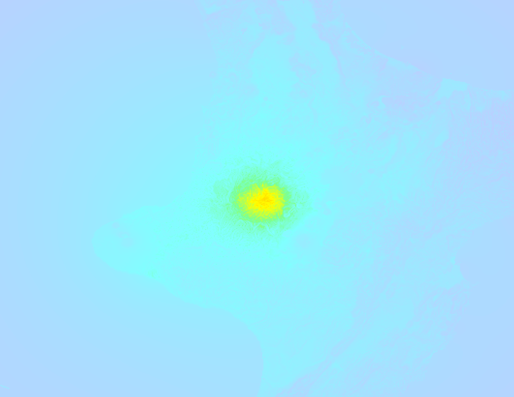
The intensity in shaking and damage by this earthquake is illustrated through the map below. The highest intensity measured for this earthquake is VII.
Shaking reported by 73 people
People that feel an earthquake may report their experience to the US Geographic Survey. Currently, 73 people have reported shaking in 30 places, all within New Zealand.We keep updating this article as more ground reports become available. You may report that you felt this earthquake here.
Places with most reports:
- Hamilton, Waikato, New Zealand: 17 people.
- New Plymouth, Taranaki, New Zealand: 8 people.
- Cambridge, Waikato, New Zealand: 4 people.
- Morrinsville, Waikato, New Zealand: 4 people.
- Ohakune, Manawatu-Wanganui, New Zealand: 4 people.
- Te Awamutu, Waikato, New Zealand: 4 people.
- Palmerston North, Manawatu-Wanganui, New Zealand: 4 people.
- Raglan, Waikato, New Zealand: 3 people.
- Hawera, Taranaki, New Zealand: 3 people.
- Stratford, Taranaki, New Zealand: 2 people.
8 Aftershocks detected
This main shock was followed by 8 smaller aftershocks. At a distance of 7 km (4 mi) southwest of this earthquake, an aftershock struck 30 mins later. It measured a magnitude of 3.7
This main shock was prefaced by 2 smaller foreshocks. Roughly 1 day before this earthquake, a foreshock measuring MAG-3.1 was detected nearby this earthquake.
Overview of foreshocks and aftershocks
| Classification | Magnitude | When | Where |
|---|---|---|---|
| Foreshock | M 3.1 |
1 day earlier Jul 23, 2026 21:27 (Auckland Time) | 48 km (30 mi) SW from Main Shock. |
| Foreshock | M 3.1 |
1 day earlier Jul 24, 2026 01:08 (Auckland Time) | 34 km (21 mi) SW from Main Shock. |
| Main Shock This Earthquake |
M 5.7 |
Jul 25, 2026 04:51 (Auckland Time) | - |
| Aftershock | M 3.0 |
12 mins later Jul 25, 2026 05:03 (Auckland Time) | 5 km (3 mi) W from Main Shock. |
| Aftershock | M 3.4 |
13 mins later Jul 25, 2026 05:04 (Auckland Time) | 8 km (5 mi) NW from Main Shock. |
| Aftershock | M 3.7 |
30 mins later Jul 25, 2026 05:21 (Auckland Time) | 7 km (4 mi) SW from Main Shock. |
| Aftershock | M 3.2 |
4 hrs later Jul 25, 2026 08:34 (Auckland Time) | 6 km (4 mi) SW from Main Shock. |
| Aftershock | M 3.2 |
6 hrs later Jul 25, 2026 11:14 (Auckland Time) | 81 km (50 mi) SE from Main Shock. |
| Aftershock | M 3.0 |
1 day later Jul 26, 2026 05:30 (Auckland Time) | 1.2 km (0.7 mi) S from Main Shock. |
| Aftershock | M 3.1 |
1 day later Jul 26, 2026 15:42 (Auckland Time) | 69 km (43 mi) NE from Main Shock. |
| Aftershock | M 3.5 |
2 days later Jul 27, 2026 00:05 (Auckland Time) | 44 km (27 mi) NE from Main Shock. |
More earthquakes coming?
Earthquakes can create aftershocks. These are generally at least 1 magnitude lower than any main shock, and as time passes the chance and strength of aftershocks decreases.
The chance that a significant earthquake like this one is followed by an even larger earthquake is not so large. On average, scientists estimate a 94% chance that a major earthquake will not be followed by an even larger one. It is still adviced to be aware of this risk
Read: How to Stay Safe during an Earthquake (cdc.gov).This is the strongest earthquake in 7 years
Earthquakes of this strength occur quite regularly in the region. This is the strongest earthquake to hit since November 23rd, 2019, when a 5.8 magnitude earthquake hit 250 km (155 mi) further north-east. An even stronger magnitude 6.1 earthquake struck on October 30th, 2018.
In total, 3 earthquakes with a magnitude of 5.7 or higher have been registered within 300km (186 mi) of this epicenter in the past 10 years. This comes down to an average of once every 3 years.
Tsunami very unlikely
While MAG-6.5+ earthquakes may cause tsunami's, it appears that the epicenter of this earthquake hit under land. In addition, the reported depth is deeper than 100km, making the risk of a tsunami even less likely. However always stay cautious and monitor advice from local authorities.
Tsunami Risk Factors
| Factor | Under Sea? | MAG-6.5 or stronger? | Shallow depth? |
|---|---|---|---|
| Explanation | Almost all tsunami's are caused by earthquakes with their epicenter under sea or very near the sea. However stay cautious in coastal areas as earthquakes on land may cause landslides into sea, potentially still causing a local tsunami. | Under MAG 6.5: Very unlikely to cause a tsunami. MAG 6.5 to 7.5: Destructive tsunami's do occur, but are uncommon. Likely to observe small sea level changes. MAG 7.6+: Earthquakes with these magnitudes might produce destructive tsunami's. |
Most destructive tsunami's are caused by shallow earthquakes with a depth between 0 and 100km under the surface of the earth. Deeper tsunami's are unlikely to displace to ocean floor. |
| This Earthquake | Not this earthquake. This earthquake appears to have struck on land far from any coast. |
Not this earthquake. This earthquake had a magnitude of 5.7. Earthquakes of this strength are unlikely to trigger a tsunami. |
This earthquake occurred at a depth of of 10 km (6 mi). Earthquakes this shallow could trigger a tsunami. |
Sources
Last updated 22/09/26 05:48 (). This article is automatically generated based on available data. We keep checking multiple sources for additional information. This article gets updated as new details on this earthquake become available.
- US Geographic Society (USGS): Earthquake us7000t34g
- European-Mediterranean Seismological Centre (EMSC): Earthquake 20260724_0000265
- Geonames.org: World Cities Database
- Google Maps: Static API
- Earthquakelist.org: Historic Earthquakes Database
Share this article:
