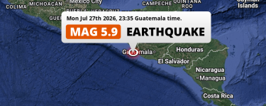
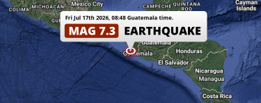
Written by on .

In the morning of Friday July 17th, 2026, a shallow and significant M5.1 aftershock hit in the North Pacific Ocean 105 kilometer from Tapachula, Mexico. Guatemala is also near its epicenter.

Felt the earthquake? Share this article: Share on Facebook Tweet Submit to Reddit Share on LinkedIn

Earthquake Summary

This earthquake hit under water in the North Pacific Ocean, 78 kilometers (49 mi) off the coast of Mexico, 105 kilometer southwest of Tapachula in Chiapas. The center of this earthquake had a very shallow depth of 10 km. Shallow earthquakes usually have a larger impact than earthquakes deep in the earth.

Date and Time: Jul 17, 2026 11:03 (Mexico City Time)
- Jul 17, 2026 17:03 Universal Time.
Location: 105 km SW of Tapachula, Chiapas, Mexico.
Coordinates 14°20'12"N 93°1'56"W.
Map: Map of area around epicenter.
Map of area around epicenter. Click to open in Google Maps.
Magnitude: MAG 5.1
Detected by 495 stations. Maximum Error Range ±0.026 .
Depth: 10 km (6 mi)
A very shallow depth.
Tsunami Risk: Low tsunami risk
Earthquakes under MAG-6.5 do not usually cause tsunami's.
Always stay cautious - More info here.

Nearby towns and cities

2 countries can be found within 300km of the epicenter of this earthquake: Mexico and Guatemala .

Tapachula in Chiapas, Mexico is the nearest significant place from the epicenter. The earthquake occurred 105 kilometer (65 mi) southwest of Tapachula.

Multiple large cities are in proximity of today's earthquake. Guatemala City is located 273 km to the east. Tuxtla is located 270 km to the north. Tapachula is located 105 km to the north-east.

The table below provides an overview of all places in proximity of today's earthquake.

Overview of nearby places

Distance Place
105 km (65 mi)
NE from epicenter
Tapachula

Chiapas, Mexico.
108 km (67 mi)
NE from epicenter
Huixtla

Chiapas, Mexico.
118 km (73 mi)
NE from epicenter
Cacahoatán

Chiapas, Mexico.
123 km (76 mi)
N from epicenter
Mapastepec

Chiapas, Mexico.
132 km (82 mi)
E from epicenter
Coatepeque

Quetzaltenango, Guatemala.
142 km (88 mi)
NE from epicenter
Motozintla

Chiapas, Mexico.
146 km (91 mi)
E from epicenter
Colomba

Quetzaltenango, Guatemala.
147 km (91 mi)
E from epicenter
Nuevo San Carlos

Retalhuleu, Guatemala.
148 km (92 mi)
E from epicenter
Retalhuleu

Retalhuleu, Guatemala.
150 km (93 mi)
NE from epicenter
San Marcos

San Marcos, Guatemala.
151 km (94 mi)
N from epicenter
Pijijiapan

Chiapas, Mexico.
154 km (96 mi)
NE from epicenter
San Pedro Sacatepéquez

San Marcos, Guatemala.
160 km (99 mi)
E from epicenter
El Palmar

Quetzaltenango, Guatemala.
161 km (100 mi)
NE from epicenter
Comitancillo

San Marcos, Guatemala.
163 km (101 mi)
E from epicenter
Ostuncalco

Quetzaltenango, Guatemala.
166 km (103 mi)
E from epicenter
Mazatenango

Suchitepeque, Guatemala.
169 km (105 mi)
E from epicenter
La Esperanza

Quetzaltenango, Guatemala.
172 km (107 mi)
E from epicenter
San Pablo Jocopilas

Suchitepeque, Guatemala.
172 km (107 mi)
E from epicenter
Quetzaltenango

Quetzaltenango, Guatemala.
175 km (109 mi)
NE from epicenter
Comalapa

Chiapas, Mexico.
178 km (111 mi)
E from epicenter
Cantel

Quetzaltenango, Guatemala.
180 km (112 mi)
E from epicenter
Tiquisate

Escuintla, Guatemala.
184 km (114 mi)
E from epicenter
San Francisco El Alto

Totonicapán, Guatemala.
185 km (115 mi)
E from epicenter
Chicacao

Suchitepeque, Guatemala.
191 km (119 mi)
E from epicenter
Totonicapán

Totonicapán, Guatemala.
192 km (119 mi)
NE from epicenter
Momostenango

Totonicapán, Guatemala.
193 km (120 mi)
E from epicenter
Nahualá

Sololá, Guatemala.
197 km (122 mi)
E from epicenter
Santiago Atitlán

Sololá, Guatemala.
200 km (124 mi)
NE from epicenter
Huehuetenango

Huehuetenango, Guatemala.
205 km (127 mi)
E from epicenter
Sololá

Sololá, Guatemala.
205 km (127 mi)
NE from epicenter
Jacaltenango

Huehuetenango, Guatemala.
210 km (130 mi)
N from epicenter
Tonalá

Chiapas, Mexico.
213 km (132 mi)
N from epicenter
Villaflores

Chiapas, Mexico.
216 km (134 mi)
E from epicenter
Santa Lucía Cotzumalguapa

Escuintla, Guatemala.
217 km (135 mi)
E from epicenter
Chichicastenango

Quiché, Guatemala.
233 km (145 mi)
NE from epicenter
Comitán

Chiapas, Mexico.
241 km (150 mi)
E from epicenter
Chimaltenango

Chimaltenango, Guatemala.
242 km (150 mi)
E from epicenter
Escuintla

Escuintla, Guatemala.
249 km (155 mi)
E from epicenter
Antigua Guatemala

Sacatepéquez, Guatemala.
259 km (161 mi)
E from epicenter
Amatitlán

Guatemala, Guatemala.
261 km (162 mi)
E from epicenter
San Juan Sacatepéquez

Guatemala, Guatemala.
263 km (163 mi)
E from epicenter
Mixco

Guatemala, Guatemala.
264 km (164 mi)
E from epicenter
Villa Nueva

Guatemala, Guatemala.
264 km (164 mi)
N from epicenter
Chiapa de Corzo

Chiapas, Mexico.
267 km (166 mi)
E from epicenter
Petapa

Guatemala, Guatemala.
270 km (168 mi)
N from epicenter
Tuxtla

Chiapas, Mexico.
270 km (168 mi)
N from epicenter
San Cristóbal de las Casas

Chiapas, Mexico.
270 km (168 mi)
E from epicenter
Villa Canales

Guatemala, Guatemala.
273 km (170 mi)
E from epicenter
Guatemala City

Guatemala, Guatemala.
274 km (170 mi)
E from epicenter
Santa Catarina Pinula

Guatemala, Guatemala.
276 km (171 mi)
E from epicenter
Chinautla

Guatemala, Guatemala.
288 km (179 mi)
E from epicenter
Barberena

Santa Rosa, Guatemala.
297 km (185 mi)
NE from epicenter
San Cristóbal Verapaz

Alta Verapaz, Guatemala.
Cities and Towns around the epicenter of this earthquake.

This is likely an aftershock

Approximately 2 hrs before this earthquake hit, a larger 7.3 magnitude earthquake struck 31 km (19 mi) north of this one. For that reason, we classify the Mag. 5.1 earthquake as an aftershock.

Overview of foreshocks and aftershocks

Classification Magnitude When Where
Foreshock M 4.1 3 days earlier
Jul 14, 2026 17:45 (Mexico City Time)
1.6 km (1 mi)
NE from Main Shock.
Foreshock M 4.1 2 days earlier
Jul 15, 2026 01:34 (Mexico City Time)
72 km (45 mi)
SW from Main Shock.
Foreshock M 3.6 2 days earlier
Jul 15, 2026 10:24 (Mexico City Time)
62 km (39 mi)
N from Main Shock.
Foreshock M 3.8 1 day earlier
Jul 16, 2026 02:05 (Mexico City Time)
64 km (39 mi)
NW from Main Shock.
Foreshock M 4.4 20 hrs earlier
Jul 16, 2026 13:02 (Mexico City Time)
75 km (47 mi)
NE from Main Shock.
Foreshock M 4.7 1 hr earlier
Jul 17, 2026 07:20 (Mexico City Time)
6 km (4 mi)
NW from Main Shock.
Main Shock M 7.3 Jul 17, 2026 08:48
(Mexico City Time)
-
Aftershock M 5.3 26 mins later
Jul 17, 2026 09:14 (Mexico City Time)
49 km (30 mi)
S from Main Shock.
Aftershock M 5.1 31 mins later
Jul 17, 2026 09:19 (Mexico City Time)
44 km (27 mi)
SW from Main Shock.
Aftershock M 6.0 31 mins later
Jul 17, 2026 09:20 (Mexico City Time)
44 km (27 mi)
S from Main Shock.
Aftershock M 5.0 42 mins later
Jul 17, 2026 09:30 (Mexico City Time)
29 km (18 mi)
S from Main Shock.
Aftershock M 5.1 1 hr later
Jul 17, 2026 09:57 (Mexico City Time)
20 km (12 mi)
S from Main Shock.
Aftershock M 4.9 1 hr later
Jul 17, 2026 10:00 (Mexico City Time)
35 km (22 mi)
SE from Main Shock.
Aftershock M 5.1 1 hr later
Jul 17, 2026 10:01 (Mexico City Time)
43 km (26 mi)
E from Main Shock.
Aftershock M 4.4 2 hrs later
Jul 17, 2026 10:25 (Mexico City Time)
33 km (20 mi)
SW from Main Shock.
Aftershock M 4.3 2 hrs later
Jul 17, 2026 10:42 (Mexico City Time)
31 km (20 mi)
S from Main Shock.
Aftershock M 4.3 2 hrs later
Jul 17, 2026 10:57 (Mexico City Time)
46 km (29 mi)
SW from Main Shock.
Aftershock
This Earthquake
M 5.1 2 hrs later
Jul 17, 2026 11:03 (Mexico City Time)
31 km (19 mi)
S from Main Shock.
Aftershock M 5.1 2 hrs later
Jul 17, 2026 11:15 (Mexico City Time)
29 km (18 mi)
S from Main Shock.
Aftershock M 5.0 3 hrs later
Jul 17, 2026 11:23 (Mexico City Time)
46 km (28 mi)
SE from Main Shock.
Aftershock M 5.0 3 hrs later
Jul 17, 2026 12:12 (Mexico City Time)
30 km (19 mi)
NE from Main Shock.
Aftershock M 5.2 4 hrs later
Jul 17, 2026 12:26 (Mexico City Time)
26 km (16 mi)
S from Main Shock.
Aftershock M 4.1 4 hrs later
Jul 17, 2026 13:17 (Mexico City Time)
46 km (28 mi)
SW from Main Shock.
Aftershock M 3.8 5 hrs later
Jul 17, 2026 13:22 (Mexico City Time)
65 km (40 mi)
S from Main Shock.
Aftershock M 5.0 5 hrs later
Jul 17, 2026 14:02 (Mexico City Time)
51 km (31 mi)
S from Main Shock.
Detected MAG2.5+ earthquakes within within 100km (62 mi), that occurred in the three days before and after the main shock.

More earthquakes coming?

The risk of aftershocks decreases rapidly over time. Usually, aftershocks are at least one order of magnitude lower than a main shock.

In only six percent of cases, significant earthquakes are followed by a larger main shock, making the current earthquake a foreshock. While the chance of this happening is not so large, it is adviced to maintain cautiousness in the hours and days following a major earthquake.

Read: How to Stay Safe during an Earthquake (cdc.gov).

Earthquakes like this happen often in the region

Earthquakes of this strength are very common in the region. In total, 124 earthquakes with a magnitude of 5.1 or higher have been registered within 300km (186 mi) of this epicenter in the past 10 years. This comes down to an average of once every 29 days.

Low tsunami risk

DISCLAIMER: We strongly suggest to closely monitor advice from local authorities with regards to tsunami risks. Our analysis is based on automatically collected data from external sources, and these might contain mistakes. In addition, earthquakes can cause landslides that may lead to a tsunami, or be a followed by another, potentially stonger, earthquake.

Based on early data it appears this earthquake was not strong enough (lower than MAG-6.5) to be likely to cause destructive tsunami's. However this earthquake appeared to have hit at a shallow depth under sea, so stay cautious and monitor advice from local authorities.

Tsunami Risk Factors

Factor Under Sea? MAG-6.5 or stronger? Shallow depth?
Explanation Almost all tsunami's are caused by earthquakes with their epicenter under sea or very near the sea. However stay cautious in coastal areas as earthquakes on land may cause landslides into sea, potentially still causing a local tsunami. Under MAG 6.5: Very unlikely to cause a tsunami.
MAG 6.5 to 7.5: Destructive tsunami's do occur, but are uncommon. Likely to observe small sea level changes.
MAG 7.6+: Earthquakes with these magnitudes might produce destructive tsunami's.
Most destructive tsunami's are caused by shallow earthquakes with a depth between 0 and 100km under the surface of the earth. Deeper tsunami's are unlikely to displace to ocean floor.
This Earthquake This earthquake appears to have struck under the sea. Not this earthquake.
This earthquake had a magnitude of 5.1. Earthquakes of this strength are unlikely to trigger a tsunami.
This earthquake occurred at a depth of of 10 km (6 mi). Earthquakes this shallow could trigger a tsunami.

Sources

Last updated 17/07/26 21:08 (). This article is automatically generated based on available data. We keep checking multiple sources for additional information. This article gets updated as new details on this earthquake become available.

  1. US Geographic Society (USGS): Earthquake us7000t1ey
  2. European-Mediterranean Seismological Centre (EMSC): Earthquake 20260717_0000296
  3. Geonames.org: World Cities Database
  4. Google Maps: Static API
  5. Earthquakelist.org: Historic Earthquakes Database

Share this article: Share on Facebook Tweet Submit to Reddit Share on LinkedIn