
Latest earthquakes near Indonesia today
Complete overview of the latest earthquakes near the country Indonesia, updated every minute. Did you feel an earthquake today in Indonesia? If an earthquake is happening right now near Indonesia, it will show up within minutes.
Recent Indonesia Earthquake News
These are the latest articles published related to earthquakes occurring near Indonesia. Check our Earthquake News section for a complete overview of articles written on earthquakes near Indonesia and elsewhere.
 Aug 24, 2026 11:10PM
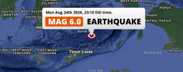
On Monday Evening a Shallow M6.0 Earthquake struck in the Banda Sea 336km from Ambon (Indonesia).
Aug 24, 2026 11:10PM
On Monday Evening a Shallow M6.0 Earthquake struck in the Banda Sea 336km from Ambon (Indonesia).
 Aug 24, 2026 07:02PM
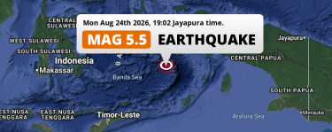
On Monday Evening a Shallow M5.5 Earthquake struck in the Banda Sea 225km from Ambon (Indonesia).
Aug 24, 2026 07:02PM
On Monday Evening a Shallow M5.5 Earthquake struck in the Banda Sea 225km from Ambon (Indonesia).
 Aug 24, 2026 05:20AM
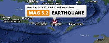
On Monday Night a Shallow M5.2 Earthquake struck in the Flores Sea near Ruteng (Indonesia).
Aug 24, 2026 05:20AM
On Monday Night a Shallow M5.2 Earthquake struck in the Flores Sea near Ruteng (Indonesia).
 Aug 22, 2026 09:30AM
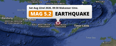
On Saturday Morning a Shallow M5.2 AFTERSHOCK struck near Labuan Bajo in Indonesia.
Aug 22, 2026 09:30AM
On Saturday Morning a Shallow M5.2 AFTERSHOCK struck near Labuan Bajo in Indonesia.
 Aug 22, 2026 12:41AM
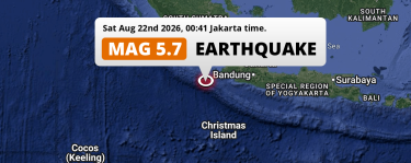
Shallow M5.7 Earthquake struck on Saturday Night in the Indian Ocean 278km from Tangerang (Indonesia).
Aug 22, 2026 12:41AM
Shallow M5.7 Earthquake struck on Saturday Night in the Indian Ocean 278km from Tangerang (Indonesia).
 Aug 21, 2026 02:12AM
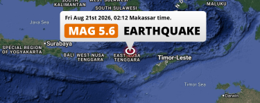
On Friday Night a Shallow M5.6 AFTERSHOCK struck in the Flores Sea near Ende (Indonesia).
Aug 21, 2026 02:12AM
On Friday Night a Shallow M5.6 AFTERSHOCK struck in the Flores Sea near Ende (Indonesia).
Indonesia Earthquake Statistics
Average
A total of 21457 earthquakes with a magnitude of four or above have struck within 300 km (186 mi) of Indonesia in the past 10 years. This comes down to a yearly average of 2145 earthquakes per year, or 178 per month. On average an earthquake will hit near Indonesia roughly every 4 hours.
A relatively large number of earthquakes occurred near Indonesia in 2019. A total of 2907 earthquakes (mag 4+) were detected within 300 km of Indonesia that year. The strongest had a 7.2 magnitude.

Magnitude Distribution
The table below visualizes the distribution of all earthquakes that occurred within 300km of Indonesia in the past 10 years. No earthquakes with a magnitude of 8 or above have occurred near Indonesia during this time. Usually, higher magnitudes are less common than lower magnitudes. Small earthquakes with a magnitude below 4 on the Richter scale have been omitted from this overview.
| Magnitude | Earthquakes | Percentage |
|---|---|---|
| Mag. 4 | 19697 | 91.8% |
| Mag. 5 | 1649 | 7.69% |
| Mag. 6 | 101 | 0.47% |
| Mag. 7 | 10 | 0.05% |
| Mag. 8 | 0 | 0.0% |
| Mag. 9 | 0 | 0.0% |
| Mag. 10 | 0 | 0.0% |
Strongest earthquakes near Indonesia
The strongest recent earthquake of the past 10 years near Indonesia occurred on Aug 15, 2026 05:58 local time (Asia/Makassar timezone). It had a magnitude of 7.7 and struck 68 kilometers (42 mi) north-west of Ende, at a depth of 10 km. Discover more strong earthquakes near Indonesia in the list below.
A longer time ago, a MAG-9.3 earthquake struck on Dec 26, 2004 07:58, 85 kilometers (53 mi) north-west of Meulaboh. It is the strongest earthquake near Indonesia in the past 126 years (Our data goes back to January 1st, 1900).
In the table below you will find the strongest earthquakes that occurred near Indonesia in the past 10 years. You can use the tabs to find the heaviest historic earthquakes since the year 1900 or within a specific year or distance from Indonesia.
Earthquakes by region of Indonesia
Click the links below for earthquake reports for regions in Indonesia.
- Aceh
- Bali (Provinsi Bali)
- Banten (Provinsi Banten)
- Bengkulu
- Central Java (Jawa Tengah)
- Central Kalimantan (Provinsi Kalimantan Tengah)
- Central Sulawesi (Sulawesi Tengah)
- East Java (Jawa Timur)
- East Kalimantan (Kalimantan Timur)
- East Nusa Tenggara (Daerah Tingkat I Nusa Tenggara Timur)
- Gorontalo (Propinsi Gorontalo)
- Jakarta
- Jambi (Provinsi Jambi)
- Kepulauan Bangka Belitung
- Lampung (Provinsi Lampung)
- Maluku (Provinsi Maluku)
- North Kalimantan
- North Maluku (Provinsi Maluku Utara)
- North Sulawesi (Sulawesi Utara)
- North Sumatra (Daerah Tingkat I Sumatera Utara)
- Papua
- Provinsi Sulawesi Barat
- Riau
- Riau Islands (Kepulauan Riau)
- South Kalimantan (Kalimantan Selatan)
- South Sulawesi (Sulawesi Selatan)
- South Sumatra (Sumatera Selatan)
- Southeast Sulawesi (Provinsi Sulawesi Tenggara)
- West Java (Jawa Barat)
- West Kalimantan (Kalimantan Barat)
- West Nusa Tenggara (Propinsi Nusa Tenggara Barat)
- West Papua (Provinsi Papua Barat)
- West Sumatra (Sumatera Barat)
- Yogyakarta
Frequently Asked Questions
These questions are commonly asked in relation to earthquakes occurring near Indonesia.
When was the last earthquake in Indonesia?
A 3.4 magnitude earthquake hit near Indonesia on the evening of August 26, 2026 at 20:42 local time (Asia/Makassar). The center of this earthquake was located 85km east of Labuan Bajo at a depth of 10km under land. Check the list on our website for any earthquakes occurring near Indonesia in the past hours.
What was the strongest earthquake near Indonesia?
A 9.3 magnitude earthquake hit near Indonesia on the morning of December 26, 2004 at 07:58 local time (Asia/Jakarta). The center of this earthquake was located 85km south-southwest of Meulaboh at a depth of 10km under water in the Indian Ocean. This is the strongest earthquake that occurred near Indonesia since the year 1900.
How often do earthquakes occur near Indonesia?
In the past 10 years, 21457 earthquakes with a magnitude of four or higher occurred within a 300 kilometer range from Indonesia. This averages to 2146 earthquakes yearly, or one earthquake every 4 hours.
