A significant MAG-5.1 earthquake struck under land 274 kilometer from Jayapura in Indonesia in the late afternoon of Saturday July 4th, 2026.
Felt the earthquake? Share this article: 


Earthquake Summary
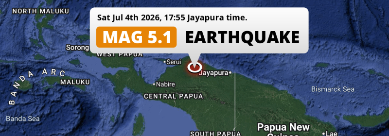
The earthquake struck on land in Indonesia, 274 kilometer (170 mi) west of Jayapura in Papua. The center of this earthquake had a quite shallow depth of 39 km. Shallow earthquakes usually have a larger impact than earthquakes deep in the earth.
| Date and Time: | Jul 4, 2026 17:55 (Jayapura Time) - Jul 4, 2026 08:55 Universal Time. |
|---|---|
| Location: | 274 km west of Jayapura, Papua, Indonesia. Coordinates 2°30'47"S 138°15'10"E. |
| Map: | 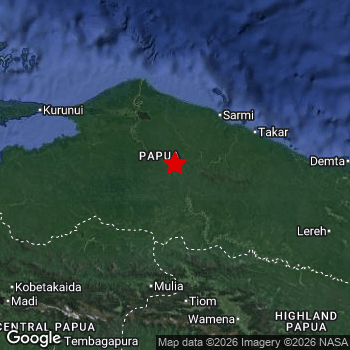 Map of area around epicenter. Click to open in Google Maps. |
| Magnitude: | MAG 5.1 Detected by 69 stations. Maximum Error Range ±0.068 . |
| Depth: | 39 km (24 mi) A quite shallow depth. |
| Tsunami Risk: | Tsunami very unlikely While this was a shallow earthquake, it appears to have occurred under land with a magnitude not strong enough to cause tsunami's. Always stay cautious - More info here. |
Nearby towns and cities
This earthquake may have been felt in Indonesia . Abepura in Papua, Indonesia is the nearest significant place from the epicenter. The earthquake occurred 264 kilometer (164 mi) west of Abepura.
Overview of nearby places
| Distance | Place |
|---|---|
| 264 km (164 mi) E from epicenter |
Abepura Papua, Indonesia. |
| 274 km (170 mi) E from epicenter |
Jayapura Papua, Indonesia. |
9 Aftershocks detected
This main shock was followed by 9 smaller aftershocks. At a distance of 81 km (50 mi) east of this earthquake, an aftershock struck 1 day later. It measured a magnitude of 4.6
Overview of foreshocks and aftershocks
| Classification | Magnitude | When | Where |
|---|---|---|---|
| Main Shock This Earthquake |
M 5.1 |
Jul 4, 2026 17:55 (Jayapura Time) | - |
| Aftershock | M 3.3 |
1 day later Jul 6, 2026 04:06 (Jayapura Time) | 85 km (53 mi) E from Main Shock. |
| Aftershock | M 4.6 |
1 day later Jul 6, 2026 04:10 (Jayapura Time) | 81 km (50 mi) E from Main Shock. |
| Aftershock | M 2.9 |
1 day later Jul 6, 2026 05:06 (Jayapura Time) | 46 km (29 mi) E from Main Shock. |
| Aftershock | M 3.3 |
1 day later Jul 6, 2026 05:15 (Jayapura Time) | 79 km (49 mi) NE from Main Shock. |
| Aftershock | M 4.2 |
1 day later Jul 6, 2026 05:26 (Jayapura Time) | 69 km (43 mi) E from Main Shock. |
| Aftershock | M 3.9 |
1 day later Jul 6, 2026 05:34 (Jayapura Time) | 79 km (49 mi) E from Main Shock. |
| Aftershock | M 2.9 |
2 days later Jul 6, 2026 06:26 (Jayapura Time) | 79 km (49 mi) E from Main Shock. |
| Aftershock | M 3.2 |
2 days later Jul 6, 2026 12:18 (Jayapura Time) | 88 km (54 mi) NE from Main Shock. |
| Aftershock | M 3.8 |
2 days later Jul 6, 2026 16:42 (Jayapura Time) | 16 km (10 mi) NE from Main Shock. |
More earthquakes coming?
The risk of aftershocks decreases rapidly over time. Usually, aftershocks are at least one order of magnitude lower than a main shock.
In only six percent of cases, significant earthquakes are followed by a larger main shock, making the current earthquake a foreshock. While the chance of this happening is not so large, it is adviced to maintain cautiousness in the hours and days following a major earthquake.
Read: How to Stay Safe during an Earthquake (cdc.gov).Earthquakes like this happen often in the region
Earthquakes of this strength are very common in the region. This is the strongest earthquake to hit since June 1st, 2026, when a 5.4 magnitude earthquake hit 83 km (51 mi) further north-east. An even stronger magnitude 6.4 earthquake struck on October 16th, 2025.
In total, 78 earthquakes with a magnitude of 5.1 or higher have been registered within 300km (186 mi) of this epicenter in the past 10 years. This comes down to an average of once every 2 months.
Tsunami very unlikely
While MAG-6.5+ earthquakes may cause tsunami's, it appears that the epicenter of this earthquake hit under land. In addition, the reported depth is deeper than 100km, making the risk of a tsunami even less likely. However always stay cautious and monitor advice from local authorities.
Tsunami Risk Factors
| Factor | Under Sea? | MAG-6.5 or stronger? | Shallow depth? |
|---|---|---|---|
| Explanation | Almost all tsunami's are caused by earthquakes with their epicenter under sea or very near the sea. However stay cautious in coastal areas as earthquakes on land may cause landslides into sea, potentially still causing a local tsunami. | Under MAG 6.5: Very unlikely to cause a tsunami. MAG 6.5 to 7.5: Destructive tsunami's do occur, but are uncommon. Likely to observe small sea level changes. MAG 7.6+: Earthquakes with these magnitudes might produce destructive tsunami's. |
Most destructive tsunami's are caused by shallow earthquakes with a depth between 0 and 100km under the surface of the earth. Deeper tsunami's are unlikely to displace to ocean floor. |
| This Earthquake | Not this earthquake. This earthquake appears to have struck on land far from any coast. |
Not this earthquake. This earthquake had a magnitude of 5.1. Earthquakes of this strength are unlikely to trigger a tsunami. |
This earthquake occurred at a depth of of 39 km (24 mi). Earthquakes this shallow could trigger a tsunami. |
Sources
Last updated 27/07/26 11:48 (). As more information on this earthquake becomes available this article will be updated. This article is automatically composed based on data originating from multiple sources.
- US Geographic Society (USGS): Earthquake us6000ta32
- European-Mediterranean Seismological Centre (EMSC): Earthquake 20260704_0000128
- Geonames.org: World Cities Database
- Google Maps: Static API
- Earthquakelist.org: Historic Earthquakes Database
Share this article:
