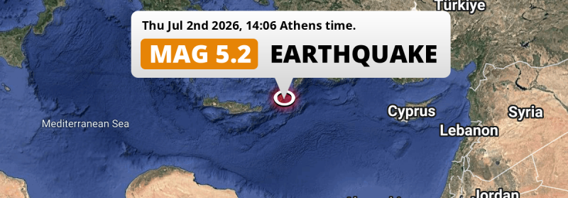
In the afternoon of Thursday July 2nd, 2026, a shallow and significant Magnitude 5.2 earthquake hit in the Mediterranean Sea, Eastern Basin 195 kilometer from Irákleion, Greece. Türkiye is also near its epicenter.
Felt the earthquake? Share this article: 


Earthquake Summary
This earthquake hit under water in the Mediterranean Sea, Eastern Basin, 20 kilometers (12 mi) off the coast of Greece, 195 kilometer east of Irákleion in Crete. The center of this earthquake had a very shallow depth of 10 km. Shallow earthquakes usually have a larger impact than earthquakes deep in the earth.
| Date and Time: | Jul 2, 2026 14:06 (Athens Time) - Jul 2, 2026 11:06 Universal Time. |
|---|---|
| Location: | 195 km east of Irákleion, Crete, Greece. Coordinates 35°18'12"N 27°17'43"E. |
| Map: |  Map of area around epicenter. Click to open in Google Maps. |
| Magnitude: | MAG 5.2 Detected by 117 stations. Maximum Error Range ±0.053 . |
| Depth: | 10 km (6 mi) A very shallow depth. |
| Tsunami Risk: | Low tsunami risk Earthquakes under MAG-6.5 do not usually cause tsunami's. Always stay cautious - More info here. |
Nearby towns and cities
Greece and Türkiye are both located within 300km distance of the epicenter of the earthquake.
Located 151 kilometer (94 mi) southwest of the epicenter of this earthquake, Ródos (South Aegean, Greece) is the nearest significant population center.
A complete list of nearby places is included below.
Overview of nearby places
| Distance | Place |
|---|---|
| 151 km (94 mi) NE from epicenter |
Ródos South Aegean, Greece. |
| 177 km (110 mi) N from epicenter |
Kos South Aegean, Greece. |
| 191 km (119 mi) N from epicenter |
Turgutreis Muğla, Türkiye. |
| 193 km (120 mi) N from epicenter |
Bodrum Muğla, Türkiye. |
| 194 km (121 mi) NE from epicenter |
Marmaris Muğla, Türkiye. |
| 195 km (121 mi) W from epicenter |
Irákleion Crete, Greece. |
| 202 km (126 mi) NE from epicenter |
Sarigerme Muğla, Türkiye. |
| 212 km (132 mi) NE from epicenter |
Dalaman Muğla, Türkiye. |
| 216 km (134 mi) NE from epicenter |
Ortaca Muğla, Türkiye. |
| 222 km (138 mi) NE from epicenter |
Fethiye Muğla, Türkiye. |
| 228 km (142 mi) N from epicenter |
Milas Muğla, Türkiye. |
| 231 km (144 mi) N from epicenter |
Didim Aydın, Türkiye. |
| 234 km (145 mi) NE from epicenter |
Muğla Muğla, Türkiye. |
| 239 km (149 mi) N from epicenter |
Yatağan Muğla, Türkiye. |
| 255 km (158 mi) W from epicenter |
Rethymno Crete, Greece. |
| 266 km (165 mi) N from epicenter |
Çine Aydın, Türkiye. |
| 272 km (169 mi) N from epicenter |
Söke Aydın, Türkiye. |
| 284 km (176 mi) N from epicenter |
Kuşadası Aydın, Türkiye. |
| 285 km (177 mi) NE from epicenter |
Elmalı Antalya, Türkiye. |
| 286 km (178 mi) N from epicenter |
İncirliova Aydın, Türkiye. |
| 287 km (178 mi) N from epicenter |
Aydın Aydın, Türkiye. |
| 294 km (183 mi) NE from epicenter |
Beykonak Antalya, Türkiye. |
| 295 km (183 mi) N from epicenter |
Selçuk İzmir, Türkiye. |
| 297 km (185 mi) W from epicenter |
Chaniá Crete, Greece. |
Shaking reported by 11 people
People that feel an earthquake may report their experience to the US Geographic Survey. Currently, 11 people have reported shaking in 8 places, all within Greece.We keep updating this article as more ground reports become available. You may report that you felt this earthquake here.
Places with most reports:
- Kárpathos, Dodekánisos, Greece: 3 people.
- Ialisós, Dodekánisos, Greece: 2 people.
- Falirákion, Dodekánisos, Greece: 1 person.
- Kíssamos, Haniá, Greece: 1 person.
- Lárdos, Dodekánisos, Greece: 1 person.
- Soroní, Dodekánisos, Greece: 1 person.
- Afántou, Dodekánisos, Greece: 1 person.
- Réthimnon, Rethímni, Greece: 1 person.
9 Aftershocks detected
This main shock was followed by 9 smaller aftershocks. A 3.9 magnitude earthquake hit 3 days later 9 km (6 mi) northwest of this earthquake.
In the days before this main shock, 1 smaller foreshock was detected. Nearby this earthquake a foreshock struck 3 days earlier. It measured a magnitude of 3.6
Overview of foreshocks and aftershocks
| Classification | Magnitude | When | Where |
|---|---|---|---|
| Foreshock | M 3.6 |
3 days earlier Jun 29, 2026 22:27 (Athens Time) | 23 km (14 mi) W from Main Shock. |
| Main Shock This Earthquake |
M 5.2 |
Jul 2, 2026 14:06 (Athens Time) | - |
| Aftershock | M 3.2 |
36 mins later Jul 2, 2026 14:42 (Athens Time) | 22 km (14 mi) W from Main Shock. |
| Aftershock | M 3.1 |
1 hr later Jul 2, 2026 15:13 (Athens Time) | 12 km (7 mi) W from Main Shock. |
| Aftershock | M 2.5 |
21 hrs later Jul 3, 2026 11:16 (Athens Time) | 7 km (4 mi) W from Main Shock. |
| Aftershock | M 2.5 |
1 day later Jul 3, 2026 14:47 (Athens Time) | 19 km (12 mi) NW from Main Shock. |
| Aftershock | M 2.7 |
1 day later Jul 4, 2026 00:15 (Athens Time) | 18 km (11 mi) NW from Main Shock. |
| Aftershock | M 3.5 |
3 days later Jul 5, 2026 04:23 (Athens Time) | 17 km (11 mi) N from Main Shock. |
| Aftershock | M 3.4 |
3 days later Jul 5, 2026 10:13 (Athens Time) | 24 km (15 mi) NW from Main Shock. |
| Aftershock | M 3.1 |
3 days later Jul 5, 2026 11:07 (Athens Time) | 11 km (7 mi) NW from Main Shock. |
| Aftershock | M 3.9 |
3 days later Jul 5, 2026 11:10 (Athens Time) | 9 km (6 mi) NW from Main Shock. |
More earthquakes coming?
Earthquakes can create aftershocks. These are generally at least 1 magnitude lower than any main shock, and as time passes the chance and strength of aftershocks decreases.
The chance that a significant earthquake like this one is followed by an even larger earthquake is not so large. On average, scientists estimate a 94% chance that a major earthquake will not be followed by an even larger one. It is still adviced to be aware of this risk
Read: How to Stay Safe during an Earthquake (cdc.gov).Earthquakes like this happen often in the region
Earthquakes of this strength are very common in the region. This is the strongest earthquake to hit since April 24th, 2026, when a 5.7 magnitude earthquake hit 134 km (83 mi) further west. An even stronger magnitude 7 earthquake struck on October 30th, 2020.
In total, 38 earthquakes with a magnitude of 5.2 or higher have been registered within 300km (186 mi) of this epicenter in the past 10 years. This comes down to an average of once every 3 months.
Low tsunami risk
Based on early data it appears this earthquake was not strong enough (lower than MAG-6.5) to be likely to cause destructive tsunami's. However this earthquake appeared to have hit at a shallow depth under sea, so stay cautious and monitor advice from local authorities.
Tsunami Risk Factors
| Factor | Under Sea? | MAG-6.5 or stronger? | Shallow depth? |
|---|---|---|---|
| Explanation | Almost all tsunami's are caused by earthquakes with their epicenter under sea or very near the sea. However stay cautious in coastal areas as earthquakes on land may cause landslides into sea, potentially still causing a local tsunami. | Under MAG 6.5: Very unlikely to cause a tsunami. MAG 6.5 to 7.5: Destructive tsunami's do occur, but are uncommon. Likely to observe small sea level changes. MAG 7.6+: Earthquakes with these magnitudes might produce destructive tsunami's. |
Most destructive tsunami's are caused by shallow earthquakes with a depth between 0 and 100km under the surface of the earth. Deeper tsunami's are unlikely to displace to ocean floor. |
| This Earthquake | This earthquake appears to have struck under the sea. | Not this earthquake. This earthquake had a magnitude of 5.2. Earthquakes of this strength are unlikely to trigger a tsunami. |
This earthquake occurred at a depth of of 10 km (6 mi). Earthquakes this shallow could trigger a tsunami. |
Sources
Last updated 27/07/26 03:08 (). This article is automatically generated based on available data. We keep checking multiple sources for additional information. This article gets updated as new details on this earthquake become available.
- US Geographic Society (USGS): Earthquake us6000t9lz
- European-Mediterranean Seismological Centre (EMSC): Earthquake 20260702_0000170
- Geonames.org: World Cities Database
- Google Maps: Static API
- Earthquakelist.org: Historic Earthquakes Database
Share this article:
