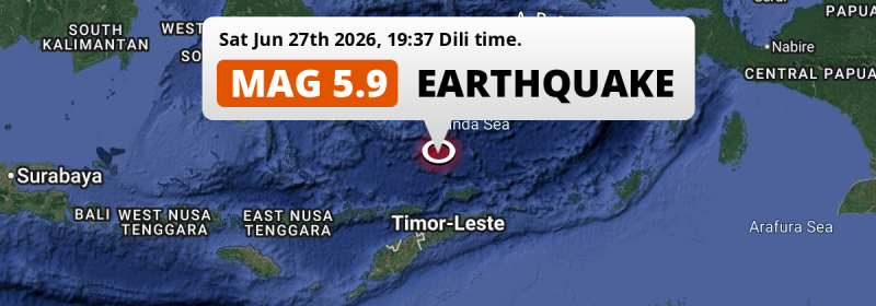
In the Banda Sea 270 kilometer from Atambua, Indonesia, a significant M5.9 earthquake occurred in the evening of Saturday June 27th, 2026. Shaking may have been felt by a total of 430 thousand people. Another country near the epicenter is Timor-Leste.
Felt the earthquake? Share this article: 


Earthquake Summary
This earthquake hit under water in the Banda Sea, 104 kilometers (65 mi) off the coast of Indonesia, 270 kilometer north of Atambua in East Nusa Tenggara. The center of this earthquake had a deep depth of 514 km.
| Date and Time: | Jun 27, 2026 19:37 (Dili Time) - Jun 27, 2026 10:37 Universal Time. |
|---|---|
| Location: | 197 km north of Dili, Díli, Timor-Leste. Coordinates 6°47'15"S 125°37'57"E. |
| Map: | 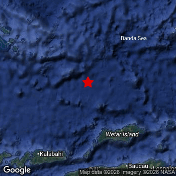 Map of area around epicenter. Click to open in Google Maps. |
| Magnitude: | MAG 5.9 Detected by 30 stations. Maximum Error Range ±0.057 . |
| Depth: | 514 km (319 mi) A deep depth. |
| Max. Intensity: | III
Weak On the Modified Mercalli Scale. |
| Tsunami Risk: | Tsunami very unlikely Earthquakes under MAG-6.5 at depths deeper than 100km are very unlikely to cause tsunami's. Always stay cautious - More info here. |
Minimal impact predicted
Based on scientific estimates by the US Geographic Survey (USGS), the risk of high fatalities for this earthquake is classified at level GREEN (low). They expect an 90% likelyhood of between 0 and 1 fatalities.
The USGS classifies the economic impact of this earthquake at level GREEN (low). They expect an 90% likelyhood of between 0 and 1 million US Dollars in economic damage and impact.
Roughly 430 thousand people exposed to shaking
This earthquake may have been felt by around 430 thousand people. That is the expected population size of the area exposed to a level of shaking of II or higher on the Modified Mercalli scale according to the USGS.
The highest earthquake impact level for this earthquake is II, which corresponds with very weak shaking and no damage. Roughly 431,200 people are expected to be exposed to this level.
People in 2 countries have been exposed to shaking. In Timor-Leste , around 320 thousand people, with impact levels up to II (very weak shaking, no damage). In Indonesia , around 110 thousand people.
| People | MMI Level | Shaking | Damage |
|---|---|---|---|
| 402,600 | I |
Not noticable | None |
| 431,200 | II |
Very weak | None |
| 0 | III |
Weak | Probably none |
| 0 | IV |
Light | Likely none |
| 0 | V |
Moderate | Very light |
| 0 | VI |
Strong | Light |
| 0 | VII |
Very Strong | Moderate |
| 0 | VIII |
Severe | Moderate to heavy |
| 0 | IX |
Violent | Heavy |
| 0 | X |
Extreme | Very heavy |
Nearby towns and cities
This earthquake struck within proximity of multiple countries. Timor-Leste and Indonesia are both within 300km distance of its epicenter.
The closest significant population center near the earthquake is Dili in Díli, Timor-Leste. Dili is located 197 kilometer (122 mi) north of the epicenter. The intensity of shaking and damage in Dili is estimated to be around level I on the Modified Mercalli Intensity scale (not noticeable, no damage).
The table below provides an overview of all places in proximity of today's earthquake. Where available, the estimated intensity on the Modified Mercalli Intensity Scale in each place is included. Places where this information is omitted likely experienced little impact.
Overview of nearby places
| Distance | Place | Intensity (MMI) |
|---|---|---|
| 197 km (122 mi) S from epicenter |
Dili Díli, Timor-Leste. |
I
Not felt |
| 203 km (126 mi) S from epicenter |
Likisá Liquiçá, Timor-Leste. |
|
| 208 km (129 mi) S from epicenter |
Maubara Liquiçá, Timor-Leste. |
|
| 209 km (130 mi) SE from epicenter |
Baukau Baucau, Timor-Leste. |
II
Weak |
| 216 km (134 mi) S from epicenter |
Aileu Aileu, Timor-Leste. |
|
| 222 km (138 mi) S from epicenter |
Venilale Baucau, Timor-Leste. |
|
| 245 km (152 mi) SE from epicenter |
Lospalos Lautém, Timor-Leste. |
II
Weak |
| 249 km (155 mi) S from epicenter |
Maliana Bobonaro, Timor-Leste. |
|
| 270 km (168 mi) S from epicenter |
Atambua East Nusa Tenggara, Indonesia. |
|
| 284 km (176 mi) S from epicenter |
Suai Cova Lima, Timor-Leste. |
|
| 322 km (200 mi) SW from epicenter |
Kefamenanu East Nusa Tenggara, Indonesia. |
|
| 373 km (232 mi) SW from epicenter |
Soe East Nusa Tenggara, Indonesia. |
|
| 388 km (241 mi) NW from epicenter |
Katobu Southeast Sulawesi, Indonesia. |
Earthquake Intensity Map
The intensity in shaking and damage by this earthquake is illustrated through the map below. The highest intensity measured for this earthquake is II.

Aftershocks detected
After this earthquake struck, 1 smaller aftershock occurred. A 4.2 magnitude earthquake hit 4 hrs later 28 km (17 mi) south of this earthquake.
In the days before this main shock, 1 smaller foreshock was detected. Roughly 17 hrs before this earthquake, a foreshock measuring MAG-3.3 was detected nearby this earthquake.
Overview of foreshocks and aftershocks
| Classification | Magnitude | When | Where |
|---|---|---|---|
| Foreshock | M 3.3 |
17 hrs earlier Jun 27, 2026 03:00 (Dili Time) | 25 km (16 mi) S from Main Shock. |
| Main Shock This Earthquake |
M 5.9 |
Jun 27, 2026 19:37 (Dili Time) | - |
| Aftershock | M 4.2 |
4 hrs later Jun 27, 2026 23:11 (Dili Time) | 28 km (17 mi) S from Main Shock. |
More earthquakes coming?
Earthquakes can create aftershocks. These are generally at least 1 magnitude lower than any main shock, and as time passes the chance and strength of aftershocks decreases.
It's always adviced to be cautious of the risk of a larger shock following any significant earthquake, however this risk is fairly small. There is a roughly 94 percent change that no larger main shock will follow in the days following this earthquake.
Read: How to Stay Safe during an Earthquake (cdc.gov).Earthquakes like this are common in the region
Earthquakes of this strength occur quite regularly in the region. This is the strongest earthquake to hit since October 26th, 2025, when a 6.2 magnitude earthquake hit 292 km (182 mi) further southwest. An even stronger magnitude 7.3 earthquake struck on December 29th, 2021.
In total, 12 earthquakes with a magnitude of 5.9 or higher have been registered within 300km (186 mi) of this epicenter in the past 10 years. This comes down to an average of once every 10 months.
Tsunami very unlikely
For a serious tsunami to occur, earthquakes usually need to have a magnitude of at least 6.5 and occur at a shallow depth of maximum 100km. Neither are the case with this earthquake. However always stay cautious and monitor advice from local authorities.
Tsunami Risk Factors
| Factor | Under Sea? | MAG-6.5 or stronger? | Shallow depth? |
|---|---|---|---|
| Explanation | Almost all tsunami's are caused by earthquakes with their epicenter under sea or very near the sea. However stay cautious in coastal areas as earthquakes on land may cause landslides into sea, potentially still causing a local tsunami. | Under MAG 6.5: Very unlikely to cause a tsunami. MAG 6.5 to 7.5: Destructive tsunami's do occur, but are uncommon. Likely to observe small sea level changes. MAG 7.6+: Earthquakes with these magnitudes might produce destructive tsunami's. |
Most destructive tsunami's are caused by shallow earthquakes with a depth between 0 and 100km under the surface of the earth. Deeper tsunami's are unlikely to displace to ocean floor. |
| This Earthquake | This earthquake appears to have struck under the sea. | Not this earthquake. This earthquake had a magnitude of 5.9. Earthquakes of this strength are unlikely to trigger a tsunami. |
Not this earthquake. This earthquake occurred at a depth of 514 km (319 mi). Earthquakes this deep in the earth are unlikely to trigger a tsunami. |
Sources
Last updated 26/07/26 14:08 (). This article is automatically generated based on available data. We keep checking multiple sources for additional information. This article gets updated as new details on this earthquake become available.
- US Geographic Society (USGS): Earthquake us6000t8nf
- European-Mediterranean Seismological Centre (EMSC): Earthquake 20260627_0000148
- Geonames.org: World Cities Database
- Google Maps: Static API
- Earthquakelist.org: Historic Earthquakes Database
Share this article:
