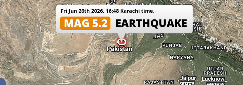
A shallow and significant Magnitude 5.2 foreshock struck under land 178 kilometer from Multan in Pakistan in the late afternoon of Friday June 26th, 2026.
Felt the earthquake? Share this article: 


Earthquake Summary
The earthquake struck on land in Pakistan, 178 kilometer (111 mi) west of Multan in Punjab. The center of this earthquake had a very shallow depth of 10 km. Shallow earthquakes usually have a larger impact than earthquakes deep in the earth.
| Date and Time: | Jun 26, 2026 16:48 (Karachi Time) - Jun 26, 2026 11:48 Universal Time. |
|---|---|
| Location: | 178 km west of Multan, Punjab, Pakistan. Coordinates 30°21'58"N 69°38'1"E. |
| Map: | 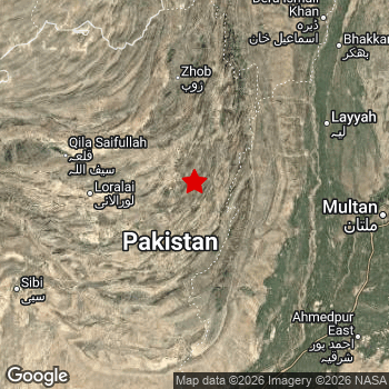 Map of area around epicenter. Click to open in Google Maps. |
| Magnitude: | MAG 5.2 Detected by 99 stations. Maximum Error Range ±0.058 . |
| Depth: | 10 km (6 mi) A very shallow depth. |
| Tsunami Risk: | Tsunami very unlikely While this was a shallow earthquake, it appears to have occurred under land with a magnitude not strong enough to cause tsunami's. Always stay cautious - More info here. |
Nearby towns and cities
This earthquake may have been felt in Pakistan . Located 99 kilometer (62 mi) east of the epicenter of this earthquake, Loralai (Balochistan, Pakistan) is the nearest significant population center.
Multiple major population centers exist within 300km of the earthquake that struck today. Multan is located 178 km to the east. Rahim Yar Khan is located 226 km to the south. Quetta is located 254 km to the west.
An overview of nearby towns and cities is available in the overview below.
Overview of nearby places
| Distance | Place |
|---|---|
| 99 km (62 mi) W from epicenter |
Loralai Balochistan, Pakistan. |
| 103 km (64 mi) E from epicenter |
Dera Ghazi Khan Punjab, Pakistan. |
| 104 km (65 mi) E from epicenter |
Taunsa Punjab, Pakistan. |
| 110 km (68 mi) N from epicenter |
Zhob Balochistan, Pakistan. |
| 115 km (71 mi) SE from epicenter |
Dajal Punjab, Pakistan. |
| 123 km (76 mi) SE from epicenter |
Jampur Punjab, Pakistan. |
| 128 km (80 mi) E from epicenter |
Kot Addu Punjab, Pakistan. |
| 141 km (88 mi) NE from epicenter |
Layyah Punjab, Pakistan. |
| 150 km (93 mi) SE from epicenter |
Jatoi Shimali Punjab, Pakistan. |
| 153 km (95 mi) E from epicenter |
Muzaffargarh Punjab, Pakistan. |
| 155 km (96 mi) E from epicenter |
Khangarh Punjab, Pakistan. |
| 155 km (96 mi) S from epicenter |
Dera Bugti Balochistan, Pakistan. |
| 156 km (97 mi) SE from epicenter |
Rajanpur Punjab, Pakistan. |
| 158 km (98 mi) NE from epicenter |
Karor Punjab, Pakistan. |
| 160 km (99 mi) SE from epicenter |
Shahr Sultan Punjab, Pakistan. |
| 165 km (103 mi) SE from epicenter |
Alipur Punjab, Pakistan. |
| 169 km (105 mi) E from epicenter |
Shujaabad Punjab, Pakistan. |
| 175 km (109 mi) NE from epicenter |
Chak Two Hundred Forty-nine Thal Development Authority Punjab, Pakistan. |
| 178 km (111 mi) E from epicenter |
Multan Punjab, Pakistan. |
| 181 km (112 mi) SE from epicenter |
Jalalpur Pirwala Punjab, Pakistan. |
| 191 km (119 mi) NE from epicenter |
Kulachi Khyber Pakhtunkhwa, Pakistan. |
| 192 km (119 mi) SW from epicenter |
Sibi Balochistan, Pakistan. |
| 193 km (120 mi) SE from epicenter |
Zahir Pir Punjab, Pakistan. |
| 196 km (122 mi) NE from epicenter |
Bhakkar Punjab, Pakistan. |
| 196 km (122 mi) E from epicenter |
Qadirpur Ran Punjab, Pakistan. |
| 203 km (126 mi) NE from epicenter |
Dera Ismail Khan Khyber Pakhtunkhwa, Pakistan. |
| 208 km (129 mi) SE from epicenter |
Ahmadpur East Punjab, Pakistan. |
| 209 km (130 mi) NE from epicenter |
Shorkot Khyber Pakhtunkhwa, Pakistan. |
| 214 km (133 mi) E from epicenter |
Kabirwala Punjab, Pakistan. |
| 214 km (133 mi) SE from epicenter |
Lodhran Punjab, Pakistan. |
| 215 km (134 mi) SE from epicenter |
Khanpur Punjab, Pakistan. |
| 224 km (139 mi) SE from epicenter |
Bahawalpur Punjab, Pakistan. |
| 226 km (140 mi) S from epicenter |
Rahim Yar Khan Punjab, Pakistan. |
| 234 km (145 mi) S from epicenter |
Saddiqabad Punjab, Pakistan. |
| 235 km (146 mi) E from epicenter |
Kahror Pakka Punjab, Pakistan. |
| 240 km (149 mi) S from epicenter |
Kandhkot Sindh, Pakistan. |
| 252 km (157 mi) E from epicenter |
Mailsi Punjab, Pakistan. |
| 254 km (158 mi) W from epicenter |
Quetta Balochistan, Pakistan. |
| 255 km (158 mi) W from epicenter |
Kot Malik Barkhurdar Balochistan, Pakistan. |
| 259 km (161 mi) SW from epicenter |
Jacobabad Sindh, Pakistan. |
| 261 km (162 mi) E from epicenter |
Mian Channun Punjab, Pakistan. |
| 264 km (164 mi) E from epicenter |
Vihari Punjab, Pakistan. |
| 264 km (164 mi) S from epicenter |
Ghotki Sindh, Pakistan. |
| 275 km (171 mi) E from epicenter |
Jhang Sadr Punjab, Pakistan. |
| 281 km (175 mi) E from epicenter |
Toba Tek Singh Punjab, Pakistan. |
| 284 km (176 mi) S from epicenter |
Pano Aqil Sindh, Pakistan. |
| 285 km (177 mi) S from epicenter |
Shikarpur Sindh, Pakistan. |
| 290 km (180 mi) E from epicenter |
Hasilpur Punjab, Pakistan. |
| 291 km (181 mi) E from epicenter |
Kamalia Punjab, Pakistan. |
| 291 km (181 mi) E from epicenter |
Burewala Punjab, Pakistan. |
| 294 km (183 mi) E from epicenter |
Chichawatni Punjab, Pakistan. |
This is likely a foreshock
This earthquake was followed by a stronger MAG-5.3 earthquake, classifying this earthquake as a foreshock.
Overview of foreshocks and aftershocks
| Classification | Magnitude | When | Where |
|---|---|---|---|
| Foreshock | M 4.7 |
21 hrs earlier Jun 26, 2026 10:57 (Karachi Time) | 26 km (16 mi) S from Main Shock. |
| Foreshock This Earthquake |
M 5.2 |
15 hrs earlier Jun 26, 2026 16:48 (Karachi Time) | 19 km (12 mi) SW from Main Shock. |
| Foreshock | M 4.4 |
2 hrs earlier Jun 27, 2026 05:44 (Karachi Time) | 61 km (38 mi) W from Main Shock. |
| Main Shock | M 5.3 |
Jun 27, 2026 08:06 (Karachi Time) | - |
More earthquakes coming?
Earthquakes can create aftershocks. These are generally at least 1 magnitude lower than any main shock, and as time passes the chance and strength of aftershocks decreases.
It's always adviced to be cautious of the risk of a larger shock following any significant earthquake, however this risk is fairly small. There is a roughly 94 percent change that no larger main shock will follow in the days following this earthquake.
Read: How to Stay Safe during an Earthquake (cdc.gov).This is the strongest earthquake in 4 years
Earthquakes of this strength occur quite regularly in the region. This is the strongest earthquake to hit since June 21st, 2022, when a 6 magnitude earthquake hit 296 km (184 mi) further north. That was also the heaviest earthquake to hit the region in the past 10 years.
In total, 3 earthquakes with a magnitude of 5.2 or higher have been registered within 300km (186 mi) of this epicenter in the past 10 years. This comes down to an average of once every 3 years.
Tsunami very unlikely
While MAG-6.5+ earthquakes may cause tsunami's, it appears that the epicenter of this earthquake hit under land. In addition, the reported depth is deeper than 100km, making the risk of a tsunami even less likely. However always stay cautious and monitor advice from local authorities.
Tsunami Risk Factors
| Factor | Under Sea? | MAG-6.5 or stronger? | Shallow depth? |
|---|---|---|---|
| Explanation | Almost all tsunami's are caused by earthquakes with their epicenter under sea or very near the sea. However stay cautious in coastal areas as earthquakes on land may cause landslides into sea, potentially still causing a local tsunami. | Under MAG 6.5: Very unlikely to cause a tsunami. MAG 6.5 to 7.5: Destructive tsunami's do occur, but are uncommon. Likely to observe small sea level changes. MAG 7.6+: Earthquakes with these magnitudes might produce destructive tsunami's. |
Most destructive tsunami's are caused by shallow earthquakes with a depth between 0 and 100km under the surface of the earth. Deeper tsunami's are unlikely to displace to ocean floor. |
| This Earthquake | Not this earthquake. This earthquake appears to have struck on land far from any coast. |
Not this earthquake. This earthquake had a magnitude of 5.2. Earthquakes of this strength are unlikely to trigger a tsunami. |
This earthquake occurred at a depth of of 10 km (6 mi). Earthquakes this shallow could trigger a tsunami. |
Sources
Last updated 20/07/26 14:48 (). This article is automatically generated based on available data. We keep checking multiple sources for additional information. This article gets updated as new details on this earthquake become available.
- US Geographic Society (USGS): Earthquake us6000t8ei
- European-Mediterranean Seismological Centre (EMSC): Earthquake 20260626_0000155
- Geonames.org: World Cities Database
- Google Maps: Static API
- Earthquakelist.org: Historic Earthquakes Database
Share this article:
