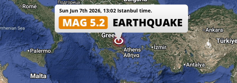
In the early afternoon of Sunday June 7th, 2026, a shallow and significant M5.2 earthquake hit under land 87 kilometer from Athens in Greece. The earthquake struck near a very densely populated region. Türkiye, North Macedonia and Bulgaria are also near its epicenter.
Felt the earthquake? Share this article: 


Earthquake Summary
The earthquake struck on land in Greece, 87 kilometer (54 mi) north of Athens in Attica. The center of this earthquake had a very shallow depth of 11 km. Shallow earthquakes usually have a larger impact than earthquakes deep in the earth.
| Date and Time: | Jun 7, 2026 13:02 (Athens Time) - Jun 7, 2026 10:02 Universal Time. |
|---|---|
| Location: | 87 km north of Athens, Attica, Greece. Coordinates 38°43'40"N 23°25'32"E. |
| Map: | 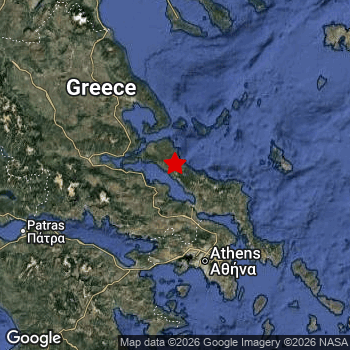 Map of area around epicenter. Click to open in Google Maps. |
| Magnitude: | MAG 5.2 Detected by 30 stations. Maximum Error Range ±0.057 . |
| Depth: | 11 km (7 mi) A very shallow depth. |
| Tsunami Risk: | Tsunami very unlikely While this was a shallow earthquake in a coastal area, it appears to have occurred under land (4 km from the sea) with a magnitude that is usually not strong enough to cause tsunami's. Always stay cautious - More info here. |
Nearby towns and cities
Greece , Türkiye , North Macedonia and Bulgaria are all located within 300km distance of the epicenter of the earthquake.
Located 33 kilometer (21 mi) northwest of the epicenter of this earthquake, Chalkída (Central Greece, Greece) is the nearest significant population center.
Major cities near this earthquake: Athens is located 87 km to the south. Piraeus is located 89 km to the south. Peristéri is located 83 km to the south.
An overview of nearby towns and cities is available in the overview below.
Overview of nearby places
| Distance | Place |
|---|---|
| 33 km (21 mi) SE from epicenter |
Chalkída Central Greece, Greece. |
| 46 km (29 mi) S from epicenter |
Thívai Central Greece, Greece. |
| 58 km (36 mi) SW from epicenter |
Livadeiá Central Greece, Greece. |
| 75 km (47 mi) S from epicenter |
Asprópyrgos Attica, Greece. |
| 76 km (47 mi) S from epicenter |
Áno Liósia Attica, Greece. |
| 77 km (48 mi) S from epicenter |
Acharnés Attica, Greece. |
| 77 km (48 mi) S from epicenter |
Elefsína Attica, Greece. |
| 79 km (49 mi) S from epicenter |
Metamórfosi Attica, Greece. |
| 79 km (49 mi) S from epicenter |
Kamaterón Attica, Greece. |
| 80 km (50 mi) SE from epicenter |
Kifisiá Attica, Greece. |
| 80 km (50 mi) S from epicenter |
Petroúpolis Attica, Greece. |
| 81 km (50 mi) SE from epicenter |
Péfki Attica, Greece. |
| 81 km (50 mi) S from epicenter |
Ílion Attica, Greece. |
| 81 km (50 mi) S from epicenter |
Irákleio Attica, Greece. |
| 82 km (51 mi) S from epicenter |
Chaïdári Attica, Greece. |
| 82 km (51 mi) S from epicenter |
Néa Filadélfeia Attica, Greece. |
| 82 km (51 mi) S from epicenter |
Ágioi Anárgyroi Attica, Greece. |
| 82 km (51 mi) S from epicenter |
Mégara Attica, Greece. |
| 82 km (51 mi) SE from epicenter |
Maroúsi Attica, Greece. |
| 82 km (51 mi) NW from epicenter |
Volos Thessaly, Greece. |
| 82 km (51 mi) S from epicenter |
Néa Ionía Attica, Greece. |
| 83 km (52 mi) S from epicenter |
Peristéri Attica, Greece. |
| 83 km (52 mi) SE from epicenter |
Melíssia Attica, Greece. |
| 84 km (52 mi) S from epicenter |
Galátsi Attica, Greece. |
| 84 km (52 mi) NW from epicenter |
Néa Ionía Thessaly, Greece. |
| 85 km (53 mi) S from epicenter |
Pérama Attica, Greece. |
| 85 km (53 mi) SE from epicenter |
Vrilissia Attica, Greece. |
| 85 km (53 mi) SE from epicenter |
Khalándrion Attica, Greece. |
| 85 km (53 mi) S from epicenter |
Salamína Attica, Greece. |
| 85 km (53 mi) S from epicenter |
Korydallós Attica, Greece. |
| 85 km (53 mi) S from epicenter |
Agía Varvára Attica, Greece. |
| 86 km (53 mi) S from epicenter |
Aigáleo Attica, Greece. |
| 87 km (54 mi) S from epicenter |
Cholargós Attica, Greece. |
| 87 km (54 mi) SE from epicenter |
Gérakas Attica, Greece. |
| 87 km (54 mi) S from epicenter |
Athens Attica, Greece. |
| 87 km (54 mi) SE from epicenter |
Agía Paraskeví Attica, Greece. |
| 87 km (54 mi) S from epicenter |
Keratsíni Attica, Greece. |
| 87 km (54 mi) S from epicenter |
Níkaia Attica, Greece. |
| 88 km (55 mi) W from epicenter |
Lamía Central Greece, Greece. |
| 89 km (55 mi) S from epicenter |
Piraeus Attica, Greece. |
| 89 km (55 mi) S from epicenter |
Zográfos Attica, Greece. |
| 90 km (56 mi) S from epicenter |
Kallithéa Attica, Greece. |
| 90 km (56 mi) S from epicenter |
Výronas Attica, Greece. |
| 90 km (56 mi) S from epicenter |
Kaisarianí Attica, Greece. |
| 91 km (57 mi) S from epicenter |
Néa Smýrni Attica, Greece. |
| 92 km (57 mi) S from epicenter |
Palaió Fáliro Attica, Greece. |
| 92 km (57 mi) S from epicenter |
Agios Dimitrios Attica, Greece. |
| 93 km (58 mi) S from epicenter |
Ilioúpoli Attica, Greece. |
| 95 km (59 mi) S from epicenter |
Álimos Attica, Greece. |
| 96 km (60 mi) S from epicenter |
Argyroúpoli Attica, Greece. |
| 97 km (60 mi) SW from epicenter |
Kórinthos Peloponnese, Greece. |
| 100 km (62 mi) S from epicenter |
Glyfáda Attica, Greece. |
| 157 km (98 mi) W from epicenter |
Pátra West Greece, Greece. |
| 217 km (135 mi) N from epicenter |
Thessaloníki Central Macedonia, Greece. |
| 224 km (139 mi) NW from epicenter |
Kozáni West Macedonia, Greece. |
| 239 km (149 mi) E from epicenter |
Chios North Aegean, Greece. |
| 245 km (152 mi) NW from epicenter |
Ioánnina Epirus, Greece. |
| 260 km (162 mi) N from epicenter |
Kavála East Macedonia and Thrace, Greece. |
| 277 km (172 mi) NE from epicenter |
Ezine Canakkale, Türkiye. |
| 280 km (174 mi) N from epicenter |
Gevgelija Gevgelija, North Macedonia. |
| 290 km (180 mi) E from epicenter |
Ayvalık Balıkesir, Türkiye. |
| 294 km (183 mi) E from epicenter |
Urla İzmir, Türkiye. |
| 298 km (185 mi) N from epicenter |
Petrich Blagoevgrad, Bulgaria. |
Shaking reported by 18 people
People that feel an earthquake may report their experience to the US Geographic Survey. Currently, 18 people have reported shaking in 12 places, all within Greece.We keep updating this article as more ground reports become available. You may report that you felt this earthquake here.
Places with most reports:
- Skíathos, Magnisía, Greece: 4 people.
- Athens, Attikí, Greece: 2 people.
- Glifáda, Attikí, Greece: 2 people.
- Zográfos, Attikí, Greece: 2 people.
- Prokópion, Évvoia, Greece: 1 person.
- Khalkís, Évvoia, Greece: 1 person.
- Neméa, Korinthía, Greece: 1 person.
- Glóssa, Magnisía, Greece: 1 person.
- Gliká Nerá, Attikí, Greece: 1 person.
- Víron, Attikí, Greece: 1 person.
72 Aftershocks detected
After this earthquake struck, 72 smaller aftershocks occurred. A 4.3 magnitude earthquake hit 16 hrs later 1.7 km (1.1 mi) north-east of this earthquake.
Before this earthquake struck, 3 smaller foreshocks occurred. A 4.9 magnitude earthquake hit 4 mins earlier nearby.
Overview of foreshocks and aftershocks
| Classification | Magnitude | When | Where |
|---|---|---|---|
| Foreshock | M 4.9 |
4 mins earlier Jun 7, 2026 12:58 (Athens Time) | 2.9 km (1.8 mi) N from Main Shock. |
| Foreshock | M 4.7 |
2 mins earlier Jun 7, 2026 13:00 (Athens Time) | 9 km (5 mi) S from Main Shock. |
| Foreshock | M 3.5 |
35 sec earlier Jun 7, 2026 13:02 (Athens Time) | 5 km (3 mi) S from Main Shock. |
| Main Shock This Earthquake |
M 5.2 |
Jun 7, 2026 13:02 (Athens Time) | - |
| Aftershock | M 3.4 |
2 mins later Jun 7, 2026 13:04 (Athens Time) | 4 km (2.6 mi) S from Main Shock. |
| Aftershock | M 3.5 |
4 mins later Jun 7, 2026 13:07 (Athens Time) | 2.2 km (1.4 mi) S from Main Shock. |
| Aftershock | M 3.0 |
12 mins later Jun 7, 2026 13:15 (Athens Time) | 4 km (2.6 mi) S from Main Shock. |
| Aftershock | M 2.6 |
14 mins later Jun 7, 2026 13:16 (Athens Time) | 6 km (3 mi) S from Main Shock. |
| Aftershock | M 3.1 |
15 mins later Jun 7, 2026 13:17 (Athens Time) | 3 km (1.9 mi) S from Main Shock. |
| Aftershock | M 3.3 |
17 mins later Jun 7, 2026 13:19 (Athens Time) | 3 km (1.9 mi) S from Main Shock. |
| Aftershock | M 3.0 |
24 mins later Jun 7, 2026 13:27 (Athens Time) | 2.3 km (1.4 mi) SE from Main Shock. |
| Aftershock | M 2.6 |
27 mins later Jun 7, 2026 13:29 (Athens Time) | 1 km (0.6 mi) SW from Main Shock. |
| Aftershock | M 2.8 |
35 mins later Jun 7, 2026 13:38 (Athens Time) | 5 km (2.8 mi) S from Main Shock. |
| Aftershock | M 2.8 |
42 mins later Jun 7, 2026 13:44 (Athens Time) | 2.1 km (1.3 mi) S from Main Shock. |
| Aftershock | M 2.8 |
46 mins later Jun 7, 2026 13:48 (Athens Time) | 4 km (2.5 mi) SW from Main Shock. |
| Aftershock | M 2.5 |
51 mins later Jun 7, 2026 13:53 (Athens Time) | 7 km (4 mi) SE from Main Shock. |
| Aftershock | M 3.0 |
1 hr later Jun 7, 2026 14:06 (Athens Time) | 3 km (2.1 mi) SE from Main Shock. |
| Aftershock | M 2.5 |
1 hr later Jun 7, 2026 14:21 (Athens Time) | 5 km (3 mi) SE from Main Shock. |
| Aftershock | M 2.7 |
2 hrs later Jun 7, 2026 14:38 (Athens Time) | 5 km (2.9 mi) SW from Main Shock. |
| Aftershock | M 2.5 |
2 hrs later Jun 7, 2026 14:51 (Athens Time) | 5 km (3 mi) S from Main Shock. |
| Aftershock | M 2.8 |
2 hrs later Jun 7, 2026 15:08 (Athens Time) | 2.9 km (1.8 mi) S from Main Shock. |
| Aftershock | M 2.5 |
3 hrs later Jun 7, 2026 16:02 (Athens Time) | 2.9 km (1.8 mi) SW from Main Shock. |
| Aftershock | M 2.8 |
3 hrs later Jun 7, 2026 16:08 (Athens Time) | 4 km (2.2 mi) S from Main Shock. |
| Aftershock | M 2.5 |
3 hrs later Jun 7, 2026 16:24 (Athens Time) | 4 km (2.7 mi) SE from Main Shock. |
| Aftershock | M 2.5 |
4 hrs later Jun 7, 2026 16:42 (Athens Time) | 5 km (2.9 mi) SE from Main Shock. |
| Aftershock | M 2.5 |
4 hrs later Jun 7, 2026 16:47 (Athens Time) | 6 km (3 mi) S from Main Shock. |
| Aftershock | M 2.8 |
4 hrs later Jun 7, 2026 17:14 (Athens Time) | 3 km (2.1 mi) SE from Main Shock. |
| Aftershock | M 3.0 |
5 hrs later Jun 7, 2026 17:34 (Athens Time) | 5 km (3 mi) SW from Main Shock. |
| Aftershock | M 2.6 |
6 hrs later Jun 7, 2026 18:53 (Athens Time) | 3 km (2.1 mi) S from Main Shock. |
| Aftershock | M 4.1 |
6 hrs later Jun 7, 2026 18:58 (Athens Time) | 6 km (4 mi) N from Main Shock. |
| Aftershock | M 2.6 |
9 hrs later Jun 7, 2026 21:58 (Athens Time) | 3 km (2.1 mi) SE from Main Shock. |
| Aftershock | M 2.9 |
13 hrs later Jun 8, 2026 01:53 (Athens Time) | 5 km (3 mi) S from Main Shock. |
| Aftershock | M 2.6 |
13 hrs later Jun 8, 2026 02:30 (Athens Time) | 5 km (3 mi) SE from Main Shock. |
| Aftershock | M 3.5 |
14 hrs later Jun 8, 2026 03:00 (Athens Time) | 4 km (2.4 mi) S from Main Shock. |
| Aftershock | M 3.5 |
14 hrs later Jun 8, 2026 03:05 (Athens Time) | 4 km (2.2 mi) S from Main Shock. |
| Aftershock | M 2.5 |
14 hrs later Jun 8, 2026 03:10 (Athens Time) | 3 km (2.1 mi) SW from Main Shock. |
| Aftershock | M 2.5 |
14 hrs later Jun 8, 2026 03:11 (Athens Time) | 4 km (2.6 mi) S from Main Shock. |
| Aftershock | M 2.8 |
14 hrs later Jun 8, 2026 03:29 (Athens Time) | 4 km (2.5 mi) S from Main Shock. |
| Aftershock | M 3.0 |
15 hrs later Jun 8, 2026 03:34 (Athens Time) | 3 km (1.9 mi) S from Main Shock. |
| Aftershock | M 2.6 |
15 hrs later Jun 8, 2026 03:36 (Athens Time) | 4 km (2.6 mi) S from Main Shock. |
| Aftershock | M 2.8 |
15 hrs later Jun 8, 2026 03:52 (Athens Time) | 4 km (2.6 mi) S from Main Shock. |
| Aftershock | M 2.7 |
15 hrs later Jun 8, 2026 04:09 (Athens Time) | 1 km (0.6 mi) SE from Main Shock. |
| Aftershock | M 4.3 |
16 hrs later Jun 8, 2026 05:13 (Athens Time) | 1.7 km (1.1 mi) NE from Main Shock. |
| Aftershock | M 2.7 |
16 hrs later Jun 8, 2026 05:26 (Athens Time) | 4 km (2.7 mi) S from Main Shock. |
| Aftershock | M 2.8 |
20 hrs later Jun 8, 2026 08:59 (Athens Time) | 5 km (3 mi) SE from Main Shock. |
| Aftershock | M 2.5 |
22 hrs later Jun 8, 2026 10:35 (Athens Time) | 4 km (2.6 mi) S from Main Shock. |
| Aftershock | M 3.0 |
1 day later Jun 8, 2026 15:09 (Athens Time) | 3 km (2.1 mi) S from Main Shock. |
| Aftershock | M 2.7 |
1 day later Jun 8, 2026 15:35 (Athens Time) | 3 km (2.1 mi) SW from Main Shock. |
| Aftershock | M 2.8 |
1 day later Jun 8, 2026 17:16 (Athens Time) | 6 km (3 mi) SW from Main Shock. |
| Aftershock | M 3.0 |
1 day later Jun 8, 2026 18:06 (Athens Time) | 4 km (2.7 mi) S from Main Shock. |
| Aftershock | M 2.9 |
1 day later Jun 8, 2026 18:37 (Athens Time) | 4 km (2.6 mi) S from Main Shock. |
| Aftershock | M 2.7 |
1 day later Jun 8, 2026 20:16 (Athens Time) | 2 km (1.2 mi) W from Main Shock. |
| Aftershock | M 2.5 |
1 day later Jun 8, 2026 20:54 (Athens Time) | 1.4 km (0.9 mi) W from Main Shock. |
| Aftershock | M 2.6 |
1 day later Jun 8, 2026 20:59 (Athens Time) | 3 km (2 mi) W from Main Shock. |
| Aftershock | M 2.7 |
1 day later Jun 8, 2026 21:09 (Athens Time) | 4 km (2.5 mi) S from Main Shock. |
| Aftershock | M 2.5 |
1 day later Jun 8, 2026 21:13 (Athens Time) | 4 km (2.6 mi) S from Main Shock. |
| Aftershock | M 3.6 |
1 day later Jun 8, 2026 21:40 (Athens Time) | 5 km (3 mi) S from Main Shock. |
| Aftershock | M 2.7 |
1 day later Jun 8, 2026 22:11 (Athens Time) | 3 km (1.9 mi) SW from Main Shock. |
| Aftershock | M 4.2 |
1 day later Jun 8, 2026 22:48 (Athens Time) | 3 km (2.1 mi) W from Main Shock. |
| Aftershock | M 3.2 |
1 day later Jun 8, 2026 22:57 (Athens Time) | 3 km (1.9 mi) SW from Main Shock. |
| Aftershock | M 3.2 |
1 day later Jun 9, 2026 00:00 (Athens Time) | 2.4 km (1.5 mi) W from Main Shock. |
| Aftershock | M 2.7 |
1 day later Jun 9, 2026 00:31 (Athens Time) | 4 km (2.3 mi) SW from Main Shock. |
| Aftershock | M 2.6 |
2 days later Jun 9, 2026 01:53 (Athens Time) | 2.1 km (1.3 mi) W from Main Shock. |
| Aftershock | M 2.5 |
2 days later Jun 9, 2026 04:06 (Athens Time) | 3 km (1.9 mi) S from Main Shock. |
| Aftershock | M 2.5 |
2 days later Jun 9, 2026 06:08 (Athens Time) | 2.3 km (1.4 mi) SE from Main Shock. |
| Aftershock | M 2.7 |
2 days later Jun 9, 2026 09:51 (Athens Time) | 3 km (2.1 mi) SW from Main Shock. |
| Aftershock | M 2.5 |
2 days later Jun 9, 2026 10:08 (Athens Time) | 3 km (1.9 mi) SW from Main Shock. |
| Aftershock | M 2.6 |
2 days later Jun 9, 2026 10:12 (Athens Time) | 1.5 km (0.9 mi) SE from Main Shock. |
| Aftershock | M 2.6 |
2 days later Jun 9, 2026 12:30 (Athens Time) | 4 km (2.4 mi) SW from Main Shock. |
| Aftershock | M 2.7 |
2 days later Jun 9, 2026 15:59 (Athens Time) | 3 km (2.1 mi) S from Main Shock. |
| Aftershock | M 2.9 |
2 days later Jun 9, 2026 16:20 (Athens Time) | 5 km (3 mi) SW from Main Shock. |
| Aftershock | M 3.1 |
2 days later Jun 9, 2026 16:46 (Athens Time) | 5 km (3 mi) S from Main Shock. |
| Aftershock | M 2.7 |
2 days later Jun 9, 2026 22:27 (Athens Time) | 4 km (2.4 mi) SW from Main Shock. |
| Aftershock | M 2.8 |
2 days later Jun 9, 2026 23:44 (Athens Time) | 5 km (2.9 mi) SE from Main Shock. |
| Aftershock | M 2.8 |
3 days later Jun 10, 2026 06:00 (Athens Time) | 6 km (4 mi) SE from Main Shock. |
| Aftershock | M 2.5 |
3 days later Jun 10, 2026 11:54 (Athens Time) | 5 km (3 mi) S from Main Shock. |
More earthquakes coming?
The risk of aftershocks decreases rapidly over time. Usually, aftershocks are at least one order of magnitude lower than a main shock.
In only six percent of cases, significant earthquakes are followed by a larger main shock, making the current earthquake a foreshock. While the chance of this happening is not so large, it is adviced to maintain cautiousness in the hours and days following a major earthquake.
Read: How to Stay Safe during an Earthquake (cdc.gov).Earthquakes like this happen often in the region
Earthquakes of this strength are very common in the region. This is the strongest earthquake to hit since March 8th, 2026, when a 5.5 magnitude earthquake hit 259 km (161 mi) further northwest. An even stronger magnitude 6.8 earthquake struck on October 25th, 2018.
In total, 27 earthquakes with a magnitude of 5.2 or higher have been registered within 300km (186 mi) of this epicenter in the past 10 years. This comes down to an average of once every 5 months.
Tsunami very unlikely
While MAG-6.5+ earthquakes may cause tsunami's, it appears that the epicenter of this earthquake hit under land. In addition, the reported depth is deeper than 100km, making the risk of a tsunami even less likely. However always stay cautious and monitor advice from local authorities.
Tsunami Risk Factors
| Factor | Under Sea? | MAG-6.5 or stronger? | Shallow depth? |
|---|---|---|---|
| Explanation | Almost all tsunami's are caused by earthquakes with their epicenter under sea or very near the sea. However stay cautious in coastal areas as earthquakes on land may cause landslides into sea, potentially still causing a local tsunami. | Under MAG 6.5: Very unlikely to cause a tsunami. MAG 6.5 to 7.5: Destructive tsunami's do occur, but are uncommon. Likely to observe small sea level changes. MAG 7.6+: Earthquakes with these magnitudes might produce destructive tsunami's. |
Most destructive tsunami's are caused by shallow earthquakes with a depth between 0 and 100km under the surface of the earth. Deeper tsunami's are unlikely to displace to ocean floor. |
| This Earthquake | This earthquake appears to have struck on land near a coastal area (4 km from the sea). | Not this earthquake. This earthquake had a magnitude of 5.2. Earthquakes of this strength are unlikely to trigger a tsunami. |
This earthquake occurred at a depth of of 11 km (7 mi). Earthquakes this shallow could trigger a tsunami. |
Sources
Last updated 06/07/26 01:28 (). As more information on this earthquake becomes available this article will be updated. This article is automatically composed based on data originating from multiple sources.
- US Geographic Society (USGS): Earthquake us7000sr7d
- European-Mediterranean Seismological Centre (EMSC): Earthquake 20260607_0000243
- Geonames.org: World Cities Database
- Google Maps: Static API
- Earthquakelist.org: Historic Earthquakes Database
Share this article:
