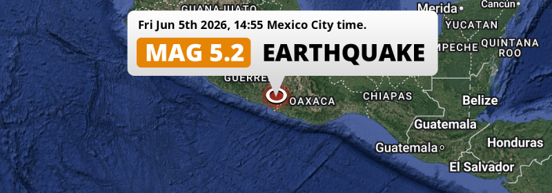
Under land 8 kilometer from Ometepec in Mexico, a significant Magnitude 5.2 earthquake occurred in the afternoon of Friday June 5th, 2026.
Felt the earthquake? Share this article: 


Earthquake Summary
The earthquake struck on land in Mexico, 8 kilometer (5 mi) north of Ometepec in Guerrero. The center of this earthquake had a quite shallow depth of 33 km. Shallow earthquakes usually have a larger impact than earthquakes deep in the earth.
| Date and Time: | Jun 5, 2026 14:55 (Mexico City Time) - Jun 5, 2026 20:55 Universal Time. |
|---|---|
| Location: | 8 km north of Ometepec, Guerrero, Mexico. Coordinates 16°45'55"N 98°24'38"W. |
| Map: | 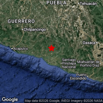 Map of area around epicenter. Click to open in Google Maps. |
| Magnitude: | MAG 5.2 Detected by 55 stations. Maximum Error Range ±0.042 . |
| Depth: | 33 km (20 mi) A quite shallow depth. |
| Tsunami Risk: | Tsunami very unlikely While this was a shallow earthquake, it appears to have occurred under land with a magnitude not strong enough to cause tsunami's. Always stay cautious - More info here. |
Nearby towns and cities
This earthquake may have been felt in Mexico . The closest significant population center near the earthquake is Ometepec in Guerrero, Mexico. Ometepec is located 8 kilometer (5 mi) north of the epicenter.
Multiple large cities are in proximity of today's earthquake. Iztapalapa is located 296 km to the north. Puebla is located 254 km to the north. Acapulco de Juárez is located 160 km to the west.
The table below provides an overview of all places in proximity of today's earthquake.
Overview of nearby places
| Distance | Place |
|---|---|
| 8 km (5 mi) S from epicenter |
Ometepec Guerrero, Mexico. |
| 61 km (38 mi) SE from epicenter |
Pinotepa Nacional Oaxaca, Mexico. |
| 76 km (47 mi) W from epicenter |
Ayutla de los Libres Guerrero, Mexico. |
| 88 km (55 mi) N from epicenter |
Tlapa de Comonfort Guerrero, Mexico. |
| 96 km (60 mi) NE from epicenter |
Heroica Ciudad de Tlaxiaco Oaxaca, Mexico. |
| 123 km (76 mi) NW from epicenter |
Chilapa de Álvarez Guerrero, Mexico. |
| 134 km (83 mi) NE from epicenter |
Ciudad de Huajuapan de León Oaxaca, Mexico. |
| 138 km (86 mi) NW from epicenter |
Tixtla de Guerrero Guerrero, Mexico. |
| 145 km (90 mi) NW from epicenter |
Chilpancingo Guerrero, Mexico. |
| 154 km (96 mi) NW from epicenter |
Zumpango del Río Guerrero, Mexico. |
| 160 km (99 mi) W from epicenter |
Acapulco de Juárez Guerrero, Mexico. |
| 164 km (102 mi) N from epicenter |
Acatlán de Osorio Puebla, Mexico. |
| 174 km (108 mi) SE from epicenter |
Puerto Escondido Oaxaca, Mexico. |
| 178 km (111 mi) E from epicenter |
Santa María Atzompa Oaxaca, Mexico. |
| 181 km (112 mi) E from epicenter |
Santa Cruz Xoxocotlán Oaxaca, Mexico. |
| 183 km (114 mi) E from epicenter |
Oaxaca Oaxaca, Mexico. |
| 184 km (114 mi) E from epicenter |
San Antonio de la Cal Oaxaca, Mexico. |
| 185 km (115 mi) E from epicenter |
Ocotlán de Morelos Oaxaca, Mexico. |
| 197 km (122 mi) NW from epicenter |
Ciudad de Huitzuco Guerrero, Mexico. |
| 197 km (122 mi) N from epicenter |
Axochiapan Morelos, Mexico. |
| 199 km (124 mi) E from epicenter |
Miahuatlán de Porfirio Díaz Oaxaca, Mexico. |
| 204 km (127 mi) N from epicenter |
Izúcar de Matamoros Puebla, Mexico. |
| 213 km (132 mi) NW from epicenter |
Iguala de la Independencia Guerrero, Mexico. |
| 217 km (135 mi) NE from epicenter |
Tehuacán Puebla, Mexico. |
| 234 km (145 mi) N from epicenter |
Cuautla Morelos, Mexico. |
| 236 km (147 mi) NW from epicenter |
Taxco de Alarcón Guerrero, Mexico. |
| 238 km (148 mi) N from epicenter |
Atlixco Puebla, Mexico. |
| 248 km (154 mi) N from epicenter |
Temixco Morelos, Mexico. |
| 249 km (155 mi) N from epicenter |
Jiutepec Morelos, Mexico. |
| 254 km (158 mi) N from epicenter |
Puebla Puebla, Mexico. |
| 255 km (158 mi) N from epicenter |
Cuernavaca Morelos, Mexico. |
| 256 km (159 mi) N from epicenter |
Cholula Puebla, Mexico. |
| 257 km (160 mi) N from epicenter |
Amozoc de Mota Puebla, Mexico. |
| 263 km (163 mi) N from epicenter |
Villa Vicente Guerrero Tlaxcala, Mexico. |
| 270 km (168 mi) NE from epicenter |
Orizaba Veracruz, Mexico. |
| 280 km (174 mi) N from epicenter |
San Martin Texmelucan de Labastida Puebla, Mexico. |
| 282 km (175 mi) N from epicenter |
Chalco México, Mexico. |
| 283 km (176 mi) NE from epicenter |
Córdoba Veracruz, Mexico. |
| 284 km (176 mi) N from epicenter |
Xico México, Mexico. |
| 284 km (176 mi) NE from epicenter |
Tuxtepec Oaxaca, Mexico. |
| 285 km (177 mi) N from epicenter |
Tlaxcala Tlaxcala, Mexico. |
| 286 km (178 mi) N from epicenter |
Xochimilco Mexico City, Mexico. |
| 287 km (178 mi) N from epicenter |
Tláhuac Mexico City, Mexico. |
| 288 km (179 mi) N from epicenter |
Ixtapaluca México, Mexico. |
| 292 km (181 mi) N from epicenter |
Tlalpan Mexico City, Mexico. |
| 295 km (183 mi) N from epicenter |
Los Reyes Acaquilpan México, Mexico. |
| 296 km (184 mi) N from epicenter |
Iztapalapa Mexico City, Mexico. |
| 298 km (185 mi) N from epicenter |
Coyoacán Mexico City, Mexico. |
| 298 km (185 mi) N from epicenter |
Magdalena Contreras Mexico City, Mexico. |
| 299 km (186 mi) N from epicenter |
Chicoloapan México, Mexico. |
| 300 km (186 mi) N from epicenter |
Ciudad Nezahualcoyotl México, Mexico. |
Shaking reported by 19 people
People that feel an earthquake may report their experience to the US Geographic Survey. Currently, 19 people have reported shaking in 9 places, all within Mexico.We keep updating this article as more ground reports become available. You may report that you felt this earthquake here.
Places with most reports:
- Mexico City, Distrito Federal, Mexico: 11 people.
- Acapulco, Guerrero, Mexico: 1 person.
- Cuautla, Morelos, Mexico: 1 person.
- Momoxpán, Puebla, Mexico: 1 person.
- Tlalnepantla, México, Mexico: 1 person.
- Santa Lucía del Camino, Oaxaca, Mexico: 1 person.
- Cuernavaca, Morelos, Mexico: 1 person.
- Nezahualcóyotl, México, Mexico: 1 person.
- Zapopan, Jalisco, Mexico: 1 person.
9 Aftershocks detected
Since this main shock, 9 smaller aftershocks were detected. Just 2 days after this main shock, an earthquake measuring MAG-4 was detected 40 km (25 mi) southwest of this earthquake.
This main shock was prefaced by 5 smaller foreshocks. Roughly 16 hrs before this earthquake, a foreshock measuring MAG-4 was detected nearby this earthquake.
Overview of foreshocks and aftershocks
| Classification | Magnitude | When | Where |
|---|---|---|---|
| Foreshock | M 3.7 |
3 days earlier Jun 2, 2026 15:32 (Mexico City Time) | 98 km (61 mi) W from Main Shock. |
| Foreshock | M 3.4 |
3 days earlier Jun 2, 2026 15:52 (Mexico City Time) | 95 km (59 mi) W from Main Shock. |
| Foreshock | M 3.0 |
3 days earlier Jun 2, 2026 16:44 (Mexico City Time) | 39 km (24 mi) W from Main Shock. |
| Foreshock | M 4.0 |
3 days earlier Jun 2, 2026 21:48 (Mexico City Time) | 72 km (45 mi) SE from Main Shock. |
| Foreshock | M 4.0 |
16 hrs earlier Jun 4, 2026 23:24 (Mexico City Time) | 37 km (23 mi) S from Main Shock. |
| Main Shock This Earthquake |
M 5.2 |
Jun 5, 2026 14:55 (Mexico City Time) | - |
| Aftershock | M 3.3 |
11 hrs later Jun 6, 2026 02:12 (Mexico City Time) | 44 km (27 mi) SW from Main Shock. |
| Aftershock | M 3.6 |
23 hrs later Jun 6, 2026 14:24 (Mexico City Time) | 52 km (33 mi) S from Main Shock. |
| Aftershock | M 3.1 |
2 days later Jun 7, 2026 03:18 (Mexico City Time) | 59 km (37 mi) E from Main Shock. |
| Aftershock | M 3.6 |
2 days later Jun 7, 2026 15:11 (Mexico City Time) | 39 km (24 mi) SW from Main Shock. |
| Aftershock | M 4.0 |
2 days later Jun 7, 2026 15:14 (Mexico City Time) | 40 km (25 mi) SW from Main Shock. |
| Aftershock | M 3.5 |
2 days later Jun 8, 2026 02:04 (Mexico City Time) | 56 km (35 mi) W from Main Shock. |
| Aftershock | M 3.7 |
2 days later Jun 8, 2026 02:50 (Mexico City Time) | 33 km (21 mi) S from Main Shock. |
| Aftershock | M 3.6 |
3 days later Jun 8, 2026 03:11 (Mexico City Time) | 33 km (20 mi) S from Main Shock. |
| Aftershock | M 3.3 |
3 days later Jun 8, 2026 03:21 (Mexico City Time) | 25 km (15 mi) S from Main Shock. |
More earthquakes coming?
Earthquakes can create aftershocks. These are generally at least 1 magnitude lower than any main shock, and as time passes the chance and strength of aftershocks decreases.
The chance that a significant earthquake like this one is followed by an even larger earthquake is not so large. On average, scientists estimate a 94% chance that a major earthquake will not be followed by an even larger one. It is still adviced to be aware of this risk
Read: How to Stay Safe during an Earthquake (cdc.gov).Earthquakes like this happen often in the region
Earthquakes of this strength are very common in the region. This is the strongest earthquake to hit since May 4th, 2026, when a 5.5 magnitude earthquake hit 53 km (33 mi) further south-east. An even stronger magnitude 7.4 earthquake struck on June 23rd, 2020.
In total, 30 earthquakes with a magnitude of 5.2 or higher have been registered within 300km (186 mi) of this epicenter in the past 10 years. This comes down to an average of once every 4 months.
Tsunami very unlikely
While MAG-6.5+ earthquakes may cause tsunami's, it appears that the epicenter of this earthquake hit under land. In addition, the reported depth is deeper than 100km, making the risk of a tsunami even less likely. However always stay cautious and monitor advice from local authorities.
Tsunami Risk Factors
| Factor | Under Sea? | MAG-6.5 or stronger? | Shallow depth? |
|---|---|---|---|
| Explanation | Almost all tsunami's are caused by earthquakes with their epicenter under sea or very near the sea. However stay cautious in coastal areas as earthquakes on land may cause landslides into sea, potentially still causing a local tsunami. | Under MAG 6.5: Very unlikely to cause a tsunami. MAG 6.5 to 7.5: Destructive tsunami's do occur, but are uncommon. Likely to observe small sea level changes. MAG 7.6+: Earthquakes with these magnitudes might produce destructive tsunami's. |
Most destructive tsunami's are caused by shallow earthquakes with a depth between 0 and 100km under the surface of the earth. Deeper tsunami's are unlikely to displace to ocean floor. |
| This Earthquake | Not this earthquake. This earthquake appears to have struck on land far from any coast. |
Not this earthquake. This earthquake had a magnitude of 5.2. Earthquakes of this strength are unlikely to trigger a tsunami. |
This earthquake occurred at a depth of of 33 km (20 mi). Earthquakes this shallow could trigger a tsunami. |
Sources
Last updated 26/06/26 23:18 (). This article is automatically generated based on available data. We keep checking multiple sources for additional information. This article gets updated as new details on this earthquake become available.
- US Geographic Society (USGS): Earthquake us7000sqzv
- European-Mediterranean Seismological Centre (EMSC): Earthquake 20260605_0000316
- Geonames.org: World Cities Database
- Google Maps: Static API
- Earthquakelist.org: Historic Earthquakes Database
Share this article:
