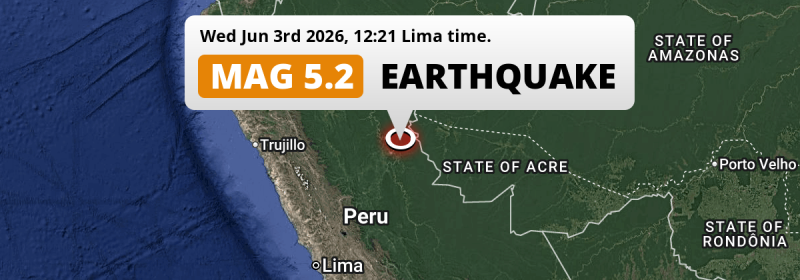
A significant Magnitude 5.2 earthquake struck under land 30 kilometer from Pucallpa in Peru around noon of Wednesday June 3rd, 2026. Brazil is also near its epicenter.
Felt the earthquake? Share this article: 


Earthquake Summary
The earthquake struck on land in Peru, 30 kilometer (19 mi) north-east of Pucallpa in Ucayali. The center of this earthquake had an intermediate depth of 147 km.
| Date and Time: | Jun 3, 2026 12:21 (Lima Time) - Jun 3, 2026 17:21 Universal Time. |
|---|---|
| Location: | 30 km NE of Pucallpa, Ucayali, Peru. Coordinates 8°13'52"S 74°19'16"W. |
| Map: | 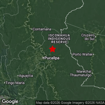 Map of area around epicenter. Click to open in Google Maps. |
| Magnitude: | MAG 5.2 Detected by 20 stations. Maximum Error Range ±0.069 . |
| Depth: | 147 km (91 mi) An intermediate depth. |
| Tsunami Risk: | Tsunami very unlikely Tsunami's are usually caused by MAG-6.5+ earthquakes, less than 100km shallow, and with an epicenter under sea. Neither of this seems to be the case. Always stay cautious - More info here. |
Nearby towns and cities
Peru and Brazil are both located within 300km distance of the epicenter of the earthquake.
The closest significant population center near the earthquake is Pucallpa in Ucayali, Peru. Pucallpa is located 30 kilometer (19 mi) north-east of the epicenter.
A complete list of nearby places is included below.
Overview of nearby places
| Distance | Place |
|---|---|
| 30 km (19 mi) SW from epicenter |
Pucallpa Ucayali, Peru. |
| 30 km (19 mi) SW from epicenter |
San Fernando Ucayali, Peru. |
| 193 km (120 mi) E from epicenter |
Cruzeiro do Sul Acre, Brazil. |
| 219 km (136 mi) SW from epicenter |
Tingo María Huanuco, Peru. |
| 237 km (147 mi) W from epicenter |
Uchiza San Martín, Peru. |
| 242 km (150 mi) W from epicenter |
Tocache San Martín, Peru. |
| 282 km (175 mi) NW from epicenter |
Bellavista San Martín, Peru. |
| 283 km (176 mi) SW from epicenter |
Huánuco Huanuco, Peru. |
| 290 km (180 mi) NW from epicenter |
Juanjuí San Martín, Peru. |
| 295 km (183 mi) NW from epicenter |
La Banda San Martín, Peru. |
Shaking reported by 2 people
People that feel an earthquake may report their experience to the US Geographic Survey. Currently, 2 people have reported shaking in 2 places in Peru.We keep updating this article as more ground reports become available. You may report that you felt this earthquake here.
Places with most reports:
- Pucallpa, Ucayali, Peru: 1 person.
- Celendín, Cajamarca, Peru: 1 person.
Risk of aftershocks?
We have not yet detected any foreshocks or aftershocks (MAG-2.5 or higher) within 100km (62 mi) of this earthquake.
Earthquakes can create aftershocks. These are generally at least 1 magnitude lower than any main shock, and as time passes the chance and strength of aftershocks decreases.
In only six percent of cases, significant earthquakes are followed by a larger main shock, making the current earthquake a foreshock. While the chance of this happening is not so large, it is adviced to maintain cautiousness in the hours and days following a major earthquake.
Read: How to Stay Safe during an Earthquake (cdc.gov).Earthquakes like this are common in the region
Earthquakes of this strength occur quite regularly in the region. This is the strongest earthquake to hit since April 1st, 2026, when a 6 magnitude earthquake hit 247 km (153 mi) further northwest. An even stronger magnitude 8 earthquake struck on May 26th, 2019.
In total, 9 earthquakes with a magnitude of 5.2 or higher have been registered within 300km (186 mi) of this epicenter in the past 10 years. This comes down to an average of once every year.
Tsunami very unlikely
It is very unlikely that this eartquake will cause any tsunami's. The reported magnitude is lower than the MAG-6.5 strength required to cause any earthquakes. In addition, this earthquake was not very shallow and appears to have occurred under land. However always stay cautious and monitor advice from local authorities.
Tsunami Risk Factors
| Factor | Under Sea? | MAG-6.5 or stronger? | Shallow depth? |
|---|---|---|---|
| Explanation | Almost all tsunami's are caused by earthquakes with their epicenter under sea or very near the sea. However stay cautious in coastal areas as earthquakes on land may cause landslides into sea, potentially still causing a local tsunami. | Under MAG 6.5: Very unlikely to cause a tsunami. MAG 6.5 to 7.5: Destructive tsunami's do occur, but are uncommon. Likely to observe small sea level changes. MAG 7.6+: Earthquakes with these magnitudes might produce destructive tsunami's. |
Most destructive tsunami's are caused by shallow earthquakes with a depth between 0 and 100km under the surface of the earth. Deeper tsunami's are unlikely to displace to ocean floor. |
| This Earthquake | Not this earthquake. This earthquake appears to have struck on land far from any coast. |
Not this earthquake. This earthquake had a magnitude of 5.2. Earthquakes of this strength are unlikely to trigger a tsunami. |
Not this earthquake. This earthquake occurred at a depth of 147 km (91 mi). Earthquakes this deep in the earth are unlikely to trigger a tsunami. |
Sources
Last updated 25/06/26 00:28 (). As more information on this earthquake becomes available this article will be updated. This article is automatically composed based on data originating from multiple sources.
- US Geographic Society (USGS): Earthquake us7000sqcu
- European-Mediterranean Seismological Centre (EMSC): Earthquake 20260603_0000252
- Geonames.org: World Cities Database
- Google Maps: Static API
- Earthquakelist.org: Historic Earthquakes Database
Share this article:
