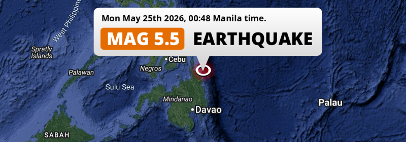
In the night of Monday May 25th, 2026, a significant Magnitude 5.5 earthquake hit in the Philippine Sea 26 kilometer from Tandag, The Philippines. Around 10 million people have been exposed to shaking.
Felt the earthquake? Share this article: 


Earthquake Summary
This earthquake hit under water in the Philippine Sea, right off the coast of The Philippines (8 mi offshore), 26 kilometer north of Tandag in Caraga. The center of this earthquake had a quite shallow depth of 34 km. Shallow earthquakes usually have a larger impact than earthquakes deep in the earth.
| Date and Time: | May 25, 2026 12:48AM (Manila Time) - May 24, 2026 16:48 Universal Time. |
|---|---|
| Location: | 26 km north of Tandag, Caraga, The Philippines. Coordinates 9°17'59"N 126°17'2"E. |
| Map: | 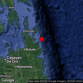 Map of area around epicenter. Click to open in Google Maps. |
| Magnitude: | MAG 5.5 Detected by 36 stations. Maximum Error Range ±0.052 . |
| Depth: | 34 km (21 mi) A quite shallow depth. |
| Max. Intensity: | V
Moderate On the Modified Mercalli Scale. |
| Tsunami Risk: | Low tsunami risk Earthquakes under MAG-6.5 do not usually cause tsunami's. Always stay cautious - More info here. |
Minimal impact predicted
Based on scientific estimates by the US Geographic Survey (USGS), the risk of high fatalities for this earthquake is classified at level GREEN (low). They expect an 90% likelyhood of between 0 and 1 fatalities.
The USGS classifies the economic impact of this earthquake at level GREEN (low). They expect an 90% likelyhood of between 0 and 1 million US Dollars in economic damage and impact.
Roughly 10 million people exposed to shaking
An estimated 10 million have been exposed to shaking (An MMI or Modified Mercalli Intensity level II or higher) as a result of this earthquake according scientific estimates published by the USGS.
An estimated 13,950 people were exposed to level V. At this level, moderate shaking and very light damage can be expected. Intensity level III was experienced by the majority of people (around 6.8 million). In their region, weak shaking and probably no damage can be expected. All exposure to shaking was within the borders of The Philippines .
| People | MMI Level | Shaking | Damage |
|---|---|---|---|
| 0 | I |
Not noticable | None |
| 645,200 | II |
Very weak | None |
| 6,807,000 | III |
Weak | Probably none |
| 2,135,000 | IV |
Light | Likely none |
| 13,950 | V |
Moderate | Very light |
| 0 | VI |
Strong | Light |
| 0 | VII |
Very Strong | Moderate |
| 0 | VIII |
Severe | Moderate to heavy |
| 0 | IX |
Violent | Heavy |
| 0 | X |
Extreme | Very heavy |
Nearby towns and cities
This earthquake may have been felt in The Philippines . The closest significant population center near the earthquake is Tandag in Caraga, The Philippines. Tandag is located 26 kilometer (16 mi) north of the epicenter. The intensity of shaking and damage in Tandag is estimated to be around level IV on the Modified Mercalli Intensity scale (light shaking, likely no damage).
Major cities near this earthquake: Davao is located 258 km to the south (intensity unknown, possibly low). Butuan is located 90 km to the southwest and experienced an intensity of IV (light shaking, likely no damage). Cebu City is located 286 km to the northwest (intensity unknown, possibly low).
The table below provides an overview of all places in proximity of today's earthquake. Where available, the estimated intensity on the Modified Mercalli Intensity Scale in each place is included. Places where this information is omitted likely experienced little impact.
Overview of nearby places
| Distance | Place | Intensity (MMI) |
|---|---|---|
| 26 km (16 mi) S from epicenter |
Tandag Caraga, The Philippines. |
IV
Light |
| 83 km (52 mi) SW from epicenter |
Bayugan Caraga, The Philippines. |
IV
Light |
| 84 km (52 mi) W from epicenter |
Cabadbaran Caraga, The Philippines. |
IV
Light |
| 87 km (54 mi) SW from epicenter |
Bah-Bah Caraga, The Philippines. |
IV
Light |
| 90 km (56 mi) SW from epicenter |
Butuan Caraga, The Philippines. |
IV
Light |
| 93 km (58 mi) SW from epicenter |
San Francisco Caraga, The Philippines. |
IV
Light |
| 95 km (59 mi) SW from epicenter |
Libertad Caraga, The Philippines. |
IV
Light |
| 102 km (63 mi) NW from epicenter |
Surigao Caraga, The Philippines. |
IV
Light |
| 103 km (64 mi) W from epicenter |
Buenavista Caraga, The Philippines. |
IV
Light |
| 109 km (68 mi) SW from epicenter |
Talacogon Caraga, The Philippines. |
III
Weak |
| 121 km (75 mi) S from epicenter |
Bislig Caraga, The Philippines. |
IV
Light |
| 130 km (81 mi) S from epicenter |
Bunawan Caraga, The Philippines. |
IV
Light |
| 138 km (86 mi) SW from epicenter |
Mariano Northern Mindanao, The Philippines. |
III
Weak |
| 141 km (88 mi) S from epicenter |
Veruela Caraga, The Philippines. |
III
Weak |
| 142 km (88 mi) S from epicenter |
Trento Caraga, The Philippines. |
III
Weak |
| 167 km (104 mi) S from epicenter |
Monkayo Davao, The Philippines. |
III
Weak |
| 180 km (112 mi) SW from epicenter |
Malaybalay Northern Mindanao, The Philippines. |
III
Weak |
| 182 km (113 mi) S from epicenter |
Compostela Davao, The Philippines. |
III
Weak |
| 183 km (114 mi) NW from epicenter |
Maasin Eastern Visayas, The Philippines. |
III
Weak |
| 183 km (114 mi) SW from epicenter |
Jasaan Northern Mindanao, The Philippines. |
III
Weak |
| 187 km (116 mi) SW from epicenter |
Manolo Fortich Northern Mindanao, The Philippines. |
III
Weak |
| 188 km (117 mi) SW from epicenter |
Tagoloan Northern Mindanao, The Philippines. |
III
Weak |
| 189 km (117 mi) SW from epicenter |
Bugo Northern Mindanao, The Philippines. |
III
Weak |
| 191 km (119 mi) S from epicenter |
Nabunturan Davao, The Philippines. |
III
Weak |
| 197 km (122 mi) S from epicenter |
New Corella Davao, The Philippines. |
III
Weak |
| 201 km (125 mi) SW from epicenter |
Cagayan de Oro Northern Mindanao, The Philippines. |
III
Weak |
| 203 km (126 mi) SW from epicenter |
NIA Valencia Northern Mindanao, The Philippines. |
III
Weak |
| 213 km (132 mi) S from epicenter |
Magugpo Poblacion Davao, The Philippines. |
|
| 214 km (133 mi) W from epicenter |
Jagna Central Visayas, The Philippines. |
|
| 221 km (137 mi) SW from epicenter |
Maramag Northern Mindanao, The Philippines. |
III
Weak |
| 231 km (144 mi) S from epicenter |
Panabo Davao, The Philippines. |
|
| 238 km (148 mi) SW from epicenter |
Iligan City Soccsksargen, The Philippines. |
|
| 254 km (158 mi) SW from epicenter |
Iligan Northern Mindanao, The Philippines. |
|
| 255 km (158 mi) S from epicenter |
Samal Davao, The Philippines. |
|
| 257 km (160 mi) NW from epicenter |
Tacloban Eastern Visayas, The Philippines. |
|
| 258 km (160 mi) NW from epicenter |
Panalanoy Eastern Visayas, The Philippines. |
|
| 258 km (160 mi) S from epicenter |
Davao Davao, The Philippines. |
|
| 260 km (162 mi) SW from epicenter |
Mantampay Northern Mindanao, The Philippines. |
|
| 261 km (162 mi) S from epicenter |
Mati Davao, The Philippines. |
|
| 263 km (163 mi) SW from epicenter |
Marawi City Rehiyong Autonomo sa Muslim na Mindanao, The Philippines. |
|
| 264 km (164 mi) NW from epicenter |
Ormoc Eastern Visayas, The Philippines. |
III
Weak |
| 270 km (168 mi) W from epicenter |
Tagbilaran City Central Visayas, The Philippines. |
|
| 279 km (173 mi) NW from epicenter |
Lapu-Lapu City Central Visayas, The Philippines. |
|
| 282 km (175 mi) NW from epicenter |
Danao Central Visayas, The Philippines. |
|
| 283 km (176 mi) NW from epicenter |
Mandaue City Central Visayas, The Philippines. |
|
| 286 km (178 mi) NW from epicenter |
Cebu City Central Visayas, The Philippines. |
|
| 287 km (178 mi) W from epicenter |
Talisay Central Visayas, The Philippines. |
|
| 287 km (178 mi) SW from epicenter |
Kidapawan Soccsksargen, The Philippines. |
|
| 287 km (178 mi) NW from epicenter |
Cogan Central Visayas, The Philippines. |
|
| 292 km (181 mi) W from epicenter |
Minglanilla Central Visayas, The Philippines. |
|
| 298 km (185 mi) SW from epicenter |
Ozamiz City Northern Mindanao, The Philippines. |
Earthquake Intensity Map
The maximum intensity (MMI Scale) caused by this earthquake is V. The map below shows in which areas this earthquake was the most and least impactful. It is based on data from the US Geographic Survey.

Shaking reported by 10 people
People that feel an earthquake may report their experience to the US Geographic Survey. Currently, 10 people have reported shaking in 7 places, all within Philippines.We keep updating this article as more ground reports become available. You may report that you felt this earthquake here.
Places with most reports:
- Purok, Caraga, Philippines: 4 people.
- Dapa, Caraga, Philippines: 1 person.
- Bacolod, Western Visayas, Philippines: 1 person.
- San Antonio (Basey, Samar), Eastern Visayas, Philippines: 1 person.
- Butuan, Caraga, Philippines: 1 person.
- Davao, Southern Mindanao, Philippines: 1 person.
- Malandag, Southern Mindanao, Philippines: 1 person.
4 Aftershocks detected
This main shock was followed by 4 smaller aftershocks. A 3.5 magnitude earthquake hit 20 hrs later 77 km (48 mi) west of this earthquake.
Before this earthquake struck, 3 smaller foreshocks occurred. A 5.1 magnitude earthquake hit 3 hrs earlier nearby.
Overview of foreshocks and aftershocks
| Classification | Magnitude | When | Where |
|---|---|---|---|
| Foreshock | M 4.6 |
8 hrs earlier May 24, 2026 04:24PM (Manila Time) | 33 km (21 mi) SE from Main Shock. |
| Foreshock | M 3.7 |
8 hrs earlier May 24, 2026 04:24PM (Manila Time) | 33 km (21 mi) SE from Main Shock. |
| Foreshock | M 5.1 |
3 hrs earlier May 24, 2026 09:19PM (Manila Time) | 32 km (20 mi) SE from Main Shock. |
| Main Shock This Earthquake |
M 5.5 |
May 25, 2026 12:48AM (Manila Time) | - |
| Aftershock | M 3.0 |
17 mins later May 25, 2026 01:05AM (Manila Time) | 10 km (6 mi) S from Main Shock. |
| Aftershock | M 3.0 |
52 mins later May 25, 2026 01:40AM (Manila Time) | 10 km (6 mi) S from Main Shock. |
| Aftershock | M 3.5 |
20 hrs later May 25, 2026 08:41PM (Manila Time) | 77 km (48 mi) W from Main Shock. |
| Aftershock | M 3.1 |
1 day later May 26, 2026 11:12AM (Manila Time) | 33 km (20 mi) NE from Main Shock. |
More earthquakes coming?
Earthquakes can create aftershocks. These are generally at least 1 magnitude lower than any main shock, and as time passes the chance and strength of aftershocks decreases.
In only six percent of cases, significant earthquakes are followed by a larger main shock, making the current earthquake a foreshock. While the chance of this happening is not so large, it is adviced to maintain cautiousness in the hours and days following a major earthquake.
Read: How to Stay Safe during an Earthquake (cdc.gov).Earthquakes like this happen often in the region
Earthquakes of this strength are very common in the region. This is the strongest earthquake to hit since May 6th, 2026, when a 5.5 magnitude earthquake hit 204 km (127 mi) further south. An even stronger magnitude 7.6 earthquake struck on December 2nd, 2023.
In total, 81 earthquakes with a magnitude of 5.5 or higher have been registered within 300km (186 mi) of this epicenter in the past 10 years. This comes down to an average of once every 2 months.
Low tsunami risk
Based on early data it appears this earthquake was not strong enough (lower than MAG-6.5) to be likely to cause destructive tsunami's. However this earthquake appeared to have hit at a shallow depth under sea, so stay cautious and monitor advice from local authorities.
Tsunami Risk Factors
| Factor | Under Sea? | MAG-6.5 or stronger? | Shallow depth? |
|---|---|---|---|
| Explanation | Almost all tsunami's are caused by earthquakes with their epicenter under sea or very near the sea. However stay cautious in coastal areas as earthquakes on land may cause landslides into sea, potentially still causing a local tsunami. | Under MAG 6.5: Very unlikely to cause a tsunami. MAG 6.5 to 7.5: Destructive tsunami's do occur, but are uncommon. Likely to observe small sea level changes. MAG 7.6+: Earthquakes with these magnitudes might produce destructive tsunami's. |
Most destructive tsunami's are caused by shallow earthquakes with a depth between 0 and 100km under the surface of the earth. Deeper tsunami's are unlikely to displace to ocean floor. |
| This Earthquake | This earthquake appears to have struck under the sea. | Not this earthquake. This earthquake had a magnitude of 5.5. Earthquakes of this strength are unlikely to trigger a tsunami. |
This earthquake occurred at a depth of of 34 km (21 mi). Earthquakes this shallow could trigger a tsunami. |
Sources
Last updated 20/06/26 03:38 (). As more information on this earthquake becomes available this article will be updated. This article is automatically composed based on data originating from multiple sources.
- US Geographic Society (USGS): Earthquake us6000szxz
- European-Mediterranean Seismological Centre (EMSC): Earthquake 20260524_0000287
- Geonames.org: World Cities Database
- Google Maps: Static API
- Earthquakelist.org: Historic Earthquakes Database
Share this article:
