A significant M5.0 earthquake struck under land 74 kilometer from Lae in Papua New Guinea in the morning of Monday May 18th, 2026.
Felt the earthquake? Share this article: 


Earthquake Summary
The earthquake struck on land in Papua New Guinea, 74 kilometer (46 mi) north-east of Lae in Morobe. The center of this earthquake had a quite shallow depth of 64 km. Shallow earthquakes usually have a larger impact than earthquakes deep in the earth.
| Date and Time: | May 18, 2026 08:58 (Port Moresby Time) - May 17, 2026 22:58 Universal Time. |
|---|---|
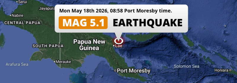
| Location: | 74 km NE of Lae, Morobe, Papua New Guinea. Coordinates 6°25'45"S 147°35'55"E. |
| Map: |  Map of area around epicenter. Click to open in Google Maps. |
| Magnitude: | MAG 5.0 Detected by 82 stations. Maximum Error Range ±0.062 . |
| Depth: | 64 km (40 mi) A quite shallow depth. |
| Tsunami Risk: | Tsunami very unlikely While this was a shallow earthquake, it appears to have occurred under land with a magnitude not strong enough to cause tsunami's. Always stay cautious - More info here. |
Nearby towns and cities
This earthquake may have been felt in Papua New Guinea . The closest significant population center near the earthquake is Lae in Morobe, Papua New Guinea. Lae is located 74 kilometer (46 mi) north-east of the epicenter.
The table below provides an overview of all places in proximity of today's earthquake.
Overview of nearby places
| Distance | Place |
|---|---|
| 74 km (46 mi) SW from epicenter |
Lae Morobe, Papua New Guinea. |
| 136 km (85 mi) SW from epicenter |
Bulolo Morobe, Papua New Guinea. |
| 241 km (150 mi) NW from epicenter |
Madang Madang, Papua New Guinea. |
| 247 km (153 mi) W from epicenter |
Goroka Eastern Highlands, Papua New Guinea. |
| 269 km (167 mi) S from epicenter |
Popondetta Northern Province, Papua New Guinea. |
| 297 km (185 mi) E from epicenter |
Kimbe West New Britain, Papua New Guinea. |
Aftershocks detected
Since this main shock, 1 smaller aftershock was detected. At a distance of 59 km (37 mi) southwest of this earthquake, an aftershock struck 1 day later. It measured a magnitude of 4.2
Overview of foreshocks and aftershocks
| Classification | Magnitude | When | Where |
|---|---|---|---|
| Main Shock This Earthquake |
M 5.0 |
May 18, 2026 08:58 (Port Moresby Time) | - |
| Aftershock | M 4.2 |
1 day later May 19, 2026 13:14 (Port Moresby Time) | 59 km (37 mi) SW from Main Shock. |
More earthquakes coming?
The risk of aftershocks decreases rapidly over time. Usually, aftershocks are at least one order of magnitude lower than a main shock.
In only six percent of cases, significant earthquakes are followed by a larger main shock, making the current earthquake a foreshock. While the chance of this happening is not so large, it is adviced to maintain cautiousness in the hours and days following a major earthquake.
Read: How to Stay Safe during an Earthquake (cdc.gov).Earthquakes like this happen often in the region
Earthquakes of this strength are very common in the region. This is the strongest earthquake to hit since May 10th, 2026, when a 5.3 magnitude earthquake hit 250 km (156 mi) further northwest. An even stronger magnitude 7.6 earthquake struck on September 10th, 2022.
In total, 213 earthquakes with a magnitude of 5 or higher have been registered within 300km (186 mi) of this epicenter in the past 10 years. This comes down to an average of once every 17 days.
Tsunami very unlikely
While MAG-6.5+ earthquakes may cause tsunami's, it appears that the epicenter of this earthquake hit under land. In addition, the reported depth is deeper than 100km, making the risk of a tsunami even less likely. However always stay cautious and monitor advice from local authorities.
Tsunami Risk Factors
| Factor | Under Sea? | MAG-6.5 or stronger? | Shallow depth? |
|---|---|---|---|
| Explanation | Almost all tsunami's are caused by earthquakes with their epicenter under sea or very near the sea. However stay cautious in coastal areas as earthquakes on land may cause landslides into sea, potentially still causing a local tsunami. | Under MAG 6.5: Very unlikely to cause a tsunami. MAG 6.5 to 7.5: Destructive tsunami's do occur, but are uncommon. Likely to observe small sea level changes. MAG 7.6+: Earthquakes with these magnitudes might produce destructive tsunami's. |
Most destructive tsunami's are caused by shallow earthquakes with a depth between 0 and 100km under the surface of the earth. Deeper tsunami's are unlikely to displace to ocean floor. |
| This Earthquake | Not this earthquake. This earthquake appears to have struck on land far from any coast. |
Not this earthquake. This earthquake had a magnitude of 5. Earthquakes of this strength are unlikely to trigger a tsunami. |
This earthquake occurred at a depth of of 64 km (40 mi). Earthquakes this shallow could trigger a tsunami. |
Sources
Last updated 14/06/26 01:18 (). This article contains currently available information about the earthquake and is automatically composed. We continue to update this article up to a few days after the earthquake occurred.
- US Geographic Society (USGS): Earthquake us6000syfk
- European-Mediterranean Seismological Centre (EMSC): Earthquake 20260517_0000340
- Geonames.org: World Cities Database
- Google Maps: Static API
- Earthquakelist.org: Historic Earthquakes Database
Share this article:
