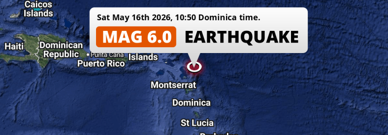
In the morning of Saturday May 16th, 2026, a strong M6.0 earthquake hit in the North Atlantic Ocean 83 kilometer from Saint John’s, Antigua and Barbuda. Roughly 580 thousand people may have felt this earthquake. Other nearby countries are Guadeloupe, Montserrat, Saint Kitts and Nevis, Anguilla, Dominica and Martinique.
Felt the earthquake? Share this article: 


Earthquake Summary
This earthquake hit under water in the North Atlantic Ocean, 62 kilometers (38 mi) off the coast of Antigua and Barbuda, 83 kilometer north-east of Saint John’s in Saint John. The center of this earthquake had a quite shallow depth of 30 km. Shallow earthquakes usually have a larger impact than earthquakes deep in the earth.
| Date and Time: | May 16, 2026 10:50 (Antigua Time) - May 16, 2026 14:50 Universal Time. |
|---|---|
| Location: | 83 km NE of Saint John’s, Saint John, Antigua and Barbuda. Coordinates 17°30'46"N 61°10'38"W. |
| Map: | 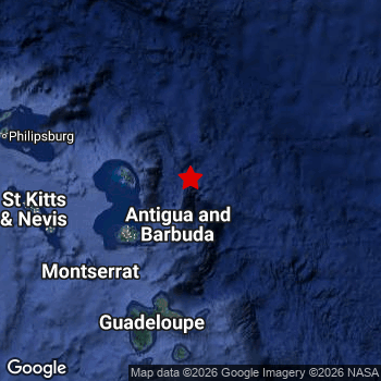 Map of area around epicenter. Click to open in Google Maps. |
| Magnitude: | MAG 6.0 Detected by 31 stations. Maximum Error Range ±0.034 . |
| Depth: | 30 km (19 mi) A quite shallow depth. |
| Max. Intensity: | V
Moderate On the Modified Mercalli Scale. |
| Tsunami Risk: | Low tsunami risk Earthquakes under MAG-6.5 do not usually cause tsunami's. Always stay cautious - More info here. |
Minimal impact predicted
Based on scientific estimates by the US Geographic Survey (USGS), the risk of high fatalities for this earthquake is classified at level GREEN (low). They expect an 90% likelyhood of between 0 and 1 fatalities.
The USGS classifies the economic impact of this earthquake at level GREEN (low). They expect an 90% likelyhood of between 0 and 1 million US Dollars in economic damage and impact.
Roughly 580 thousand people exposed to shaking
An estimated 580 thousand have been exposed to shaking (An MMI or Modified Mercalli Intensity level II or higher) as a result of this earthquake according scientific estimates published by the USGS.
Light shaking and likely no damage may have been experienced by an estimated 400,700 people. At IV, it is the highest MMI level this earthquake has caused.
People in 8 countries have been exposed to shaking. In Guadeloupe , around 390 thousand people, with impact levels up to IV (light shaking, likely no damage). Roughly 100 thousand people were exposed to shaking in Antigua and Barbuda . In Saint Kitts and Nevis , around 50 thousand people. A smaller number of people were exposed in the following countries: Montserrat, Caribbean Netherlands, Saint Martin, Saint Barthelemy and Anguilla.
| People | MMI Level | Shaking | Damage |
|---|---|---|---|
| 0 | I |
Not noticable | None |
| 0 | II |
Very weak | None |
| 175,300 | III |
Weak | Probably none |
| 400,700 | IV |
Light | Likely none |
| 0 | V |
Moderate | Very light |
| 0 | VI |
Strong | Light |
| 0 | VII |
Very Strong | Moderate |
| 0 | VIII |
Severe | Moderate to heavy |
| 0 | IX |
Violent | Heavy |
| 0 | X |
Extreme | Very heavy |
Nearby towns and cities
12 countries can be found within 300km of the epicenter of this earthquake: Antigua and Barbuda , Guadeloupe , Montserrat , Saint Kitts and Nevis , Anguilla , Dominica and Martinique . Futher away, this earthquake may also have been felt in British Virgin Islands, U.S. Virgin Islands and Saint Lucia.
Located 83 kilometer (52 mi) north-east of the epicenter of this earthquake, Saint John’s (Saint John, Antigua and Barbuda) is the nearest significant population center. Saint John’s experienced an earthquake intensity (MMI Scale) of roughly IV. That level implies light shaking and likely no damage.
The table below provides an overview of all places in proximity of today's earthquake. Where available, the estimated intensity on the Modified Mercalli Intensity Scale in each place is included. Places where this information is omitted likely experienced little impact.
Overview of nearby places
| Distance | Place | Intensity (MMI) |
|---|---|---|
| 83 km (52 mi) SW from epicenter |
Saint John’s Saint John, Antigua and Barbuda. |
IV
Light |
| 133 km (83 mi) S from epicenter |
Le Moule Guadeloupe, Guadeloupe. |
IV
Light |
| 136 km (85 mi) SW from epicenter |
Brades Saint Peter, Montserrat. |
III
Weak |
| 142 km (88 mi) S from epicenter |
Sainte-Rose Guadeloupe, Guadeloupe. |
IV
Light |
| 142 km (88 mi) S from epicenter |
Les Abymes Guadeloupe, Guadeloupe. |
IV
Light |
| 142 km (88 mi) SW from epicenter |
Plymouth Saint Anthony, Montserrat. |
III
Weak |
| 145 km (90 mi) S from epicenter |
Sainte-Anne Guadeloupe, Guadeloupe. |
IV
Light |
| 145 km (90 mi) S from epicenter |
Baie-Mahault Guadeloupe, Guadeloupe. |
IV
Light |
| 146 km (91 mi) S from epicenter |
Pointe-à-Pitre Guadeloupe, Guadeloupe. |
IV
Light |
| 149 km (93 mi) S from epicenter |
Le Gosier Guadeloupe, Guadeloupe. |
IV
Light |
| 153 km (95 mi) S from epicenter |
Petit-Bourg Guadeloupe, Guadeloupe. |
IV
Light |
| 166 km (103 mi) W from epicenter |
Basseterre Saint George Basseterre, Saint Kitts and Nevis. |
III
Weak |
| 168 km (104 mi) S from epicenter |
Capesterre-Belle-Eau Guadeloupe, Guadeloupe. |
IV
Light |
| 179 km (111 mi) S from epicenter |
Basse-Terre Guadeloupe, Guadeloupe. |
III
Weak |
| 182 km (113 mi) W from epicenter |
Gustavia All regions, Saint Barthelemy. |
III
Weak |
| 211 km (131 mi) W from epicenter |
Marigot All regions, Saint Martin. |
|
| 214 km (133 mi) W from epicenter |
The Valley The Valley, Anguilla. |
|
| 247 km (153 mi) S from epicenter |
Roseau Saint George, Dominica. |
|
| 304 km (189 mi) S from epicenter |
Sainte-Marie Martinique, Martinique. |
|
| 309 km (192 mi) S from epicenter |
La Trinité Martinique, Martinique. |
|
| 316 km (196 mi) S from epicenter |
Saint-Joseph Martinique, Martinique. |
|
| 316 km (196 mi) S from epicenter |
Le Robert Martinique, Martinique. |
|
| 323 km (201 mi) S from epicenter |
Le Lamentin Martinique, Martinique. |
|
| 324 km (201 mi) S from epicenter |
Le François Martinique, Martinique. |
|
| 324 km (201 mi) S from epicenter |
Fort-de-France Martinique, Martinique. |
|
| 327 km (203 mi) S from epicenter |
Ducos Martinique, Martinique. |
|
| 378 km (235 mi) W from epicenter |
Road Town All regions, British Virgin Islands. |
|
| 379 km (235 mi) W from epicenter |
Saint Croix Saint Croix Island, U.S. Virgin Islands. |
|
| 392 km (244 mi) S from epicenter |
Castries Castries, Saint Lucia. |
Earthquake Intensity Map
The maximum intensity (MMI Scale) caused by this earthquake is V. The map below shows in which areas this earthquake was the most and least impactful. It is based on data from the US Geographic Survey.

Shaking reported by 103 people in 9 countries
People that feel an earthquake may report their experience to the US Geographic Survey. Currently, 103 people have reported shaking in 43 places in 9 countries (Antigua and Barbuda, Saint Kitts and Nevis, Guadeloupe, Montserrat, Netherlands Antilles, Saint Vincent and The Grenadines, Martinique, Dominica, British Virgin Islands).We keep updating this article as more ground reports become available. You may report that you felt this earthquake here.
Places with most reports:
- Saint Johnʿs, Saint John, Antigua and Barbuda: 9 people.
- Low Lands, Sint Maarten, Netherlands Antilles: 6 people.
- Point-à-Pitre, Grande-Terre, Guadeloupe: 6 people.
- Cedar Grove, Saint John, Antigua and Barbuda: 6 people.
- Bolands, Saint Mary, Antigua and Barbuda: 5 people.
- Basseterre, Saint George Basseterre, Saint Kitts and Nevis: 4 people.
- Cul De Sac, Sint Maarten, Netherlands Antilles: 4 people.
- All Saints, Saint John, Antigua and Barbuda: 4 people.
- Simpson Bay, Sint Maarten, Netherlands Antilles: 3 people.
- Saint-Barthélemy, Saint Barthélemy, Guadeloupe: 3 people.
Aftershocks detected
After this earthquake struck, 1 smaller aftershock occurred. At a distance of 33 km (20 mi) southwest of this earthquake, an aftershock struck 2 sec later. It measured a magnitude of 6
In the days before this main shock, 1 smaller foreshock was detected. Nearby this earthquake a foreshock struck 14 hrs earlier. It measured a magnitude of 3.6
Overview of foreshocks and aftershocks
| Classification | Magnitude | When | Where |
|---|---|---|---|
| Foreshock | M 3.6 |
14 hrs earlier May 15, 2026 21:10 (Antigua Time) | 59 km (36 mi) W from Main Shock. |
| Main Shock This Earthquake |
M 6.0 |
May 16, 2026 10:50 (Antigua Time) | - |
| Aftershock | M 6.0 |
2 sec later May 16, 2026 10:50 (Antigua Time) | 33 km (20 mi) SW from Main Shock. |
More earthquakes coming?
The risk of aftershocks decreases rapidly over time. Usually, aftershocks are at least one order of magnitude lower than a main shock.
In only six percent of cases, significant earthquakes are followed by a larger main shock, making the current earthquake a foreshock. While the chance of this happening is not so large, it is adviced to maintain cautiousness in the hours and days following a major earthquake.
Read: How to Stay Safe during an Earthquake (cdc.gov).Earthquakes like this are common in the region
Earthquakes of this strength occur quite regularly in the region. This is the strongest earthquake to hit since October 27th, 2025, when a 6.5 magnitude earthquake hit 203 km (126 mi) further south-east. An even stronger magnitude 6.6 earthquake struck on July 10th, 2023.
In total, 3 earthquakes with a magnitude of 6 or higher have been registered within 300km (186 mi) of this epicenter in the past 10 years. This comes down to an average of once every 3 years.
Low tsunami risk
Based on early data it appears this earthquake was not strong enough (lower than MAG-6.5) to be likely to cause destructive tsunami's. However this earthquake appeared to have hit at a shallow depth under sea, so stay cautious and monitor advice from local authorities.
Tsunami Risk Factors
| Factor | Under Sea? | MAG-6.5 or stronger? | Shallow depth? |
|---|---|---|---|
| Explanation | Almost all tsunami's are caused by earthquakes with their epicenter under sea or very near the sea. However stay cautious in coastal areas as earthquakes on land may cause landslides into sea, potentially still causing a local tsunami. | Under MAG 6.5: Very unlikely to cause a tsunami. MAG 6.5 to 7.5: Destructive tsunami's do occur, but are uncommon. Likely to observe small sea level changes. MAG 7.6+: Earthquakes with these magnitudes might produce destructive tsunami's. |
Most destructive tsunami's are caused by shallow earthquakes with a depth between 0 and 100km under the surface of the earth. Deeper tsunami's are unlikely to displace to ocean floor. |
| This Earthquake | This earthquake appears to have struck under the sea. | Not this earthquake. This earthquake had a magnitude of 6. Earthquakes of this strength are unlikely to trigger a tsunami. |
This earthquake occurred at a depth of of 30 km (19 mi). Earthquakes this shallow could trigger a tsunami. |
Sources
Last updated 16/05/26 22:28 (). This article is automatically generated based on available data. We keep checking multiple sources for additional information. This article gets updated as new details on this earthquake become available.
- US Geographic Society (USGS): Earthquake us6000sy84
- Geonames.org: World Cities Database
- Google Maps: Static API
- Earthquakelist.org: Historic Earthquakes Database
Share this article:
