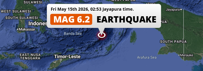
In the Banda Sea 366 kilometer from Ambon, Indonesia, a strong MAG-6.2 earthquake occurred in the night of Friday May 15th, 2026. Roughly 140 thousand people may have felt this earthquake.
Felt the earthquake? Share this article: 


Earthquake Summary
This earthquake hit under water in the Banda Sea, 158 kilometers (98 mi) off the coast of Indonesia, 366 kilometer south-east of Ambon in Maluku. The center of this earthquake had an intermediate depth of 137 km.
| Date and Time: | May 15, 2026 02:53 (Jayapura Time) - May 14, 2026 17:53 Universal Time. |
|---|---|
| Location: | 366 km SE of Ambon, Maluku, Indonesia. Coordinates 6°8'59"S 130°22'51"E. |
| Map: | 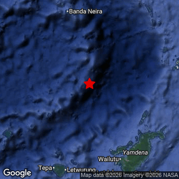 Map of area around epicenter. Click to open in Google Maps. |
| Magnitude: | MAG 6.2 Detected by 62 stations. Maximum Error Range ±0.039 . |
| Depth: | 137 km (85 mi) An intermediate depth. |
| Max. Intensity: | IV
Light On the Modified Mercalli Scale. |
| Tsunami Risk: | Tsunami very unlikely Earthquakes under MAG-6.5 at depths deeper than 100km are very unlikely to cause tsunami's. Always stay cautious - More info here. |
Minimal impact predicted
Based on scientific estimates by the US Geographic Survey (USGS), the risk of high fatalities for this earthquake is classified at level GREEN (low). They expect an 90% likelyhood of between 0 and 1 fatalities.
The USGS classifies the economic impact of this earthquake at level GREEN (low). They expect an 90% likelyhood of between 0 and 1 million US Dollars in economic damage and impact.
Roughly 140 thousand people exposed to shaking
This earthquake may have been felt by around 140 thousand people. That is the expected population size of the area exposed to a level of shaking of II or higher on the Modified Mercalli scale according to the USGS.
The highest earthquake impact level for this earthquake is IV, which corresponds with light shaking and likely no damage. Roughly 12,020 people are expected to be exposed to this level. The majority of people (roughly 130 thousand) live in an area exposed to level III, where weak shaking and probably no damage is expected. All exposure to shaking was within the borders of Indonesia .
| People | MMI Level | Shaking | Damage |
|---|---|---|---|
| 0 | I |
Not noticable | None |
| 0 | II |
Very weak | None |
| 126,400 | III |
Weak | Probably none |
| 12,020 | IV |
Light | Likely none |
| 0 | V |
Moderate | Very light |
| 0 | VI |
Strong | Light |
| 0 | VII |
Very Strong | Moderate |
| 0 | VIII |
Severe | Moderate to heavy |
| 0 | IX |
Violent | Heavy |
| 0 | X |
Extreme | Very heavy |
Nearby towns and cities
This earthquake may have been felt in Indonesia . The closest significant population center near the earthquake is Tual in Maluku, Indonesia. Tual is located 269 kilometer (167 mi) west of the epicenter.
Overview of nearby places
| Distance | Place |
|---|---|
| 269 km (167 mi) E from epicenter |
Tual Maluku, Indonesia. |
| 352 km (219 mi) NW from epicenter |
Amahai Maluku, Indonesia. |
| 366 km (227 mi) NW from epicenter |
Ambon Maluku, Indonesia. |
Earthquake Intensity Map
The graph below overlays a map of the region around the epicenter with earthquake intensity data provided by the US Geographic Survey. The highest intensity level detected for this earthquake is IV.

Shaking reported by 15 people
People that feel an earthquake may report their experience to the US Geographic Survey. Currently, 15 people have reported shaking in 4 places, all within Australia.We keep updating this article as more ground reports become available. You may report that you felt this earthquake here.
Places with most reports:
- Darwin, Northern Territory, Australia: 12 people.
- Humpty Doo-MacMinns Lagoon, Northern Territory, Australia: 1 person.
- Howard Springs, Northern Territory, Australia: 1 person.
- Palmerston, Northern Territory, Australia: 1 person.
2 Aftershocks detected
Since this main shock, 2 smaller aftershocks were detected. At a distance of 39 km (24 mi) west of this earthquake, an aftershock struck 1 day later. It measured a magnitude of 3.9
Before this earthquake struck, 2 smaller foreshocks occurred. Roughly 22 hrs before this earthquake, a foreshock measuring MAG-3.8 was detected nearby this earthquake.
Overview of foreshocks and aftershocks
| Classification | Magnitude | When | Where |
|---|---|---|---|
| Foreshock | M 3.6 |
1 day earlier May 13, 2026 21:43 (Jayapura Time) | 2.4 km (1.5 mi) NE from Main Shock. |
| Foreshock | M 3.8 |
22 hrs earlier May 14, 2026 05:18 (Jayapura Time) | 69 km (43 mi) E from Main Shock. |
| Main Shock This Earthquake |
M 6.2 |
May 15, 2026 02:53 (Jayapura Time) | - |
| Aftershock | M 3.4 |
1 day later May 16, 2026 05:11 (Jayapura Time) | 12 km (8 mi) E from Main Shock. |
| Aftershock | M 3.9 |
1 day later May 16, 2026 14:47 (Jayapura Time) | 39 km (24 mi) W from Main Shock. |
More earthquakes coming?
Earthquakes can create aftershocks. These are generally at least 1 magnitude lower than any main shock, and as time passes the chance and strength of aftershocks decreases.
In only six percent of cases, significant earthquakes are followed by a larger main shock, making the current earthquake a foreshock. While the chance of this happening is not so large, it is adviced to maintain cautiousness in the hours and days following a major earthquake.
Read: How to Stay Safe during an Earthquake (cdc.gov).Earthquakes like this are common in the region
Earthquakes of this strength occur quite regularly in the region. This is the strongest earthquake to hit since October 28th, 2025, when a 6.4 magnitude earthquake hit 75 km (47 mi) further southwest. An even stronger magnitude 7.6 earthquake struck on January 9th, 2023.
In total, 11 earthquakes with a magnitude of 6.2 or higher have been registered within 300km (186 mi) of this epicenter in the past 10 years. This comes down to an average of once every year.
Tsunami very unlikely
For a serious tsunami to occur, earthquakes usually need to have a magnitude of at least 6.5 and occur at a shallow depth of maximum 100km. Neither are the case with this earthquake. However always stay cautious and monitor advice from local authorities.
Tsunami Risk Factors
| Factor | Under Sea? | MAG-6.5 or stronger? | Shallow depth? |
|---|---|---|---|
| Explanation | Almost all tsunami's are caused by earthquakes with their epicenter under sea or very near the sea. However stay cautious in coastal areas as earthquakes on land may cause landslides into sea, potentially still causing a local tsunami. | Under MAG 6.5: Very unlikely to cause a tsunami. MAG 6.5 to 7.5: Destructive tsunami's do occur, but are uncommon. Likely to observe small sea level changes. MAG 7.6+: Earthquakes with these magnitudes might produce destructive tsunami's. |
Most destructive tsunami's are caused by shallow earthquakes with a depth between 0 and 100km under the surface of the earth. Deeper tsunami's are unlikely to displace to ocean floor. |
| This Earthquake | This earthquake appears to have struck under the sea. | Not this earthquake. This earthquake had a magnitude of 6.2. Earthquakes of this strength are unlikely to trigger a tsunami. |
Not this earthquake. This earthquake occurred at a depth of 137 km (85 mi). Earthquakes this deep in the earth are unlikely to trigger a tsunami. |
Sources
Last updated 13/07/26 02:08 (). This article is automatically generated based on available data. We keep checking multiple sources for additional information. This article gets updated as new details on this earthquake become available.
- US Geographic Society (USGS): Earthquake us6000sxqf
- European-Mediterranean Seismological Centre (EMSC): Earthquake 20260514_0000247
- Geonames.org: World Cities Database
- Google Maps: Static API
- Earthquakelist.org: Historic Earthquakes Database
Share this article:
