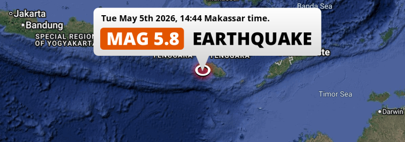
In the Indian Ocean 185 kilometer from Labuan Bajo, Indonesia, a shallow and significant MAG-5.8 earthquake occurred in the afternoon of Tuesday May 5th, 2026. Around 3 million people have been exposed to shaking.
Felt the earthquake? Share this article: 


Earthquake Summary
This earthquake hit under water in the Indian Ocean, 35 kilometers (22 mi) off the coast of Indonesia, 185 kilometer south of Labuan Bajo in East Nusa Tenggara. The center of this earthquake had a very shallow depth of 22 km. Shallow earthquakes usually have a larger impact than earthquakes deep in the earth.
| Date and Time: | May 5, 2026 14:44 (Makassar Time) - May 5, 2026 06:44 Universal Time. |
|---|---|
| Location: | 185 km south of Labuan Bajo, East Nusa Tenggara, Indonesia. Coordinates 10°3'50"S 119°19'30"E. |
| Map: | 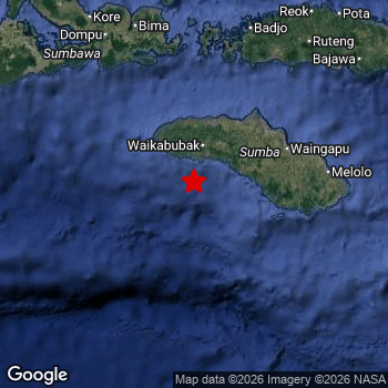 Map of area around epicenter. Click to open in Google Maps. |
| Magnitude: | MAG 5.8 Detected by 23 stations. Maximum Error Range ±0.065 . |
| Depth: | 22 km (14 mi) A very shallow depth. |
| Max. Intensity: | V
Moderate On the Modified Mercalli Scale. |
| Tsunami Risk: | Low tsunami risk Earthquakes under MAG-6.5 do not usually cause tsunami's. Always stay cautious - More info here. |
Minimal impact predicted
Based on scientific estimates by the US Geographic Survey (USGS), the risk of high fatalities for this earthquake is classified at level GREEN (low). They expect an 90% likelyhood of between 0 and 1 fatalities.
The USGS classifies the economic impact of this earthquake at level GREEN (low). They expect an 90% likelyhood of between 0 and 1 million US Dollars in economic damage and impact.
Roughly 3 million people exposed to shaking
This earthquake may have been felt by around 3 million people. That is the expected population size of the area exposed to a level of shaking of II or higher on the Modified Mercalli scale according to the USGS.
The highest earthquake impact level for this earthquake is IV, which corresponds with light shaking and likely no damage. Roughly 684,600 people are expected to be exposed to this level. Intensity level III was experienced by the majority of people (around 2.2 million). In their region, weak shaking and probably no damage can be expected. All exposure to shaking was within the borders of Indonesia .
| People | MMI Level | Shaking | Damage |
|---|---|---|---|
| 0 | I |
Not noticable | None |
| 171,000 | II |
Very weak | None |
| 2,188,000 | III |
Weak | Probably none |
| 684,600 | IV |
Light | Likely none |
| 0 | V |
Moderate | Very light |
| 0 | VI |
Strong | Light |
| 0 | VII |
Very Strong | Moderate |
| 0 | VIII |
Severe | Moderate to heavy |
| 0 | IX |
Violent | Heavy |
| 0 | X |
Extreme | Very heavy |
Nearby towns and cities
This earthquake may have been felt in Indonesia . The closest significant population center near the earthquake is Waingapu in East Nusa Tenggara, Indonesia. Waingapu is located 112 kilometer (70 mi) southwest of the epicenter. The intensity of shaking and damage in Waingapu is estimated to be around level IV on the Modified Mercalli Intensity scale (light shaking, likely no damage).
An overview of nearby towns and cities is available in the overview below. If places don't have intensity data available, it likely means the experienced impact in those places was fairly small.
Overview of nearby places
| Distance | Place | Intensity (MMI) |
|---|---|---|
| 112 km (70 mi) NE from epicenter |
Waingapu East Nusa Tenggara, Indonesia. |
IV
Light |
| 185 km (115 mi) N from epicenter |
Labuan Bajo East Nusa Tenggara, Indonesia. |
III
Weak |
| 190 km (118 mi) N from epicenter |
Bima West Nusa Tenggara, Indonesia. |
III
Weak |
| 194 km (121 mi) NW from epicenter |
Dompu West Nusa Tenggara, Indonesia. |
III
Weak |
| 204 km (127 mi) NE from epicenter |
Ruteng East Nusa Tenggara, Indonesia. |
III
Weak |
| 272 km (169 mi) NW from epicenter |
Sumbawa Besar West Nusa Tenggara, Indonesia. |
|
| 290 km (180 mi) NE from epicenter |
Ende East Nusa Tenggara, Indonesia. |
|
| 355 km (221 mi) NE from epicenter |
Maumere East Nusa Tenggara, Indonesia. |
|
| 368 km (229 mi) NW from epicenter |
Praya West Nusa Tenggara, Indonesia. |
|
| 389 km (242 mi) NW from epicenter |
Mataram West Nusa Tenggara, Indonesia. |
Earthquake Intensity Map
The intensity in shaking and damage by this earthquake is illustrated through the map below. The highest intensity measured for this earthquake is V.

49 Aftershocks detected
Since this main shock, 49 smaller aftershocks were detected. A 3.6 magnitude earthquake hit 19 mins later 10 km (6 mi) south of this earthquake.
In the days before this main shock, 9 smaller foreshocks were detected. A 4.4 magnitude earthquake hit 2 hrs earlier nearby.
Overview of foreshocks and aftershocks
| Classification | Magnitude | When | Where |
|---|---|---|---|
| Foreshock | M 2.7 |
2 days earlier May 3, 2026 05:51 (Makassar Time) | 96 km (60 mi) NW from Main Shock. |
| Foreshock | M 3.1 |
2 days earlier May 3, 2026 09:41 (Makassar Time) | 84 km (52 mi) N from Main Shock. |
| Foreshock | M 2.5 |
2 days earlier May 3, 2026 17:28 (Makassar Time) | 80 km (50 mi) NW from Main Shock. |
| Foreshock | M 2.7 |
1 day earlier May 4, 2026 05:42 (Makassar Time) | 62 km (38 mi) N from Main Shock. |
| Foreshock | M 2.6 |
3 hrs earlier May 5, 2026 11:39 (Makassar Time) | 24 km (15 mi) S from Main Shock. |
| Foreshock | M 2.5 |
2 hrs earlier May 5, 2026 12:35 (Makassar Time) | 73 km (45 mi) E from Main Shock. |
| Foreshock | M 4.4 |
2 hrs earlier May 5, 2026 12:57 (Makassar Time) | 39 km (24 mi) SW from Main Shock. |
| Foreshock | M 4.2 |
2 hrs earlier May 5, 2026 13:01 (Makassar Time) | 44 km (28 mi) SW from Main Shock. |
| Foreshock | M 3.7 |
2 hrs earlier May 5, 2026 13:01 (Makassar Time) | 5 km (3 mi) SW from Main Shock. |
| Main Shock This Earthquake |
M 5.8 |
May 5, 2026 14:44 (Makassar Time) | - |
| Aftershock | M 3.6 |
19 mins later May 5, 2026 15:03 (Makassar Time) | 10 km (6 mi) S from Main Shock. |
| Aftershock | M 3.1 |
25 mins later May 5, 2026 15:09 (Makassar Time) | 25 km (16 mi) S from Main Shock. |
| Aftershock | M 2.7 |
26 mins later May 5, 2026 15:11 (Makassar Time) | 19 km (12 mi) S from Main Shock. |
| Aftershock | M 3.1 |
28 mins later May 5, 2026 15:12 (Makassar Time) | 21 km (13 mi) S from Main Shock. |
| Aftershock | M 2.7 |
39 mins later May 5, 2026 15:24 (Makassar Time) | 34 km (21 mi) SW from Main Shock. |
| Aftershock | M 2.7 |
52 mins later May 5, 2026 15:36 (Makassar Time) | 32 km (20 mi) S from Main Shock. |
| Aftershock | M 2.8 |
1 hr later May 5, 2026 16:04 (Makassar Time) | 20 km (12 mi) S from Main Shock. |
| Aftershock | M 2.8 |
1 hr later May 5, 2026 16:13 (Makassar Time) | 22 km (14 mi) S from Main Shock. |
| Aftershock | M 2.7 |
2 hrs later May 5, 2026 16:31 (Makassar Time) | 23 km (15 mi) S from Main Shock. |
| Aftershock | M 2.9 |
2 hrs later May 5, 2026 16:38 (Makassar Time) | 13 km (8 mi) S from Main Shock. |
| Aftershock | M 3.2 |
2 hrs later May 5, 2026 16:49 (Makassar Time) | 18 km (11 mi) S from Main Shock. |
| Aftershock | M 2.5 |
3 hrs later May 5, 2026 17:30 (Makassar Time) | 10 km (6 mi) S from Main Shock. |
| Aftershock | M 3.1 |
3 hrs later May 5, 2026 17:37 (Makassar Time) | 19 km (11 mi) S from Main Shock. |
| Aftershock | M 2.7 |
4 hrs later May 5, 2026 18:22 (Makassar Time) | 29 km (18 mi) S from Main Shock. |
| Aftershock | M 2.6 |
5 hrs later May 5, 2026 19:58 (Makassar Time) | 28 km (17 mi) S from Main Shock. |
| Aftershock | M 2.5 |
5 hrs later May 5, 2026 20:14 (Makassar Time) | 17 km (11 mi) S from Main Shock. |
| Aftershock | M 2.6 |
6 hrs later May 5, 2026 21:11 (Makassar Time) | 40 km (25 mi) S from Main Shock. |
| Aftershock | M 2.7 |
6 hrs later May 5, 2026 21:12 (Makassar Time) | 48 km (30 mi) W from Main Shock. |
| Aftershock | M 3.0 |
7 hrs later May 5, 2026 21:45 (Makassar Time) | 23 km (14 mi) S from Main Shock. |
| Aftershock | M 2.5 |
7 hrs later May 5, 2026 22:09 (Makassar Time) | 32 km (20 mi) SW from Main Shock. |
| Aftershock | M 2.6 |
7 hrs later May 5, 2026 22:13 (Makassar Time) | 13 km (8 mi) S from Main Shock. |
| Aftershock | M 2.5 |
8 hrs later May 5, 2026 22:21 (Makassar Time) | 33 km (21 mi) S from Main Shock. |
| Aftershock | M 2.5 |
8 hrs later May 5, 2026 22:47 (Makassar Time) | 26 km (16 mi) S from Main Shock. |
| Aftershock | M 2.6 |
9 hrs later May 5, 2026 23:17 (Makassar Time) | 41 km (25 mi) S from Main Shock. |
| Aftershock | M 2.6 |
9 hrs later May 5, 2026 23:20 (Makassar Time) | 22 km (14 mi) S from Main Shock. |
| Aftershock | M 2.6 |
9 hrs later May 5, 2026 23:43 (Makassar Time) | 37 km (23 mi) S from Main Shock. |
| Aftershock | M 2.5 |
10 hrs later May 6, 2026 00:23 (Makassar Time) | 29 km (18 mi) S from Main Shock. |
| Aftershock | M 3.5 |
10 hrs later May 6, 2026 00:51 (Makassar Time) | 34 km (21 mi) SW from Main Shock. |
| Aftershock | M 2.5 |
10 hrs later May 6, 2026 01:11 (Makassar Time) | 21 km (13 mi) S from Main Shock. |
| Aftershock | M 2.5 |
11 hrs later May 6, 2026 01:17 (Makassar Time) | 26 km (16 mi) S from Main Shock. |
| Aftershock | M 2.5 |
12 hrs later May 6, 2026 02:58 (Makassar Time) | 27 km (17 mi) SW from Main Shock. |
| Aftershock | M 2.6 |
13 hrs later May 6, 2026 03:46 (Makassar Time) | 17 km (11 mi) S from Main Shock. |
| Aftershock | M 2.6 |
14 hrs later May 6, 2026 04:29 (Makassar Time) | 31 km (19 mi) S from Main Shock. |
| Aftershock | M 2.7 |
16 hrs later May 6, 2026 06:15 (Makassar Time) | 87 km (54 mi) N from Main Shock. |
| Aftershock | M 2.7 |
20 hrs later May 6, 2026 10:46 (Makassar Time) | 31 km (19 mi) S from Main Shock. |
| Aftershock | M 2.7 |
21 hrs later May 6, 2026 12:10 (Makassar Time) | 35 km (22 mi) S from Main Shock. |
| Aftershock | M 2.7 |
1 day later May 6, 2026 21:50 (Makassar Time) | 72 km (45 mi) W from Main Shock. |
| Aftershock | M 2.5 |
1 day later May 6, 2026 23:28 (Makassar Time) | 16 km (10 mi) SE from Main Shock. |
| Aftershock | M 2.5 |
2 days later May 7, 2026 03:35 (Makassar Time) | 21 km (13 mi) S from Main Shock. |
| Aftershock | M 3.3 |
2 days later May 7, 2026 10:34 (Makassar Time) | 17 km (11 mi) S from Main Shock. |
| Aftershock | M 2.8 |
2 days later May 7, 2026 11:32 (Makassar Time) | 15 km (10 mi) S from Main Shock. |
| Aftershock | M 2.6 |
2 days later May 7, 2026 12:54 (Makassar Time) | 30 km (19 mi) S from Main Shock. |
| Aftershock | M 2.8 |
2 days later May 7, 2026 13:19 (Makassar Time) | 41 km (26 mi) SW from Main Shock. |
| Aftershock | M 2.5 |
2 days later May 8, 2026 01:36 (Makassar Time) | 42 km (26 mi) S from Main Shock. |
| Aftershock | M 2.7 |
2 days later May 8, 2026 02:28 (Makassar Time) | 34 km (21 mi) NW from Main Shock. |
| Aftershock | M 2.6 |
3 days later May 8, 2026 07:54 (Makassar Time) | 21 km (13 mi) NE from Main Shock. |
| Aftershock | M 2.7 |
3 days later May 8, 2026 09:03 (Makassar Time) | 74 km (46 mi) NE from Main Shock. |
| Aftershock | M 2.8 |
3 days later May 8, 2026 09:50 (Makassar Time) | 9 km (6 mi) NE from Main Shock. |
| Aftershock | M 2.9 |
3 days later May 8, 2026 10:01 (Makassar Time) | 22 km (14 mi) S from Main Shock. |
More earthquakes coming?
Aftershocks are usually at least 1 order of magnitude less strong than main shocks. The more time passes, the smaller the chance and likely strength of any potential aftershocks.
It's always adviced to be cautious of the risk of a larger shock following any significant earthquake, however this risk is fairly small. There is a roughly 94 percent change that no larger main shock will follow in the days following this earthquake.
Read: How to Stay Safe during an Earthquake (cdc.gov).This is the strongest earthquake in 7 years
Earthquakes of this strength occur quite regularly in the region. This is the strongest earthquake to hit since January 22nd, 2019, when a 6.3 magnitude earthquake hit 52 km (32 mi) further southwest. That was also the heaviest earthquake to hit the region in the past 10 years.
In total, 5 earthquakes with a magnitude of 5.8 or higher have been registered within 300km (186 mi) of this epicenter in the past 10 years. This comes down to an average of once every 2 years.
Low tsunami risk
Based on early data it appears this earthquake was not strong enough (lower than MAG-6.5) to be likely to cause destructive tsunami's. However this earthquake appeared to have hit at a shallow depth under sea, so stay cautious and monitor advice from local authorities.
Tsunami Risk Factors
| Factor | Under Sea? | MAG-6.5 or stronger? | Shallow depth? |
|---|---|---|---|
| Explanation | Almost all tsunami's are caused by earthquakes with their epicenter under sea or very near the sea. However stay cautious in coastal areas as earthquakes on land may cause landslides into sea, potentially still causing a local tsunami. | Under MAG 6.5: Very unlikely to cause a tsunami. MAG 6.5 to 7.5: Destructive tsunami's do occur, but are uncommon. Likely to observe small sea level changes. MAG 7.6+: Earthquakes with these magnitudes might produce destructive tsunami's. |
Most destructive tsunami's are caused by shallow earthquakes with a depth between 0 and 100km under the surface of the earth. Deeper tsunami's are unlikely to displace to ocean floor. |
| This Earthquake | This earthquake appears to have struck under the sea. | Not this earthquake. This earthquake had a magnitude of 5.8. Earthquakes of this strength are unlikely to trigger a tsunami. |
This earthquake occurred at a depth of of 22 km (14 mi). Earthquakes this shallow could trigger a tsunami. |
Sources
Last updated 03/07/26 06:38 (). This article is automatically generated based on available data. We keep checking multiple sources for additional information. This article gets updated as new details on this earthquake become available.
- US Geographic Society (USGS): Earthquake us7000sicu
- European-Mediterranean Seismological Centre (EMSC): Earthquake 20260505_0000131
- Geonames.org: World Cities Database
- Google Maps: Static API
- Earthquakelist.org: Historic Earthquakes Database
Share this article:
