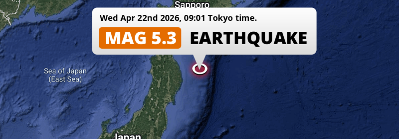
A significant MAG-5.3 aftershock struck in the North Pacific Ocean 157 kilometer from Hachinohe, Japan in the morning of Wednesday April 22nd, 2026.
Felt the earthquake? Share this article: 


Earthquake Summary
This earthquake hit under water in the North Pacific Ocean, 132 kilometers (82 mi) off the coast of Japan, 157 kilometer south-east of Hachinohe in Aomori. The center of this earthquake had a quite shallow depth of 35 km. Shallow earthquakes usually have a larger impact than earthquakes deep in the earth.
| Date and Time: | Apr 22, 2026 09:01 (Tokyo Time) - Apr 22, 2026 00:01 Universal Time. |
|---|---|
| Location: | 157 km SE of Hachinohe, Aomori, Japan. Coordinates 39°55'57"N 143°11'28"E. |
| Map: | 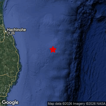 Map of area around epicenter. Click to open in Google Maps. |
| Magnitude: | MAG 5.3 Detected by 9 stations. Maximum Error Range ±0.103 . |
| Depth: | 35 km (22 mi) A quite shallow depth. |
| Tsunami Risk: | Low tsunami risk Earthquakes under MAG-6.5 do not usually cause tsunami's. Always stay cautious - More info here. |
Nearby towns and cities
This earthquake may have been felt in Japan . The closest significant population center near the earthquake is Miyako in Iwate, Japan. Miyako is located 111 kilometer (69 mi) east of the epicenter.
Major cities near this earthquake: Sendai is located 273 km to the southwest. Morioka is located 176 km to the west. Hachinohe is located 157 km to the northwest.
A complete list of nearby places is included below.
Overview of nearby places
| Distance | Place |
|---|---|
| 111 km (69 mi) W from epicenter |
Miyako Iwate, Japan. |
| 118 km (73 mi) SW from epicenter |
Yamada Iwate, Japan. |
| 135 km (84 mi) SW from epicenter |
Kamaishi Iwate, Japan. |
| 157 km (98 mi) NW from epicenter |
Hachinohe Aomori, Japan. |
| 158 km (98 mi) SW from epicenter |
Tōno Iwate, Japan. |
| 159 km (99 mi) SW from epicenter |
Ōfunato Iwate, Japan. |
| 174 km (108 mi) NW from epicenter |
Misawa Aomori, Japan. |
| 176 km (109 mi) W from epicenter |
Morioka Iwate, Japan. |
| 188 km (117 mi) W from epicenter |
Hanamaki Iwate, Japan. |
| 190 km (118 mi) W from epicenter |
Shizukuishi Iwate, Japan. |
| 192 km (119 mi) SW from epicenter |
Kitakami Iwate, Japan. |
| 196 km (122 mi) SW from epicenter |
Kanegasaki Iwate, Japan. |
| 198 km (123 mi) SW from epicenter |
Mizusawa Iwate, Japan. |
| 206 km (128 mi) W from epicenter |
Hanawa Akita, Japan. |
| 210 km (130 mi) SW from epicenter |
Ichinoseki Iwate, Japan. |
| 225 km (140 mi) NW from epicenter |
Mutsu Aomori, Japan. |
| 227 km (141 mi) W from epicenter |
Ōdate Akita, Japan. |
| 230 km (143 mi) NW from epicenter |
Aomori Aomori, Japan. |
| 234 km (145 mi) SW from epicenter |
Ishinomaki Miyagi, Japan. |
| 235 km (146 mi) SW from epicenter |
Wakuya Miyagi, Japan. |
| 235 km (146 mi) W from epicenter |
Kuroishi Aomori, Japan. |
| 236 km (147 mi) W from epicenter |
Yokote Akita, Japan. |
| 237 km (147 mi) W from epicenter |
Namioka Aomori, Japan. |
| 238 km (148 mi) W from epicenter |
Ōmagari Akita, Japan. |
| 239 km (149 mi) SW from epicenter |
Yamoto Miyagi, Japan. |
| 240 km (149 mi) SW from epicenter |
Kogota Miyagi, Japan. |
| 242 km (150 mi) W from epicenter |
Hirosaki Aomori, Japan. |
| 243 km (151 mi) W from epicenter |
Takanosu Akita, Japan. |
| 245 km (152 mi) SW from epicenter |
Furukawa Miyagi, Japan. |
| 246 km (153 mi) W from epicenter |
Yuzawa Akita, Japan. |
| 252 km (157 mi) W from epicenter |
Goshogawara Aomori, Japan. |
| 253 km (157 mi) SW from epicenter |
Matsushima Miyagi, Japan. |
| 258 km (160 mi) W from epicenter |
Shimokizukuri Aomori, Japan. |
| 259 km (161 mi) SW from epicenter |
Shiogama Miyagi, Japan. |
| 261 km (162 mi) SW from epicenter |
Rifu Miyagi, Japan. |
| 262 km (163 mi) SW from epicenter |
Tomiya Miyagi, Japan. |
| 264 km (164 mi) W from epicenter |
Akita Akita, Japan. |
| 271 km (168 mi) W from epicenter |
Noshiro Akita, Japan. |
| 273 km (170 mi) SW from epicenter |
Sendai Miyagi, Japan. |
| 275 km (171 mi) W from epicenter |
Tennō Akita, Japan. |
| 276 km (171 mi) N from epicenter |
Shizunai-furukawachō Hokkaido, Japan. |
| 281 km (175 mi) SW from epicenter |
Shinjō Yamagata, Japan. |
| 282 km (175 mi) SW from epicenter |
Obanazawa Yamagata, Japan. |
| 286 km (178 mi) SW from epicenter |
Iwanuma Miyagi, Japan. |
| 291 km (181 mi) NW from epicenter |
Hakodate Hokkaido, Japan. |
| 292 km (181 mi) SW from epicenter |
Higashine Yamagata, Japan. |
| 292 km (181 mi) SW from epicenter |
Watari Miyagi, Japan. |
| 298 km (185 mi) SW from epicenter |
Ōkawara Miyagi, Japan. |
| 300 km (186 mi) NW from epicenter |
Kamiiso Hokkaido, Japan. |
Shaking reported by 1 person
People that feel an earthquake may report their experience to the US Geographic Survey. Currently, 1 person has reported shaking in one place in Japan.We keep updating this article as more ground reports become available. You may report that you felt this earthquake here.
Places with most reports:
- Misawa, Aomori, Japan: 1 person.
This is likely an aftershock
This earthquake is likely an aftershock of the MAG-7.4 earthquake that struck 2 days earlier. That main earthquake hit 13 km (8 mi) west of the epicenter of this MAG-5.3 aftershock.
Overview of foreshocks and aftershocks
| Classification | Magnitude | When | Where |
|---|---|---|---|
| Main Shock | M 7.4 |
Apr 20, 2026 16:53 (Tokyo Time) | - |
| Aftershock | M 5.3 |
10 mins later Apr 20, 2026 17:03 (Tokyo Time) | 75 km (47 mi) NE from Main Shock. |
| Aftershock | M 5.2 |
16 mins later Apr 20, 2026 17:08 (Tokyo Time) | 29 km (18 mi) E from Main Shock. |
| Aftershock | M 4.9 |
22 mins later Apr 20, 2026 17:14 (Tokyo Time) | 64 km (39 mi) SE from Main Shock. |
| Aftershock | M 5.0 |
31 mins later Apr 20, 2026 17:23 (Tokyo Time) | 21 km (13 mi) SW from Main Shock. |
| Aftershock | M 4.7 |
37 mins later Apr 20, 2026 17:30 (Tokyo Time) | 7 km (5 mi) S from Main Shock. |
| Aftershock | M 5.6 |
40 mins later Apr 20, 2026 17:32 (Tokyo Time) | 39 km (24 mi) SE from Main Shock. |
| Aftershock | M 4.3 |
1 hr later Apr 20, 2026 18:07 (Tokyo Time) | 28 km (17 mi) SE from Main Shock. |
| Aftershock | M 4.2 |
2 hrs later Apr 20, 2026 18:26 (Tokyo Time) | 20 km (13 mi) S from Main Shock. |
| Aftershock | M 5.1 |
2 hrs later Apr 20, 2026 18:49 (Tokyo Time) | 30 km (19 mi) E from Main Shock. |
| Aftershock | M 4.4 |
2 hrs later Apr 20, 2026 19:00 (Tokyo Time) | 17 km (11 mi) SE from Main Shock. |
| Aftershock | M 4.4 |
2 hrs later Apr 20, 2026 19:02 (Tokyo Time) | 36 km (22 mi) SE from Main Shock. |
| Aftershock | M 4.1 |
2 hrs later Apr 20, 2026 19:20 (Tokyo Time) | 51 km (32 mi) SE from Main Shock. |
| Aftershock | M 4.1 |
3 hrs later Apr 20, 2026 19:30 (Tokyo Time) | 22 km (14 mi) NW from Main Shock. |
| Aftershock | M 4.4 |
3 hrs later Apr 20, 2026 19:37 (Tokyo Time) | 56 km (35 mi) SE from Main Shock. |
| Aftershock | M 5.1 |
3 hrs later Apr 20, 2026 19:44 (Tokyo Time) | 68 km (42 mi) SE from Main Shock. |
| Aftershock | M 4.2 |
3 hrs later Apr 20, 2026 19:53 (Tokyo Time) | 52 km (32 mi) S from Main Shock. |
| Aftershock | M 4.5 |
4 hrs later Apr 20, 2026 20:28 (Tokyo Time) | 32 km (20 mi) S from Main Shock. |
| Aftershock | M 4.2 |
5 hrs later Apr 20, 2026 21:44 (Tokyo Time) | 43 km (27 mi) S from Main Shock. |
| Aftershock | M 5.1 |
5 hrs later Apr 20, 2026 21:56 (Tokyo Time) | 51 km (32 mi) SE from Main Shock. |
| Aftershock | M 4.4 |
5 hrs later Apr 20, 2026 22:03 (Tokyo Time) | 43 km (27 mi) SE from Main Shock. |
| Aftershock | M 4.7 |
6 hrs later Apr 20, 2026 23:15 (Tokyo Time) | 24 km (15 mi) SE from Main Shock. |
| Aftershock | M 4.5 |
8 hrs later Apr 21, 2026 01:13 (Tokyo Time) | 74 km (46 mi) SE from Main Shock. |
| Aftershock | M 4.4 |
8 hrs later Apr 21, 2026 01:15 (Tokyo Time) | 51 km (32 mi) E from Main Shock. |
| Aftershock | M 4.2 |
13 hrs later Apr 21, 2026 06:13 (Tokyo Time) | 38 km (24 mi) W from Main Shock. |
| Aftershock | M 4.2 |
14 hrs later Apr 21, 2026 06:50 (Tokyo Time) | 1.2 km (0.7 mi) NE from Main Shock. |
| Aftershock | M 4.1 |
14 hrs later Apr 21, 2026 07:06 (Tokyo Time) | 62 km (39 mi) SE from Main Shock. |
| Aftershock | M 4.1 |
16 hrs later Apr 21, 2026 08:36 (Tokyo Time) | 61 km (38 mi) S from Main Shock. |
| Aftershock | M 4.1 |
17 hrs later Apr 21, 2026 09:54 (Tokyo Time) | 20 km (13 mi) E from Main Shock. |
| Aftershock | M 4.2 |
18 hrs later Apr 21, 2026 10:44 (Tokyo Time) | 37 km (23 mi) SE from Main Shock. |
| Aftershock | M 4.8 |
19 hrs later Apr 21, 2026 11:35 (Tokyo Time) | 15 km (9 mi) SE from Main Shock. |
| Aftershock | M 4.7 |
21 hrs later Apr 21, 2026 14:19 (Tokyo Time) | 56 km (35 mi) E from Main Shock. |
| Aftershock | M 4.4 |
22 hrs later Apr 21, 2026 14:23 (Tokyo Time) | 47 km (29 mi) E from Main Shock. |
| Aftershock | M 4.4 |
22 hrs later Apr 21, 2026 14:26 (Tokyo Time) | 51 km (32 mi) SE from Main Shock. |
| Aftershock | M 5.3 |
22 hrs later Apr 21, 2026 14:29 (Tokyo Time) | 44 km (27 mi) E from Main Shock. |
| Aftershock | M 4.1 |
1 day later Apr 21, 2026 22:01 (Tokyo Time) | 30 km (19 mi) SE from Main Shock. |
| Aftershock | M 4.4 |
1 day later Apr 22, 2026 01:18 (Tokyo Time) | 71 km (44 mi) W from Main Shock. |
| Aftershock | M 4.5 |
1 day later Apr 22, 2026 03:42 (Tokyo Time) | 32 km (20 mi) NE from Main Shock. |
| Aftershock | M 5.5 |
1 day later Apr 22, 2026 03:44 (Tokyo Time) | 27 km (17 mi) NE from Main Shock. |
| Aftershock | M 4.4 |
1 day later Apr 22, 2026 03:52 (Tokyo Time) | 33 km (21 mi) NE from Main Shock. |
| Aftershock This Earthquake |
M 5.3 |
2 days later Apr 22, 2026 09:01 (Tokyo Time) | 13 km (8 mi) E from Main Shock. |
| Aftershock | M 4.2 |
2 days later Apr 22, 2026 11:11 (Tokyo Time) | 52 km (32 mi) SE from Main Shock. |
| Aftershock | M 4.2 |
2 days later Apr 22, 2026 18:49 (Tokyo Time) | 1.7 km (1.1 mi) E from Main Shock. |
| Aftershock | M 4.5 |
2 days later Apr 22, 2026 21:06 (Tokyo Time) | 75 km (47 mi) NW from Main Shock. |
| Aftershock | M 5.0 |
2 days later Apr 22, 2026 21:18 (Tokyo Time) | 11 km (7 mi) NW from Main Shock. |
| Aftershock | M 4.9 |
2 days later Apr 22, 2026 22:35 (Tokyo Time) | 33 km (21 mi) S from Main Shock. |
| Aftershock | M 4.6 |
2 days later Apr 22, 2026 23:26 (Tokyo Time) | 1.3 km (0.8 mi) S from Main Shock. |
| Aftershock | M 4.5 |
2 days later Apr 23, 2026 02:46 (Tokyo Time) | 62 km (38 mi) W from Main Shock. |
| Aftershock | M 4.9 |
3 days later Apr 23, 2026 09:07 (Tokyo Time) | 39 km (24 mi) SE from Main Shock. |
| Aftershock | M 4.4 |
3 days later Apr 23, 2026 15:41 (Tokyo Time) | 45 km (28 mi) W from Main Shock. |
| Aftershock | M 4.2 |
3 days later Apr 23, 2026 16:20 (Tokyo Time) | 58 km (36 mi) SE from Main Shock. |
| Aftershock | M 3.9 |
3 days later Apr 23, 2026 18:40 (Tokyo Time) | 57 km (36 mi) W from Main Shock. |
| Aftershock | M 4.3 |
3 days later Apr 24, 2026 01:56 (Tokyo Time) | 18 km (11 mi) SE from Main Shock. |
| Aftershock | M 4.4 |
4 days later Apr 24, 2026 07:18 (Tokyo Time) | 31 km (19 mi) NE from Main Shock. |
| Aftershock | M 5.0 |
4 days later Apr 24, 2026 14:13 (Tokyo Time) | 24 km (15 mi) NW from Main Shock. |
| Aftershock | M 3.5 |
4 days later Apr 24, 2026 23:33 (Tokyo Time) | 55 km (34 mi) W from Main Shock. |
More earthquakes coming?
The risk of aftershocks decreases rapidly over time. Usually, aftershocks are at least one order of magnitude lower than a main shock.
In only six percent of cases, significant earthquakes are followed by a larger main shock, making the current earthquake a foreshock. While the chance of this happening is not so large, it is adviced to maintain cautiousness in the hours and days following a major earthquake.
Read: How to Stay Safe during an Earthquake (cdc.gov).Earthquakes like this happen often in the region
Earthquakes of this strength are very common in the region. In total, 114 earthquakes with a magnitude of 5.3 or higher have been registered within 300km (186 mi) of this epicenter in the past 10 years. This comes down to an average of once every month.
Low tsunami risk
Based on early data it appears this earthquake was not strong enough (lower than MAG-6.5) to be likely to cause destructive tsunami's. However this earthquake appeared to have hit at a shallow depth under sea, so stay cautious and monitor advice from local authorities.
Tsunami Risk Factors
| Factor | Under Sea? | MAG-6.5 or stronger? | Shallow depth? |
|---|---|---|---|
| Explanation | Almost all tsunami's are caused by earthquakes with their epicenter under sea or very near the sea. However stay cautious in coastal areas as earthquakes on land may cause landslides into sea, potentially still causing a local tsunami. | Under MAG 6.5: Very unlikely to cause a tsunami. MAG 6.5 to 7.5: Destructive tsunami's do occur, but are uncommon. Likely to observe small sea level changes. MAG 7.6+: Earthquakes with these magnitudes might produce destructive tsunami's. |
Most destructive tsunami's are caused by shallow earthquakes with a depth between 0 and 100km under the surface of the earth. Deeper tsunami's are unlikely to displace to ocean floor. |
| This Earthquake | This earthquake appears to have struck under the sea. | Not this earthquake. This earthquake had a magnitude of 5.3. Earthquakes of this strength are unlikely to trigger a tsunami. |
This earthquake occurred at a depth of of 35 km (22 mi). Earthquakes this shallow could trigger a tsunami. |
Sources
Last updated 13/05/26 01:58 (). This article is automatically generated based on available data. We keep checking multiple sources for additional information. This article gets updated as new details on this earthquake become available.
- US Geographic Society (USGS): Earthquake us6000srxu
- European-Mediterranean Seismological Centre (EMSC): Earthquake 20260422_0000004
- Geonames.org: World Cities Database
- Google Maps: Static API
- Earthquakelist.org: Historic Earthquakes Database
Share this article:
