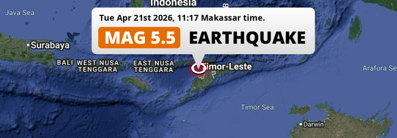
A significant MAG-5.5 earthquake struck in the Sawu Sea 173 kilometer from Dili, Timor-Leste in the morning of Tuesday April 21st, 2026. Shaking may have been felt by a total of 4.2 million people. Another nearby country is Indonesia.
Felt the earthquake? Share this article: 


Earthquake Summary
This earthquake hit under water in the Sawu Sea, 24 kilometers (15 mi) off the coast of Timor-Leste, 173 kilometer west of Dili in Díli. The center of this earthquake had an intermediate depth of 77 km.
| Date and Time: | Apr 21, 2026 11:17 (Makassar Time) - Apr 21, 2026 03:17 Universal Time. |
|---|---|
| Location: | 60 km NW of Kefamenanu, East Nusa Tenggara, Indonesia. Coordinates 9°4'5"S 124°5'11"E. |
| Map: | 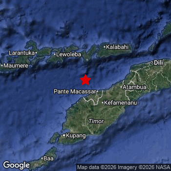 Map of area around epicenter. Click to open in Google Maps. |
| Magnitude: | MAG 5.5 Detected by 16 stations. Maximum Error Range ±0.078 . |
| Depth: | 77 km (48 mi) An intermediate depth. |
| Max. Intensity: | V
Moderate On the Modified Mercalli Scale. |
| Tsunami Risk: | Low tsunami risk Earthquakes under MAG-6.5 do not usually cause tsunami's. Always stay cautious - More info here. |
Minimal impact predicted
Based on scientific estimates by the US Geographic Survey (USGS), the risk of high fatalities for this earthquake is classified at level GREEN (low). They expect an 90% likelyhood of between 0 and 1 fatalities.
The USGS classifies the economic impact of this earthquake at level GREEN (low). They expect an 90% likelyhood of between 0 and 1 million US Dollars in economic damage and impact.
Roughly 4.2 million people exposed to shaking
This earthquake may have been felt by around 4.2 million people. That is the expected population size of the area exposed to a level of shaking of II or higher on the Modified Mercalli scale according to the USGS.
Light shaking and likely no damage may have been experienced by an estimated 1,076,000 people. At IV, it is the highest MMI level this earthquake has caused. The majority of people (roughly 3.1 million) live in an area exposed to level III, where weak shaking and probably no damage is expected.
People in 2 countries have been exposed to shaking. Roughly 3 million people were exposed to shaking in Indonesia , with level IV (light shaking, likely no damage) as the highest recorded. In Timor-Leste , around 1.2 million people.
| People | MMI Level | Shaking | Damage |
|---|---|---|---|
| 0 | I |
Not noticable | None |
| 5,070 | II |
Very weak | None |
| 3,096,000 | III |
Weak | Probably none |
| 1,076,000 | IV |
Light | Likely none |
| 0 | V |
Moderate | Very light |
| 0 | VI |
Strong | Light |
| 0 | VII |
Very Strong | Moderate |
| 0 | VIII |
Severe | Moderate to heavy |
| 0 | IX |
Violent | Heavy |
| 0 | X |
Extreme | Very heavy |
Nearby towns and cities
2 countries can be found within 300km of the epicenter of this earthquake: Indonesia and Timor-Leste .
Located 60 kilometer (37 mi) northwest of the epicenter of this earthquake, Kefamenanu (East Nusa Tenggara, Indonesia) is the nearest significant population center. Kefamenanu experienced an earthquake intensity (MMI Scale) of roughly IV. That level implies light shaking and likely no damage.
The table below provides an overview of all places in proximity of today's earthquake. Where available, the estimated intensity on the Modified Mercalli Intensity Scale in each place is included. Places where this information is omitted likely experienced little impact.
Overview of nearby places
| Distance | Place | Intensity (MMI) |
|---|---|---|
| 60 km (37 mi) SE from epicenter |
Kefamenanu East Nusa Tenggara, Indonesia. |
IV
Light |
| 89 km (55 mi) E from epicenter |
Atambua East Nusa Tenggara, Indonesia. |
IV
Light |
| 91 km (57 mi) S from epicenter |
Soe East Nusa Tenggara, Indonesia. |
IV
Light |
| 125 km (78 mi) E from epicenter |
Maliana Bobonaro, Timor-Leste. |
III
Weak |
| 131 km (81 mi) E from epicenter |
Suai Cova Lima, Timor-Leste. |
III
Weak |
| 133 km (83 mi) SW from epicenter |
Kupang East Nusa Tenggara, Indonesia. |
III
Weak |
| 133 km (83 mi) NE from epicenter |
Maubara Liquiçá, Timor-Leste. |
III
Weak |
| 148 km (92 mi) E from epicenter |
Likisá Liquiçá, Timor-Leste. |
III
Weak |
| 167 km (104 mi) E from epicenter |
Aileu Aileu, Timor-Leste. |
III
Weak |
| 173 km (107 mi) E from epicenter |
Dili Díli, Timor-Leste. |
III
Weak |
| 212 km (132 mi) W from epicenter |
Maumere East Nusa Tenggara, Indonesia. |
|
| 256 km (159 mi) E from epicenter |
Venilale Baucau, Timor-Leste. |
|
| 267 km (166 mi) W from epicenter |
Ende East Nusa Tenggara, Indonesia. |
|
| 269 km (167 mi) E from epicenter |
Baukau Baucau, Timor-Leste. |
Earthquake Intensity Map
The intensity in shaking and damage by this earthquake is illustrated through the map below. The highest intensity measured for this earthquake is IV.

Shaking reported by 2 people in 2 countries
People that feel an earthquake may report their experience to the US Geographic Survey. Currently, 2 people have reported shaking in 2 places in 2 countries (East Timor, Indonesia).We keep updating this article as more ground reports become available. You may report that you felt this earthquake here.
Places with most reports:
- Dili, Dili, East Timor: 1 person.
- Kupang, Nusa Tenggara Timur, Indonesia: 1 person.
11 Aftershocks detected
This main shock was followed by 11 smaller aftershocks. At a distance of 10 km (6 mi) south-east of this earthquake, an aftershock struck 2 mins later. It measured a magnitude of 4.4
This main shock was prefaced by 4 smaller foreshocks. Nearby this earthquake a foreshock struck 6 hrs earlier. It measured a magnitude of 2.6
Overview of foreshocks and aftershocks
| Classification | Magnitude | When | Where |
|---|---|---|---|
| Foreshock | M 2.6 |
2 days earlier Apr 19, 2026 07:49 (Makassar Time) | 17 km (11 mi) N from Main Shock. |
| Foreshock | M 2.6 |
1 day earlier Apr 20, 2026 05:20 (Makassar Time) | 31 km (19 mi) W from Main Shock. |
| Foreshock | M 2.5 |
22 hrs earlier Apr 20, 2026 12:50 (Makassar Time) | 43 km (27 mi) NE from Main Shock. |
| Foreshock | M 2.6 |
6 hrs earlier Apr 21, 2026 05:16 (Makassar Time) | 23 km (14 mi) N from Main Shock. |
| Main Shock This Earthquake |
M 5.5 |
Apr 21, 2026 11:17 (Makassar Time) | - |
| Aftershock | M 4.4 |
2 mins later Apr 21, 2026 11:19 (Makassar Time) | 10 km (6 mi) SE from Main Shock. |
| Aftershock | M 3.1 |
5 mins later Apr 21, 2026 11:22 (Makassar Time) | 28 km (17 mi) SE from Main Shock. |
| Aftershock | M 2.8 |
8 mins later Apr 21, 2026 11:24 (Makassar Time) | 13 km (8 mi) E from Main Shock. |
| Aftershock | M 2.7 |
9 mins later Apr 21, 2026 11:25 (Makassar Time) | 13 km (8 mi) SE from Main Shock. |
| Aftershock | M 3.2 |
11 mins later Apr 21, 2026 11:28 (Makassar Time) | 10 km (6 mi) E from Main Shock. |
| Aftershock | M 2.5 |
31 mins later Apr 21, 2026 11:48 (Makassar Time) | 12 km (7 mi) E from Main Shock. |
| Aftershock | M 3.2 |
2 hrs later Apr 21, 2026 12:56 (Makassar Time) | 7 km (4 mi) E from Main Shock. |
| Aftershock | M 2.5 |
6 hrs later Apr 21, 2026 16:53 (Makassar Time) | 19 km (12 mi) NE from Main Shock. |
| Aftershock | M 2.5 |
7 hrs later Apr 21, 2026 18:32 (Makassar Time) | 86 km (53 mi) W from Main Shock. |
| Aftershock | M 2.6 |
19 hrs later Apr 22, 2026 06:46 (Makassar Time) | 9 km (6 mi) E from Main Shock. |
| Aftershock | M 2.5 |
2 days later Apr 23, 2026 09:42 (Makassar Time) | 30 km (19 mi) W from Main Shock. |
More earthquakes coming?
Aftershocks are usually at least 1 order of magnitude less strong than main shocks. The more time passes, the smaller the chance and likely strength of any potential aftershocks.
It's always adviced to be cautious of the risk of a larger shock following any significant earthquake, however this risk is fairly small. There is a roughly 94 percent change that no larger main shock will follow in the days following this earthquake.
Read: How to Stay Safe during an Earthquake (cdc.gov).Earthquakes like this happen often in the region
Earthquakes of this strength are very common in the region. This is the strongest earthquake to hit since October 26th, 2025, when a 6.2 magnitude earthquake hit 26 km (16 mi) further northwest. An even stronger magnitude 7.3 earthquake struck on December 14th, 2021.
In total, 22 earthquakes with a magnitude of 5.5 or higher have been registered within 300km (186 mi) of this epicenter in the past 10 years. This comes down to an average of once every 6 months.
Low tsunami risk
Based on early data it appears this earthquake was not strong enough (lower than MAG-6.5) to be likely to cause destructive tsunami's. However this earthquake appeared to have hit at a shallow depth under sea, so stay cautious and monitor advice from local authorities.
Tsunami Risk Factors
| Factor | Under Sea? | MAG-6.5 or stronger? | Shallow depth? |
|---|---|---|---|
| Explanation | Almost all tsunami's are caused by earthquakes with their epicenter under sea or very near the sea. However stay cautious in coastal areas as earthquakes on land may cause landslides into sea, potentially still causing a local tsunami. | Under MAG 6.5: Very unlikely to cause a tsunami. MAG 6.5 to 7.5: Destructive tsunami's do occur, but are uncommon. Likely to observe small sea level changes. MAG 7.6+: Earthquakes with these magnitudes might produce destructive tsunami's. |
Most destructive tsunami's are caused by shallow earthquakes with a depth between 0 and 100km under the surface of the earth. Deeper tsunami's are unlikely to displace to ocean floor. |
| This Earthquake | This earthquake appears to have struck under the sea. | Not this earthquake. This earthquake had a magnitude of 5.5. Earthquakes of this strength are unlikely to trigger a tsunami. |
This earthquake occurred at a depth of of 77 km (48 mi). Earthquakes this shallow could trigger a tsunami. |
Sources
Last updated 11/05/26 05:48 (). This article contains currently available information about the earthquake and is automatically composed. We continue to update this article up to a few days after the earthquake occurred.
- US Geographic Society (USGS): Earthquake us6000srrc
- European-Mediterranean Seismological Centre (EMSC): Earthquake 20260421_0000048
- Geonames.org: World Cities Database
- Google Maps: Static API
- Earthquakelist.org: Historic Earthquakes Database
Share this article:
