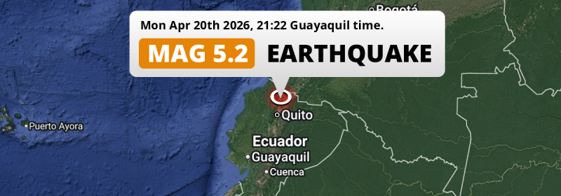
A significant MAG-5.2 earthquake struck under land 22 kilometer from Ibarra in Ecuador in the evening of Monday April 20th, 2026. Around 10 million people have been exposed to shaking. Another country near the epicenter is Colombia.
Felt the earthquake? Share this article: 


Earthquake Summary
The earthquake struck on land in Ecuador, 22 kilometer (14 mi) west of Ibarra in Imbabura. The center of this earthquake had an intermediate depth of 129 km.
| Date and Time: | Apr 20, 2026 21:22 (Guayaquil Time) - Apr 21, 2026 02:22 Universal Time. |
|---|---|
| Location: | 22 km west of Ibarra, Imbabura, Ecuador. Coordinates 0°20'11"N 78°19'24"W. |
| Map: | 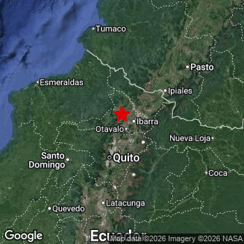 Map of area around epicenter. Click to open in Google Maps. |
| Magnitude: | MAG 5.2 Detected by 47 stations. Maximum Error Range ±0.045 . |
| Depth: | 129 km (80 mi) An intermediate depth. |
| Max. Intensity: | IV
Light On the Modified Mercalli Scale. |
| Tsunami Risk: | Tsunami very unlikely Tsunami's are usually caused by MAG-6.5+ earthquakes, less than 100km shallow, and with an epicenter under sea. Neither of this seems to be the case. Always stay cautious - More info here. |
Minimal impact predicted
Based on scientific estimates by the US Geographic Survey (USGS), the risk of high fatalities for this earthquake is classified at level GREEN (low). They expect an 90% likelyhood of between 0 and 1 fatalities.
The USGS classifies the economic impact of this earthquake at level GREEN (low). They expect an 90% likelyhood of between 0 and 1 million US Dollars in economic damage and impact.
Roughly 10 million people exposed to shaking
The USGS has published a report estimating the number of people exposed to this earthquake. Acoording to their analysis, roughly 10 million have been exposed to shaking at an MMI level of II or higher.
The highest earthquake impact level for this earthquake is IV, which corresponds with light shaking and likely no damage. Roughly 8,420 people are expected to be exposed to this level. Intensity level III was experienced by the majority of people (around 9 million). In their region, weak shaking and probably no damage can be expected.
People in 2 countries have been exposed to shaking. In Ecuador , around 8 million people, with impact levels up to IV (light shaking, likely no damage). In Colombia , around 2.1 million people.
| People | MMI Level | Shaking | Damage |
|---|---|---|---|
| 0 | I |
Not noticable | None |
| 1,391,000 | II |
Very weak | None |
| 8,983,000 | III |
Weak | Probably none |
| 8,420 | IV |
Light | Likely none |
| 0 | V |
Moderate | Very light |
| 0 | VI |
Strong | Light |
| 0 | VII |
Very Strong | Moderate |
| 0 | VIII |
Severe | Moderate to heavy |
| 0 | IX |
Violent | Heavy |
| 0 | X |
Extreme | Very heavy |
Nearby towns and cities
This earthquake struck within proximity of multiple countries. Ecuador and Colombia are both within 300km distance of its epicenter.
Atuntaqui in Imbabura, Ecuador is the nearest significant place from the epicenter. The earthquake occurred 12 kilometer (7 mi) west of Atuntaqui. The intensity of shaking and damage in Atuntaqui is estimated to be around level III on the Modified Mercalli Intensity scale (weak shaking, probably no damage).
Major cities near this earthquake: Quito is located 67 km to the south and experienced an intensity of III (weak shaking, probably no damage). Ibarra is located 22 km to the east and experienced an intensity of IV (light shaking, likely no damage). Pasto is located 151 km to the north-east and experienced an intensity of III (weak shaking, probably no damage).
A complete list of nearby places is included below. Estimated intensity data (MMI) sourced from a shake-map published by the US Geographic Survey is shown where available (cities without data probably experienced little impact).
Overview of nearby places
| Distance | Place | Intensity (MMI) |
|---|---|---|
| 12 km (7 mi) E from epicenter |
Atuntaqui Imbabura, Ecuador. |
III
Weak |
| 13 km (8 mi) SE from epicenter |
Otavalo Imbabura, Ecuador. |
III
Weak |
| 22 km (14 mi) E from epicenter |
Ibarra Imbabura, Ecuador. |
IV
Light |
| 38 km (24 mi) SE from epicenter |
Cayambe Pichincha, Ecuador. |
III
Weak |
| 67 km (42 mi) S from epicenter |
Quito Pichincha, Ecuador. |
III
Weak |
| 86 km (53 mi) NE from epicenter |
Tulcán Carchi, Ecuador. |
III
Weak |
| 93 km (58 mi) NE from epicenter |
Ipiales Nariño, Colombia. |
III
Weak |
| 98 km (61 mi) S from epicenter |
Machachi Pichincha, Ecuador. |
III
Weak |
| 114 km (71 mi) NE from epicenter |
Túquerres Nariño, Colombia. |
III
Weak |
| 115 km (71 mi) SW from epicenter |
Santo Domingo de los Colorados Santo Domingo de los Tsáchilas, Ecuador. |
III
Weak |
| 120 km (75 mi) NW from epicenter |
San Lorenzo de Esmeraldas Esmeraldas, Ecuador. |
III
Weak |
| 128 km (80 mi) W from epicenter |
Rosa Zarate Esmeraldas, Ecuador. |
III
Weak |
| 145 km (90 mi) S from epicenter |
Latacunga Cotopaxi, Ecuador. |
III
Weak |
| 150 km (93 mi) S from epicenter |
Pujilí Cotopaxi, Ecuador. |
III
Weak |
| 151 km (94 mi) NE from epicenter |
Pasto Nariño, Colombia. |
III
Weak |
| 158 km (98 mi) S from epicenter |
Tena Napo, Ecuador. |
III
Weak |
| 161 km (100 mi) E from epicenter |
Nueva Loja Sucumbios, Ecuador. |
III
Weak |
| 163 km (101 mi) NW from epicenter |
Esmeraldas Esmeraldas, Ecuador. |
III
Weak |
| 170 km (106 mi) N from epicenter |
Tumaco Nariño, Colombia. |
III
Weak |
| 173 km (107 mi) SE from epicenter |
Puerto Francisco de Orellana Orellana, Ecuador. |
III
Weak |
| 174 km (108 mi) SW from epicenter |
La Maná Cotopaxi, Ecuador. |
III
Weak |
| 175 km (109 mi) SE from epicenter |
Boca Suno Orellana, Ecuador. |
III
Weak |
| 179 km (111 mi) S from epicenter |
Ambato Tungurahua, Ecuador. |
II
Weak |
| 187 km (116 mi) S from epicenter |
Pelileo Tungurahua, Ecuador. |
II
Weak |
| 193 km (120 mi) NE from epicenter |
La Unión Nariño, Colombia. |
III
Weak |
| 198 km (123 mi) SW from epicenter |
Quevedo Los Ríos, Ecuador. |
III
Weak |
| 204 km (127 mi) E from epicenter |
Puerto Asís Putumayo, Colombia. |
|
| 206 km (128 mi) S from epicenter |
Puyo Pastaza, Ecuador. |
|
| 207 km (129 mi) NE from epicenter |
Mocoa Putumayo, Colombia. |
II
Weak |
| 212 km (132 mi) SW from epicenter |
Velasco Ibarra Guayas, Ecuador. |
III
Weak |
| 226 km (140 mi) S from epicenter |
Riobamba Chimborazo, Ecuador. |
|
| 227 km (141 mi) S from epicenter |
Guaranda Bolívar, Ecuador. |
|
| 228 km (142 mi) SW from epicenter |
Chone Manabí, Ecuador. |
III
Weak |
| 235 km (146 mi) SW from epicenter |
Ventanas Los Ríos, Ecuador. |
III
Weak |
| 239 km (149 mi) NE from epicenter |
Patía Cauca, Colombia. |
II
Weak |
| 240 km (149 mi) N from epicenter |
El Charco Nariño, Colombia. |
|
| 243 km (151 mi) SW from epicenter |
Calceta Manabí, Ecuador. |
|
| 256 km (159 mi) SW from epicenter |
Bahía de Caráquez Manabí, Ecuador. |
|
| 258 km (160 mi) SW from epicenter |
Balzar Guayas, Ecuador. |
III
Weak |
| 260 km (162 mi) SW from epicenter |
Montalvo Los Ríos, Ecuador. |
|
| 264 km (164 mi) SW from epicenter |
Vinces Los Ríos, Ecuador. |
|
| 273 km (170 mi) SW from epicenter |
Babahoyo Los Ríos, Ecuador. |
|
| 283 km (176 mi) SW from epicenter |
Portoviejo Manabí, Ecuador. |
|
| 294 km (183 mi) SW from epicenter |
Sucre Manabí, Ecuador. |
|
| 295 km (183 mi) S from epicenter |
Macas Morona-Santiago, Ecuador. |
|
| 299 km (186 mi) SW from epicenter |
Samborondón Guayas, Ecuador. |
Earthquake Intensity Map
The maximum intensity (MMI Scale) caused by this earthquake is IV. The map below shows in which areas this earthquake was the most and least impactful. It is based on data from the US Geographic Survey.

Shaking reported by 11 people
People that feel an earthquake may report their experience to the US Geographic Survey. Currently, 11 people have reported shaking in 6 places, all within Ecuador.We keep updating this article as more ground reports become available. You may report that you felt this earthquake here.
Places with most reports:
- Quito, Pichincha, Ecuador: 3 people.
- Cotacachi, Imbabura, Ecuador: 3 people.
- Otavalo, Imbabura, Ecuador: 2 people.
- Saquisilí, Cotopaxi, Ecuador: 1 person.
- Ibarra, Imbabura, Ecuador: 1 person.
- Latacunga, Cotopaxi, Ecuador: 1 person.
Risk of aftershocks?
We monitor for foreshocks or aftershocks that have a magnitude of 2.5+ and occur within 100km (62 mi) of the epicenter of this earthquake. So far no such earthquakes have been detected.
Earthquakes can create aftershocks. These are generally at least 1 magnitude lower than any main shock, and as time passes the chance and strength of aftershocks decreases.
In only six percent of cases, significant earthquakes are followed by a larger main shock, making the current earthquake a foreshock. While the chance of this happening is not so large, it is adviced to maintain cautiousness in the hours and days following a major earthquake.
Read: How to Stay Safe during an Earthquake (cdc.gov).Earthquakes like this happen often in the region
Earthquakes of this strength are very common in the region. This is the strongest earthquake to hit since September 3rd, 2025, when a 5.3 magnitude earthquake hit 211 km (131 mi) further south. An even stronger magnitude 6.9 earthquake struck on May 18th, 2016.
In total, 20 earthquakes with a magnitude of 5.2 or higher have been registered within 300km (186 mi) of this epicenter in the past 10 years. This comes down to an average of once every 6 months.
Tsunami very unlikely
It is very unlikely that this eartquake will cause any tsunami's. The reported magnitude is lower than the MAG-6.5 strength required to cause any earthquakes. In addition, this earthquake was not very shallow and appears to have occurred under land. However always stay cautious and monitor advice from local authorities.
Tsunami Risk Factors
| Factor | Under Sea? | MAG-6.5 or stronger? | Shallow depth? |
|---|---|---|---|
| Explanation | Almost all tsunami's are caused by earthquakes with their epicenter under sea or very near the sea. However stay cautious in coastal areas as earthquakes on land may cause landslides into sea, potentially still causing a local tsunami. | Under MAG 6.5: Very unlikely to cause a tsunami. MAG 6.5 to 7.5: Destructive tsunami's do occur, but are uncommon. Likely to observe small sea level changes. MAG 7.6+: Earthquakes with these magnitudes might produce destructive tsunami's. |
Most destructive tsunami's are caused by shallow earthquakes with a depth between 0 and 100km under the surface of the earth. Deeper tsunami's are unlikely to displace to ocean floor. |
| This Earthquake | Not this earthquake. This earthquake appears to have struck on land far from any coast. |
Not this earthquake. This earthquake had a magnitude of 5.2. Earthquakes of this strength are unlikely to trigger a tsunami. |
Not this earthquake. This earthquake occurred at a depth of 129 km (80 mi). Earthquakes this deep in the earth are unlikely to trigger a tsunami. |
Sources
Last updated 11/05/26 04:18 (). This article is automatically generated based on available data. We keep checking multiple sources for additional information. This article gets updated as new details on this earthquake become available.
- US Geographic Society (USGS): Earthquake us6000srr2
- European-Mediterranean Seismological Centre (EMSC): Earthquake 20260421_0000030
- Geonames.org: World Cities Database
- Google Maps: Static API
- Earthquakelist.org: Historic Earthquakes Database
Share this article:
