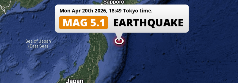
A significant Magnitude 5.1 aftershock struck in the North Pacific Ocean 193 kilometer from Morioka, Japan in the evening of Monday April 20th, 2026.
Felt the earthquake? Share this article: 


Earthquake Summary
This earthquake hit under water in the North Pacific Ocean, 152 kilometers (94 mi) off the coast of Japan, 193 kilometer east of Morioka in Iwate. The center of this earthquake had a quite shallow depth of 35 km. Shallow earthquakes usually have a larger impact than earthquakes deep in the earth.
| Date and Time: | Apr 20, 2026 18:49 (Tokyo Time) - Apr 20, 2026 09:49 Universal Time. |
|---|---|
| Location: | 193 km east of Morioka, Iwate, Japan. Coordinates 39°53'17"N 143°23'24"E. |
| Map: | 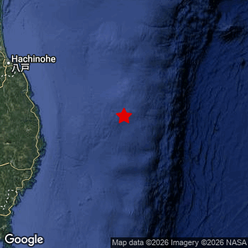 Map of area around epicenter. Click to open in Google Maps. |
| Magnitude: | MAG 5.1 Detected by 323 stations. Maximum Error Range ±0.032 . |
| Depth: | 35 km (22 mi) A quite shallow depth. |
| Tsunami Risk: | Low tsunami risk Earthquakes under MAG-6.5 do not usually cause tsunami's. Always stay cautious - More info here. |
Nearby towns and cities
This earthquake may have been felt in Japan . Miyako in Iwate, Japan is the nearest significant place from the epicenter. The earthquake occurred 127 kilometer (79 mi) east of Miyako.
Multiple large cities are in proximity of today's earthquake. Sendai is located 283 km to the southwest. Morioka is located 193 km to the west. Hachinohe is located 174 km to the west.
An overview of nearby towns and cities is available in the overview below.
Overview of nearby places
| Distance | Place |
|---|---|
| 127 km (79 mi) W from epicenter |
Miyako Iwate, Japan. |
| 132 km (82 mi) W from epicenter |
Yamada Iwate, Japan. |
| 147 km (91 mi) SW from epicenter |
Kamaishi Iwate, Japan. |
| 170 km (106 mi) SW from epicenter |
Ōfunato Iwate, Japan. |
| 171 km (106 mi) W from epicenter |
Tōno Iwate, Japan. |
| 174 km (108 mi) W from epicenter |
Hachinohe Aomori, Japan. |
| 192 km (119 mi) NW from epicenter |
Misawa Aomori, Japan. |
| 193 km (120 mi) W from epicenter |
Morioka Iwate, Japan. |
| 203 km (126 mi) W from epicenter |
Hanamaki Iwate, Japan. |
| 206 km (128 mi) W from epicenter |
Kitakami Iwate, Japan. |
| 207 km (129 mi) W from epicenter |
Shizukuishi Iwate, Japan. |
| 209 km (130 mi) W from epicenter |
Kanegasaki Iwate, Japan. |
| 211 km (131 mi) SW from epicenter |
Mizusawa Iwate, Japan. |
| 222 km (138 mi) SW from epicenter |
Ichinoseki Iwate, Japan. |
| 224 km (139 mi) W from epicenter |
Hanawa Akita, Japan. |
| 241 km (150 mi) NW from epicenter |
Mutsu Aomori, Japan. |
| 243 km (151 mi) SW from epicenter |
Ishinomaki Miyagi, Japan. |
| 245 km (152 mi) SW from epicenter |
Wakuya Miyagi, Japan. |
| 245 km (152 mi) W from epicenter |
Ōdate Akita, Japan. |
| 248 km (154 mi) NW from epicenter |
Aomori Aomori, Japan. |
| 248 km (154 mi) SW from epicenter |
Yamoto Miyagi, Japan. |
| 251 km (156 mi) SW from epicenter |
Kogota Miyagi, Japan. |
| 251 km (156 mi) W from epicenter |
Yokote Akita, Japan. |
| 253 km (157 mi) W from epicenter |
Kuroishi Aomori, Japan. |
| 253 km (157 mi) W from epicenter |
Ōmagari Akita, Japan. |
| 254 km (158 mi) W from epicenter |
Namioka Aomori, Japan. |
| 256 km (159 mi) SW from epicenter |
Furukawa Miyagi, Japan. |
| 260 km (162 mi) W from epicenter |
Takanosu Akita, Japan. |
| 260 km (162 mi) W from epicenter |
Hirosaki Aomori, Japan. |
| 261 km (162 mi) W from epicenter |
Yuzawa Akita, Japan. |
| 262 km (163 mi) SW from epicenter |
Matsushima Miyagi, Japan. |
| 268 km (167 mi) SW from epicenter |
Shiogama Miyagi, Japan. |
| 270 km (168 mi) W from epicenter |
Goshogawara Aomori, Japan. |
| 271 km (168 mi) SW from epicenter |
Rifu Miyagi, Japan. |
| 272 km (169 mi) SW from epicenter |
Tomiya Miyagi, Japan. |
| 275 km (171 mi) W from epicenter |
Shimokizukuri Aomori, Japan. |
| 280 km (174 mi) W from epicenter |
Akita Akita, Japan. |
| 283 km (176 mi) SW from epicenter |
Sendai Miyagi, Japan. |
| 285 km (177 mi) N from epicenter |
Shizunai-furukawachō Hokkaido, Japan. |
| 288 km (179 mi) W from epicenter |
Noshiro Akita, Japan. |
| 292 km (181 mi) W from epicenter |
Tennō Akita, Japan. |
| 294 km (183 mi) SW from epicenter |
Shinjō Yamagata, Japan. |
| 294 km (183 mi) SW from epicenter |
Obanazawa Yamagata, Japan. |
| 295 km (183 mi) SW from epicenter |
Iwanuma Miyagi, Japan. |
This is likely an aftershock
This earthquake was an aftershock. A larger mag. 7.4 earthquake struck 30 km (19 mi) west in advance of this 5.1 earthquake around 2 hrs earlier.
Overview of foreshocks and aftershocks
| Classification | Magnitude | When | Where |
|---|---|---|---|
| Main Shock | M 7.4 |
Apr 20, 2026 16:53 (Tokyo Time) | - |
| Aftershock | M 5.3 |
10 mins later Apr 20, 2026 17:03 (Tokyo Time) | 75 km (47 mi) NE from Main Shock. |
| Aftershock | M 5.2 |
16 mins later Apr 20, 2026 17:08 (Tokyo Time) | 29 km (18 mi) E from Main Shock. |
| Aftershock | M 4.9 |
22 mins later Apr 20, 2026 17:14 (Tokyo Time) | 64 km (39 mi) SE from Main Shock. |
| Aftershock | M 5.0 |
31 mins later Apr 20, 2026 17:23 (Tokyo Time) | 21 km (13 mi) SW from Main Shock. |
| Aftershock | M 4.7 |
37 mins later Apr 20, 2026 17:30 (Tokyo Time) | 7 km (5 mi) S from Main Shock. |
| Aftershock | M 5.6 |
40 mins later Apr 20, 2026 17:32 (Tokyo Time) | 39 km (24 mi) SE from Main Shock. |
| Aftershock | M 4.3 |
1 hr later Apr 20, 2026 18:07 (Tokyo Time) | 28 km (17 mi) SE from Main Shock. |
| Aftershock | M 4.2 |
2 hrs later Apr 20, 2026 18:26 (Tokyo Time) | 20 km (13 mi) S from Main Shock. |
| Aftershock This Earthquake |
M 5.1 |
2 hrs later Apr 20, 2026 18:49 (Tokyo Time) | 30 km (19 mi) E from Main Shock. |
| Aftershock | M 4.4 |
2 hrs later Apr 20, 2026 19:00 (Tokyo Time) | 17 km (11 mi) SE from Main Shock. |
| Aftershock | M 4.4 |
2 hrs later Apr 20, 2026 19:02 (Tokyo Time) | 36 km (22 mi) SE from Main Shock. |
| Aftershock | M 4.1 |
2 hrs later Apr 20, 2026 19:20 (Tokyo Time) | 51 km (32 mi) SE from Main Shock. |
| Aftershock | M 4.1 |
3 hrs later Apr 20, 2026 19:30 (Tokyo Time) | 22 km (14 mi) NW from Main Shock. |
| Aftershock | M 4.4 |
3 hrs later Apr 20, 2026 19:37 (Tokyo Time) | 56 km (35 mi) SE from Main Shock. |
| Aftershock | M 5.1 |
3 hrs later Apr 20, 2026 19:44 (Tokyo Time) | 68 km (42 mi) SE from Main Shock. |
| Aftershock | M 4.2 |
3 hrs later Apr 20, 2026 19:53 (Tokyo Time) | 52 km (32 mi) S from Main Shock. |
| Aftershock | M 4.5 |
4 hrs later Apr 20, 2026 20:28 (Tokyo Time) | 33 km (21 mi) S from Main Shock. |
| Aftershock | M 5.1 |
5 hrs later Apr 20, 2026 21:56 (Tokyo Time) | 42 km (26 mi) SE from Main Shock. |
| Aftershock | M 4.4 |
5 hrs later Apr 20, 2026 22:03 (Tokyo Time) | 43 km (27 mi) SE from Main Shock. |
| Aftershock | M 4.7 |
6 hrs later Apr 20, 2026 23:15 (Tokyo Time) | 24 km (15 mi) SE from Main Shock. |
| Aftershock | M 4.5 |
8 hrs later Apr 21, 2026 01:13 (Tokyo Time) | 74 km (46 mi) SE from Main Shock. |
| Aftershock | M 4.4 |
8 hrs later Apr 21, 2026 01:15 (Tokyo Time) | 51 km (32 mi) E from Main Shock. |
| Aftershock | M 4.3 |
14 hrs later Apr 21, 2026 06:50 (Tokyo Time) | 1.9 km (1.2 mi) E from Main Shock. |
| Aftershock | M 4.2 |
14 hrs later Apr 21, 2026 07:06 (Tokyo Time) | 60 km (37 mi) E from Main Shock. |
| Aftershock | M 4.1 |
17 hrs later Apr 21, 2026 09:54 (Tokyo Time) | 20 km (13 mi) E from Main Shock. |
| Aftershock | M 4.8 |
19 hrs later Apr 21, 2026 11:35 (Tokyo Time) | 15 km (9 mi) SE from Main Shock. |
| Aftershock | M 4.7 |
21 hrs later Apr 21, 2026 14:19 (Tokyo Time) | 54 km (34 mi) E from Main Shock. |
| Aftershock | M 5.4 |
22 hrs later Apr 21, 2026 14:29 (Tokyo Time) | 51 km (32 mi) E from Main Shock. |
| Aftershock | M 4.4 |
1 day later Apr 22, 2026 01:18 (Tokyo Time) | 71 km (44 mi) W from Main Shock. |
| Aftershock | M 4.5 |
1 day later Apr 22, 2026 03:42 (Tokyo Time) | 32 km (20 mi) NE from Main Shock. |
| Aftershock | M 5.5 |
1 day later Apr 22, 2026 03:44 (Tokyo Time) | 27 km (17 mi) NE from Main Shock. |
| Aftershock | M 4.4 |
1 day later Apr 22, 2026 03:52 (Tokyo Time) | 33 km (21 mi) NE from Main Shock. |
| Aftershock | M 5.3 |
2 days later Apr 22, 2026 09:01 (Tokyo Time) | 13 km (8 mi) E from Main Shock. |
| Aftershock | M 4.2 |
2 days later Apr 22, 2026 11:11 (Tokyo Time) | 52 km (32 mi) SE from Main Shock. |
| Aftershock | M 4.2 |
2 days later Apr 22, 2026 18:49 (Tokyo Time) | 1.7 km (1.1 mi) E from Main Shock. |
| Aftershock | M 4.5 |
2 days later Apr 22, 2026 21:06 (Tokyo Time) | 75 km (47 mi) NW from Main Shock. |
| Aftershock | M 5.0 |
2 days later Apr 22, 2026 21:18 (Tokyo Time) | 11 km (7 mi) NW from Main Shock. |
| Aftershock | M 4.9 |
2 days later Apr 22, 2026 22:35 (Tokyo Time) | 33 km (21 mi) S from Main Shock. |
| Aftershock | M 4.6 |
2 days later Apr 22, 2026 23:26 (Tokyo Time) | 1.3 km (0.8 mi) S from Main Shock. |
| Aftershock | M 4.5 |
2 days later Apr 23, 2026 02:46 (Tokyo Time) | 62 km (38 mi) W from Main Shock. |
| Aftershock | M 4.9 |
3 days later Apr 23, 2026 09:07 (Tokyo Time) | 39 km (24 mi) SE from Main Shock. |
| Aftershock | M 4.4 |
3 days later Apr 23, 2026 15:41 (Tokyo Time) | 45 km (28 mi) W from Main Shock. |
| Aftershock | M 4.2 |
3 days later Apr 23, 2026 16:20 (Tokyo Time) | 58 km (36 mi) SE from Main Shock. |
| Aftershock | M 3.9 |
3 days later Apr 23, 2026 18:40 (Tokyo Time) | 57 km (36 mi) W from Main Shock. |
More earthquakes coming?
Aftershocks are usually at least 1 order of magnitude less strong than main shocks. The more time passes, the smaller the chance and likely strength of any potential aftershocks.
The chance that a significant earthquake like this one is followed by an even larger earthquake is not so large. On average, scientists estimate a 94% chance that a major earthquake will not be followed by an even larger one. It is still adviced to be aware of this risk
Read: How to Stay Safe during an Earthquake (cdc.gov).Earthquakes like this happen often in the region
Earthquakes of this strength are very common in the region. In total, 148 earthquakes with a magnitude of 5.1 or higher have been registered within 300km (186 mi) of this epicenter in the past 10 years. This comes down to an average of once every 25 days.
Low tsunami risk
Based on early data it appears this earthquake was not strong enough (lower than MAG-6.5) to be likely to cause destructive tsunami's. However this earthquake appeared to have hit at a shallow depth under sea, so stay cautious and monitor advice from local authorities.
Tsunami Risk Factors
| Factor | Under Sea? | MAG-6.5 or stronger? | Shallow depth? |
|---|---|---|---|
| Explanation | Almost all tsunami's are caused by earthquakes with their epicenter under sea or very near the sea. However stay cautious in coastal areas as earthquakes on land may cause landslides into sea, potentially still causing a local tsunami. | Under MAG 6.5: Very unlikely to cause a tsunami. MAG 6.5 to 7.5: Destructive tsunami's do occur, but are uncommon. Likely to observe small sea level changes. MAG 7.6+: Earthquakes with these magnitudes might produce destructive tsunami's. |
Most destructive tsunami's are caused by shallow earthquakes with a depth between 0 and 100km under the surface of the earth. Deeper tsunami's are unlikely to displace to ocean floor. |
| This Earthquake | This earthquake appears to have struck under the sea. | Not this earthquake. This earthquake had a magnitude of 5.1. Earthquakes of this strength are unlikely to trigger a tsunami. |
This earthquake occurred at a depth of of 35 km (22 mi). Earthquakes this shallow could trigger a tsunami. |
Sources
Last updated 11/05/26 12:08 (). This article is automatically generated based on available data. We keep checking multiple sources for additional information. This article gets updated as new details on this earthquake become available.
- US Geographic Society (USGS): Earthquake us6000sriv
- European-Mediterranean Seismological Centre (EMSC): Earthquake 20260420_0000142
- Geonames.org: World Cities Database
- Google Maps: Static API
- Earthquakelist.org: Historic Earthquakes Database
Share this article:
