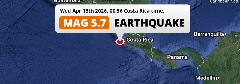
A shallow and significant Magnitude 5.7 earthquake struck in the North Pacific Ocean 130 kilometer from Liberia, Costa Rica in the night of Wednesday April 15th, 2026. Roughly 1.2 million people may have felt this earthquake. Another nearby country is Nicaragua.
Felt the earthquake? Share this article: 


Earthquake Summary
This earthquake hit under water in the North Pacific Ocean, 67 kilometers (41 mi) off the coast of Costa Rica, 130 kilometer southwest of Liberia in Guanacaste. The center of this earthquake had a very shallow depth of 17 km. Shallow earthquakes usually have a larger impact than earthquakes deep in the earth.
| Date and Time: | Apr 15, 2026 12:56AM (Costa Rica Time) - Apr 15, 2026 06:56 Universal Time. |
|---|---|
| Location: | 250 km south of Managua, Nicaragua. Coordinates 9°53'20"N 86°21'21"W. |
| Map: | 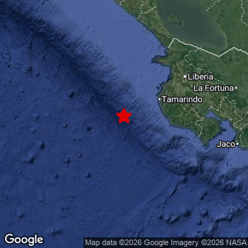 Map of area around epicenter. Click to open in Google Maps. |
| Magnitude: | MAG 5.7 Detected by 68 stations. Maximum Error Range ±0.038 . |
| Depth: | 17 km (11 mi) A very shallow depth. |
| Max. Intensity: | V
Moderate On the Modified Mercalli Scale. |
| Tsunami Risk: | Low tsunami risk Earthquakes under MAG-6.5 do not usually cause tsunami's. Always stay cautious - More info here. |
Minimal impact predicted
Based on scientific estimates by the US Geographic Survey (USGS), the risk of high fatalities for this earthquake is classified at level GREEN (low). They expect an 90% likelyhood of between 0 and 1 fatalities.
The USGS classifies the economic impact of this earthquake at level GREEN (low). They expect an 90% likelyhood of between 0 and 1 million US Dollars in economic damage and impact.
Roughly 1.2 million people exposed to shaking
An estimated 1.2 million have been exposed to shaking (An MMI or Modified Mercalli Intensity level II or higher) as a result of this earthquake according scientific estimates published by the USGS.
The highest earthquake impact level for this earthquake is IV, which corresponds with light shaking and likely no damage. Roughly 143,200 people are expected to be exposed to this level. Intensity level III was experienced by the majority of people (around 1.1 million). In their region, weak shaking and probably no damage can be expected.
People in 2 countries have been exposed to shaking. In Costa Rica , around 0.9 million people, with impact levels up to IV (light shaking, likely no damage). Roughly 300 thousand people were exposed to shaking in Nicaragua .
| People | MMI Level | Shaking | Damage |
|---|---|---|---|
| 0 | I |
Not noticable | None |
| 470 | II |
Very weak | None |
| 1,052,000 | III |
Weak | Probably none |
| 143,200 | IV |
Light | Likely none |
| 0 | V |
Moderate | Very light |
| 0 | VI |
Strong | Light |
| 0 | VII |
Very Strong | Moderate |
| 0 | VIII |
Severe | Moderate to heavy |
| 0 | IX |
Violent | Heavy |
| 0 | X |
Extreme | Very heavy |
Nearby towns and cities
This earthquake struck within proximity of multiple countries. Costa Rica and Nicaragua are both within 300km distance of its epicenter.
Located 103 kilometer (64 mi) west of the epicenter of this earthquake, Nicoya (Guanacaste, Costa Rica) is the nearest significant population center. The intensity of shaking and damage in Nicoya is estimated to be around level IV on the Modified Mercalli Intensity scale (light shaking, likely no damage).
Multiple large cities are in proximity of today's earthquake. Managua is located 250 km to the north (intensity unknown, possibly low). San José is located 249 km to the east (intensity unknown, possibly low). Masaya is located 234 km to the north (intensity unknown, possibly low).
A complete list of nearby places is included below. Estimated intensity data (MMI) sourced from a shake-map published by the US Geographic Survey is shown where available (cities without data probably experienced little impact).
Overview of nearby places
| Distance | Place | Intensity (MMI) |
|---|---|---|
| 103 km (64 mi) E from epicenter |
Nicoya Guanacaste, Costa Rica. |
IV
Light |
| 130 km (81 mi) NE from epicenter |
Liberia Guanacaste, Costa Rica. |
III
Weak |
| 150 km (93 mi) NE from epicenter |
Cañas Guanacaste, Costa Rica. |
III
Weak |
| 166 km (103 mi) E from epicenter |
Puntarenas Puntarenas, Costa Rica. |
III
Weak |
| 173 km (107 mi) E from epicenter |
Chacarita Puntarenas, Costa Rica. |
III
Weak |
| 178 km (111 mi) NE from epicenter |
San José Alajuela, Costa Rica. |
III
Weak |
| 182 km (113 mi) N from epicenter |
Rivas Rivas, Nicaragua. |
III
Weak |
| 185 km (115 mi) E from epicenter |
Esparza Puntarenas, Costa Rica. |
III
Weak |
| 210 km (130 mi) N from epicenter |
Nandaime Granada, Nicaragua. |
|
| 216 km (134 mi) E from epicenter |
Quesada Alajuela, Costa Rica. |
|
| 218 km (135 mi) N from epicenter |
San Rafael del Sur Managua, Nicaragua. |
|
| 219 km (136 mi) N from epicenter |
Diriamba Carazo, Nicaragua. |
|
| 219 km (136 mi) N from epicenter |
Jinotepe Carazo, Nicaragua. |
|
| 225 km (140 mi) N from epicenter |
San Marcos Carazo, Nicaragua. |
|
| 226 km (140 mi) N from epicenter |
Masatepe Masaya, Nicaragua. |
|
| 226 km (140 mi) E from epicenter |
San Rafael Abajo San José, Costa Rica. |
|
| 231 km (144 mi) N from epicenter |
Granada Granada, Nicaragua. |
|
| 233 km (145 mi) E from epicenter |
Tejar San José, Costa Rica. |
|
| 234 km (145 mi) N from epicenter |
Masaya Masaya, Nicaragua. |
|
| 235 km (146 mi) E from epicenter |
Alajuela Alajuela, Costa Rica. |
|
| 243 km (151 mi) E from epicenter |
San Rafael San José, Costa Rica. |
|
| 244 km (152 mi) E from epicenter |
San Francisco Heredia, Costa Rica. |
|
| 244 km (152 mi) E from epicenter |
Mercedes Norte Heredia, Costa Rica. |
|
| 246 km (153 mi) E from epicenter |
San Felipe San José, Costa Rica. |
|
| 246 km (153 mi) E from epicenter |
Heredia Heredia, Costa Rica. |
|
| 248 km (154 mi) E from epicenter |
San Pablo Heredia, Costa Rica. |
|
| 248 km (154 mi) E from epicenter |
Aserrí San José, Costa Rica. |
|
| 249 km (155 mi) E from epicenter |
San José San José, Costa Rica. |
|
| 250 km (155 mi) E from epicenter |
San Juan San José, Costa Rica. |
|
| 250 km (155 mi) N from epicenter |
Managua Managua, Nicaragua. |
|
| 251 km (156 mi) E from epicenter |
Calle Blancos San José, Costa Rica. |
|
| 251 km (156 mi) E from epicenter |
San Miguel San José, Costa Rica. |
|
| 252 km (157 mi) E from epicenter |
Guadalupe San José, Costa Rica. |
|
| 252 km (157 mi) N from epicenter |
Ciudad Sandino Managua, Nicaragua. |
|
| 253 km (157 mi) E from epicenter |
San Pedro San José, Costa Rica. |
|
| 253 km (157 mi) E from epicenter |
San Vicente de Moravia San José, Costa Rica. |
|
| 253 km (157 mi) E from epicenter |
San Vicente San José, Costa Rica. |
|
| 254 km (158 mi) E from epicenter |
Curridabat San José, Costa Rica. |
|
| 254 km (158 mi) E from epicenter |
Patarrá San José, Costa Rica. |
|
| 255 km (158 mi) E from epicenter |
Purral San José, Costa Rica. |
|
| 256 km (159 mi) E from epicenter |
Ipís San José, Costa Rica. |
|
| 258 km (160 mi) N from epicenter |
Tipitapa Managua, Nicaragua. |
|
| 265 km (165 mi) N from epicenter |
Nagarote León, Nicaragua. |
|
| 267 km (166 mi) E from epicenter |
Cartago Cartago, Costa Rica. |
|
| 269 km (167 mi) NE from epicenter |
Juigalpa Chontales, Nicaragua. |
|
| 273 km (170 mi) E from epicenter |
Paraíso Cartago, Costa Rica. |
|
| 284 km (176 mi) E from epicenter |
Guápiles Limón, Costa Rica. |
|
| 288 km (179 mi) NE from epicenter |
Nueva Guinea South Caribbean Coast, Nicaragua. |
|
| 289 km (180 mi) N from epicenter |
León León, Nicaragua. |
|
| 293 km (182 mi) E from epicenter |
Turrialba Cartago, Costa Rica. |
|
| 297 km (185 mi) E from epicenter |
San Isidro San José, Costa Rica. |
|
| 297 km (185 mi) N from epicenter |
Boaco Boaco, Nicaragua. |
Earthquake Intensity Map
The maximum intensity (MMI Scale) caused by this earthquake is IV. The map below shows in which areas this earthquake was the most and least impactful. It is based on data from the US Geographic Survey.

Shaking reported by 34 people in 2 countries
People that feel an earthquake may report their experience to the US Geographic Survey. Currently, 34 people have reported shaking in 17 places in 2 countries (Costa Rica, Nicaragua).We keep updating this article as more ground reports become available. You may report that you felt this earthquake here.
Places with most reports:
- Sámara, Guanacaste, Costa Rica: 8 people.
- Santa Cruz, Guanacaste, Costa Rica: 6 people.
- Sardinal, Guanacaste, Costa Rica: 5 people.
- San José, San José, Costa Rica: 2 people.
- Santa Ana, San José, Costa Rica: 1 person.
- Esparta, Puntarenas, Costa Rica: 1 person.
- Golfito, Puntarenas, Costa Rica: 1 person.
- Fortuna, Alajuela, Costa Rica: 1 person.
- San Antonio, Alajuela, Costa Rica: 1 person.
- Belén, Guanacaste, Costa Rica: 1 person.
3 Aftershocks detected
This main shock was followed by 3 smaller aftershocks. A 3.2 magnitude earthquake hit 2 days later 56 km (35 mi) north-east of this earthquake.
Overview of foreshocks and aftershocks
| Classification | Magnitude | When | Where |
|---|---|---|---|
| Main Shock This Earthquake |
M 5.7 |
Apr 15, 2026 12:56AM (Costa Rica Time) | - |
| Aftershock | M 2.8 |
19 hrs later Apr 15, 2026 08:04PM (Costa Rica Time) | 72 km (45 mi) N from Main Shock. |
| Aftershock | M 3.2 |
2 days later Apr 17, 2026 10:30AM (Costa Rica Time) | 56 km (35 mi) NE from Main Shock. |
| Aftershock | M 2.6 |
3 days later Apr 17, 2026 01:43PM (Costa Rica Time) | 32 km (20 mi) NE from Main Shock. |
More earthquakes coming?
Aftershocks are usually at least 1 order of magnitude less strong than main shocks. The more time passes, the smaller the chance and likely strength of any potential aftershocks.
The chance that a significant earthquake like this one is followed by an even larger earthquake is not so large. On average, scientists estimate a 94% chance that a major earthquake will not be followed by an even larger one. It is still adviced to be aware of this risk
Read: How to Stay Safe during an Earthquake (cdc.gov).Earthquakes like this are common in the region
Earthquakes of this strength occur quite regularly in the region. This is the strongest earthquake to hit since October 22nd, 2025, when a 5.9 magnitude earthquake hit 242 km (151 mi) further east. An even stronger magnitude 6.6 earthquake struck on April 21st, 2022.
In total, 10 earthquakes with a magnitude of 5.7 or higher have been registered within 300km (186 mi) of this epicenter in the past 10 years. This comes down to an average of once every year.
Low tsunami risk
Based on early data it appears this earthquake was not strong enough (lower than MAG-6.5) to be likely to cause destructive tsunami's. However this earthquake appeared to have hit at a shallow depth under sea, so stay cautious and monitor advice from local authorities.
Tsunami Risk Factors
| Factor | Under Sea? | MAG-6.5 or stronger? | Shallow depth? |
|---|---|---|---|
| Explanation | Almost all tsunami's are caused by earthquakes with their epicenter under sea or very near the sea. However stay cautious in coastal areas as earthquakes on land may cause landslides into sea, potentially still causing a local tsunami. | Under MAG 6.5: Very unlikely to cause a tsunami. MAG 6.5 to 7.5: Destructive tsunami's do occur, but are uncommon. Likely to observe small sea level changes. MAG 7.6+: Earthquakes with these magnitudes might produce destructive tsunami's. |
Most destructive tsunami's are caused by shallow earthquakes with a depth between 0 and 100km under the surface of the earth. Deeper tsunami's are unlikely to displace to ocean floor. |
| This Earthquake | This earthquake appears to have struck under the sea. | Not this earthquake. This earthquake had a magnitude of 5.7. Earthquakes of this strength are unlikely to trigger a tsunami. |
This earthquake occurred at a depth of of 17 km (11 mi). Earthquakes this shallow could trigger a tsunami. |
Sources
Last updated 13/06/26 15:28 (). As more information on this earthquake becomes available this article will be updated. This article is automatically composed based on data originating from multiple sources.
- US Geographic Society (USGS): Earthquake us6000sq5z
- European-Mediterranean Seismological Centre (EMSC): Earthquake 20260415_0000097
- Geonames.org: World Cities Database
- Google Maps: Static API
- Earthquakelist.org: Historic Earthquakes Database
Share this article:
