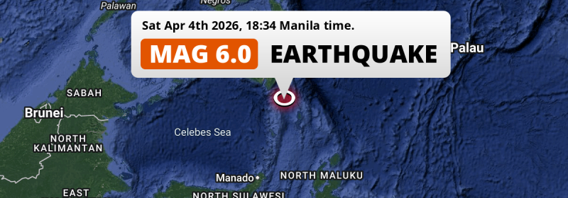
A strong M6.0 earthquake struck in the Philippine Sea 175 kilometer from General Santos, The Philippines in the evening of Saturday April 4th, 2026. Roughly 3.7 million people may have felt this earthquake.
Felt the earthquake? Share this article: 


Earthquake Summary
This earthquake hit under water in the Philippine Sea, 112 kilometers (70 mi) off the coast of The Philippines, 175 kilometer south-east of General Santos in Soccsksargen. The center of this earthquake had a quite shallow depth of 67 km. Shallow earthquakes usually have a larger impact than earthquakes deep in the earth.
| Date and Time: | Apr 4, 2026 06:34PM (Manila Time) - Apr 4, 2026 10:34 Universal Time. |
|---|---|
| Location: | 175 km SE of General Santos, Soccsksargen, The Philippines. Coordinates 4°52'24"N 126°8'21"E. |
| Map: | 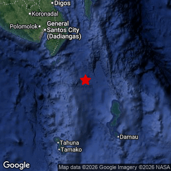 Map of area around epicenter. Click to open in Google Maps. |
| Magnitude: | MAG 6.0 Detected by 50 stations. Maximum Error Range ±0.044 . |
| Depth: | 67 km (42 mi) A quite shallow depth. |
| Max. Intensity: | V
Moderate On the Modified Mercalli Scale. |
| Tsunami Risk: | Low tsunami risk Earthquakes under MAG-6.5 do not usually cause tsunami's. Always stay cautious - More info here. |
Minimal impact predicted
Based on scientific estimates by the US Geographic Survey (USGS), the risk of high fatalities for this earthquake is classified at level GREEN (low). They expect an 90% likelyhood of between 0 and 1 fatalities.
The USGS classifies the economic impact of this earthquake at level GREEN (low). They expect an 90% likelyhood of between 0 and 1 million US Dollars in economic damage and impact.
Roughly 3.7 million people exposed to shaking
This earthquake may have been felt by around 3.7 million people. That is the expected population size of the area exposed to a level of shaking of II or higher on the Modified Mercalli scale according to the USGS.
The highest earthquake impact level for this earthquake is IV, which corresponds with light shaking and likely no damage. Roughly 723,300 people are expected to be exposed to this level. The majority of people (roughly 3 million) live in an area exposed to level III, where weak shaking and probably no damage is expected.
People in 2 countries have been exposed to shaking. Roughly 3.5 million people were exposed to shaking in The Philippines , with level IV (light shaking, likely no damage) as the highest recorded. In Indonesia , around 250 thousand people.
| People | MMI Level | Shaking | Damage |
|---|---|---|---|
| 0 | I |
Not noticable | None |
| 910 | II |
Very weak | None |
| 3,022,000 | III |
Weak | Probably none |
| 723,300 | IV |
Light | Likely none |
| 0 | V |
Moderate | Very light |
| 0 | VI |
Strong | Light |
| 0 | VII |
Very Strong | Moderate |
| 0 | VIII |
Severe | Moderate to heavy |
| 0 | IX |
Violent | Heavy |
| 0 | X |
Extreme | Very heavy |
Nearby towns and cities
This earthquake may have been felt in The Philippines . The closest significant population center near the earthquake is Glan in Soccsksargen, The Philippines. Glan is located 148 kilometer (92 mi) south-east of the epicenter. The intensity of shaking and damage in Glan is estimated to be around level IV on the Modified Mercalli Intensity scale (light shaking, likely no damage).
Major cities near this earthquake: Davao is located 251 km to the north (intensity unknown, possibly low). Budta is located 320 km to the northwest (intensity unknown, possibly low). General Santos is located 175 km to the northwest and experienced an intensity of IV (light shaking, likely no damage).
A complete list of nearby places is included below. Estimated intensity data (MMI) sourced from a shake-map published by the US Geographic Survey is shown where available (cities without data probably experienced little impact).
Overview of nearby places
| Distance | Place | Intensity (MMI) |
|---|---|---|
| 148 km (92 mi) NW from epicenter |
Glan Soccsksargen, The Philippines. |
IV
Light |
| 154 km (96 mi) NW from epicenter |
Malapatan Soccsksargen, The Philippines. |
III
Weak |
| 166 km (103 mi) NW from epicenter |
Alabel Soccsksargen, The Philippines. |
IV
Light |
| 175 km (109 mi) NW from epicenter |
General Santos Soccsksargen, The Philippines. |
IV
Light |
| 181 km (112 mi) N from epicenter |
Malita Davao, The Philippines. |
III
Weak |
| 183 km (114 mi) NW from epicenter |
Maluñgun Soccsksargen, The Philippines. |
III
Weak |
| 191 km (119 mi) NW from epicenter |
Polomolok Soccsksargen, The Philippines. |
III
Weak |
| 201 km (125 mi) N from epicenter |
Santa Maria Davao, The Philippines. |
III
Weak |
| 209 km (130 mi) NW from epicenter |
Tupi Soccsksargen, The Philippines. |
III
Weak |
| 218 km (135 mi) NW from epicenter |
Lake Sebu Soccsksargen, The Philippines. |
III
Weak |
| 226 km (140 mi) NW from epicenter |
Digos Davao, The Philippines. |
|
| 226 km (140 mi) N from epicenter |
Lupon Davao, The Philippines. |
|
| 227 km (141 mi) NW from epicenter |
Surallah Soccsksargen, The Philippines. |
III
Weak |
| 229 km (142 mi) NW from epicenter |
Bañga Soccsksargen, The Philippines. |
III
Weak |
| 231 km (144 mi) NW from epicenter |
Koronadal Soccsksargen, The Philippines. |
III
Weak |
| 232 km (144 mi) N from epicenter |
Mati Davao, The Philippines. |
|
| 236 km (147 mi) NW from epicenter |
Magsaysay Davao, The Philippines. |
|
| 236 km (147 mi) NW from epicenter |
Bansalan Davao, The Philippines. |
|
| 249 km (155 mi) N from epicenter |
Samal Davao, The Philippines. |
|
| 251 km (156 mi) N from epicenter |
Davao Davao, The Philippines. |
|
| 253 km (157 mi) NW from epicenter |
Buluan Rehiyong Autonomo sa Muslim na Mindanao, The Philippines. |
|
| 259 km (161 mi) NW from epicenter |
Isulan Soccsksargen, The Philippines. |
III
Weak |
| 259 km (161 mi) NW from epicenter |
Tacurong Soccsksargen, The Philippines. |
|
| 264 km (164 mi) NW from epicenter |
Kidapawan Soccsksargen, The Philippines. |
|
| 264 km (164 mi) N from epicenter |
Manay Davao, The Philippines. |
|
| 268 km (167 mi) NW from epicenter |
Laguilayan Soccsksargen, The Philippines. |
|
| 275 km (171 mi) N from epicenter |
Panabo Davao, The Philippines. |
|
| 285 km (177 mi) N from epicenter |
Cabayangan Davao, The Philippines. |
|
| 288 km (179 mi) NW from epicenter |
Kabacan Soccsksargen, The Philippines. |
|
| 289 km (180 mi) N from epicenter |
Magugpo Poblacion Davao, The Philippines. |
|
| 290 km (180 mi) NW from epicenter |
Maganoy Rehiyong Autonomo sa Muslim na Mindanao, The Philippines. |
|
| 292 km (181 mi) N from epicenter |
San Mariano Davao, The Philippines. |
|
| 304 km (189 mi) N from epicenter |
New Corella Davao, The Philippines. |
|
| 305 km (190 mi) N from epicenter |
Nabunturan Davao, The Philippines. |
|
| 311 km (193 mi) N from epicenter |
Compostela Davao, The Philippines. |
|
| 313 km (194 mi) NW from epicenter |
Midsayap Soccsksargen, The Philippines. |
|
| 314 km (195 mi) NW from epicenter |
Malingao Soccsksargen, The Philippines. |
|
| 318 km (198 mi) NW from epicenter |
Pagaluñgan Rehiyong Autonomo sa Muslim na Mindanao, The Philippines. |
|
| 320 km (199 mi) NW from epicenter |
Budta Rehiyong Autonomo sa Muslim na Mindanao, The Philippines. |
|
| 327 km (203 mi) N from epicenter |
Monkayo Davao, The Philippines. |
|
| 335 km (208 mi) NW from epicenter |
Cotabato Rehiyong Autonomo sa Muslim na Mindanao, The Philippines. |
|
| 336 km (209 mi) N from epicenter |
Don Carlos Northern Mindanao, The Philippines. |
|
| 338 km (210 mi) N from epicenter |
Quezon Northern Mindanao, The Philippines. |
|
| 345 km (214 mi) N from epicenter |
Maramag Northern Mindanao, The Philippines. |
|
| 346 km (215 mi) NW from epicenter |
Parang Rehiyong Autonomo sa Muslim na Mindanao, The Philippines. |
|
| 352 km (219 mi) NW from epicenter |
Wao Rehiyong Autonomo sa Muslim na Mindanao, The Philippines. |
|
| 353 km (219 mi) N from epicenter |
Trento Caraga, The Philippines. |
|
| 356 km (221 mi) N from epicenter |
Veruela Caraga, The Philippines. |
|
| 356 km (221 mi) N from epicenter |
NIA Valencia Northern Mindanao, The Philippines. |
|
| 372 km (231 mi) N from epicenter |
Bislig Caraga, The Philippines. |
|
| 382 km (237 mi) N from epicenter |
Malaybalay Northern Mindanao, The Philippines. |
Earthquake Intensity Map
The graph below overlays a map of the region around the epicenter with earthquake intensity data provided by the US Geographic Survey. The highest intensity level detected for this earthquake is IV.

Shaking reported by 11 people in 2 countries
People that feel an earthquake may report their experience to the US Geographic Survey. Currently, 11 people have reported shaking in 5 places in 2 countries (Philippines, Indonesia).We keep updating this article as more ground reports become available. You may report that you felt this earthquake here.
Places with most reports:
- Buayan, Southern Mindanao, Philippines: 6 people.
- Katangawan, Southern Mindanao, Philippines: 2 people.
- Davao, Southern Mindanao, Philippines: 1 person.
- Manado, Sulawesi Utara, Indonesia: 1 person.
- Barra, Northern Mindanao, Philippines: 1 person.
5 Aftershocks detected
This main shock was followed by 5 smaller aftershocks. At a distance of 52 km (32 mi) southwest of this earthquake, an aftershock struck 2 days later. It measured a magnitude of 3.5
In the days before this main shock, 3 smaller foreshocks were detected. Roughly 2 days before this earthquake, a foreshock measuring MAG-3.8 was detected nearby this earthquake.
Overview of foreshocks and aftershocks
| Classification | Magnitude | When | Where |
|---|---|---|---|
| Foreshock | M 3.5 |
3 days earlier Apr 2, 2026 02:29AM (Manila Time) | 99 km (62 mi) SE from Main Shock. |
| Foreshock | M 3.8 |
2 days earlier Apr 3, 2026 01:43AM (Manila Time) | 94 km (58 mi) E from Main Shock. |
| Foreshock | M 3.1 |
15 hrs earlier Apr 4, 2026 03:15AM (Manila Time) | 95 km (59 mi) N from Main Shock. |
| Main Shock This Earthquake |
M 6.0 |
Apr 4, 2026 06:34PM (Manila Time) | - |
| Aftershock | M 3.0 |
4 hrs later Apr 4, 2026 10:50PM (Manila Time) | 24 km (15 mi) NE from Main Shock. |
| Aftershock | M 3.3 |
12 hrs later Apr 5, 2026 06:35AM (Manila Time) | 94 km (58 mi) SE from Main Shock. |
| Aftershock | M 3.0 |
1 day later Apr 6, 2026 01:10AM (Manila Time) | 65 km (40 mi) S from Main Shock. |
| Aftershock | M 3.2 |
2 days later Apr 7, 2026 01:20AM (Manila Time) | 90 km (56 mi) SE from Main Shock. |
| Aftershock | M 3.5 |
2 days later Apr 7, 2026 04:33AM (Manila Time) | 52 km (32 mi) SW from Main Shock. |
More earthquakes coming?
Earthquakes can create aftershocks. These are generally at least 1 magnitude lower than any main shock, and as time passes the chance and strength of aftershocks decreases.
The chance that a significant earthquake like this one is followed by an even larger earthquake is not so large. On average, scientists estimate a 94% chance that a major earthquake will not be followed by an even larger one. It is still adviced to be aware of this risk
Read: How to Stay Safe during an Earthquake (cdc.gov).Earthquakes like this happen often in the region
Earthquakes of this strength are very common in the region. This is the strongest earthquake to hit since January 10th, 2026, when a 6.4 magnitude earthquake hit 154 km (96 mi) further south-east. An even stronger magnitude 7.4 earthquake struck on October 10th, 2025.
In total, 39 earthquakes with a magnitude of 6 or higher have been registered within 300km (186 mi) of this epicenter in the past 10 years. This comes down to an average of once every 3 months.
Low tsunami risk
Based on early data it appears this earthquake was not strong enough (lower than MAG-6.5) to be likely to cause destructive tsunami's. However this earthquake appeared to have hit at a shallow depth under sea, so stay cautious and monitor advice from local authorities.
Tsunami Risk Factors
| Factor | Under Sea? | MAG-6.5 or stronger? | Shallow depth? |
|---|---|---|---|
| Explanation | Almost all tsunami's are caused by earthquakes with their epicenter under sea or very near the sea. However stay cautious in coastal areas as earthquakes on land may cause landslides into sea, potentially still causing a local tsunami. | Under MAG 6.5: Very unlikely to cause a tsunami. MAG 6.5 to 7.5: Destructive tsunami's do occur, but are uncommon. Likely to observe small sea level changes. MAG 7.6+: Earthquakes with these magnitudes might produce destructive tsunami's. |
Most destructive tsunami's are caused by shallow earthquakes with a depth between 0 and 100km under the surface of the earth. Deeper tsunami's are unlikely to displace to ocean floor. |
| This Earthquake | This earthquake appears to have struck under the sea. | Not this earthquake. This earthquake had a magnitude of 6. Earthquakes of this strength are unlikely to trigger a tsunami. |
This earthquake occurred at a depth of of 67 km (42 mi). Earthquakes this shallow could trigger a tsunami. |
Sources
Last updated 02/06/26 19:08 (). This article is automatically generated based on available data. We keep checking multiple sources for additional information. This article gets updated as new details on this earthquake become available.
- US Geographic Society (USGS): Earthquake us6000smj4
- European-Mediterranean Seismological Centre (EMSC): Earthquake 20260404_0000243
- Geonames.org: World Cities Database
- Google Maps: Static API
- Earthquakelist.org: Historic Earthquakes Database
Share this article:
