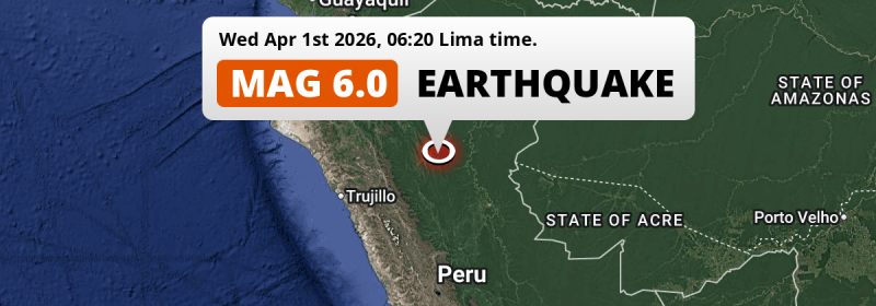
In the early morning of Wednesday April 1st, 2026, a strong M6.0 earthquake hit under land 68 kilometer from Juanjuí in Peru. Roughly 2 million people may have felt this earthquake. Another country near the epicenter is Brazil.
Felt the earthquake? Share this article: 


Earthquake Summary
The earthquake struck on land in Peru, 68 kilometer (42 mi) east of Juanjuí in San Martín. The center of this earthquake had an intermediate depth of 109 km.
| Date and Time: | Apr 1, 2026 06:20 (Lima Time) - Apr 1, 2026 11:20 Universal Time. |
|---|---|
| Location: | 68 km east of Juanjuí, San Martín, Peru. Coordinates 7°3'21"S 76°7'27"W. |
| Map: | 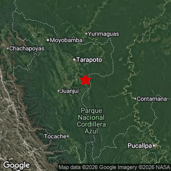 Map of area around epicenter. Click to open in Google Maps. |
| Magnitude: | MAG 6.0 Detected by 50 stations. Maximum Error Range ±0.044 . |
| Depth: | 109 km (68 mi) An intermediate depth. |
| Max. Intensity: | V
Moderate On the Modified Mercalli Scale. |
| Tsunami Risk: | Tsunami very unlikely Tsunami's are usually caused by MAG-6.5+ earthquakes, less than 100km shallow, and with an epicenter under sea. Neither of this seems to be the case. Always stay cautious - More info here. |
Minimal impact predicted
Based on scientific estimates by the US Geographic Survey (USGS), the risk of high fatalities for this earthquake is classified at level GREEN (low). They expect an 90% likelyhood of between 0 and 1 fatalities.
The USGS classifies the economic impact of this earthquake at level GREEN (low). They expect an 90% likelyhood of between 0 and 1 million US Dollars in economic damage and impact.
Roughly 2 million people exposed to shaking
This earthquake may have been felt by around 2 million people. That is the expected population size of the area exposed to a level of shaking of II or higher on the Modified Mercalli scale according to the USGS.
Light shaking and likely no damage may have been experienced by an estimated 1,015,000 people. At IV, it is the highest MMI level this earthquake has caused. All exposure to shaking was within the borders of Peru .
| People | MMI Level | Shaking | Damage |
|---|---|---|---|
| 0 | I |
Not noticable | None |
| 0 | II |
Very weak | None |
| 972,800 | III |
Weak | Probably none |
| 1,015,000 | IV |
Light | Likely none |
| 0 | V |
Moderate | Very light |
| 0 | VI |
Strong | Light |
| 0 | VII |
Very Strong | Moderate |
| 0 | VIII |
Severe | Moderate to heavy |
| 0 | IX |
Violent | Heavy |
| 0 | X |
Extreme | Very heavy |
Nearby towns and cities
This earthquake struck within proximity of multiple countries. Peru and Brazil are both within 300km distance of its epicenter.
Bellavista in San Martín, Peru is the nearest significant place from the epicenter. The earthquake occurred 52 kilometer (32 mi) east of Bellavista. The intensity of shaking and damage in Bellavista is estimated to be around level IV on the Modified Mercalli Intensity scale (light shaking, likely no damage).
Multiple large cities are in proximity of today's earthquake. Trujillo is located 341 km to the west (intensity unknown, possibly low). Pucallpa is located 227 km to the south-east and experienced an intensity of III (weak shaking, probably no damage). Chimbote is located 352 km to the southwest (intensity unknown, possibly low).
The table below provides an overview of all places in proximity of today's earthquake. Where available, the estimated intensity on the Modified Mercalli Intensity Scale in each place is included. Places where this information is omitted likely experienced little impact.
Overview of nearby places
| Distance | Place | Intensity (MMI) |
|---|---|---|
| 52 km (32 mi) W from epicenter |
Bellavista San Martín, Peru. |
IV
Light |
| 67 km (42 mi) N from epicenter |
La Banda San Martín, Peru. |
IV
Light |
| 68 km (42 mi) W from epicenter |
Juanjuí San Martín, Peru. |
IV
Light |
| 128 km (80 mi) N from epicenter |
Yurimaguas Loreto, Peru. |
IV
Light |
| 133 km (83 mi) S from epicenter |
Tocache San Martín, Peru. |
IV
Light |
| 147 km (91 mi) NW from epicenter |
Moyobamba San Martín, Peru. |
IV
Light |
| 160 km (99 mi) NW from epicenter |
Rioja San Martín, Peru. |
IV
Light |
| 160 km (99 mi) S from epicenter |
Uchiza San Martín, Peru. |
III
Weak |
| 213 km (132 mi) NW from epicenter |
Chachapoyas Amazonas, Peru. |
III
Weak |
| 227 km (141 mi) SE from epicenter |
Pucallpa Ucayali, Peru. |
III
Weak |
| 230 km (143 mi) SE from epicenter |
San Fernando Ucayali, Peru. |
III
Weak |
| 230 km (143 mi) W from epicenter |
Huamachuco La Libertad, Peru. |
|
| 249 km (155 mi) S from epicenter |
Tingo María Huanuco, Peru. |
|
| 262 km (163 mi) W from epicenter |
Cajamarca Cajamarca, Peru. |
|
| 294 km (183 mi) NW from epicenter |
Bagua Grande Amazonas, Peru. |
|
| 302 km (188 mi) NW from epicenter |
La Peca Amazonas, Peru. |
|
| 314 km (195 mi) SW from epicenter |
Centenario Ancash, Peru. |
|
| 315 km (196 mi) SW from epicenter |
Huaraz Ancash, Peru. |
|
| 320 km (199 mi) S from epicenter |
Huánuco Huanuco, Peru. |
|
| 327 km (203 mi) SW from epicenter |
Virú La Libertad, Peru. |
|
| 332 km (206 mi) NW from epicenter |
Jaén Cajamarca, Peru. |
|
| 333 km (207 mi) W from epicenter |
Laredo La Libertad, Peru. |
|
| 341 km (212 mi) W from epicenter |
Moche La Libertad, Peru. |
|
| 341 km (212 mi) W from epicenter |
Trujillo La Libertad, Peru. |
|
| 351 km (218 mi) W from epicenter |
Chocope La Libertad, Peru. |
|
| 351 km (218 mi) SW from epicenter |
Coishco Ancash, Peru. |
|
| 352 km (219 mi) SW from epicenter |
Chimbote Ancash, Peru. |
|
| 358 km (222 mi) W from epicenter |
Santiago de Cao La Libertad, Peru. |
|
| 358 km (222 mi) W from epicenter |
Paiján La Libertad, Peru. |
|
| 359 km (223 mi) S from epicenter |
Yanacancha Huanuco, Peru. |
|
| 363 km (226 mi) W from epicenter |
Chongoyape Lambayeque, Peru. |
|
| 365 km (227 mi) W from epicenter |
Chepén La Libertad, Peru. |
|
| 371 km (231 mi) W from epicenter |
Guadalupe La Libertad, Peru. |
|
| 374 km (232 mi) S from epicenter |
Chaupimarca Pasco, Peru. |
|
| 375 km (233 mi) W from epicenter |
San Pedro de Lloc La Libertad, Peru. |
|
| 382 km (237 mi) W from epicenter |
Pacasmayo La Libertad, Peru. |
|
| 382 km (237 mi) W from epicenter |
Saña Lambayeque, Peru. |
|
| 385 km (239 mi) E from epicenter |
Cruzeiro do Sul Acre, Brazil. |
|
| 389 km (242 mi) W from epicenter |
Pátapo Lambayeque, Peru. |
Earthquake Intensity Map
The graph below overlays a map of the region around the epicenter with earthquake intensity data provided by the US Geographic Survey. The highest intensity level detected for this earthquake is V.

Shaking reported by 9 people in 2 countries
People that feel an earthquake may report their experience to the US Geographic Survey. Currently, 9 people have reported shaking in 8 places in 2 countries (Peru, Ecuador).We keep updating this article as more ground reports become available. You may report that you felt this earthquake here.
Places with most reports:
- Pucallpa, Ucayali, Peru: 2 people.
- Oxapampa, Pasco, Peru: 1 person.
- San Miguel de Cauri, Huánuco, Peru: 1 person.
- Tarapoto, San Martín, Peru: 1 person.
- Pucará, Cajamarca, Peru: 1 person.
- Loja, Loja, Ecuador: 1 person.
- Trujillo, La Libertad, Peru: 1 person.
- San Luis, Lima Provincias, Peru: 1 person.
Aftershocks detected
Before this earthquake struck, 1 smaller foreshock occurred. Nearby this earthquake a foreshock struck 1 day earlier. It measured a magnitude of 3.6
Overview of foreshocks and aftershocks
| Classification | Magnitude | When | Where |
|---|---|---|---|
| Foreshock | M 3.6 |
1 day earlier Mar 30, 2026 19:20 (Lima Time) | 12 km (8 mi) SE from Main Shock. |
| Main Shock This Earthquake |
M 6.0 |
Apr 1, 2026 06:20 (Lima Time) | - |
More earthquakes coming?
The risk of aftershocks decreases rapidly over time. Usually, aftershocks are at least one order of magnitude lower than a main shock.
In only six percent of cases, significant earthquakes are followed by a larger main shock, making the current earthquake a foreshock. While the chance of this happening is not so large, it is adviced to maintain cautiousness in the hours and days following a major earthquake.
Read: How to Stay Safe during an Earthquake (cdc.gov).This is the strongest earthquake in 4 years
Earthquakes of this strength occur quite regularly in the region. This is the strongest earthquake to hit since November 28th, 2021, when a 7.5 magnitude earthquake hit 298 km (185 mi) further north. An even stronger magnitude 8 earthquake struck on May 26th, 2019.
In total, 3 earthquakes with a magnitude of 6 or higher have been registered within 300km (186 mi) of this epicenter in the past 10 years. This comes down to an average of once every 3 years.
Tsunami very unlikely
It is very unlikely that this eartquake will cause any tsunami's. The reported magnitude is lower than the MAG-6.5 strength required to cause any earthquakes. In addition, this earthquake was not very shallow and appears to have occurred under land. However always stay cautious and monitor advice from local authorities.
Tsunami Risk Factors
| Factor | Under Sea? | MAG-6.5 or stronger? | Shallow depth? |
|---|---|---|---|
| Explanation | Almost all tsunami's are caused by earthquakes with their epicenter under sea or very near the sea. However stay cautious in coastal areas as earthquakes on land may cause landslides into sea, potentially still causing a local tsunami. | Under MAG 6.5: Very unlikely to cause a tsunami. MAG 6.5 to 7.5: Destructive tsunami's do occur, but are uncommon. Likely to observe small sea level changes. MAG 7.6+: Earthquakes with these magnitudes might produce destructive tsunami's. |
Most destructive tsunami's are caused by shallow earthquakes with a depth between 0 and 100km under the surface of the earth. Deeper tsunami's are unlikely to displace to ocean floor. |
| This Earthquake | Not this earthquake. This earthquake appears to have struck on land far from any coast. |
Not this earthquake. This earthquake had a magnitude of 6. Earthquakes of this strength are unlikely to trigger a tsunami. |
Not this earthquake. This earthquake occurred at a depth of 109 km (68 mi). Earthquakes this deep in the earth are unlikely to trigger a tsunami. |
Sources
Last updated 01/04/26 12:28 (). This article is automatically generated based on available data. We keep checking multiple sources for additional information. This article gets updated as new details on this earthquake become available.
- US Geographic Society (USGS): Earthquake us7000s9cg
- European-Mediterranean Seismological Centre (EMSC): Earthquake 20260401_0000167
- Geonames.org: World Cities Database
- Google Maps: Static API
- Earthquakelist.org: Historic Earthquakes Database
Share this article:
