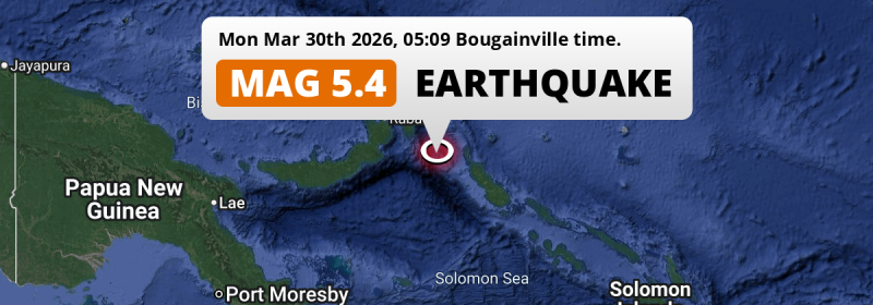
In the Solomon Sea 222 kilometer from Arawa, Papua New Guinea, a significant MAG-5.4 earthquake occurred in the night of Monday March 30th, 2026. Around 0.8 million people have been exposed to shaking.
Felt the earthquake? Share this article: 


Earthquake Summary
This earthquake hit under water in the Solomon Sea, 95 kilometers (59 mi) off the coast of Papua New Guinea, 222 kilometer northwest of Arawa in Bougainville. The center of this earthquake had a quite shallow depth of 43 km. Shallow earthquakes usually have a larger impact than earthquakes deep in the earth.
| Date and Time: | Mar 30, 2026 04:09 (Port Moresby Time) - Mar 29, 2026 18:09 Universal Time. |
|---|---|
| Location: | 222 km NW of Arawa, Bougainville, Papua New Guinea. Coordinates 5°26'12"S 153°43'41"E. |
| Map: | 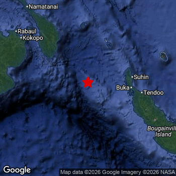 Map of area around epicenter. Click to open in Google Maps. |
| Magnitude: | MAG 5.4 Detected by 21 stations. Maximum Error Range ±0.068 . |
| Depth: | 43 km (27 mi) A quite shallow depth. |
| Max. Intensity: | IV
Light On the Modified Mercalli Scale. |
| Tsunami Risk: | Low tsunami risk Earthquakes under MAG-6.5 do not usually cause tsunami's. Always stay cautious - More info here. |
Minimal impact predicted
Based on scientific estimates by the US Geographic Survey (USGS), the risk of high fatalities for this earthquake is classified at level GREEN (low). They expect an 90% likelyhood of between 0 and 1 fatalities.
The USGS classifies the economic impact of this earthquake at level GREEN (low). They expect an 90% likelyhood of between 0 and 1 million US Dollars in economic damage and impact.
Roughly 0.8 million people exposed to shaking
An estimated 0.8 million have been exposed to shaking (An MMI or Modified Mercalli Intensity level II or higher) as a result of this earthquake according scientific estimates published by the USGS.
An estimated 18,430 people were exposed to level IV. At this level, light shaking and likely no damage can be expected. The majority of people (roughly 700 thousand) live in an area exposed to level III, where weak shaking and probably no damage is expected.
People in 2 countries have been exposed to shaking. In Papua New Guinea , around 0.8 million people, with impact levels up to IV (light shaking, likely no damage).
| People | MMI Level | Shaking | Damage |
|---|---|---|---|
| 0 | I |
Not noticable | None |
| 123,100 | II |
Very weak | None |
| 697,200 | III |
Weak | Probably none |
| 18,430 | IV |
Light | Likely none |
| 0 | V |
Moderate | Very light |
| 0 | VI |
Strong | Light |
| 0 | VII |
Very Strong | Moderate |
| 0 | VIII |
Severe | Moderate to heavy |
| 0 | IX |
Violent | Heavy |
| 0 | X |
Extreme | Very heavy |
Nearby towns and cities
This earthquake may have been felt in Papua New Guinea . The closest significant population center near the earthquake is Kokopo in East New Britain, Papua New Guinea. Kokopo is located 202 kilometer (126 mi) south-east of the epicenter. The intensity of shaking and damage in Kokopo is estimated to be around level III on the Modified Mercalli Intensity scale (weak shaking, probably no damage).
Overview of nearby places
| Distance | Place | Intensity (MMI) |
|---|---|---|
| 202 km (126 mi) NW from epicenter |
Kokopo East New Britain, Papua New Guinea. |
III
Weak |
| 222 km (138 mi) SE from epicenter |
Arawa Bougainville, Papua New Guinea. |
Earthquake Intensity Map
The intensity in shaking and damage by this earthquake is illustrated through the map below. The highest intensity measured for this earthquake is IV.

Shaking reported by 1 person
People that feel an earthquake may report their experience to the US Geographic Survey. Currently, 1 person has reported shaking in one place in Papua New Guinea.We keep updating this article as more ground reports become available. You may report that you felt this earthquake here.
Places with most reports:
- Panguna, North Solomons, Papua New Guinea: 1 person.
Risk of aftershocks?
We monitor for foreshocks or aftershocks that have a magnitude of 2.5+ and occur within 100km (62 mi) of the epicenter of this earthquake. So far no such earthquakes have been detected.
The risk of aftershocks decreases rapidly over time. Usually, aftershocks are at least one order of magnitude lower than a main shock.
The chance that a significant earthquake like this one is followed by an even larger earthquake is not so large. On average, scientists estimate a 94% chance that a major earthquake will not be followed by an even larger one. It is still adviced to be aware of this risk
Read: How to Stay Safe during an Earthquake (cdc.gov).Earthquakes like this happen often in the region
Earthquakes of this strength are very common in the region. This is the strongest earthquake to hit since February 28th, 2026, when a 5.4 magnitude earthquake hit 203 km (126 mi) further west. An even stronger magnitude 7.9 earthquake struck on January 22nd, 2017.
In total, 125 earthquakes with a magnitude of 5.4 or higher have been registered within 300km (186 mi) of this epicenter in the past 10 years. This comes down to an average of once every 29 days.
Low tsunami risk
Based on early data it appears this earthquake was not strong enough (lower than MAG-6.5) to be likely to cause destructive tsunami's. However this earthquake appeared to have hit at a shallow depth under sea, so stay cautious and monitor advice from local authorities.
Tsunami Risk Factors
| Factor | Under Sea? | MAG-6.5 or stronger? | Shallow depth? |
|---|---|---|---|
| Explanation | Almost all tsunami's are caused by earthquakes with their epicenter under sea or very near the sea. However stay cautious in coastal areas as earthquakes on land may cause landslides into sea, potentially still causing a local tsunami. | Under MAG 6.5: Very unlikely to cause a tsunami. MAG 6.5 to 7.5: Destructive tsunami's do occur, but are uncommon. Likely to observe small sea level changes. MAG 7.6+: Earthquakes with these magnitudes might produce destructive tsunami's. |
Most destructive tsunami's are caused by shallow earthquakes with a depth between 0 and 100km under the surface of the earth. Deeper tsunami's are unlikely to displace to ocean floor. |
| This Earthquake | This earthquake appears to have struck under the sea. | Not this earthquake. This earthquake had a magnitude of 5.4. Earthquakes of this strength are unlikely to trigger a tsunami. |
This earthquake occurred at a depth of of 43 km (27 mi). Earthquakes this shallow could trigger a tsunami. |
Sources
Last updated 31/03/26 18:58 (). This article is automatically generated based on available data. We keep checking multiple sources for additional information. This article gets updated as new details on this earthquake become available.
- US Geographic Society (USGS): Earthquake us7000s8kx
- European-Mediterranean Seismological Centre (EMSC): Earthquake 20260329_0000298
- Geonames.org: World Cities Database
- Google Maps: Static API
- Earthquakelist.org: Historic Earthquakes Database
Share this article:
