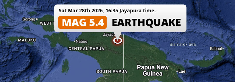
Under land 125 kilometer from Jayapura in Indonesia, a shallow and significant MAG-5.4 earthquake occurred in the late afternoon of Saturday March 28th, 2026. Shaking may have been felt by a total of 2 million people.
Felt the earthquake? Share this article: 


Earthquake Summary
The earthquake struck on land in Indonesia, 125 kilometer (78 mi) south of Jayapura in Papua. The center of this earthquake had a very shallow depth of 10 km. Shallow earthquakes usually have a larger impact than earthquakes deep in the earth.
| Date and Time: | Mar 28, 2026 16:35 (Jayapura Time) - Mar 28, 2026 07:35 Universal Time. |
|---|---|
| Location: | 125 km south of Jayapura, Papua, Indonesia. Coordinates 3°34'50"S 140°19'6"E. |
| Map: | 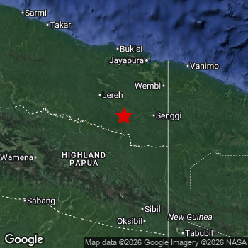 Map of area around epicenter. Click to open in Google Maps. |
| Magnitude: | MAG 5.4 Detected by 92 stations. Maximum Error Range ±0.061 . |
| Depth: | 10 km (6 mi) A very shallow depth. |
| Max. Intensity: | VII
Very Strong On the Modified Mercalli Scale. |
| Tsunami Risk: | Tsunami very unlikely While this was a shallow earthquake, it appears to have occurred under land with a magnitude not strong enough to cause tsunami's. Always stay cautious - More info here. |
Minimal impact predicted
Based on scientific estimates by the US Geographic Survey (USGS), the risk of high fatalities for this earthquake is classified at level GREEN (low). They expect an 90% likelyhood of between 0 and 1 fatalities.
The USGS classifies the economic impact of this earthquake at level GREEN (low). They expect an 90% likelyhood of between 0 and 1 million US Dollars in economic damage and impact.
Roughly 2 million people exposed to shaking
This earthquake may have been felt by around 2 million people. That is the expected population size of the area exposed to a level of shaking of II or higher on the Modified Mercalli scale according to the USGS.
Strong shaking and probably light damage may have been experienced by an estimated 230 people. At VI, it is the highest MMI level this earthquake has caused. Intensity level III was experienced by the majority of people (around 1.6 million). In their region, weak shaking and probably no damage can be expected.
People in 2 countries have been exposed to shaking. In Indonesia , around 1.8 million people, with impact levels up to VI (strong shaking, probably light damage). In Papua New Guinea , around 250 thousand people.
| People | MMI Level | Shaking | Damage |
|---|---|---|---|
| 0 | I |
Not noticable | None |
| 327,500 | II |
Very weak | None |
| 1,574,000 | III |
Weak | Probably none |
| 143,100 | IV |
Light | Likely none |
| 960 | V |
Moderate | Very light |
| 230 | VI |
Strong | Light |
| 0 | VII |
Very Strong | Moderate |
| 0 | VIII |
Severe | Moderate to heavy |
| 0 | IX |
Violent | Heavy |
| 0 | X |
Extreme | Very heavy |
Nearby towns and cities
This earthquake may have been felt in Indonesia . Located 115 kilometer (71 mi) south of the epicenter of this earthquake, Abepura (Papua, Indonesia) is the nearest significant population center. The intensity of shaking and damage in Abepura is estimated to be around level III on the Modified Mercalli Intensity scale (weak shaking, probably no damage).
Overview of nearby places
| Distance | Place | Intensity (MMI) |
|---|---|---|
| 115 km (71 mi) N from epicenter |
Abepura Papua, Indonesia. |
III
Weak |
| 125 km (78 mi) N from epicenter |
Jayapura Papua, Indonesia. |
III
Weak |
Earthquake Intensity Map
The graph below overlays a map of the region around the epicenter with earthquake intensity data provided by the US Geographic Survey. The highest intensity level detected for this earthquake is VI.

8 Aftershocks detected
After this earthquake struck, 8 smaller aftershocks occurred. A 3.6 magnitude earthquake hit 18 hrs later 21 km (13 mi) east of this earthquake.
In the days before this main shock, 2 smaller foreshocks were detected. A 4.2 magnitude earthquake hit 3 days earlier nearby.
Overview of foreshocks and aftershocks
| Classification | Magnitude | When | Where |
|---|---|---|---|
| Foreshock | M 4.2 |
3 days earlier Mar 26, 2026 02:32 (Jayapura Time) | 90 km (56 mi) N from Main Shock. |
| Foreshock | M 3.3 |
1 day earlier Mar 27, 2026 14:57 (Jayapura Time) | 34 km (21 mi) W from Main Shock. |
| Main Shock This Earthquake |
M 5.4 |
Mar 28, 2026 16:35 (Jayapura Time) | - |
| Aftershock | M 2.8 |
4 hrs later Mar 28, 2026 20:39 (Jayapura Time) | 16 km (10 mi) NW from Main Shock. |
| Aftershock | M 3.6 |
18 hrs later Mar 29, 2026 10:54 (Jayapura Time) | 21 km (13 mi) E from Main Shock. |
| Aftershock | M 3.4 |
1 day later Mar 29, 2026 21:21 (Jayapura Time) | 19 km (12 mi) NE from Main Shock. |
| Aftershock | M 2.8 |
1 day later Mar 30, 2026 02:02 (Jayapura Time) | 30 km (19 mi) E from Main Shock. |
| Aftershock | M 2.7 |
1 day later Mar 30, 2026 02:21 (Jayapura Time) | 23 km (15 mi) SE from Main Shock. |
| Aftershock | M 2.7 |
1 day later Mar 30, 2026 02:33 (Jayapura Time) | 27 km (17 mi) E from Main Shock. |
| Aftershock | M 2.9 |
2 days later Mar 30, 2026 05:34 (Jayapura Time) | 17 km (10 mi) NE from Main Shock. |
| Aftershock | M 3.4 |
2 days later Mar 31, 2026 01:02 (Jayapura Time) | 33 km (20 mi) E from Main Shock. |
More earthquakes coming?
Aftershocks are usually at least 1 order of magnitude less strong than main shocks. The more time passes, the smaller the chance and likely strength of any potential aftershocks.
In only six percent of cases, significant earthquakes are followed by a larger main shock, making the current earthquake a foreshock. While the chance of this happening is not so large, it is adviced to maintain cautiousness in the hours and days following a major earthquake.
Read: How to Stay Safe during an Earthquake (cdc.gov).Earthquakes like this happen often in the region
Earthquakes of this strength are very common in the region. This is the strongest earthquake to hit since March 26th, 2026, when a 5.7 magnitude earthquake hit 113 km (70 mi) further west. An even stronger magnitude 6.4 earthquake struck on October 16th, 2025.
In total, 43 earthquakes with a magnitude of 5.4 or higher have been registered within 300km (186 mi) of this epicenter in the past 10 years. This comes down to an average of once every 3 months.
Tsunami very unlikely
While MAG-6.5+ earthquakes may cause tsunami's, it appears that the epicenter of this earthquake hit under land. In addition, the reported depth is deeper than 100km, making the risk of a tsunami even less likely. However always stay cautious and monitor advice from local authorities.
Tsunami Risk Factors
| Factor | Under Sea? | MAG-6.5 or stronger? | Shallow depth? |
|---|---|---|---|
| Explanation | Almost all tsunami's are caused by earthquakes with their epicenter under sea or very near the sea. However stay cautious in coastal areas as earthquakes on land may cause landslides into sea, potentially still causing a local tsunami. | Under MAG 6.5: Very unlikely to cause a tsunami. MAG 6.5 to 7.5: Destructive tsunami's do occur, but are uncommon. Likely to observe small sea level changes. MAG 7.6+: Earthquakes with these magnitudes might produce destructive tsunami's. |
Most destructive tsunami's are caused by shallow earthquakes with a depth between 0 and 100km under the surface of the earth. Deeper tsunami's are unlikely to displace to ocean floor. |
| This Earthquake | Not this earthquake. This earthquake appears to have struck on land far from any coast. |
Not this earthquake. This earthquake had a magnitude of 5.4. Earthquakes of this strength are unlikely to trigger a tsunami. |
This earthquake occurred at a depth of of 10 km (6 mi). Earthquakes this shallow could trigger a tsunami. |
Sources
Last updated 31/03/26 07:28 (). As more information on this earthquake becomes available this article will be updated. This article is automatically composed based on data originating from multiple sources.
- US Geographic Society (USGS): Earthquake us7000s8c7
- European-Mediterranean Seismological Centre (EMSC): Earthquake 20260328_0000086
- Geonames.org: World Cities Database
- Google Maps: Static API
- Earthquakelist.org: Historic Earthquakes Database
Share this article:
