A shallow and strong M6.5 earthquake struck in the North Pacific Ocean 192 kilometer from Morioka, Japan in the evening of Thursday March 26th, 2026. Mag 6.5+ earthquakes at shallow depth under sea have the potential to cause tsunami's.
Felt the earthquake? Share this article: 


Earthquake Summary
This earthquake hit under water in the North Pacific Ocean, 145 kilometers (90 mi) off the coast of Japan, 192 kilometer east of Morioka in Iwate. The center of this earthquake had a very shallow depth of 10 km. Shallow earthquakes usually have a larger impact than earthquakes deep in the earth.
| Date and Time: | Mar 26, 2026 23:18 (Tokyo Time) - Mar 26, 2026 14:18 Universal Time. |
|---|---|
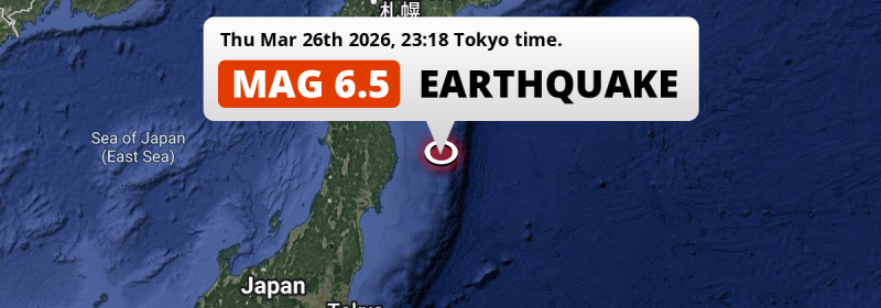
| Location: | 192 km east of Morioka, Iwate, Japan. Coordinates 39°26'46"N 143°22'18"E. |
| Map: |  Map of area around epicenter. Click to open in Google Maps. |
| Magnitude: | MAG 6.5 Detected by 118 stations. Maximum Error Range ±0.2 . |
| Depth: | 10 km (6 mi) A very shallow depth. |
| Max. Intensity: | V
Moderate On the Modified Mercalli Scale. |
| Tsunami Risk: | Potential Tsunami Risk Mag 6.5+ earthquakes at shallow depth under sea have the potential to cause tsunami's. Always stay cautious - More info here. |
Potential Tsunami Risk
There is a potential tsunami risk in the aftermath of this earthquake, immediately evacuate to higher grounds away from coastal areas and monitor advice from local authorities. This earthquake checks all the likely tsunami risk factors: under sea, at a magnitude of MAG-6.5+ and at a shallow depth.
Tsunami Risk Factors
| Factor | Under Sea? | MAG-6.5 or stronger? | Shallow depth? |
|---|---|---|---|
| Explanation | Almost all tsunami's are caused by earthquakes with their epicenter under sea or very near the sea. However stay cautious in coastal areas as earthquakes on land may cause landslides into sea, potentially still causing a local tsunami. | Under MAG 6.5: Very unlikely to cause a tsunami. MAG 6.5 to 7.5: Destructive tsunami's do occur, but are uncommon. Likely to observe small sea level changes. MAG 7.6+: Earthquakes with these magnitudes might produce destructive tsunami's. |
Most destructive tsunami's are caused by shallow earthquakes with a depth between 0 and 100km under the surface of the earth. Deeper tsunami's are unlikely to displace to ocean floor. |
| This Earthquake | This earthquake appears to have struck under the sea. | This earthquake had a magnitude of 6.5. Earthquakes of this strength could trigger a tsunami. | This earthquake occurred at a depth of of 10 km (6 mi). Earthquakes this shallow could trigger a tsunami. |
Minimal impact predicted
Based on scientific estimates by the US Geographic Survey (USGS), the risk of high fatalities for this earthquake is classified at level GREEN (low). They expect an 90% likelyhood of between 0 and 1 fatalities.
The USGS classifies the economic impact of this earthquake at level GREEN (low). They expect an 90% likelyhood of between 0 and 1 million US Dollars in economic damage and impact.
Roughly 1.8 million people exposed to shaking
An estimated 1.8 million have been exposed to shaking (An MMI or Modified Mercalli Intensity level II or higher) as a result of this earthquake according scientific estimates published by the USGS.
Light shaking and likely no damage may have been experienced by an estimated 1,539,000 people. At IV, it is the highest MMI level this earthquake has caused. All exposure to shaking was within the borders of Japan .
| People | MMI Level | Shaking | Damage |
|---|---|---|---|
| 0 | I |
Not noticable | None |
| 0 | II |
Very weak | None |
| 311,300 | III |
Weak | Probably none |
| 1,539,000 | IV |
Light | Likely none |
| 0 | V |
Moderate | Very light |
| 0 | VI |
Strong | Light |
| 0 | VII |
Very Strong | Moderate |
| 0 | VIII |
Severe | Moderate to heavy |
| 0 | IX |
Violent | Heavy |
| 0 | X |
Extreme | Very heavy |
Nearby towns and cities
This earthquake may have been felt in Japan . Located 122 kilometer (76 mi) east of the epicenter of this earthquake, Yamada (Iwate, Japan) is the nearest significant population center. The intensity of shaking and damage in Yamada is estimated to be around level IV on the Modified Mercalli Intensity scale (light shaking, likely no damage).
Multiple large cities are in proximity of today's earthquake. Sapporo is located 437 km to the northwest (intensity unknown, possibly low). Sendai is located 253 km to the southwest (intensity unknown, possibly low). Niigata is located 417 km to the southwest (intensity unknown, possibly low).
A complete list of nearby places is included below. Estimated intensity data (MMI) sourced from a shake-map published by the US Geographic Survey is shown where available (cities without data probably experienced little impact).
Overview of nearby places
| Distance | Place | Intensity (MMI) |
|---|---|---|
| 122 km (76 mi) W from epicenter |
Yamada Iwate, Japan. |
IV
Light |
| 125 km (78 mi) W from epicenter |
Miyako Iwate, Japan. |
IV
Light |
| 131 km (81 mi) W from epicenter |
Kamaishi Iwate, Japan. |
IV
Light |
| 148 km (92 mi) W from epicenter |
Ōfunato Iwate, Japan. |
IV
Light |
| 159 km (99 mi) W from epicenter |
Tōno Iwate, Japan. |
IV
Light |
| 192 km (119 mi) W from epicenter |
Morioka Iwate, Japan. |
IV
Light |
| 194 km (121 mi) W from epicenter |
Hanamaki Iwate, Japan. |
IV
Light |
| 195 km (121 mi) W from epicenter |
Kitakami Iwate, Japan. |
IV
Light |
| 196 km (122 mi) W from epicenter |
Kanegasaki Iwate, Japan. |
IV
Light |
| 196 km (122 mi) W from epicenter |
Mizusawa Iwate, Japan. |
IV
Light |
| 198 km (123 mi) NW from epicenter |
Hachinohe Aomori, Japan. |
IV
Light |
| 202 km (126 mi) W from epicenter |
Ichinoseki Iwate, Japan. |
IV
Light |
| 213 km (132 mi) SW from epicenter |
Ishinomaki Miyagi, Japan. |
III
Weak |
| 218 km (135 mi) SW from epicenter |
Yamoto Miyagi, Japan. |
IV
Light |
| 218 km (135 mi) NW from epicenter |
Misawa Aomori, Japan. |
IV
Light |
| 230 km (143 mi) SW from epicenter |
Furukawa Miyagi, Japan. |
|
| 235 km (146 mi) W from epicenter |
Hanawa Akita, Japan. |
|
| 238 km (148 mi) SW from epicenter |
Shiogama Miyagi, Japan. |
|
| 242 km (150 mi) SW from epicenter |
Rifu Miyagi, Japan. |
|
| 243 km (151 mi) W from epicenter |
Yokote Akita, Japan. |
|
| 245 km (152 mi) SW from epicenter |
Tomiya Miyagi, Japan. |
|
| 248 km (154 mi) W from epicenter |
Ōmagari Akita, Japan. |
|
| 249 km (155 mi) W from epicenter |
Yuzawa Akita, Japan. |
|
| 253 km (157 mi) SW from epicenter |
Sendai Miyagi, Japan. |
|
| 257 km (160 mi) W from epicenter |
Ōdate Akita, Japan. |
|
| 264 km (164 mi) SW from epicenter |
Iwanuma Miyagi, Japan. |
|
| 271 km (168 mi) NW from epicenter |
Aomori Aomori, Japan. |
|
| 272 km (169 mi) NW from epicenter |
Kuroishi Aomori, Japan. |
|
| 274 km (170 mi) NW from epicenter |
Mutsu Aomori, Japan. |
|
| 276 km (171 mi) W from epicenter |
Shinjō Yamagata, Japan. |
|
| 278 km (173 mi) NW from epicenter |
Hirosaki Aomori, Japan. |
|
| 280 km (174 mi) SW from epicenter |
Higashine Yamagata, Japan. |
|
| 281 km (175 mi) W from epicenter |
Akita Akita, Japan. |
|
| 287 km (178 mi) SW from epicenter |
Tendō Yamagata, Japan. |
|
| 291 km (181 mi) NW from epicenter |
Goshogawara Aomori, Japan. |
|
| 293 km (182 mi) SW from epicenter |
Yamagata Yamagata, Japan. |
|
| 294 km (183 mi) SW from epicenter |
Sagae Yamagata, Japan. |
|
| 298 km (185 mi) W from epicenter |
Noshiro Akita, Japan. |
|
| 309 km (192 mi) W from epicenter |
Sakata Yamagata, Japan. |
|
| 315 km (196 mi) SW from epicenter |
Fukushima Fukushima, Japan. |
|
| 317 km (197 mi) W from epicenter |
Tsuruoka Yamagata, Japan. |
|
| 341 km (212 mi) NW from epicenter |
Hakodate Hokkaido, Japan. |
|
| 344 km (214 mi) SW from epicenter |
Iwaki Fukushima, Japan. |
|
| 346 km (215 mi) SW from epicenter |
Kōriyama Fukushima, Japan. |
|
| 385 km (239 mi) NW from epicenter |
Tomakomai Hokkaido, Japan. |
|
| 386 km (240 mi) N from epicenter |
Obihiro Hokkaido, Japan. |
|
| 396 km (246 mi) SW from epicenter |
Hitachi Ibaraki, Japan. |
|
| 417 km (259 mi) SW from epicenter |
Niigata Niigata, Japan. |
|
| 437 km (272 mi) NW from epicenter |
Sapporo Hokkaido, Japan. |
|
| 443 km (275 mi) SW from epicenter |
Utsunomiya Tochigi, Japan. |
|
| 488 km (303 mi) N from epicenter |
Asahikawa Hokkaido, Japan. |
|
| 496 km (308 mi) SW from epicenter |
Ōta Gunma, Japan. |
|
| 498 km (309 mi) SW from epicenter |
Kashiwa Chiba, Japan. |
|
| 500 km (311 mi) SW from epicenter |
Kasukabe Saitama, Japan. |
Earthquake Intensity Map
The graph below overlays a map of the region around the epicenter with earthquake intensity data provided by the US Geographic Survey. The highest intensity level detected for this earthquake is IV.

Shaking reported by 6 people
People that feel an earthquake may report their experience to the US Geographic Survey. Currently, 6 people have reported shaking in 6 places, all within Japan.We keep updating this article as more ground reports become available. You may report that you felt this earthquake here.
Places with most reports:
- Morioka, Iwate, Japan: 1 person.
- Hakodate, Hokkaido, Japan: 1 person.
- Misawa, Aomori, Japan: 1 person.
- Sendai, Miyagi, Japan: 1 person.
- Hamamatsu, Shizuoka, Japan: 1 person.
- Misato, Saitama, Japan: 1 person.
9 Aftershocks detected
Since this main shock, 9 smaller aftershocks were detected. Just 1 day after this main shock, an earthquake measuring MAG-5.1 was detected 16 km (10 mi) west of this earthquake.
In the days before this main shock, 1 smaller foreshock was detected. Roughly 5 hrs before this earthquake, a foreshock measuring MAG-4.6 was detected nearby this earthquake.
Overview of foreshocks and aftershocks
| Classification | Magnitude | When | Where |
|---|---|---|---|
| Foreshock | M 4.6 |
5 hrs earlier Mar 26, 2026 17:51 (Tokyo Time) | 17 km (10 mi) W from Main Shock. |
| Main Shock This Earthquake |
M 6.5 |
Mar 26, 2026 23:18 (Tokyo Time) | - |
| Aftershock | M 4.6 |
18 mins later Mar 26, 2026 23:37 (Tokyo Time) | 16 km (10 mi) W from Main Shock. |
| Aftershock | M 4.6 |
28 mins later Mar 26, 2026 23:47 (Tokyo Time) | 8 km (5 mi) SE from Main Shock. |
| Aftershock | M 4.5 |
52 mins later Mar 27, 2026 00:10 (Tokyo Time) | 10 km (6 mi) NW from Main Shock. |
| Aftershock | M 4.6 |
2 hrs later Mar 27, 2026 00:59 (Tokyo Time) | 16 km (10 mi) N from Main Shock. |
| Aftershock | M 4.8 |
2 hrs later Mar 27, 2026 01:20 (Tokyo Time) | 17 km (11 mi) N from Main Shock. |
| Aftershock | M 4.6 |
3 hrs later Mar 27, 2026 01:55 (Tokyo Time) | 12 km (8 mi) NE from Main Shock. |
| Aftershock | M 4.9 |
6 hrs later Mar 27, 2026 04:56 (Tokyo Time) | 7 km (4 mi) SE from Main Shock. |
| Aftershock | M 5.1 |
1 day later Mar 28, 2026 00:24 (Tokyo Time) | 16 km (10 mi) W from Main Shock. |
| Aftershock | M 4.2 |
1 day later Mar 28, 2026 01:38 (Tokyo Time) | 32 km (20 mi) N from Main Shock. |
More earthquakes coming?
Earthquakes can create aftershocks. These are generally at least 1 magnitude lower than any main shock, and as time passes the chance and strength of aftershocks decreases.
In only six percent of cases, significant earthquakes are followed by a larger main shock, making the current earthquake a foreshock. While the chance of this happening is not so large, it is adviced to maintain cautiousness in the hours and days following a major earthquake.
Read: How to Stay Safe during an Earthquake (cdc.gov).Earthquakes like this are common in the region
Earthquakes of this strength occur quite regularly in the region. This is the strongest earthquake to hit since December 12th, 2025, when a 6.7 magnitude earthquake hit 167 km (104 mi) further north. An even stronger magnitude 7.6 earthquake struck on December 8th, 2025.
In total, 9 earthquakes with a magnitude of 6.5 or higher have been registered within 300km (186 mi) of this epicenter in the past 10 years. This comes down to an average of once every year.
Sources
Last updated 31/03/26 13:48 (). This article is automatically generated based on available data. We keep checking multiple sources for additional information. This article gets updated as new details on this earthquake become available.
- US Geographic Society (USGS): Earthquake us7000s7u4
- European-Mediterranean Seismological Centre (EMSC): Earthquake 20260326_0000250
- Geonames.org: World Cities Database
- Google Maps: Static API
- Earthquakelist.org: Historic Earthquakes Database
Share this article:
