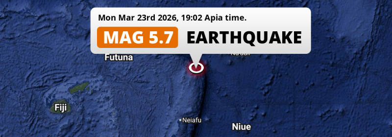
In the evening of Monday March 23rd, 2026, a shallow and significant MAG-5.7 aftershock hit in the South Pacific Ocean 226 kilometer from Apia, Samoa. Around 180 thousand people have been exposed to shaking. American Samoa is also near its epicenter.
Felt the earthquake? Share this article: 


Earthquake Summary
This earthquake hit under water in the South Pacific Ocean, 198 kilometers (123 mi) off the coast of Samoa, 226 kilometer southwest of Apia in Tuamasaga. The center of this earthquake had a very shallow depth of 10 km. Shallow earthquakes usually have a larger impact than earthquakes deep in the earth.
| Date and Time: | Mar 23, 2026 19:02 (Apia Time) - Mar 23, 2026 06:02 Universal Time. |
|---|---|
| Location: | 226 km SW of Apia, Tuamasaga, Samoa. Coordinates 15°32'45"S 172°53'48"W. |
| Map: | 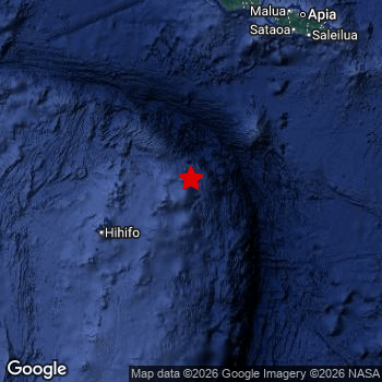 Map of area around epicenter. Click to open in Google Maps. |
| Magnitude: | MAG 5.7 Detected by 35 stations. Maximum Error Range ±0.052 . |
| Depth: | 10 km (6 mi) A very shallow depth. |
| Max. Intensity: | IV
Light On the Modified Mercalli Scale. |
| Tsunami Risk: | Low tsunami risk Earthquakes under MAG-6.5 do not usually cause tsunami's. Always stay cautious - More info here. |
Minimal impact predicted
Based on scientific estimates by the US Geographic Survey (USGS), the risk of high fatalities for this earthquake is classified at level GREEN (low). They expect an 90% likelyhood of between 0 and 1 fatalities.
The USGS classifies the economic impact of this earthquake at level GREEN (low). They expect an 90% likelyhood of between 0 and 1 million US Dollars in economic damage and impact.
Roughly 180 thousand people exposed to shaking
This earthquake may have been felt by around 180 thousand people. That is the expected population size of the area exposed to a level of shaking of II or higher on the Modified Mercalli scale according to the USGS.
Weak shaking and probably no damage may have been experienced by an estimated 62,080 people. At III, it is the highest MMI level this earthquake has caused. The majority of people (roughly 120 thousand) live in an area exposed to level II, where very weak shaking and no damage is expected.
People in 2 countries have been exposed to shaking. In Samoa , around 180 thousand people, with impact levels up to III (weak shaking, probably no damage).
| People | MMI Level | Shaking | Damage |
|---|---|---|---|
| 0 | I |
Not noticable | None |
| 117,500 | II |
Very weak | None |
| 62,080 | III |
Weak | Probably none |
| 0 | IV |
Light | Likely none |
| 0 | V |
Moderate | Very light |
| 0 | VI |
Strong | Light |
| 0 | VII |
Very Strong | Moderate |
| 0 | VIII |
Severe | Moderate to heavy |
| 0 | IX |
Violent | Heavy |
| 0 | X |
Extreme | Very heavy |
Nearby towns and cities
Samoa and American Samoa are both located within 300km distance of the epicenter of the earthquake.
Located 226 kilometer (140 mi) southwest of the epicenter of this earthquake, Apia (Tuamasaga, Samoa) is the nearest significant population center. The intensity of shaking and damage in Apia is estimated to be around level III on the Modified Mercalli Intensity scale (weak shaking, probably no damage).
Overview of nearby places
| Distance | Place | Intensity (MMI) |
|---|---|---|
| 226 km (140 mi) NE from epicenter |
Apia Tuamasaga, Samoa. |
III
Weak |
| 275 km (171 mi) NE from epicenter |
Pago Pago Eastern District, American Samoa. |
Earthquake Intensity Map
The intensity in shaking and damage by this earthquake is illustrated through the map below. The highest intensity measured for this earthquake is IV.

This is likely an aftershock
Approximately 15 hrs before this earthquake hit, a larger 6.3 magnitude earthquake struck 35 km (22 mi) north-east of this one. For that reason, we classify the Mag. 5.7 earthquake as an aftershock.
Overview of foreshocks and aftershocks
| Classification | Magnitude | When | Where |
|---|---|---|---|
| Foreshock | M 4.4 |
9 hrs earlier Mar 22, 2026 19:07 (Apia Time) | 35 km (21 mi) NW from Main Shock. |
| Foreshock | M 6.2 |
9 hrs earlier Mar 22, 2026 19:15 (Apia Time) | 37 km (23 mi) NW from Main Shock. |
| Foreshock | M 4.4 |
9 hrs earlier Mar 22, 2026 19:31 (Apia Time) | 49 km (30 mi) W from Main Shock. |
| Foreshock | M 4.4 |
9 hrs earlier Mar 22, 2026 19:36 (Apia Time) | 34 km (21 mi) N from Main Shock. |
| Foreshock | M 4.4 |
8 hrs earlier Mar 22, 2026 20:11 (Apia Time) | 27 km (16 mi) W from Main Shock. |
| Foreshock | M 4.5 |
5 hrs earlier Mar 22, 2026 23:57 (Apia Time) | 55 km (34 mi) W from Main Shock. |
| Foreshock | M 4.6 |
1 hr earlier Mar 23, 2026 03:08 (Apia Time) | 15 km (9 mi) E from Main Shock. |
| Foreshock | M 6.2 |
3 mins earlier Mar 23, 2026 04:27 (Apia Time) | 12 km (8 mi) NE from Main Shock. |
| Foreshock | M 6.2 |
3 mins earlier Mar 23, 2026 04:27 (Apia Time) | 37 km (23 mi) W from Main Shock. |
| Main Shock | M 6.3 |
Mar 23, 2026 04:30 (Apia Time) | - |
| Aftershock | M 5.6 |
30 mins later Mar 23, 2026 05:00 (Apia Time) | 62 km (39 mi) NW from Main Shock. |
| Aftershock | M 4.8 |
53 mins later Mar 23, 2026 05:23 (Apia Time) | 54 km (34 mi) NW from Main Shock. |
| Aftershock | M 4.8 |
53 mins later Mar 23, 2026 05:23 (Apia Time) | 54 km (34 mi) NW from Main Shock. |
| Aftershock | M 5.9 |
7 hrs later Mar 23, 2026 11:26 (Apia Time) | 37 km (23 mi) SW from Main Shock. |
| Aftershock This Earthquake |
M 5.7 |
15 hrs later Mar 23, 2026 19:02 (Apia Time) | 35 km (22 mi) SW from Main Shock. |
| Aftershock | M 5.0 |
17 hrs later Mar 23, 2026 21:44 (Apia Time) | 20 km (13 mi) W from Main Shock. |
| Aftershock | M 4.3 |
20 hrs later Mar 24, 2026 00:40 (Apia Time) | 49 km (31 mi) W from Main Shock. |
| Aftershock | M 4.6 |
20 hrs later Mar 24, 2026 00:58 (Apia Time) | 40 km (25 mi) W from Main Shock. |
| Aftershock | M 4.2 |
21 hrs later Mar 24, 2026 01:25 (Apia Time) | 41 km (25 mi) W from Main Shock. |
| Aftershock | M 4.2 |
21 hrs later Mar 24, 2026 01:27 (Apia Time) | 68 km (42 mi) NW from Main Shock. |
| Aftershock | M 4.4 |
21 hrs later Mar 24, 2026 01:44 (Apia Time) | 24 km (15 mi) W from Main Shock. |
| Aftershock | M 4.2 |
21 hrs later Mar 24, 2026 01:58 (Apia Time) | 43 km (26 mi) W from Main Shock. |
| Aftershock | M 4.5 |
1 day later Mar 24, 2026 12:07 (Apia Time) | 80 km (50 mi) SW from Main Shock. |
| Aftershock | M 4.4 |
1 day later Mar 24, 2026 12:10 (Apia Time) | 86 km (53 mi) SW from Main Shock. |
| Aftershock | M 4.9 |
1 day later Mar 24, 2026 13:30 (Apia Time) | 86 km (54 mi) S from Main Shock. |
More earthquakes coming?
Aftershocks are usually at least 1 order of magnitude less strong than main shocks. The more time passes, the smaller the chance and likely strength of any potential aftershocks.
In only six percent of cases, significant earthquakes are followed by a larger main shock, making the current earthquake a foreshock. While the chance of this happening is not so large, it is adviced to maintain cautiousness in the hours and days following a major earthquake.
Read: How to Stay Safe during an Earthquake (cdc.gov).Earthquakes like this happen often in the region
Earthquakes of this strength are very common in the region. In total, 35 earthquakes with a magnitude of 5.7 or higher have been registered within 300km (186 mi) of this epicenter in the past 10 years. This comes down to an average of once every 3 months.
Low tsunami risk
Based on early data it appears this earthquake was not strong enough (lower than MAG-6.5) to be likely to cause destructive tsunami's. However this earthquake appeared to have hit at a shallow depth under sea, so stay cautious and monitor advice from local authorities.
Tsunami Risk Factors
| Factor | Under Sea? | MAG-6.5 or stronger? | Shallow depth? |
|---|---|---|---|
| Explanation | Almost all tsunami's are caused by earthquakes with their epicenter under sea or very near the sea. However stay cautious in coastal areas as earthquakes on land may cause landslides into sea, potentially still causing a local tsunami. | Under MAG 6.5: Very unlikely to cause a tsunami. MAG 6.5 to 7.5: Destructive tsunami's do occur, but are uncommon. Likely to observe small sea level changes. MAG 7.6+: Earthquakes with these magnitudes might produce destructive tsunami's. |
Most destructive tsunami's are caused by shallow earthquakes with a depth between 0 and 100km under the surface of the earth. Deeper tsunami's are unlikely to displace to ocean floor. |
| This Earthquake | This earthquake appears to have struck under the sea. | Not this earthquake. This earthquake had a magnitude of 5.7. Earthquakes of this strength are unlikely to trigger a tsunami. |
This earthquake occurred at a depth of of 10 km (6 mi). Earthquakes this shallow could trigger a tsunami. |
Sources
Last updated 18/04/26 00:38 (). This article is automatically generated based on available data. We keep checking multiple sources for additional information. This article gets updated as new details on this earthquake become available.
- US Geographic Society (USGS): Earthquake us6000sisb
- European-Mediterranean Seismological Centre (EMSC): Earthquake 20260323_0000100
- Geonames.org: World Cities Database
- Google Maps: Static API
- Earthquakelist.org: Historic Earthquakes Database
Share this article:
