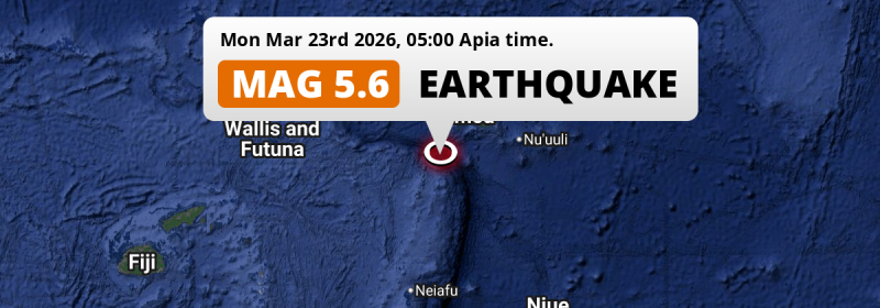
In the early morning of Monday March 23rd, 2026, a shallow and significant Magnitude 5.6 aftershock hit in the South Pacific Ocean 188 kilometer from Apia, Samoa. Around 210 thousand people have been exposed to shaking. Another country near the epicenter is American Samoa.
Felt the earthquake? Share this article: 


Earthquake Summary
This earthquake hit under water in the South Pacific Ocean, 141 kilometers (88 mi) off the coast of Samoa, 188 kilometer southwest of Apia in Tuamasaga. The center of this earthquake had a very shallow depth of 10 km. Shallow earthquakes usually have a larger impact than earthquakes deep in the earth.
| Date and Time: | Mar 23, 2026 05:00 (Apia Time) - Mar 22, 2026 16:00 Universal Time. |
|---|---|
| Location: | 188 km SW of Apia, Tuamasaga, Samoa. Coordinates 14°57'8"S 173°4'20"W. |
| Map: | 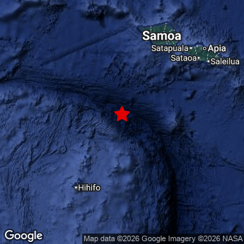 Map of area around epicenter. Click to open in Google Maps. |
| Magnitude: | MAG 5.6 Detected by 28 stations. Maximum Error Range ±0.059 . |
| Depth: | 10 km (6 mi) A very shallow depth. |
| Max. Intensity: | IV
Light On the Modified Mercalli Scale. |
| Tsunami Risk: | Low tsunami risk Earthquakes under MAG-6.5 do not usually cause tsunami's. Always stay cautious - More info here. |
Minimal impact predicted
Based on scientific estimates by the US Geographic Survey (USGS), the risk of high fatalities for this earthquake is classified at level GREEN (low). They expect an 90% likelyhood of between 0 and 1 fatalities.
The USGS classifies the economic impact of this earthquake at level GREEN (low). They expect an 90% likelyhood of between 0 and 1 million US Dollars in economic damage and impact.
Roughly 210 thousand people exposed to shaking
An estimated 210 thousand have been exposed to shaking (An MMI or Modified Mercalli Intensity level II or higher) as a result of this earthquake according scientific estimates published by the USGS.
Weak shaking and probably no damage may have been experienced by an estimated 209,600 people. At III, it is the highest MMI level this earthquake has caused.
People in 2 countries have been exposed to shaking. Roughly 210 thousand people were exposed to shaking in Samoa , with level III (weak shaking, probably no damage) as the highest recorded.
| People | MMI Level | Shaking | Damage |
|---|---|---|---|
| 0 | I |
Not noticable | None |
| 2,170 | II |
Very weak | None |
| 209,600 | III |
Weak | Probably none |
| 0 | IV |
Light | Likely none |
| 0 | V |
Moderate | Very light |
| 0 | VI |
Strong | Light |
| 0 | VII |
Very Strong | Moderate |
| 0 | VIII |
Severe | Moderate to heavy |
| 0 | IX |
Violent | Heavy |
| 0 | X |
Extreme | Very heavy |
Nearby towns and cities
2 countries can be found within 300km of the epicenter of this earthquake: Samoa and American Samoa .
The closest significant population center near the earthquake is Apia in Tuamasaga, Samoa. Apia is located 188 kilometer (117 mi) southwest of the epicenter. Apia experienced an earthquake intensity (MMI Scale) of roughly III. That level implies weak shaking and probably no damage.
Overview of nearby places
| Distance | Place | Intensity (MMI) |
|---|---|---|
| 188 km (117 mi) NE from epicenter |
Apia Tuamasaga, Samoa. |
III
Weak |
| 266 km (165 mi) E from epicenter |
Pago Pago Eastern District, American Samoa. |
Earthquake Intensity Map
The intensity in shaking and damage by this earthquake is illustrated through the map below. The highest intensity measured for this earthquake is IV.

This is likely an aftershock
This earthquake is likely an aftershock of the MAG-6.3 earthquake that struck 30 mins earlier. That main earthquake hit 62 km (39 mi) south-east of the epicenter of this MAG-5.6 aftershock.
Overview of foreshocks and aftershocks
| Classification | Magnitude | When | Where |
|---|---|---|---|
| Foreshock | M 4.4 |
9 hrs earlier Mar 22, 2026 19:07 (Apia Time) | 35 km (21 mi) NW from Main Shock. |
| Foreshock | M 6.2 |
9 hrs earlier Mar 22, 2026 19:15 (Apia Time) | 37 km (23 mi) NW from Main Shock. |
| Foreshock | M 4.4 |
9 hrs earlier Mar 22, 2026 19:31 (Apia Time) | 49 km (30 mi) W from Main Shock. |
| Foreshock | M 4.6 |
1 hr earlier Mar 23, 2026 03:08 (Apia Time) | 15 km (9 mi) E from Main Shock. |
| Foreshock | M 6.2 |
3 mins earlier Mar 23, 2026 04:27 (Apia Time) | 12 km (8 mi) NE from Main Shock. |
| Foreshock | M 6.2 |
3 mins earlier Mar 23, 2026 04:27 (Apia Time) | 37 km (23 mi) W from Main Shock. |
| Main Shock | M 6.3 |
Mar 23, 2026 04:30 (Apia Time) | - |
| Aftershock This Earthquake |
M 5.6 |
30 mins later Mar 23, 2026 05:00 (Apia Time) | 62 km (39 mi) NW from Main Shock. |
| Aftershock | M 4.8 |
53 mins later Mar 23, 2026 05:23 (Apia Time) | 54 km (34 mi) NW from Main Shock. |
| Aftershock | M 4.8 |
53 mins later Mar 23, 2026 05:23 (Apia Time) | 54 km (34 mi) NW from Main Shock. |
| Aftershock | M 5.9 |
7 hrs later Mar 23, 2026 11:26 (Apia Time) | 37 km (23 mi) SW from Main Shock. |
| Aftershock | M 5.8 |
15 hrs later Mar 23, 2026 19:02 (Apia Time) | 32 km (20 mi) W from Main Shock. |
| Aftershock | M 4.9 |
17 hrs later Mar 23, 2026 21:44 (Apia Time) | 30 km (19 mi) S from Main Shock. |
| Aftershock | M 5.1 |
20 hrs later Mar 24, 2026 00:58 (Apia Time) | 48 km (30 mi) W from Main Shock. |
| Aftershock | M 4.5 |
1 day later Mar 24, 2026 12:07 (Apia Time) | 80 km (50 mi) SW from Main Shock. |
| Aftershock | M 4.4 |
1 day later Mar 24, 2026 12:10 (Apia Time) | 87 km (54 mi) S from Main Shock. |
| Aftershock | M 4.9 |
1 day later Mar 24, 2026 13:30 (Apia Time) | 86 km (54 mi) S from Main Shock. |
More earthquakes coming?
Earthquakes can create aftershocks. These are generally at least 1 magnitude lower than any main shock, and as time passes the chance and strength of aftershocks decreases.
The chance that a significant earthquake like this one is followed by an even larger earthquake is not so large. On average, scientists estimate a 94% chance that a major earthquake will not be followed by an even larger one. It is still adviced to be aware of this risk
Read: How to Stay Safe during an Earthquake (cdc.gov).Earthquakes like this happen often in the region
Earthquakes of this strength are very common in the region. In total, 46 earthquakes with a magnitude of 5.6 or higher have been registered within 300km (186 mi) of this epicenter in the past 10 years. This comes down to an average of once every 3 months.
Low tsunami risk
Based on early data it appears this earthquake was not strong enough (lower than MAG-6.5) to be likely to cause destructive tsunami's. However this earthquake appeared to have hit at a shallow depth under sea, so stay cautious and monitor advice from local authorities.
Tsunami Risk Factors
| Factor | Under Sea? | MAG-6.5 or stronger? | Shallow depth? |
|---|---|---|---|
| Explanation | Almost all tsunami's are caused by earthquakes with their epicenter under sea or very near the sea. However stay cautious in coastal areas as earthquakes on land may cause landslides into sea, potentially still causing a local tsunami. | Under MAG 6.5: Very unlikely to cause a tsunami. MAG 6.5 to 7.5: Destructive tsunami's do occur, but are uncommon. Likely to observe small sea level changes. MAG 7.6+: Earthquakes with these magnitudes might produce destructive tsunami's. |
Most destructive tsunami's are caused by shallow earthquakes with a depth between 0 and 100km under the surface of the earth. Deeper tsunami's are unlikely to displace to ocean floor. |
| This Earthquake | This earthquake appears to have struck under the sea. | Not this earthquake. This earthquake had a magnitude of 5.6. Earthquakes of this strength are unlikely to trigger a tsunami. |
This earthquake occurred at a depth of of 10 km (6 mi). Earthquakes this shallow could trigger a tsunami. |
Sources
Last updated 14/04/26 18:38 (). This article contains currently available information about the earthquake and is automatically composed. We continue to update this article up to a few days after the earthquake occurred.
- US Geographic Society (USGS): Earthquake us6000siia
- European-Mediterranean Seismological Centre (EMSC): Earthquake 20260322_0000230
- Geonames.org: World Cities Database
- Google Maps: Static API
- Earthquakelist.org: Historic Earthquakes Database
Share this article:
