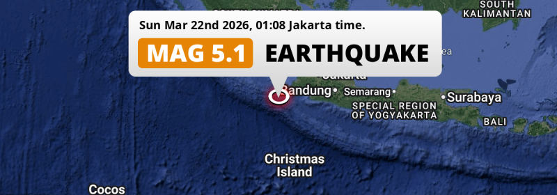
A shallow and significant M5.1 earthquake struck in the Indian Ocean 235 kilometer from Tangerang, Indonesia in the night of Sunday March 22nd, 2026.
Felt the earthquake? Share this article: 


Earthquake Summary
This earthquake hit under water in the Indian Ocean, 83 kilometers (51 mi) off the coast of Indonesia, 235 kilometer southwest of Tangerang in Banten. The center of this earthquake had a very shallow depth of 10 km. Shallow earthquakes usually have a larger impact than earthquakes deep in the earth.
| Date and Time: | Mar 22, 2026 01:08 (Jakarta Time) - Mar 21, 2026 18:08 Universal Time. |
|---|---|
| Location: | 235 km SW of Tangerang, Banten, Indonesia. Coordinates 7°29'54"S 104°57'45"E. |
| Map: | 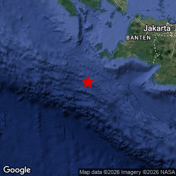 Map of area around epicenter. Click to open in Google Maps. |
| Magnitude: | MAG 5.1 Detected by 11 stations. Maximum Error Range ±0.093 . |
| Depth: | 10 km (6 mi) A very shallow depth. |
| Tsunami Risk: | Low tsunami risk Earthquakes under MAG-6.5 do not usually cause tsunami's. Always stay cautious - More info here. |
Nearby towns and cities
This earthquake may have been felt in Indonesia . Located 157 kilometer (98 mi) southwest of the epicenter of this earthquake, Labuan (Banten, Indonesia) is the nearest significant population center.
Major cities near this earthquake: Jakarta is located 252 km to the north-east. Tangerang is located 235 km to the north-east. Bekasi is located 264 km to the north-east.
A complete list of nearby places is included below.
Overview of nearby places
| Distance | Place |
|---|---|
| 157 km (98 mi) NE from epicenter |
Labuan Banten, Indonesia. |
| 183 km (114 mi) NE from epicenter |
Pandeglang Banten, Indonesia. |
| 184 km (114 mi) E from epicenter |
Pelabuhanratu West Java, Indonesia. |
| 190 km (118 mi) NE from epicenter |
Rangkasbitung Banten, Indonesia. |
| 202 km (126 mi) NE from epicenter |
Serang Banten, Indonesia. |
| 216 km (134 mi) E from epicenter |
Cicurug West Java, Indonesia. |
| 218 km (135 mi) NE from epicenter |
Kresek West Java, Indonesia. |
| 219 km (136 mi) NE from epicenter |
Ciampea West Java, Indonesia. |
| 221 km (137 mi) NE from epicenter |
Cikupa West Java, Indonesia. |
| 223 km (139 mi) NE from epicenter |
Caringin West Java, Indonesia. |
| 223 km (139 mi) NE from epicenter |
Curug Banten, Indonesia. |
| 225 km (140 mi) NE from epicenter |
Bogor West Java, Indonesia. |
| 226 km (140 mi) E from epicenter |
Sukabumi West Java, Indonesia. |
| 228 km (142 mi) NE from epicenter |
Pasarkemis West Java, Indonesia. |
| 229 km (142 mi) NE from epicenter |
Parung West Java, Indonesia. |
| 229 km (142 mi) NE from epicenter |
Serpong West Java, Indonesia. |
| 232 km (144 mi) N from epicenter |
Bandar Lampung Lampung, Indonesia. |
| 234 km (145 mi) NE from epicenter |
Pamulang West Java, Indonesia. |
| 234 km (145 mi) NE from epicenter |
Sawangan West Java, Indonesia. |
| 235 km (146 mi) NE from epicenter |
Sepatan West Java, Indonesia. |
| 235 km (146 mi) NE from epicenter |
Tangerang Banten, Indonesia. |
| 236 km (147 mi) NE from epicenter |
South Tangerang Banten, Indonesia. |
| 237 km (147 mi) NE from epicenter |
Cibinong West Java, Indonesia. |
| 237 km (147 mi) NE from epicenter |
Ciputat West Java, Indonesia. |
| 239 km (149 mi) NE from epicenter |
Depok West Java, Indonesia. |
| 240 km (149 mi) NE from epicenter |
Citeureup West Java, Indonesia. |
| 242 km (150 mi) NE from epicenter |
Teluknaga West Java, Indonesia. |
| 252 km (157 mi) NE from epicenter |
Cileungsir West Java, Indonesia. |
| 252 km (157 mi) NE from epicenter |
Jakarta Jakarta, Indonesia. |
| 264 km (164 mi) E from epicenter |
Ciranjang-hilir West Java, Indonesia. |
| 264 km (164 mi) NE from epicenter |
Bekasi West Java, Indonesia. |
| 268 km (167 mi) N from epicenter |
Metro Lampung, Indonesia. |
| 274 km (170 mi) E from epicenter |
Banjar West Java, Indonesia. |
| 278 km (173 mi) NE from epicenter |
Cikarang West Java, Indonesia. |
| 287 km (178 mi) E from epicenter |
Soreang West Java, Indonesia. |
| 287 km (178 mi) E from epicenter |
Padalarang West Java, Indonesia. |
| 293 km (182 mi) E from epicenter |
Cimahi West Java, Indonesia. |
| 293 km (182 mi) E from epicenter |
Purwakarta West Java, Indonesia. |
| 293 km (182 mi) E from epicenter |
Margahayukencana West Java, Indonesia. |
| 293 km (182 mi) N from epicenter |
Terbanggi Besar Lampung, Indonesia. |
| 294 km (183 mi) E from epicenter |
Banjaran West Java, Indonesia. |
| 296 km (184 mi) E from epicenter |
Pameungpeuk West Java, Indonesia. |
| 297 km (185 mi) N from epicenter |
Kotabumi Lampung, Indonesia. |
| 298 km (185 mi) NE from epicenter |
Rengasdengklok West Java, Indonesia. |
| 299 km (186 mi) E from epicenter |
Bandung West Java, Indonesia. |
Shaking reported by 2 people
People that feel an earthquake may report their experience to the US Geographic Survey. Currently, 2 people have reported shaking in 2 places in Indonesia.We keep updating this article as more ground reports become available. You may report that you felt this earthquake here.
Places with most reports:
- Karawang, Jawa Barat, Indonesia: 1 person.
- Jakarta, Jakarta, Indonesia: 1 person.
Aftershocks detected
Since this main shock, 1 smaller aftershock was detected. A 3.3 magnitude earthquake hit 17 hrs later 5 km (3 mi) south-east of this earthquake.
This main shock was prefaced by 3 smaller foreshocks. Roughly 2 days before this earthquake, a foreshock measuring MAG-3.7 was detected nearby this earthquake.
Overview of foreshocks and aftershocks
| Classification | Magnitude | When | Where |
|---|---|---|---|
| Foreshock | M 2.8 |
2 days earlier Mar 19, 2026 16:59 (Jakarta Time) | 89 km (55 mi) N from Main Shock. |
| Foreshock | M 3.7 |
2 days earlier Mar 19, 2026 23:51 (Jakarta Time) | 80 km (50 mi) N from Main Shock. |
| Foreshock | M 2.5 |
1 hr earlier Mar 22, 2026 00:08 (Jakarta Time) | 5 km (3 mi) E from Main Shock. |
| Main Shock This Earthquake |
M 5.1 |
Mar 22, 2026 01:08 (Jakarta Time) | - |
| Aftershock | M 3.3 |
17 hrs later Mar 22, 2026 18:18 (Jakarta Time) | 5 km (3 mi) SE from Main Shock. |
More earthquakes coming?
Earthquakes can create aftershocks. These are generally at least 1 magnitude lower than any main shock, and as time passes the chance and strength of aftershocks decreases.
The chance that a significant earthquake like this one is followed by an even larger earthquake is not so large. On average, scientists estimate a 94% chance that a major earthquake will not be followed by an even larger one. It is still adviced to be aware of this risk
Read: How to Stay Safe during an Earthquake (cdc.gov).Earthquakes like this happen often in the region
Earthquakes of this strength are very common in the region. This is the strongest earthquake to hit since March 12th, 2026, when a 5.2 magnitude earthquake hit 235 km (146 mi) further east. An even stronger magnitude 6.9 earthquake struck on August 2nd, 2019.
In total, 50 earthquakes with a magnitude of 5.1 or higher have been registered within 300km (186 mi) of this epicenter in the past 10 years. This comes down to an average of once every 2 months.
Low tsunami risk
Based on early data it appears this earthquake was not strong enough (lower than MAG-6.5) to be likely to cause destructive tsunami's. However this earthquake appeared to have hit at a shallow depth under sea, so stay cautious and monitor advice from local authorities.
Tsunami Risk Factors
| Factor | Under Sea? | MAG-6.5 or stronger? | Shallow depth? |
|---|---|---|---|
| Explanation | Almost all tsunami's are caused by earthquakes with their epicenter under sea or very near the sea. However stay cautious in coastal areas as earthquakes on land may cause landslides into sea, potentially still causing a local tsunami. | Under MAG 6.5: Very unlikely to cause a tsunami. MAG 6.5 to 7.5: Destructive tsunami's do occur, but are uncommon. Likely to observe small sea level changes. MAG 7.6+: Earthquakes with these magnitudes might produce destructive tsunami's. |
Most destructive tsunami's are caused by shallow earthquakes with a depth between 0 and 100km under the surface of the earth. Deeper tsunami's are unlikely to displace to ocean floor. |
| This Earthquake | This earthquake appears to have struck under the sea. | Not this earthquake. This earthquake had a magnitude of 5.1. Earthquakes of this strength are unlikely to trigger a tsunami. |
This earthquake occurred at a depth of of 10 km (6 mi). Earthquakes this shallow could trigger a tsunami. |
Sources
Last updated 31/03/26 18:58 (). This article contains currently available information about the earthquake and is automatically composed. We continue to update this article up to a few days after the earthquake occurred.
- US Geographic Society (USGS): Earthquake us6000si8m
- European-Mediterranean Seismological Centre (EMSC): Earthquake 20260321_0000311
- Geonames.org: World Cities Database
- Google Maps: Static API
- Earthquakelist.org: Historic Earthquakes Database
Share this article:
