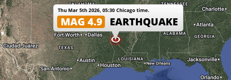
In the early morning of Thursday March 5th, 2026, an unusually powerful Magnitude 4.9 earthquake hit under land 39 miles from Shreveport in The United States. Around 3.5 million people have been exposed to shaking.
Felt the earthquake? Share this article: 


Earthquake Summary
The earthquake struck on land in The United States, 39 miles (63 km) south-east of Shreveport in Louisiana. The center of this earthquake had a very shallow depth of 7 km. Shallow earthquakes usually have a larger impact than earthquakes deep in the earth.
| Date and Time: | Mar 5, 2026 05:30AM (Chicago Time) - Mar 5, 2026 11:30 Universal Time. |
|---|---|
| Location: | 39 mi SE of Shreveport, Louisiana, The United States. Coordinates 32°2'17"N 93°24'53"W. |
| Map: | 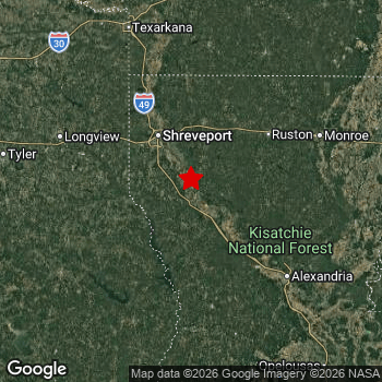 Map of area around epicenter. Click to open in Google Maps. |
| Magnitude: | MAG 4.9 Detected by 50 stations. Maximum Error Range ±0.044 . |
| Depth: | 7 mi (11 km) A very shallow depth. |
| Max. Intensity: | VI
Strong On the Modified Mercalli Scale. |
| Tsunami Risk: | Tsunami very unlikely While this was a shallow earthquake, it appears to have occurred under land with a magnitude not strong enough to cause tsunami's. Always stay cautious - More info here. |
Minimal impact predicted
Based on scientific estimates by the US Geographic Survey (USGS), the risk of high fatalities for this earthquake is classified at level GREEN (low). They expect an 69% likelyhood of between 0 and 1 fatalities, and a 98% chance that the number of fatalities falls no higher than 10.
The USGS classifies the economic impact of this earthquake at level GREEN (low). They expect an 100% likelyhood of between 0 and 1 million US Dollars in economic damage and impact.
Roughly 3.5 million people exposed to shaking
The USGS has published a report estimating the number of people exposed to this earthquake. Acoording to their analysis, roughly 3.5 million have been exposed to shaking at an MMI level of II or higher.
An estimated 1,070 people were exposed to level VI. At this level, strong shaking and probably light damage can be expected. The majority of people (roughly 2.6 million) live in an area exposed to level IV, where light shaking and likely no damage is expected.
| People | MMI Level | Shaking | Damage |
|---|---|---|---|
| 0 | I |
Not noticable | None |
| 0 | II |
Very weak | None |
| 836,300 | III |
Weak | Probably none |
| 2,626,000 | IV |
Light | Likely none |
| 22,100 | V |
Moderate | Very light |
| 1,070 | VI |
Strong | Light |
| 0 | VII |
Very Strong | Moderate |
| 0 | VIII |
Severe | Moderate to heavy |
| 0 | IX |
Violent | Heavy |
| 0 | X |
Extreme | Very heavy |
Nearby towns and cities
This earthquake may have been felt in The United States . The closest significant population center near the earthquake is Natchitoches in Louisiana, The United States. Natchitoches is located 27 miles (44 km) northwest of the epicenter. The intensity of shaking and damage in Natchitoches is estimated to be around level IV on the Modified Mercalli Intensity scale (light shaking, likely no damage).
Multiple major population centers exist within 300km of the earthquake that struck today. Shreveport is located 39 mi to the northwest and experienced an intensity of III (weak shaking, probably no damage). Baton Rouge is located 171 mi to the south-east (intensity unknown, possibly low). Tyler is located 112 mi to the west and experienced an intensity of IV (light shaking, likely no damage).
The table below provides an overview of all places in proximity of today's earthquake. Where available, the estimated intensity on the Modified Mercalli Intensity Scale in each place is included. Places where this information is omitted likely experienced little impact.
Overview of nearby places
| Distance | Place | Intensity (MMI) |
|---|---|---|
| 27 mi (44 km) SE from epicenter |
Natchitoches Louisiana, The United States. |
IV
Light |
| 38 mi (61 km) NW from epicenter |
Bossier City Louisiana, The United States. |
III
Weak |
| 39 mi (63 km) NW from epicenter |
Shreveport Louisiana, The United States. |
III
Weak |
| 57 mi (91 km) NE from epicenter |
Ruston Louisiana, The United States. |
IV
Light |
| 66 mi (106 km) NW from epicenter |
Marshall Texas, The United States. |
IV
Light |
| 76 mi (122 km) SE from epicenter |
Alexandria Louisiana, The United States. |
IV
Light |
| 79 mi (127 km) SW from epicenter |
Nacogdoches Texas, The United States. |
IV
Light |
| 83 mi (133 km) NE from epicenter |
Monroe Louisiana, The United States. |
IV
Light |
| 84 mi (135 km) W from epicenter |
Longview Texas, The United States. |
IV
Light |
| 91 mi (147 km) SW from epicenter |
Lufkin Texas, The United States. |
IV
Light |
| 92 mi (148 km) NE from epicenter |
El Dorado Arkansas, The United States. |
IV
Light |
| 103 mi (165 km) N from epicenter |
Texarkana Texas, The United States. |
IV
Light |
| 104 mi (167 km) N from epicenter |
Texarkana Arkansas, The United States. |
IV
Light |
| 112 mi (181 km) W from epicenter |
Tyler Texas, The United States. |
IV
Light |
| 119 mi (191 km) NW from epicenter |
Mount Pleasant Texas, The United States. |
IV
Light |
| 122 mi (197 km) E from epicenter |
Natchez Mississippi, The United States. |
IV
Light |
| 124 mi (200 km) S from epicenter |
Sulphur Louisiana, The United States. |
IV
Light |
| 127 mi (204 km) S from epicenter |
Lake Charles Louisiana, The United States. |
|
| 130 mi (210 km) SE from epicenter |
Opelousas Louisiana, The United States. |
IV
Light |
| 131 mi (211 km) W from epicenter |
Palestine Texas, The United States. |
|
| 135 mi (218 km) S from epicenter |
Orange Texas, The United States. |
|
| 141 mi (227 km) S from epicenter |
Beaumont Texas, The United States. |
|
| 147 mi (236 km) S from epicenter |
Nederland Texas, The United States. |
|
| 147 mi (237 km) S from epicenter |
Groves Texas, The United States. |
|
| 149 mi (239 km) NW from epicenter |
Sulphur Springs Texas, The United States. |
|
| 150 mi (241 km) SE from epicenter |
Lafayette Louisiana, The United States. |
III
Weak |
| 150 mi (241 km) E from epicenter |
Vicksburg Mississippi, The United States. |
|
| 152 mi (245 km) S from epicenter |
Port Arthur Texas, The United States. |
|
| 155 mi (250 km) SW from epicenter |
Huntsville Texas, The United States. |
|
| 164 mi (264 km) SE from epicenter |
Zachary Louisiana, The United States. |
|
| 167 mi (268 km) NE from epicenter |
Greenville Mississippi, The United States. |
|
| 167 mi (269 km) NW from epicenter |
Paris Texas, The United States. |
|
| 170 mi (273 km) SE from epicenter |
New Iberia Louisiana, The United States. |
|
| 170 mi (273 km) SW from epicenter |
Conroe Texas, The United States. |
III
Weak |
| 171 mi (276 km) N from epicenter |
Hot Springs Arkansas, The United States. |
|
| 171 mi (276 km) SE from epicenter |
Baton Rouge Louisiana, The United States. |
|
| 172 mi (277 km) NE from epicenter |
Pine Bluff Arkansas, The United States. |
|
| 173 mi (279 km) N from epicenter |
Hot Springs National Park Arkansas, The United States. |
|
| 174 mi (280 km) W from epicenter |
Terrell Texas, The United States. |
|
| 174 mi (280 km) SE from epicenter |
Central Louisiana, The United States. |
|
| 175 mi (281 km) NW from epicenter |
Greenville Texas, The United States. |
|
| 175 mi (282 km) SW from epicenter |
Atascocita Texas, The United States. |
|
| 179 mi (288 km) W from epicenter |
Corsicana Texas, The United States. |
|
| 179 mi (288 km) SW from epicenter |
The Woodlands Texas, The United States. |
|
| 180 mi (289 km) SW from epicenter |
Spring Texas, The United States. |
|
| 181 mi (291 km) N from epicenter |
Benton Arkansas, The United States. |
|
| 182 mi (293 km) E from epicenter |
Clinton Mississippi, The United States. |
|
| 182 mi (293 km) SE from epicenter |
Shenandoah Louisiana, The United States. |
|
| 184 mi (296 km) SW from epicenter |
Baytown Texas, The United States. |
|
| 185 mi (297 km) N from epicenter |
Bryant Arkansas, The United States. |
|
| 186 mi (299 km) SW from epicenter |
Channelview Texas, The United States. |
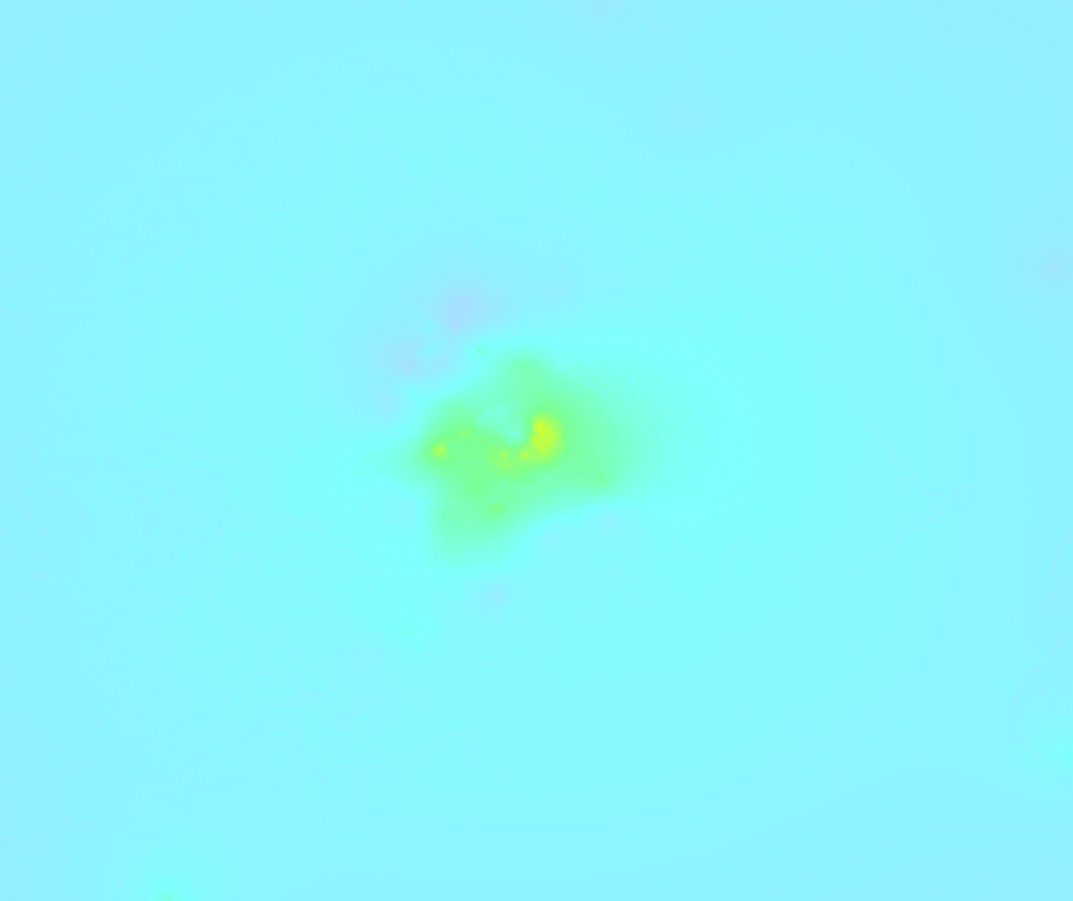
Earthquake Intensity Map
The graph below overlays a map of the region around the epicenter with earthquake intensity data provided by the US Geographic Survey. The highest intensity level detected for this earthquake is VI.
Aftershocks detected
In the days before this main shock, 1 smaller foreshock was detected. Roughly 17 mins before this earthquake, a foreshock measuring MAG-2.9 was detected nearby this earthquake.
Overview of foreshocks and aftershocks
| Classification | Magnitude | When | Where |
|---|---|---|---|
| Foreshock | M 2.9 |
17 mins earlier Mar 5, 2026 05:13AM (Chicago Time) | 5 mi (9 km) NE from Main Shock. |
| Main Shock This Earthquake |
M 4.9 |
Mar 5, 2026 05:30AM (Chicago Time) | - |
More earthquakes coming?
Aftershocks are usually at least 1 order of magnitude less strong than main shocks. The more time passes, the smaller the chance and likely strength of any potential aftershocks.
It's always adviced to be cautious of the risk of a larger shock following any significant earthquake, however this risk is fairly small. There is a roughly 94 percent change that no larger main shock will follow in the days following this earthquake.
Read: How to Stay Safe during an Earthquake (cdc.gov).This is an unusually powerful earthquake
No earthquake of this strength has struck this region for a long time. Our data goes back 10 years, and no earthquakes measuring a magnitude of 4.9 or higher have been detected within 300 km (186 mi) of this epicenter.
Tsunami very unlikely
While MAG-6.5+ earthquakes may cause tsunami's, it appears that the epicenter of this earthquake hit under land. In addition, the reported depth is deeper than 100km, making the risk of a tsunami even less likely. However always stay cautious and monitor advice from local authorities.
Tsunami Risk Factors
| Factor | Under Sea? | MAG-6.5 or stronger? | Shallow depth? |
|---|---|---|---|
| Explanation | Almost all tsunami's are caused by earthquakes with their epicenter under sea or very near the sea. However stay cautious in coastal areas as earthquakes on land may cause landslides into sea, potentially still causing a local tsunami. | Under MAG 6.5: Very unlikely to cause a tsunami. MAG 6.5 to 7.5: Destructive tsunami's do occur, but are uncommon. Likely to observe small sea level changes. MAG 7.6+: Earthquakes with these magnitudes might produce destructive tsunami's. |
Most destructive tsunami's are caused by shallow earthquakes with a depth between 0 and 100km under the surface of the earth. Deeper tsunami's are unlikely to displace to ocean floor. |
| This Earthquake | Not this earthquake. This earthquake appears to have struck on land far from any coast. |
Not this earthquake. This earthquake had a magnitude of 4.9. Earthquakes of this strength are unlikely to trigger a tsunami. |
This earthquake occurred at a depth of of 7 mi (11 km). Earthquakes this shallow could trigger a tsunami. |
Sources
Last updated 31/03/26 00:38 (). As more information on this earthquake becomes available this article will be updated. This article is automatically composed based on data originating from multiple sources.
- US Geographic Society (USGS): Earthquake us7000s27e
- European-Mediterranean Seismological Centre (EMSC): Earthquake 20260305_0000173
- Geonames.org: World Cities Database
- Google Maps: Static API
- Earthquakelist.org: Historic Earthquakes Database
Share this article:
