In the early afternoon of Wednesday March 4th, 2026, a significant M5.3 earthquake hit in the North Pacific Ocean 86 kilometer from Usulután, El Salvador. Other countries near the epicenter include Nicaragua, Honduras and Guatemala.
Felt the earthquake? Share this article: 


Earthquake Summary
This earthquake hit under water in the North Pacific Ocean, 65 kilometers (40 mi) off the coast of El Salvador, 86 kilometer south of Usulután. The center of this earthquake had a quite shallow depth of 47 km. Shallow earthquakes usually have a larger impact than earthquakes deep in the earth.
| Date and Time: | Mar 4, 2026 12:56PM (El Salvador Time) - Mar 4, 2026 18:56 Universal Time. |
|---|---|
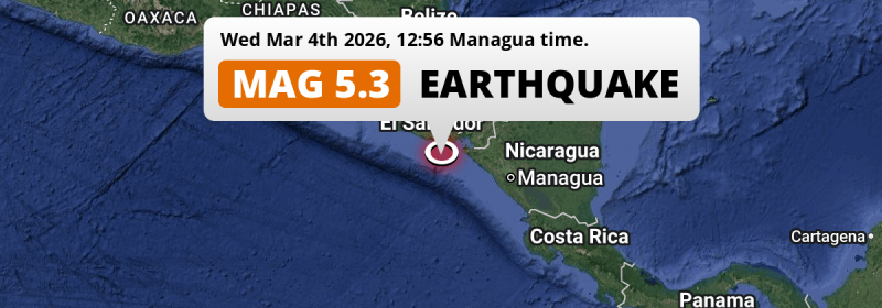
| Location: | 86 km south of Usulután, El Salvador. Coordinates 12°34'58"N 88°19'25"W. |
| Map: |  Map of area around epicenter. Click to open in Google Maps. |
| Magnitude: | MAG 5.3 Detected by 672 stations. Maximum Error Range ±0.022 . |
| Depth: | 47 km (29 mi) A quite shallow depth. |
| Tsunami Risk: | Low tsunami risk Earthquakes under MAG-6.5 do not usually cause tsunami's. Always stay cautious - More info here. |
Nearby towns and cities
This earthquake struck within proximity of multiple countries. El Salvador , Nicaragua , Honduras and Guatemala are all within 300km distance of its epicenter.
Located 82 kilometer (51 mi) south of the epicenter of this earthquake, Puerto El Triunfo (Usulután, El Salvador) is the nearest significant population center.
Major cities near this earthquake: Managua is located 231 km to the east. Tegucigalpa is located 206 km to the north-east. San Salvador is located 155 km to the northwest.
A complete list of nearby places is included below.
Overview of nearby places
| Distance | Place |
|---|---|
| 82 km (51 mi) N from epicenter |
Puerto El Triunfo Usulután, El Salvador. |
| 86 km (53 mi) N from epicenter |
Usulután Usulután, El Salvador. |
| 89 km (55 mi) N from epicenter |
San Rafael Oriente San Miguel, El Salvador. |
| 99 km (62 mi) NE from epicenter |
La Unión La Unión, El Salvador. |
| 101 km (63 mi) N from epicenter |
San Miguel San Miguel, El Salvador. |
| 101 km (63 mi) N from epicenter |
Santiago de María Usulután, El Salvador. |
| 118 km (73 mi) NW from epicenter |
Zacatecoluca La Paz, El Salvador. |
| 125 km (78 mi) E from epicenter |
Corinto Chinandega, Nicaragua. |
| 126 km (78 mi) E from epicenter |
El Viejo Chinandega, Nicaragua. |
| 127 km (79 mi) N from epicenter |
San Francisco Morazán, El Salvador. |
| 128 km (80 mi) NW from epicenter |
San Vicente San Vicente, El Salvador. |
| 130 km (81 mi) E from epicenter |
Chinandega Chinandega, Nicaragua. |
| 133 km (83 mi) NE from epicenter |
San Lorenzo Valle, Honduras. |
| 141 km (88 mi) E from epicenter |
Chichigalpa Chinandega, Nicaragua. |
| 142 km (88 mi) NW from epicenter |
Cojutepeque Cuscatlán, El Salvador. |
| 146 km (91 mi) NE from epicenter |
Ciudad Choluteca Choluteca, Honduras. |
| 147 km (91 mi) N from epicenter |
Sensuntepeque Cabañas, El Salvador. |
| 148 km (92 mi) NW from epicenter |
La Libertad La Libertad, El Salvador. |
| 148 km (92 mi) NW from epicenter |
San Martín Cuscatlán, El Salvador. |
| 151 km (94 mi) NW from epicenter |
Ilopango San Salvador, El Salvador. |
| 152 km (94 mi) NW from epicenter |
San Marcos San Salvador, El Salvador. |
| 153 km (95 mi) NW from epicenter |
Soyapango San Salvador, El Salvador. |
| 155 km (96 mi) NW from epicenter |
San Salvador San Salvador, El Salvador. |
| 156 km (97 mi) NW from epicenter |
Delgado San Salvador, El Salvador. |
| 157 km (98 mi) NW from epicenter |
Antiguo Cuscatlán La Libertad, El Salvador. |
| 158 km (98 mi) NW from epicenter |
Cuscatancingo San Salvador, El Salvador. |
| 158 km (98 mi) E from epicenter |
León León, Nicaragua. |
| 158 km (98 mi) NW from epicenter |
Mejicanos San Salvador, El Salvador. |
| 160 km (99 mi) NW from epicenter |
Santa Tecla La Libertad, El Salvador. |
| 160 km (99 mi) NW from epicenter |
Ayutuxtepeque San Salvador, El Salvador. |
| 162 km (101 mi) E from epicenter |
Somotillo Chinandega, Nicaragua. |
| 165 km (103 mi) NW from epicenter |
Apopa San Salvador, El Salvador. |
| 173 km (107 mi) NW from epicenter |
Quezaltepeque La Libertad, El Salvador. |
| 174 km (108 mi) NW from epicenter |
Chalatenango Chalatenango, El Salvador. |
| 179 km (111 mi) NW from epicenter |
Aguilares San Salvador, El Salvador. |
| 181 km (112 mi) E from epicenter |
La Paz Centro León, Nicaragua. |
| 194 km (121 mi) E from epicenter |
Nagarote León, Nicaragua. |
| 195 km (121 mi) NW from epicenter |
Izalco Sonsonate, El Salvador. |
| 197 km (122 mi) NW from epicenter |
Sonsonate Sonsonate, El Salvador. |
| 198 km (123 mi) NW from epicenter |
Acajutla Sonsonate, El Salvador. |
| 198 km (123 mi) NW from epicenter |
Sonzacate Sonsonate, El Salvador. |
| 205 km (127 mi) N from epicenter |
La Paz La Paz, Honduras. |
| 206 km (128 mi) NE from epicenter |
Tegucigalpa Francisco Morazán, Honduras. |
| 206 km (128 mi) NW from epicenter |
Santa Ana Santa Ana, El Salvador. |
| 213 km (132 mi) NE from epicenter |
Somoto Madriz, Nicaragua. |
| 220 km (137 mi) E from epicenter |
Ciudad Sandino Managua, Nicaragua. |
| 221 km (137 mi) N from epicenter |
Comayagua Comayagua, Honduras. |
| 221 km (137 mi) E from epicenter |
Estelí Estelí, Nicaragua. |
| 222 km (138 mi) NW from epicenter |
Ahuachapán Ahuachapán, El Salvador. |
| 231 km (144 mi) E from epicenter |
Managua Managua, Nicaragua. |
| 232 km (144 mi) NE from epicenter |
Ocotal Nueva Segovia, Nicaragua. |
| 240 km (149 mi) E from epicenter |
Diriamba Carazo, Nicaragua. |
| 246 km (153 mi) E from epicenter |
Tipitapa Managua, Nicaragua. |
| 248 km (154 mi) NE from epicenter |
Danlí El Paraíso, Honduras. |
| 248 km (154 mi) N from epicenter |
Santa Rosa de Copán Copán, Honduras. |
| 251 km (156 mi) E from epicenter |
Masaya Masaya, Nicaragua. |
| 255 km (158 mi) NW from epicenter |
Jutiapa Jutiapa, Guatemala. |
| 258 km (160 mi) E from epicenter |
Jinotega Jinotega, Nicaragua. |
| 260 km (162 mi) N from epicenter |
Santa Bárbara Santa Bárbara, Honduras. |
| 264 km (164 mi) E from epicenter |
Matagalpa Matagalpa, Nicaragua. |
| 267 km (166 mi) E from epicenter |
Granada Granada, Nicaragua. |
| 280 km (174 mi) NW from epicenter |
Chiquimula Chiquimula, Guatemala. |
| 290 km (180 mi) E from epicenter |
Boaco Boaco, Nicaragua. |
| 291 km (181 mi) NW from epicenter |
Jalapa Jalapa, Guatemala. |
| 292 km (181 mi) NW from epicenter |
Barberena Santa Rosa, Guatemala. |
| 296 km (184 mi) NW from epicenter |
Zacapa Zacapa, Guatemala. |
| 297 km (185 mi) N from epicenter |
Potrerillos Cortés, Honduras. |
| 300 km (186 mi) SE from epicenter |
Rivas Rivas, Nicaragua. |
Shaking reported by 7 people in 2 countries
People that feel an earthquake may report their experience to the US Geographic Survey. Currently, 7 people have reported shaking in 6 places in 2 countries (El Salvador, Costa Rica).We keep updating this article as more ground reports become available. You may report that you felt this earthquake here.
Places with most reports:
- Antiguo Cuscatlán, La Libertad, El Salvador: 2 people.
- Soyapango, San Salvador, El Salvador: 1 person.
- Nuevo Cuscatlán, La Libertad, El Salvador: 1 person.
- La Libertad, La Libertad, El Salvador: 1 person.
- Jucuarán, Usulután, El Salvador: 1 person.
- Jacó, Puntarenas, Costa Rica: 1 person.
9 Aftershocks detected
Since this main shock, 9 smaller aftershocks were detected. A 3.8 magnitude earthquake hit 16 hrs later 49 km (30 mi) north-east of this earthquake.
In the days before this main shock, 3 smaller foreshocks were detected. Nearby this earthquake a foreshock struck 1 day earlier. It measured a magnitude of 3.9
Overview of foreshocks and aftershocks
| Classification | Magnitude | When | Where |
|---|---|---|---|
| Foreshock | M 3.0 |
1 day earlier Mar 3, 2026 09:17AM (El Salvador Time) | 64 km (40 mi) S from Main Shock. |
| Foreshock | M 3.9 |
1 day earlier Mar 3, 2026 10:40AM (El Salvador Time) | 86 km (53 mi) SE from Main Shock. |
| Foreshock | M 2.6 |
6 hrs earlier Mar 4, 2026 06:37AM (El Salvador Time) | 53 km (33 mi) SE from Main Shock. |
| Main Shock This Earthquake |
M 5.3 |
Mar 4, 2026 12:56PM (El Salvador Time) | - |
| Aftershock | M 3.1 |
2 hrs later Mar 4, 2026 03:09PM (El Salvador Time) | 86 km (54 mi) W from Main Shock. |
| Aftershock | M 3.2 |
2 hrs later Mar 4, 2026 03:19PM (El Salvador Time) | 18 km (11 mi) SE from Main Shock. |
| Aftershock | M 3.0 |
7 hrs later Mar 4, 2026 08:09PM (El Salvador Time) | 42 km (26 mi) NW from Main Shock. |
| Aftershock | M 3.0 |
11 hrs later Mar 4, 2026 11:47PM (El Salvador Time) | 61 km (38 mi) W from Main Shock. |
| Aftershock | M 3.8 |
16 hrs later Mar 5, 2026 04:29AM (El Salvador Time) | 49 km (30 mi) NE from Main Shock. |
| Aftershock | M 2.8 |
19 hrs later Mar 5, 2026 07:53AM (El Salvador Time) | 38 km (24 mi) NW from Main Shock. |
| Aftershock | M 3.5 |
2 days later Mar 6, 2026 02:48PM (El Salvador Time) | 45 km (28 mi) NW from Main Shock. |
| Aftershock | M 2.5 |
2 days later Mar 6, 2026 03:31PM (El Salvador Time) | 45 km (28 mi) E from Main Shock. |
| Aftershock | M 2.6 |
3 days later Mar 7, 2026 01:53AM (El Salvador Time) | 31 km (19 mi) E from Main Shock. |
More earthquakes coming?
The risk of aftershocks decreases rapidly over time. Usually, aftershocks are at least one order of magnitude lower than a main shock.
In only six percent of cases, significant earthquakes are followed by a larger main shock, making the current earthquake a foreshock. While the chance of this happening is not so large, it is adviced to maintain cautiousness in the hours and days following a major earthquake.
Read: How to Stay Safe during an Earthquake (cdc.gov).Earthquakes like this happen often in the region
Earthquakes of this strength are very common in the region. This is the strongest earthquake to hit since August 23rd, 2025, when a 6 magnitude earthquake hit 235 km (146 mi) further west. An even stronger magnitude 6.9 earthquake struck on November 24th, 2016.
In total, 63 earthquakes with a magnitude of 5.3 or higher have been registered within 300km (186 mi) of this epicenter in the past 10 years. This comes down to an average of once every 2 months.
Low tsunami risk
Based on early data it appears this earthquake was not strong enough (lower than MAG-6.5) to be likely to cause destructive tsunami's. However this earthquake appeared to have hit at a shallow depth under sea, so stay cautious and monitor advice from local authorities.
Tsunami Risk Factors
| Factor | Under Sea? | MAG-6.5 or stronger? | Shallow depth? |
|---|---|---|---|
| Explanation | Almost all tsunami's are caused by earthquakes with their epicenter under sea or very near the sea. However stay cautious in coastal areas as earthquakes on land may cause landslides into sea, potentially still causing a local tsunami. | Under MAG 6.5: Very unlikely to cause a tsunami. MAG 6.5 to 7.5: Destructive tsunami's do occur, but are uncommon. Likely to observe small sea level changes. MAG 7.6+: Earthquakes with these magnitudes might produce destructive tsunami's. |
Most destructive tsunami's are caused by shallow earthquakes with a depth between 0 and 100km under the surface of the earth. Deeper tsunami's are unlikely to displace to ocean floor. |
| This Earthquake | This earthquake appears to have struck under the sea. | Not this earthquake. This earthquake had a magnitude of 5.3. Earthquakes of this strength are unlikely to trigger a tsunami. |
This earthquake occurred at a depth of of 47 km (29 mi). Earthquakes this shallow could trigger a tsunami. |
Sources
Last updated 01/04/26 02:28 (). This article contains currently available information about the earthquake and is automatically composed. We continue to update this article up to a few days after the earthquake occurred.
- US Geographic Society (USGS): Earthquake us7000s21s
- European-Mediterranean Seismological Centre (EMSC): Earthquake 20260304_0000323
- Geonames.org: World Cities Database
- Google Maps: Static API
- Earthquakelist.org: Historic Earthquakes Database
Share this article:
