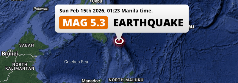
In the night of Sunday February 15th, 2026, a significant MAG-5.2 earthquake hit in the Philippine Sea 228 kilometer from Davao, The Philippines.
Felt the earthquake? Share this article: 


Earthquake Summary
This earthquake hit under water in the Philippine Sea, 123 kilometers (76 mi) off the coast of The Philippines, 228 kilometer south-east of Davao. The center of this earthquake had an intermediate depth of 79 km.
| Date and Time: | Feb 15, 2026 01:23AM (Manila Time) - Feb 14, 2026 17:23 Universal Time. |
|---|---|
| Location: | 228 km SE of Davao, The Philippines. Coordinates 5°40'11"N 127°7'13"E. |
| Map: | 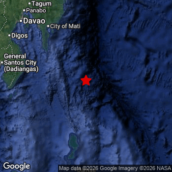 Map of area around epicenter. Click to open in Google Maps. |
| Magnitude: | MAG 5.2 Detected by 9 stations. Maximum Error Range ±0.103 . |
| Depth: | 79 km (49 mi) An intermediate depth. |
| Tsunami Risk: | Low tsunami risk Earthquakes under MAG-6.5 do not usually cause tsunami's. Always stay cautious - More info here. |
Impact
The US Geographic Survey (USGS) describes the impact of this earthquake as follows:
w
Nearby towns and cities
This earthquake may have been felt in The Philippines . The closest significant population center near the earthquake is Mati in Davao, The Philippines. Mati is located 174 kilometer (108 mi) south-east of the epicenter.
Major cities near this earthquake: Davao is located 228 km to the northwest. General Santos is located 221 km to the west-northwest. Magugpo Poblacion is located 245 km to the northwest.
The table below provides an overview of all places in proximity of today's earthquake.
Overview of nearby places
| Distance | Place |
|---|---|
| 174 km (108 mi) NW from epicenter |
Mati Davao, The Philippines. |
| 183 km (114 mi) NNW from epicenter |
Manay Davao, The Philippines. |
| 184 km (114 mi) NW from epicenter |
Lupon Davao, The Philippines. |
| 186 km (116 mi) WNW from epicenter |
Malita Davao, The Philippines. |
| 205 km (127 mi) W from epicenter |
Malapatan Soccsksargen, The Philippines. |
| 207 km (129 mi) WNW from epicenter |
Santa Maria Davao, The Philippines. |
| 208 km (129 mi) WNW from epicenter |
Alabel Soccsksargen, The Philippines. |
| 213 km (132 mi) W from epicenter |
Glan Soccsksargen, The Philippines. |
| 214 km (133 mi) WNW from epicenter |
Maluñgun Soccsksargen, The Philippines. |
| 221 km (137 mi) WNW from epicenter |
General Santos Soccsksargen, The Philippines. |
| 221 km (137 mi) NW from epicenter |
Samal Davao, The Philippines. |
| 228 km (142 mi) NW from epicenter |
Davao Davao, The Philippines. |
| 229 km (142 mi) WNW from epicenter |
Digos Davao, The Philippines. |
| 236 km (147 mi) WNW from epicenter |
Polomolok Soccsksargen, The Philippines. |
| 238 km (148 mi) NNW from epicenter |
San Mariano Davao, The Philippines. |
| 242 km (150 mi) NW from epicenter |
Panabo Davao, The Philippines. |
| 245 km (152 mi) WNW from epicenter |
Bansalan Davao, The Philippines. |
| 245 km (152 mi) NW from epicenter |
Magugpo Poblacion Davao, The Philippines. |
| 246 km (153 mi) WNW from epicenter |
Magsaysay Davao, The Philippines. |
| 247 km (153 mi) NW from epicenter |
Cabayangan Davao, The Philippines. |
| 250 km (155 mi) NNW from epicenter |
Nabunturan Davao, The Philippines. |
| 250 km (155 mi) NNW from epicenter |
Compostela Davao, The Philippines. |
| 251 km (156 mi) WNW from epicenter |
Tupi Soccsksargen, The Philippines. |
| 257 km (160 mi) NW from epicenter |
New Corella Davao, The Philippines. |
| 266 km (165 mi) NNW from epicenter |
Monkayo Davao, The Philippines. |
| 268 km (167 mi) WNW from epicenter |
Koronadal Soccsksargen, The Philippines. |
| 269 km (167 mi) WNW from epicenter |
Kidapawan Soccsksargen, The Philippines. |
| 272 km (169 mi) WNW from epicenter |
Bañga Soccsksargen, The Philippines. |
| 274 km (170 mi) WNW from epicenter |
Surallah Soccsksargen, The Philippines. |
| 274 km (170 mi) WNW from epicenter |
Lake Sebu Soccsksargen, The Philippines. |
| 282 km (175 mi) WNW from epicenter |
Buluan Rehiyong Autonomo sa Muslim na Mindanao, The Philippines. |
| 289 km (180 mi) NNW from epicenter |
Trento Caraga, The Philippines. |
| 293 km (182 mi) WNW from epicenter |
Tacurong Soccsksargen, The Philippines. |
| 297 km (185 mi) NNW from epicenter |
Bislig Caraga, The Philippines. |
| 297 km (185 mi) NNW from epicenter |
Veruela Caraga, The Philippines. |
| 298 km (185 mi) WNW from epicenter |
Isulan Soccsksargen, The Philippines. |
| 299 km (186 mi) WNW from epicenter |
Kabacan Soccsksargen, The Philippines. |
Shaking reported by 2 people
People that feel an earthquake may report their experience to the US Geographic Survey. Currently, 2 people have reported shaking in 2 places in Philippines.We keep updating this article as more ground reports become available. You may report that you felt this earthquake here.
Places with most reports:
- Davao, Southern Mindanao, Philippines: 1 person.
- Buayan, Southern Mindanao, Philippines: 1 person.
2 Aftershocks detected
Since this main shock, 2 smaller aftershocks were detected. Just 15 hrs after this main shock, an earthquake measuring MAG-3.5 was detected 62 km (39 mi) south-east of this earthquake.
In the days before this main shock, 2 smaller foreshocks were detected. Roughly 1 day before this earthquake, a foreshock measuring MAG-4.6 was detected nearby this earthquake.
Overview of foreshocks and aftershocks
| Classification | Magnitude | When | Where |
|---|---|---|---|
| Foreshock | M 3.7 |
2 days earlier Feb 13, 2026 12:34AM (Manila Time) | 91 km (56 mi) WNW from Main Shock. |
| Foreshock | M 4.6 |
1 day earlier Feb 13, 2026 08:50PM (Manila Time) | 82 km (51 mi) NNW from Main Shock. |
| Main Shock This Earthquake |
M 5.2 |
Feb 15, 2026 01:23AM (Manila Time) | - |
| Aftershock | M 3.5 |
15 hrs later Feb 15, 2026 04:24PM (Manila Time) | 62 km (39 mi) SE from Main Shock. |
| Aftershock | M 3.4 |
3 days later Feb 17, 2026 10:31PM (Manila Time) | 91 km (57 mi) WSW from Main Shock. |
More earthquakes coming?
Earthquakes can create aftershocks. These are generally at least 1 magnitude lower than any main shock, and as time passes the chance and strength of aftershocks decreases.
It's always adviced to be cautious of the risk of a larger shock following any significant earthquake, however this risk is fairly small. There is a roughly 94 percent change that no larger main shock will follow in the days following this earthquake.
Read: How to Stay Safe during an Earthquake (cdc.gov).Earthquakes like this happen often in the region
Earthquakes of this strength are very common in the region. This is the strongest earthquake to hit since February 13th, 2026, when a 5.6 magnitude earthquake hit 204 km (127 mi) further south-east. An even stronger magnitude 7.4 earthquake struck on October 10th, 2025.
In total, 154 earthquakes with a magnitude of 5.2 or higher have been registered within 300km (186 mi) of this epicenter in the past 10 years. This comes down to an average of once every 24 days.
Low tsunami risk
Based on early data it appears this earthquake was not strong enough (lower than MAG-6.5) to be likely to cause destructive tsunami's. However this earthquake appeared to have hit at a shallow depth under sea, so stay cautious and monitor advice from local authorities.
Tsunami Risk Factors
| Factor | Under Sea? | MAG-6.5 or stronger? | Shallow depth? |
|---|---|---|---|
| Explanation | Almost all tsunami's are caused by earthquakes with their epicenter under sea or very near the sea. However stay cautious in coastal areas as earthquakes on land may cause landslides into sea, potentially still causing a local tsunami. | Under MAG 6.5: Very unlikely to cause a tsunami. MAG 6.5 to 7.5: Destructive tsunami's do occur, but are uncommon. Likely to observe small sea level changes. MAG 7.6+: Earthquakes with these magnitudes might produce destructive tsunami's. |
Most destructive tsunami's are caused by shallow earthquakes with a depth between 0 and 100km under the surface of the earth. Deeper tsunami's are unlikely to displace to ocean floor. |
| This Earthquake | This earthquake appears to have struck under the sea. | Not this earthquake. This earthquake had a magnitude of 5.2. Earthquakes of this strength are unlikely to trigger a tsunami. |
This earthquake occurred at a depth of of 79 km (49 mi). Earthquakes this shallow could trigger a tsunami. |
Sources
Last updated 18/02/26 17:28 (). As more information on this earthquake becomes available this article will be updated. This article is automatically composed based on data originating from multiple sources.
- US Geographic Society (USGS): Earthquake us6000s98c
- European-Mediterranean Seismological Centre (EMSC): Earthquake 20260214_0000307
- Geonames.org: World Cities Database
- Google Maps: Static API
- Earthquakelist.org: Historic Earthquakes Database
Share this article:
